| Basin |
Humboldt Bay |
| Caption |
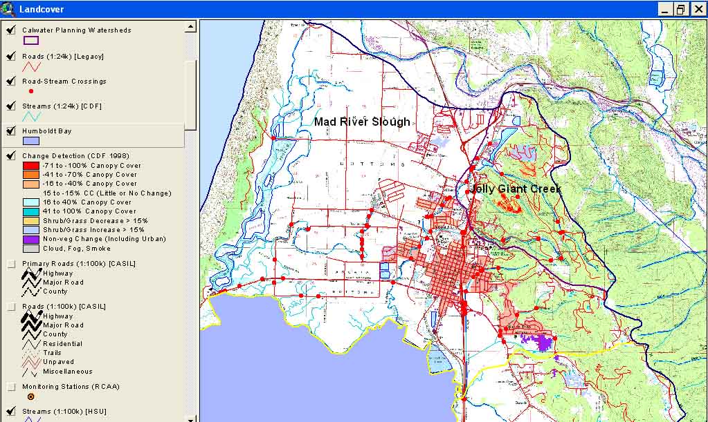
This is a map image of Arcata Calwater Planning Watersheds with roads, stream crossings and landscape change scene detection from the USFS Spatial Analysis Lab and California Department of Forestry FRAP Division. The latter is derived from comparison of 1994 and 1998 Landsat images. |
| CaptionTemplate |
[Description] |
| Description |
This is a map image of Arcata Calwater Planning Watersheds with roads, stream crossings and landscape change scene detection from the USFS Spatial Analysis Lab and California Department of Forestry FRAP Division. The latter is derived from comparison of 1994 and 1998 Landsat images. |
| Filename |
ar_roads_xings_cw_2000.jpg |
| Filesize |
185088 |
| Meta_Id |
HB_Roads |
| Notefile |
humbay.htm#ROADS |
| Path |
topics/ar/ar_roads_xings_cw_2000.jpg |
| Series |
GIS: Roads in Humboldt Bay Sub-Basins 2000 |
| SubBasin |
Arcata |