| Hyperlink |
Agency |
Basin |
Bearing Direction |
Caption |
CaptionTemplate |
Category |
Datum_Zone |
Description |
ExtraField1 |
ExtraField2 |
Filename |
Filesize |
Funder |
GIS_Project |
Graphic |
Hotlinkfield |
KRIS_Hotlink |
Latitud_DD |
Longit_DD |
Meta_Id |
Miscellaneous_Notes |
Notefile |
Path |
Photo Number |
Photodate |
Photographer |
ProjectLocation |
ProjectName |
Restriction |
Series |
Shapefile |
Site_Name |
Site_Type |
Streamname |
SubBasin |
Time |
UTM_E |
UTM_N |
UpdateDate |
UpdateName |
Watershed |
|
View
|
Doug Thron Nature Photography |
Humboldt Bay |
-- |
This aerial photograph shows Headwaters Grove at center with Elkhead Springs Grove on the right in the upper Elk River watershed. Most timber harvests in the photograph appear to be clear cuts. Photo courtesy of Doug Thron and Project Lighthawk. Copyright by Doug Thron Nature Photography. Summer 1994.
|
[Description] |
-- |
-- |
This aerial photograph shows Headwaters Grove at center with Elkhead Springs Grove on the right in the upper Elk River watershed. Most timber harvests in the photograph appear to be clear cuts. Photo courtesy of Doug Thron and Project Lighthawk. Copyright by Doug Thron Nature Photography. Summer 1994.
|
-- |
-- |
thron4.jpg |
94719 |
-- |
-- |
-- |
-- |
-- |
-- |
-- |
forest_picts |
-- |
humbay.htm#Council |
topics/er/thron4.jpg |
-- |
-- |
Doug Thron |
-- |
-- |
Photo courtesy of and copyright by Doug Thron Nature Photography |
Aerial Photos: Elk River Timber Harvests 199 |
-- |
-- |
-- |
-- |
Elk River |
-- |
-- |
-- |
-- |
-- |
-- |
|
View
|
Doug Thron Nature Photography |
Humboldt Bay |
-- |
Clear cut on Elk River Timber Company land after a controlled burn. Humboldt Bay is visible in the background. Photo courtesy of and copyright by Doug Thron Nature Photography. February 1997. |
[Description] |
-- |
-- |
Clear cut on Elk River Timber Company land after a controlled burn. Humboldt Bay is visible in the background. Photo courtesy of and copyright by Doug Thron Nature Photography. February 1997. |
-- |
-- |
thron66.jpg |
95049 |
-- |
-- |
-- |
-- |
-- |
-- |
-- |
forest_picts |
-- |
humbay.htm#Council |
topics/er/thron66.jpg |
-- |
-- |
Doug Thron |
-- |
-- |
Photo courtesy of and copyright by Doug Thron Nature Photography |
Aerial Photos: Elk River Timber Harvests 199 |
-- |
-- |
-- |
-- |
Elk River |
-- |
-- |
-- |
-- |
-- |
-- |
|
View
|
Doug Thron Nature Photography |
Humboldt Bay |
-- |
Selective harvests in the upper North Fork Elk River watershed. Skid trails in the photograph are not part of road density calculations in the PALCO HCP. Photo courtesy of Doug Thron and Project Lighthawk. Copyright by Doug Thron Nature Photography. January 1997. |
[Description] |
-- |
-- |
Selective harvests in the upper North Fork Elk River watershed. Skid trails in the photograph are not part of road density calculations in the PALCO HCP. Photo courtesy of Doug Thron and Project Lighthawk. Copyright by Doug Thron Nature Photography. January 1997. |
-- |
-- |
thron73.jpg |
129042 |
-- |
-- |
-- |
-- |
-- |
-- |
-- |
forest_picts |
-- |
humbay.htm#Council |
topics/er/thron73.jpg |
-- |
-- |
Doug Thron |
-- |
-- |
Photo courtesy of and copyright by Doug Thron Nature Photography |
Aerial Photos: Elk River Timber Harvests 199 |
-- |
-- |
-- |
-- |
Elk River |
-- |
-- |
-- |
-- |
-- |
-- |
|
View
|
Doug Thron Nature Photography |
Humboldt Bay |
-- |
Clear cuts surrounding Elkhead Springs Grove as seen from the air in summer 1994. The dense network of skid trails increases erosion. Photo courtesy of Doug Thron and Project Lighthawk. Copyright by Doug Thron Nature Photography. |
[Description] |
-- |
-- |
Clear cuts surrounding Elkhead Springs Grove as seen from the air in summer 1994. The dense network of skid trails increases erosion. Photo courtesy of Doug Thron and Project Lighthawk. Copyright by Doug Thron Nature Photography. |
-- |
-- |
thron7nw.jpg |
45174 |
-- |
-- |
-- |
-- |
-- |
-- |
-- |
forest_picts |
-- |
humbay.htm#Council |
topics/er/thron7nw.jpg |
-- |
-- |
Doug Thron |
-- |
-- |
Photo courtesy of and copyright by Doug Thron Nature Photography |
Aerial Photos: Elk River Timber Harvests 199 |
-- |
-- |
-- |
-- |
Elk River |
-- |
-- |
-- |
-- |
-- |
-- |
|
View
|
Doug Thron Nature Photography |
Humboldt Bay |
-- |
Clear cut adjacent to Headwaters Grove on the upper South Fork Elk River watershed on lands owned by Elk River Timber Company, a subsidiary of Sierra Pacific Industries. Photo courtesy of Doug Thron and Project Lighthawk. Copyright by Doug Thron Nature Photography. Summer 1995. |
[Description] |
-- |
-- |
Clear cut adjacent to Headwaters Grove on the upper South Fork Elk River watershed on lands owned by Elk River Timber Company, a subsidiary of Sierra Pacific Industries. Photo courtesy of Doug Thron and Project Lighthawk. Copyright by Doug Thron Nature Photography. Summer 1995. |
-- |
-- |
thron30.jpg |
95354 |
-- |
-- |
-- |
-- |
-- |
-- |
-- |
forest_picts |
-- |
humbay.htm#Council |
topics/er/thron30.jpg |
-- |
-- |
Doug Thron |
-- |
-- |
Photo courtesy of and copyright by Doug Thron Nature Photography |
Aerial Photos: Elk River Timber Harvests 1996 |
-- |
-- |
-- |
-- |
Elk River |
-- |
-- |
-- |
-- |
-- |
-- |
|
View
|
Humboldt Watershed Council |
Humboldt Bay |
-- |
This photo shows recent clear cuts in the Freshwater watershed with red-brown indicating recent application of herbicides. Photo from the Humboldt Watershed Council. August 9, 1997. |
[Description] |
-- |
-- |
This photo shows recent clear cuts in the Freshwater watershed with red-brown indicating recent application of herbicides. Photo from the Humboldt Watershed Council. August 9, 1997. |
-- |
-- |
ellen10.gif |
101586 |
-- |
-- |
-- |
-- |
-- |
-- |
-- |
forest_picts |
-- |
Humbay.htm#Council |
topics/fc/ellen10.gif |
-- |
-- |
-- |
-- |
-- |
-- |
Aerial Photos: Freshwater Basin Timber Harvest and Forest Health Aerials 1997 |
-- |
-- |
-- |
-- |
Freshwater Creek-Ryan Slough |
-- |
-- |
-- |
-- |
-- |
-- |
|
View
|
Humboldt Watershed Council |
Humboldt Bay |
-- |
Close up aerial photograph of active clear cut in the Freshwater Creek watershed taken in 1997. Photo courtesy of the Humboldt Watershed Council.
|
[Description] |
-- |
-- |
Close up aerial photograph of active clear cut in the Freshwater Creek watershed taken in 1997. Photo courtesy of the Humboldt Watershed Council.
|
-- |
-- |
fccut.jpg |
327789 |
-- |
-- |
-- |
-- |
-- |
-- |
-- |
forest_picts |
-- |
Humbay.htm#Council |
topics/fc/fccut.jpg |
-- |
-- |
-- |
-- |
-- |
-- |
Aerial Photos: Freshwater Basin Timber Harvest and Forest Health Aerials 1997 |
-- |
-- |
-- |
-- |
Freshwater Creek-Ryan Slough |
-- |
-- |
-- |
-- |
-- |
-- |
|
View
|
Humboldt Watershed Council |
Humboldt Bay |
-- |
This aerial photograph shows the same logging operation but from a wider angle as Picture #1. Aerial photograph of active clear cut in the Freshwater Creek watershed taken in 1997. Several adjacent timber harvests can also be seen in this picture. Photo courtesy of the Humboldt Watershed Council.
|
[Description] |
-- |
-- |
This aerial photograph shows the same logging operation but from a wider angle as Picture #1. Aerial photograph of active clear cut in the Freshwater Creek watershed taken in 1997. Several adjacent timber harvests can also be seen in this picture. Photo courtesy of the Humboldt Watershed Council.
|
-- |
-- |
fresh92a.gif |
196076 |
-- |
-- |
-- |
-- |
-- |
-- |
-- |
forest_picts |
-- |
Humbay.htm#Council |
topics/fc/fresh92a.gif |
-- |
-- |
-- |
-- |
-- |
-- |
Aerial Photos: Freshwater Basin Timber Harvest and Forest Health Aerials 1997 |
-- |
-- |
-- |
-- |
Freshwater Creek-Ryan Slough |
-- |
-- |
-- |
-- |
-- |
-- |
|
View
|
-- |
Humboldt Bay |
-- |
Pacth clear cut off Freshwater-Kneeland road showing intrusion of pampass grass into redwood forest after clear cutting. Silviculture that uses thinning from below does not provide as much opportunity for colonization of non-native species. Photo by Pat Higgins. |
[Description] |
-- |
-- |
Pacth clear cut off Freshwater-Kneeland road showing intrusion of pampass grass into redwood forest after clear cutting. Silviculture that uses thinning from below does not provide as much opportunity for colonization of non-native species. Photo by Pat Higgins. |
-- |
-- |
pampass.jpg |
256171 |
-- |
-- |
-- |
-- |
-- |
-- |
-- |
forest_picts |
-- |
Humbay.htm#Council |
topics/fc/pampass.jpg |
-- |
-- |
Pat Higgins |
-- |
-- |
-- |
Aerial Photos: Freshwater Basin Timber Harvest and Forest Health Aerials 1997 |
-- |
-- |
-- |
-- |
Freshwater Creek-Ryan Slough |
-- |
-- |
-- |
-- |
-- |
-- |
|
View
|
-- |
Humboldt Bay |
-- |
Clear cuts just upslope and upstream of the town of Freshwater. Photos taken Freshwater residents in summer 1997. |
[Description] |
-- |
-- |
Clear cuts just upslope and upstream of the town of Freshwater. Photos taken Freshwater residents in summer 1997. |
-- |
-- |
thron48.jpg |
113684 |
-- |
-- |
-- |
-- |
-- |
-- |
-- |
forest_picts |
-- |
Humbay.htm#Council |
topics/fc/thron48.jpg |
-- |
-- |
-- |
-- |
-- |
-- |
Aerial Photos: Freshwater Basin Timber Harvest and Forest Health Aerials 1997 |
-- |
-- |
-- |
-- |
Freshwater Creek-Ryan Slough |
-- |
-- |
-- |
-- |
-- |
-- |
|
View
|
-- |
Humboldt Bay |
-- |
Patch clear cuts along a ridge and early seral forest to the left and mid-seral forests to the right of patches. Photos provided by Freshwater residents taken in summer 1997 |
[Description] |
-- |
-- |
Patch clear cuts along a ridge and early seral forest to the left and mid-seral forests to the right of patches. Photos provided by Freshwater residents taken in summer 1997 |
-- |
-- |
thron49.jpg |
78250 |
-- |
-- |
-- |
-- |
-- |
-- |
-- |
forest_picts |
-- |
Humbay.htm#Council |
topics/fc/thron49.jpg |
-- |
-- |
-- |
-- |
-- |
-- |
Aerial Photos: Freshwater Basin Timber Harvest and Forest Health Aerials 1997 |
-- |
-- |
-- |
-- |
Freshwater Creek-Ryan Slough |
-- |
-- |
-- |
-- |
-- |
-- |
|
View
|
-- |
Humboldt Bay |
-- |
Photo provided by Freshwater residents of timber harvest activity in upper Little Freshwater Creek. Photos taken in summer 1997. |
[Description] |
-- |
-- |
Photo provided by Freshwater residents of timber harvest activity in upper Little Freshwater Creek. Photos taken in summer 1997. |
-- |
-- |
thron50.jpg |
104858 |
-- |
-- |
-- |
-- |
-- |
-- |
-- |
forest_picts |
-- |
Humbay.htm#Council |
topics/fc/thron50.jpg |
-- |
-- |
-- |
-- |
-- |
-- |
Aerial Photos: Freshwater Basin Timber Harvest and Forest Health Aerials 1997 |
-- |
-- |
-- |
-- |
Freshwater Creek-Ryan Slough |
-- |
-- |
-- |
-- |
-- |
-- |
|
View
|
Redwood Sciences Lab (U.S. Forest Service) |
Humboldt Bay |
-- |
This chart is part of a series showing data results from the turbidity threshold salmpling station on Upper Jacoby Creek, operated by Redwood Sciences Lab (U.S. Forest Service). The chart shows a summary of the results from hydrologic year 2001, including discharge, turbidity, suspended sediment concentration (SSC), and annual loading estimate. |
This chart is part of a series showing data results from the turbidity threshold salmpling station on Upper Jacoby Creek, operated by [Agency]. [description] |
Data Charts |
-- |
The chart shows a summary of the results from hydrologic year 2001, including discharge, turbidity, suspended sediment concentration (SSC), and annual loading estimate. |
-- |
-- |
ujc01AnnualLoad.gif |
19364 |
-- |
-- |
-- |
-- |
-- |
-- |
-- |
-- |
-- |
-- |
tts_monitor/rsl/ujc01annualload.gif |
-- |
-- |
-- |
-- |
-- |
None |
Data Charts: Upper Jacoby Creek (UJC) Turbidity Threshold Sampling Results |
-- |
-- |
-- |
-- |
Jacoby Creek |
-- |
-- |
-- |
2/3/2006 |
JEA |
-- |
|
View
|
Redwood Sciences Lab (U.S. Forest Service) |
Humboldt Bay |
-- |
This chart is part of a series showing data results from the turbidity threshold salmpling station on Upper Jacoby Creek, operated by Redwood Sciences Lab (U.S. Forest Service). The chart shows the relationship between turbidity and suspended sediment concentration (SSC) for hydrologic year 2001, and the curve fit to the data. |
This chart is part of a series showing data results from the turbidity threshold salmpling station on Upper Jacoby Creek, operated by [Agency]. [description] |
Data Charts |
-- |
The chart shows the relationship between turbidity and suspended sediment concentration (SSC) for hydrologic year 2001, and the curve fit to the data. |
-- |
-- |
ujc01model.gif |
13404 |
-- |
-- |
-- |
-- |
-- |
-- |
-- |
-- |
-- |
-- |
tts_monitor/rsl/ujc01model.gif |
-- |
-- |
-- |
-- |
-- |
None |
Data Charts: Upper Jacoby Creek (UJC) Turbidity Threshold Sampling Results |
-- |
-- |
-- |
-- |
Jacoby Creek |
-- |
-- |
-- |
2/3/2006 |
JEA |
-- |
|
View
|
Redwood Sciences Lab (U.S. Forest Service) |
Humboldt Bay |
-- |
This chart is part of a series showing data results from the turbidity threshold salmpling station on Upper Jacoby Creek, operated by Redwood Sciences Lab (U.S. Forest Service). The chart shows a summary of the results from hydrologic year 2003, including discharge, turbidity, suspended sediment concentration (SSC), and annual loading estimate. |
This chart is part of a series showing data results from the turbidity threshold salmpling station on Upper Jacoby Creek, operated by [Agency]. [description] |
Data Charts |
-- |
The chart shows a summary of the results from hydrologic year 2003, including discharge, turbidity, suspended sediment concentration (SSC), and annual loading estimate. |
-- |
-- |
ujc03AnnualLoad.gif |
20681 |
-- |
-- |
-- |
-- |
-- |
-- |
-- |
-- |
-- |
-- |
tts_monitor/rsl/ujc03annualload.gif |
-- |
-- |
-- |
-- |
-- |
None |
Data Charts: Upper Jacoby Creek (UJC) Turbidity Threshold Sampling Results |
-- |
-- |
-- |
-- |
Jacoby Creek |
-- |
-- |
-- |
2/3/2006 |
JEA |
-- |
|
View
|
Redwood Sciences Lab (U.S. Forest Service) |
Humboldt Bay |
-- |
This chart is part of a series showing data results from the turbidity threshold salmpling station on Upper Jacoby Creek, operated by Redwood Sciences Lab (U.S. Forest Service). The chart shows the relationship between turbidity and suspended sediment concentration (SSC) for hydrologic year 2003, and the curve fit to the data. |
This chart is part of a series showing data results from the turbidity threshold salmpling station on Upper Jacoby Creek, operated by [Agency]. [description] |
Data Charts |
-- |
The chart shows the relationship between turbidity and suspended sediment concentration (SSC) for hydrologic year 2003, and the curve fit to the data. |
-- |
-- |
ujc03model.jpg |
44910 |
-- |
-- |
-- |
-- |
-- |
-- |
-- |
-- |
-- |
-- |
tts_monitor/rsl/ujc03model.jpg |
-- |
-- |
-- |
-- |
-- |
None |
Data Charts: Upper Jacoby Creek (UJC) Turbidity Threshold Sampling Results |
-- |
-- |
-- |
-- |
Jacoby Creek |
-- |
-- |
-- |
2/3/2006 |
JEA |
-- |
|
View
|
Humboldt Fish Action Council |
Humboldt Bay |
-- |
This picture is part of a series showing examples of the educational activities of the Freshwater Creek Salmonid Monitoring Program. This photo shows a Six Rivers Charter School student at Cloney Gulch downstream migrant trapping working on a mark and recapture problem during a field trip, March 2005. Photo contributed to KRIS by the Bob Pagliuco. |
This picture is part of a series showing examples of the educational activities of the Freshwater Creek Salmonid Monitoring Program. This photo shows [Description] Photo contributed to KRIS by the Bob Pagliuco. |
Education |
-- |
a Six Rivers Charter School student at Cloney Gulch downstream migrant trapping working on a mark and recapture problem during a field trip, March 2005. |
-- |
-- |
6 Rivers Charter School Cloney Gulch DSMT, Mar 2005_.jpg |
112670 |
-- |
-- |
-- |
-- |
-- |
-- |
-- |
-- |
-- |
-- |
fcsmp/education/6_rivers_charter_school_cloney_gulch_dsmt,_mar_2005_.jpg |
-- |
-- |
-- |
-- |
-- |
none |
Education: Freshwater Creek Salmonid Monitoring Program, Educational Activities |
-- |
-- |
-- |
-- |
Freshwater Creek-Ryan Slough |
-- |
-- |
-- |
2/7/2006 |
JEA |
-- |
|
View
|
Humboldt Fish Action Council |
Humboldt Bay |
-- |
This picture is part of a series showing examples of the educational activities of the Freshwater Creek Salmonid Monitoring Program. This photo shows Bob Pagliuco, Colin Anderson, and Scott Silloway giving a tour of the HFAC trap to Eureka High School students, December 2003. Photo contributed to KRIS by the Bob Pagliuco. |
This picture is part of a series showing examples of the educational activities of the Freshwater Creek Salmonid Monitoring Program. This photo shows [Description] Photo contributed to KRIS by the Bob Pagliuco. |
Education |
-- |
Bob Pagliuco, Colin Anderson, and Scott Silloway giving a tour of the HFAC trap to Eureka High School students, December 2003. |
-- |
-- |
Bob P, Colin Anderson, Scott Silloway, EHS, Dec 2003_.JPG |
163028 |
-- |
-- |
-- |
-- |
-- |
-- |
-- |
-- |
-- |
-- |
fcsmp/education/bob_p,_colin_anderson,_scott_silloway,_ehs,_dec_2003_.jpg |
-- |
-- |
-- |
-- |
-- |
none |
Education: Freshwater Creek Salmonid Monitoring Program, Educational Activities |
-- |
-- |
-- |
-- |
Freshwater Creek-Ryan Slough |
-- |
-- |
-- |
2/7/2006 |
JEA |
-- |
|
View
|
Humboldt Fish Action Council |
Humboldt Bay |
-- |
This picture is part of a series showing examples of the educational activities of the Freshwater Creek Salmonid Monitoring Program. This photo shows Bob Pagliuco and Cedar Academy students PIT tagging a fish at the weir, February 2004. Photo contributed to KRIS by the Bob Pagliuco. |
This picture is part of a series showing examples of the educational activities of the Freshwater Creek Salmonid Monitoring Program. This photo shows [Description] Photo contributed to KRIS by the Bob Pagliuco. |
Education |
-- |
Bob Pagliuco and Cedar Academy students PIT tagging a fish at the weir, February 2004. |
-- |
-- |
Bob P and Cedar Academy students PIT tag, Feb 2004_.jpg |
113353 |
-- |
-- |
-- |
-- |
-- |
-- |
-- |
-- |
-- |
-- |
fcsmp/education/bob_p_and_cedar_academy_students_pit_tag,_feb_2004_.jpg |
-- |
-- |
-- |
-- |
-- |
none |
Education: Freshwater Creek Salmonid Monitoring Program, Educational Activities |
-- |
-- |
-- |
-- |
Freshwater Creek-Ryan Slough |
-- |
-- |
-- |
2/7/2006 |
JEA |
-- |
|
View
|
Humboldt Fish Action Council |
Humboldt Bay |
-- |
This picture is part of a series showing examples of the educational activities of the Freshwater Creek Salmonid Monitoring Program. This photo shows Bob Pagliuco and Cedar Academy students taking scales at HFAC, February 2004. Photo contributed to KRIS by the Bob Pagliuco. |
This picture is part of a series showing examples of the educational activities of the Freshwater Creek Salmonid Monitoring Program. This photo shows [Description] Photo contributed to KRIS by the Bob Pagliuco. |
Education |
-- |
Bob Pagliuco and Cedar Academy students taking scales at HFAC, February 2004. |
-- |
-- |
Bob P and Cedar Academy students scales, Feb 2004_.jpg |
142593 |
-- |
-- |
-- |
-- |
-- |
-- |
-- |
-- |
-- |
-- |
fcsmp/education/bob_p_and_cedar_academy_students_scales,_feb_2004_.jpg |
-- |
-- |
-- |
-- |
-- |
none |
Education: Freshwater Creek Salmonid Monitoring Program, Educational Activities |
-- |
-- |
-- |
-- |
Freshwater Creek-Ryan Slough |
-- |
-- |
-- |
2/7/2006 |
JEA |
-- |
|
View
|
Humboldt Fish Action Council |
Humboldt Bay |
-- |
This picture is part of a series showing examples of the educational activities of the Freshwater Creek Salmonid Monitoring Program. This photo shows Bob Pagliuco training community members and resource professionals on spawner survey protocols, January 2003. Photo contributed to KRIS by the Bob Pagliuco. |
This picture is part of a series showing examples of the educational activities of the Freshwater Creek Salmonid Monitoring Program. This photo shows [Description] Photo contributed to KRIS by the Bob Pagliuco. |
Education |
-- |
Bob Pagliuco training community members and resource professionals on spawner survey protocols, January 2003. |
-- |
-- |
Bob P training on spawner survey protocol, Jan 2003_.JPG |
182691 |
-- |
-- |
-- |
-- |
-- |
-- |
-- |
-- |
-- |
-- |
fcsmp/education/bob_p_training_on_spawner_survey_protocol,_jan_2003_.jpg |
-- |
-- |
-- |
-- |
-- |
none |
Education: Freshwater Creek Salmonid Monitoring Program, Educational Activities |
-- |
-- |
-- |
-- |
Freshwater Creek-Ryan Slough |
-- |
-- |
-- |
2/7/2006 |
JEA |
-- |
|
View
|
Humboldt Fish Action Council |
Humboldt Bay |
-- |
This picture is part of a series showing examples of the educational activities of the Freshwater Creek Salmonid Monitoring Program. This photo shows a Eureka High School student measuring the depth of pot on a Middle Main Stem spawner survey, January, 2005. Photo contributed to KRIS by the Bob Pagliuco. |
This picture is part of a series showing examples of the educational activities of the Freshwater Creek Salmonid Monitoring Program. This photo shows [Description] Photo contributed to KRIS by the Bob Pagliuco. |
Education |
-- |
a Eureka High School student measuring the depth of pot on a Middle Main Stem spawner survey, January, 2005. |
-- |
-- |
EHS student measure pot Mid MS spawn surv, Jan, 2005_.JPG |
175002 |
-- |
-- |
-- |
-- |
-- |
-- |
-- |
-- |
-- |
-- |
fcsmp/education/ehs_student_measure_pot_mid_ms_spawn_surv,_jan,_2005_.jpg |
-- |
12/14/2004 |
-- |
-- |
-- |
none |
Education: Freshwater Creek Salmonid Monitoring Program, Educational Activities |
-- |
-- |
-- |
-- |
Freshwater Creek-Ryan Slough |
12:19:33 PM |
-- |
-- |
2/7/2006 |
JEA |
-- |
|
View
|
Humboldt Fish Action Council |
Humboldt Bay |
-- |
This picture is part of a series showing examples of the educational activities of the Freshwater Creek Salmonid Monitoring Program. This photo shows a Eureka High School Student jaw-tagging a Coho carcass on a spawner survey, January 2004. Photo contributed to KRIS by the Bob Pagliuco. |
This picture is part of a series showing examples of the educational activities of the Freshwater Creek Salmonid Monitoring Program. This photo shows [Description] Photo contributed to KRIS by the Bob Pagliuco. |
Education |
-- |
a Eureka High School Student jaw-tagging a Coho carcass on a spawner survey, January 2004. |
-- |
-- |
EHS Student tag coho carcass on spawn surv, Jan 2004_.JPG |
161783 |
-- |
-- |
-- |
-- |
-- |
-- |
-- |
-- |
-- |
-- |
fcsmp/education/ehs_student_tag_coho_carcass_on_spawn_surv,_jan_2004_.jpg |
-- |
-- |
-- |
-- |
-- |
none |
Education: Freshwater Creek Salmonid Monitoring Program, Educational Activities |
-- |
-- |
-- |
-- |
Freshwater Creek-Ryan Slough |
-- |
-- |
-- |
2/7/2006 |
JEA |
-- |
|
View
|
Humboldt Fish Action Council |
Humboldt Bay |
-- |
This picture is part of a series showing examples of the educational activities of the Freshwater Creek Salmonid Monitoring Program. This photo shows Jan Duncan-Vaughn showing kids the McReady Gulch egg rearing station, April 2003. Photo contributed to KRIS by the Bob Pagliuco. |
This picture is part of a series showing examples of the educational activities of the Freshwater Creek Salmonid Monitoring Program. This photo shows [Description] Photo contributed to KRIS by the Bob Pagliuco. |
Education |
-- |
Jan Duncan-Vaughn showing kids the McReady Gulch egg rearing station, April 2003. |
-- |
-- |
Jan Duncan-Vaughn kids McReady egg station, Apr 2003_.jpg |
110170 |
-- |
-- |
-- |
-- |
-- |
-- |
-- |
-- |
-- |
-- |
fcsmp/education/jan_duncan-vaughn_kids_mcready_egg_station,_apr_2003_.jpg |
-- |
-- |
-- |
-- |
-- |
none |
Education: Freshwater Creek Salmonid Monitoring Program, Educational Activities |
-- |
-- |
-- |
-- |
Freshwater Creek-Ryan Slough |
-- |
-- |
-- |
2/7/2006 |
JEA |
-- |
|
View
|
Humboldt Fish Action Council |
Humboldt Bay |
-- |
This picture is part of a series showing examples of the educational activities of the Freshwater Creek Salmonid Monitoring Program. This photo shows Pat Righter training Eureka High students on spawner survey protocol at Freshwater Park, January 2003. Photo contributed to KRIS by the Bob Pagliuco. |
This picture is part of a series showing examples of the educational activities of the Freshwater Creek Salmonid Monitoring Program. This photo shows [Description] Photo contributed to KRIS by the Bob Pagliuco. |
Education |
-- |
Pat Righter training Eureka High students on spawner survey protocol at Freshwater Park, January 2003. |
-- |
-- |
Pat Righter EHS spawn protocol FW Park, Jan 2003_.JPG |
173710 |
-- |
-- |
-- |
-- |
-- |
-- |
-- |
-- |
-- |
-- |
fcsmp/education/pat_righter_ehs__spawn_protocol_fw_park,_jan_2003_.jpg |
-- |
-- |
-- |
-- |
-- |
none |
Education: Freshwater Creek Salmonid Monitoring Program, Educational Activities |
-- |
-- |
-- |
-- |
Freshwater Creek-Ryan Slough |
-- |
-- |
-- |
2/7/2006 |
JEA |
-- |
|
View
|
Humboldt Fish Action Council |
Humboldt Bay |
-- |
This picture is part of a series showing spawner surveys conducted by the Freshwater Creek Salmonid Monitoring Program. students who have raised HFAC-spawned Chinook releasing their fry back into Freshwater Creek, April 2003. Photo contributed to KRIS by the Bob Pagliuco. |
This picture is part of a series showing spawner surveys conducted by the Freshwater Creek Salmonid Monitoring Program. [Description] Photo contributed to KRIS by the Bob Pagliuco. |
Education |
-- |
students who have raised HFAC-spawned Chinook releasing their fry back into Freshwater Creek, April 2003. |
-- |
-- |
Students release fry back to Freshwater Cr, Apr 2003_.jpg |
144193 |
-- |
-- |
-- |
-- |
-- |
-- |
-- |
-- |
-- |
-- |
fcsmp/education/students_release_fry_back_to_freshwater_cr,_apr_2003_.jpg |
-- |
-- |
-- |
-- |
-- |
none |
Education: Freshwater Creek Salmonid Monitoring Program, Educational Activities |
-- |
-- |
-- |
-- |
Freshwater Creek-Ryan Slough |
-- |
-- |
-- |
2/7/2006 |
JEA |
-- |
|
View
|
Humboldt Watershed Council |
Humboldt Bay |
-- |
This photograph of the upper Elk River watershed shows clear cut headwall and inner gorge areas which are very susceptible to landsliding. Note the debris slide on the steep, inner gorge area of the photo at left in the photo and small landslides coming off landings. Photo courtesy of the Humboldt Watershed Council. September 1997.
|
[Description] |
-- |
-- |
This photograph of the upper Elk River watershed shows clear cut headwall and inner gorge areas which are very susceptible to landsliding. Note the debris slide on the steep, inner gorge area of the photo at left in the photo and small landslides coming off landings. Photo courtesy of the Humboldt Watershed Council. September 1997.
|
-- |
-- |
nelk111c.gif |
228398 |
-- |
-- |
-- |
-- |
-- |
-- |
-- |
forest_picts |
-- |
humbay.htm#Council |
topics/er/nelk111c.gif |
-- |
-- |
-- |
-- |
-- |
-- |
Erosion: Elk River Landslides 1997 |
-- |
-- |
-- |
-- |
Elk River |
-- |
-- |
-- |
-- |
-- |
-- |
|
View
|
Humboldt Watershed Council |
Humboldt Bay |
-- |
Photo taken logging down hill in the track of a debris torrent in the Elk River watershed. Photo courtesy of the Humboldt Watershed Council.
|
[Description] |
-- |
-- |
Photo taken logging down hill in the track of a debris torrent in the Elk River watershed. Photo courtesy of the Humboldt Watershed Council.
|
-- |
-- |
nelk122c.gif |
271301 |
-- |
-- |
-- |
-- |
-- |
-- |
-- |
forest_picts |
-- |
humbay.htm#Council |
topics/er/nelk122c.gif |
-- |
-- |
-- |
-- |
-- |
-- |
Erosion: Elk River Landslides 1997 |
-- |
-- |
-- |
-- |
Elk River |
-- |
-- |
-- |
-- |
-- |
-- |
|
View
|
-- |
Humboldt Bay |
-- |
This photo looks down hill in the track of a debris torrent in the Elk River drainage. The large trees at the base of the photo may have helped stop some of the sediment from reaching a watercourse. |
[Description] |
-- |
-- |
This photo looks down hill in the track of a debris torrent in the Elk River drainage. The large trees at the base of the photo may have helped stop some of the sediment from reaching a watercourse. |
-- |
-- |
nelk125a.gif |
232113 |
-- |
-- |
-- |
-- |
-- |
-- |
-- |
forest_picts |
-- |
humbay.htm#Council |
topics/er/nelk125a.gif |
-- |
-- |
-- |
-- |
-- |
-- |
Erosion: Elk River Landslides 1997 |
-- |
-- |
-- |
-- |
Elk River |
-- |
-- |
-- |
-- |
-- |
-- |
|
View
|
Humboldt Watershed Council |
Humboldt Bay |
-- |
The photo above shows a debris torrent in the Elk River basin that initiated at a road. It is likely that this failure occurred during the January 1, 1997 storm event. Photo courtesy of the Humboldt Watershed Council. |
[Description] |
-- |
-- |
The photo above shows a debris torrent in the Elk River basin that initiated at a road. It is likely that this failure occurred during the January 1, 1997 storm event. Photo courtesy of the Humboldt Watershed Council. |
-- |
-- |
nelk109b.gif |
279469 |
-- |
-- |
-- |
-- |
-- |
-- |
-- |
forest_picts |
-- |
humbay.htm#Council |
topics/er/nelk109b.gif |
-- |
-- |
-- |
-- |
-- |
-- |
Erosion: Elk River Roads & Erosion 1996-97 |
-- |
-- |
-- |
-- |
Elk River |
-- |
-- |
-- |
-- |
-- |
-- |
|
View
|
Humboldt Watershed Council |
Humboldt Bay |
-- |
This debris slide in the Elk River basin appears to have been triggered by the road which crosses the photo. Photo courtesy of the Humboldt Watershed Council. September 1997.
|
[Description] |
-- |
-- |
This debris slide in the Elk River basin appears to have been triggered by the road which crosses the photo. Photo courtesy of the Humboldt Watershed Council. September 1997.
|
-- |
-- |
nelk109c.gif |
198328 |
-- |
-- |
-- |
-- |
-- |
-- |
-- |
forest_picts |
-- |
humbay.htm#Council |
topics/er/nelk109c.gif |
-- |
-- |
-- |
-- |
-- |
-- |
Erosion: Elk River Roads & Erosion 1996-97 |
-- |
-- |
-- |
-- |
Elk River |
-- |
-- |
-- |
-- |
-- |
-- |
|
View
|
Humboldt Watershed Council |
Humboldt Bay |
-- |
This road in the Elk River watershed has been reconstructed across an active landslide. Photo courtesy of the Humboldt Watershed Council. September 1997. |
[Description] |
-- |
-- |
This road in the Elk River watershed has been reconstructed across an active landslide. Photo courtesy of the Humboldt Watershed Council. September 1997. |
-- |
-- |
nelk113b.gif |
246061 |
-- |
-- |
-- |
-- |
-- |
-- |
-- |
forest_picts |
-- |
humbay.htm#Council |
topics/er/nelk113b.gif |
-- |
-- |
-- |
-- |
-- |
-- |
Erosion: Elk River Roads & Erosion 1996-97 |
-- |
-- |
-- |
-- |
Elk River |
-- |
-- |
-- |
-- |
-- |
-- |
|
View
|
Humboldt Watershed Council |
Humboldt Bay |
-- |
This photograph shows a landslide triggered by a logging road in the Elk River basin. Photo courtesy of the Humboldt Watershed Council. Note that post-logging vegetation is dominated by shrubs, grass and pampas grass. |
[Description] |
-- |
-- |
This photograph shows a landslide triggered by a logging road in the Elk River basin. Photo courtesy of the Humboldt Watershed Council. Note that post-logging vegetation is dominated by shrubs, grass and pampas grass. |
-- |
-- |
nelk114a.gif |
224611 |
-- |
-- |
-- |
-- |
-- |
-- |
-- |
forest_picts |
-- |
humbay.htm#Council |
topics/er/nelk114a.gif |
-- |
-- |
-- |
-- |
-- |
-- |
Erosion: Elk River Roads & Erosion 1996-97 |
-- |
-- |
-- |
-- |
Elk River |
-- |
-- |
-- |
-- |
-- |
-- |
|
View
|
Humboldt Watershed Council |
Humboldt Bay |
-- |
Failed road in the Elk River watershed in July 1997. Photo courtesy of the Humboldt Watershed Council. |
[Description] |
-- |
-- |
Failed road in the Elk River watershed in July 1997. Photo courtesy of the Humboldt Watershed Council. |
-- |
-- |
nelk122b.gif |
308743 |
-- |
-- |
-- |
-- |
-- |
-- |
-- |
forest_picts |
-- |
humbay.htm#Council |
topics/er/nelk122b.gif |
-- |
-- |
-- |
-- |
-- |
-- |
Erosion: Elk River Roads & Erosion 1996-97 |
-- |
-- |
-- |
-- |
Elk River |
-- |
-- |
-- |
-- |
-- |
-- |
|
View
|
Humboldt Watershed Council |
Humboldt Bay |
-- |
This photograph is of a road failure in the Elk River watershed. Landslides such as this can be triggered by fill slope or cut bank failures. August 1997. Photo courtesy of the Humboldt Watershed Council. |
[Description] |
-- |
-- |
This photograph is of a road failure in the Elk River watershed. Landslides such as this can be triggered by fill slope or cut bank failures. August 1997. Photo courtesy of the Humboldt Watershed Council. |
-- |
-- |
nfelk123.gif |
327256 |
-- |
-- |
-- |
-- |
-- |
-- |
-- |
forest_picts |
-- |
humbay.htm#Council |
topics/er/nfelk123.gif |
-- |
-- |
-- |
-- |
-- |
-- |
Erosion: Elk River Roads & Erosion 1996-97 |
-- |
-- |
-- |
-- |
Elk River |
-- |
-- |
-- |
-- |
-- |
-- |
|
View
|
Doug Thron Nature Photography |
Humboldt Bay |
-- |
This photograph is of the upper North Fork Elk River watershed and shows logging roads as well as a dense network of tractor skid trails. Logging spur roads and tractor trails are not included in road density calculations. Photo courtesy of and copyright by Doug Thron Nature Photography. |
[Description] |
-- |
-- |
This photograph is of the upper North Fork Elk River watershed and shows logging roads as well as a dense network of tractor skid trails. Logging spur roads and tractor trails are not included in road density calculations. Photo courtesy of and copyright by Doug Thron Nature Photography. |
-- |
-- |
thron82.jpg |
124054 |
-- |
-- |
-- |
-- |
-- |
-- |
-- |
forest_picts |
-- |
humbay.htm#Council |
topics/er/thron82.jpg |
-- |
-- |
Doug Thron |
-- |
-- |
Photo courtesy of and copyright by Doug Thron Nature Photography |
Erosion: Elk River Roads & Erosion 1996-97 |
-- |
-- |
-- |
-- |
Elk River |
-- |
-- |
-- |
-- |
-- |
-- |
|
View
|
-- |
Humboldt Bay |
-- |
This photograph shows three wild coho salmon spawning in the North Fork Elk River in the fall of 1997. Coho males often turn red when they spawn. The white on the fish is a fungus which develops as the salmons energy resources dwindle. The fish die shortly after spawning and provide nutrients to the stream that will harbor their young. The lack of clarity of the water is a result of fine sediment which can be harmful to salmon egg survival.
|
[Description] |
-- |
-- |
This photograph shows three wild coho salmon spawning in the North Fork Elk River in the fall of 1997. Coho males often turn red when they spawn. The white on the fish is a fungus which develops as the salmons energy resources dwindle. The fish die shortly after spawning and provide nutrients to the stream that will harbor their young. The lack of clarity of the water is a result of fine sediment which can be harmful to salmon egg survival.
|
-- |
-- |
elk040.gif |
181924 |
-- |
-- |
-- |
-- |
-- |
-- |
-- |
forest_picts |
-- |
humbay.htm#Council |
topics/er/elk040.gif |
-- |
-- |
-- |
-- |
-- |
-- |
Fish: Elk River Coho Salmon |
-- |
-- |
-- |
-- |
Elk River |
-- |
-- |
-- |
-- |
-- |
-- |
|
View
|
-- |
Humboldt Bay |
-- |
This large chinook salmon was caught in lower Freshwater Creek. The early returning chinooks that anglers caught in tide water were probably the result of chinook salmon introductions (click on InfoLinks tab for more information). The strain of early returning chinook found flows in Freshwater Creek too low for successful migration upstream and fell prey to anglers. Native chinook in Humboldt Bay tributaries return during winter storms from December through January.
|
[Description] |
-- |
-- |
This large chinook salmon was caught in lower Freshwater Creek. The early returning chinooks that anglers caught in tide water were probably the result of chinook salmon introductions (click on InfoLinks tab for more information). The strain of early returning chinook found flows in Freshwater Creek too low for successful migration upstream and fell prey to anglers. Native chinook in Humboldt Bay tributaries return during winter storms from December through January.
|
-- |
-- |
fc045.gif |
230068 |
-- |
-- |
-- |
-- |
-- |
-- |
-- |
forest_picts |
-- |
humbay.htm#hwc_picts |
topics/fc/fc045.gif |
-- |
-- |
-- |
-- |
-- |
-- |
Fish: Freshwater Creek Fish Pictures 1970's |
-- |
-- |
-- |
-- |
Freshwater Creek-Ryan Slough |
-- |
-- |
-- |
-- |
-- |
-- |
|
View
|
-- |
Humboldt Bay |
-- |
This large chinook salmon was caught in lower Freshwater Creek. in the eraly 1970's when chinook salmon were being planted. Photo courtesy of Freshwater resident. |
[Description] |
-- |
-- |
This large chinook salmon was caught in lower Freshwater Creek. in the eraly 1970's when chinook salmon were being planted. Photo courtesy of Freshwater resident. |
-- |
-- |
fc052.gif |
217922 |
-- |
-- |
-- |
-- |
-- |
-- |
-- |
forest_picts |
-- |
humbay.htm#hwc_picts |
topics/fc/fc052.gif |
-- |
-- |
-- |
-- |
-- |
-- |
Fish: Freshwater Creek Fish Pictures 1970's |
-- |
-- |
-- |
-- |
Freshwater Creek-Ryan Slough |
-- |
-- |
-- |
-- |
-- |
-- |
|
View
|
-- |
Humboldt Bay |
-- |
This large chinook salmon was caught in lower Freshwater Creek during the fall in the early 1970's and was likely a fish introduced through hathcery transplanting. The strain of early returning chinook found flows in Freshwater Creek too low for successful migration upstream and fell prey to anglers in the reach of tidewater from Ryan Slough to Three Corners. Picture provided by Freshwater resident. |
[Description] |
-- |
-- |
This large chinook salmon was caught in lower Freshwater Creek during the fall in the early 1970's and was likely a fish introduced through hathcery transplanting. The strain of early returning chinook found flows in Freshwater Creek too low for successful migration upstream and fell prey to anglers in the reach of tidewater from Ryan Slough to Three Corners. Picture provided by Freshwater resident. |
-- |
-- |
fc053.gif |
197125 |
-- |
-- |
-- |
-- |
-- |
-- |
-- |
forest_picts |
-- |
humbay.htm#hwc_picts |
topics/fc/fc053.gif |
-- |
-- |
-- |
-- |
-- |
-- |
Fish: Freshwater Creek Fish Pictures 1970's |
-- |
-- |
-- |
-- |
Freshwater Creek-Ryan Slough |
-- |
-- |
-- |
-- |
-- |
-- |
|
View
|
-- |
Humboldt Bay |
-- |
Anotehr large chinook salmon caught in tidewater of Freshwater Creek and likely a result of chinook salmon planiting of an early returning strain of early that found Freshwater Creek too low for successful migration upstream and fell prey to this young angler. Photo provided by Freshwater resident. |
[Description] |
-- |
-- |
Anotehr large chinook salmon caught in tidewater of Freshwater Creek and likely a result of chinook salmon planiting of an early returning strain of early that found Freshwater Creek too low for successful migration upstream and fell prey to this young angler. Photo provided by Freshwater resident. |
-- |
-- |
fc054.gif |
217823 |
-- |
-- |
-- |
-- |
-- |
-- |
-- |
forest_picts |
-- |
humbay.htm#hwc_picts |
topics/fc/fc054.gif |
-- |
-- |
-- |
-- |
-- |
-- |
Fish: Freshwater Creek Fish Pictures 1970's |
-- |
-- |
-- |
-- |
Freshwater Creek-Ryan Slough |
-- |
-- |
-- |
-- |
-- |
-- |
|
View
|
Humboldt Watershed Council |
Humboldt Bay |
-- |
The Elk River over-topped its banks and threatened stream side properties during the January 1, 1997 storm. Residents feel that flood frequency has increased as logging activity expanded. Photo courtesy of the Humboldt Watershed Council.
|
[Description] |
-- |
-- |
The Elk River over-topped its banks and threatened stream side properties during the January 1, 1997 storm. Residents feel that flood frequency has increased as logging activity expanded. Photo courtesy of the Humboldt Watershed Council.
|
-- |
-- |
elk035.gif |
248317 |
-- |
-- |
-- |
-- |
-- |
-- |
-- |
forest_picts |
-- |
humbay.htm#Council |
topics/er/elk035.gif |
-- |
-- |
-- |
-- |
-- |
-- |
Floods: Elk River 1997 Storm |
-- |
-- |
-- |
-- |
Elk River |
-- |
-- |
-- |
-- |
-- |
-- |
|
View
|
Humboldt Watershed Council |
Humboldt Bay |
-- |
The Elk River flooding a county road and an adjacent field during the January 1, 1997 storm. Photo courtesy of the Humboldt Watershed Council.
|
[Description] |
-- |
-- |
The Elk River flooding a county road and an adjacent field during the January 1, 1997 storm. Photo courtesy of the Humboldt Watershed Council.
|
-- |
-- |
elk036.gif |
144874 |
-- |
-- |
-- |
-- |
-- |
-- |
-- |
forest_picts |
-- |
humbay.htm#Council |
topics/er/elk036.gif |
-- |
-- |
-- |
-- |
-- |
-- |
Floods: Elk River 1997 Storm |
-- |
-- |
-- |
-- |
Elk River |
-- |
-- |
-- |
-- |
-- |
-- |
|
View
|
Humboldt Watershed Council |
Humboldt Bay |
-- |
This photograph shows the Elk River during the January 1, 1997 storm and flood risk to stream side residents. Photo courtesy of the Humboldt Watershed Council.
|
[Description] |
-- |
-- |
This photograph shows the Elk River during the January 1, 1997 storm and flood risk to stream side residents. Photo courtesy of the Humboldt Watershed Council.
|
-- |
-- |
elk037.gif |
231815 |
-- |
-- |
-- |
-- |
-- |
-- |
-- |
forest_picts |
-- |
humbay.htm#Council |
topics/er/elk037.gif |
-- |
-- |
-- |
-- |
-- |
-- |
Floods: Elk River 1997 Storm |
-- |
-- |
-- |
-- |
Elk River |
-- |
-- |
-- |
-- |
-- |
-- |
|
View
|
Humboldt Watershed Council |
Humboldt Bay |
-- |
The Elk River over-topped its banks flooded the Wrigley property during the January 1, 1997 storm. Decreased channel capacity caused by sedimentation from logging may be exacerbating flooding problems. Photo courtesy of the Humboldt Watershed Council.
|
[Description] |
-- |
-- |
The Elk River over-topped its banks flooded the Wrigley property during the January 1, 1997 storm. Decreased channel capacity caused by sedimentation from logging may be exacerbating flooding problems. Photo courtesy of the Humboldt Watershed Council.
|
-- |
-- |
elk038.gif |
146463 |
-- |
-- |
-- |
-- |
-- |
-- |
-- |
forest_picts |
-- |
humbay.htm#Council |
topics/er/elk038.gif |
-- |
-- |
-- |
-- |
-- |
-- |
Floods: Elk River 1997 Storm |
-- |
-- |
-- |
-- |
Elk River |
-- |
-- |
-- |
-- |
-- |
-- |
|
View
|
-- |
Humboldt Bay |
-- |
This photo shows Freshwater Creek at left with Cloney Gulch in the foreground pouring from the large and recently renovated culvert that passes under Freshwater Road on January 1, 2003. Photos by Pat Higgins. |
[Description] |
-- |
-- |
This photo shows Freshwater Creek at left with Cloney Gulch in the foreground pouring from the large and recently renovated culvert that passes under Freshwater Road on January 1, 2003. Photos by Pat Higgins. |
-- |
-- |
cloney_outlet_1_1_2003.jpg |
150524 |
-- |
-- |
-- |
-- |
-- |
-- |
-- |
IFR_Picts |
-- |
humbay.htm#ifr_pics |
topics/fc/cloney_outlet_1_1_2003.jpg |
-- |
-- |
Pat Higgins |
-- |
-- |
-- |
Floods: Freshwater Cr & Trib Photos New Years Day 2003 |
-- |
-- |
-- |
-- |
Freshwater Creek-Ryan Slough |
-- |
-- |
-- |
-- |
-- |
-- |
|
View
|
-- |
Humboldt Bay |
-- |
This is another photo of Freshwater Creek at the County Park on January 1, 2003. Photos by Pat Higgins. |
[Description] |
-- |
-- |
This is another photo of Freshwater Creek at the County Park on January 1, 2003. Photos by Pat Higgins. |
-- |
-- |
fw_co_park_sideshot_1_1_03.jpg |
183217 |
-- |
-- |
-- |
-- |
-- |
-- |
-- |
IFR_Picts |
-- |
humbay.htm#ifr_pics |
topics/fc/fw_co_park_sideshot_1_1_03.jpg |
-- |
-- |
Pat Higgins |
-- |
-- |
-- |
Floods: Freshwater Cr & Trib Photos New Years Day 2003 |
-- |
-- |
-- |
-- |
Freshwater Creek-Ryan Slough |
-- |
-- |
-- |
-- |
-- |
-- |
|
View
|
-- |
Humboldt Bay |
-- |
This photo shows Freshwater Creek looking upstream at the County Park on January 1, 2003. Photos by Pat Higgins. |
[Description] |
-- |
-- |
This photo shows Freshwater Creek looking upstream at the County Park on January 1, 2003. Photos by Pat Higgins. |
-- |
-- |
fw_co_park_us_1_1_03.jpg |
170484 |
-- |
-- |
-- |
-- |
-- |
-- |
-- |
IFR_Picts |
-- |
humbay.htm#ifr_pics |
topics/fc/fw_co_park_us_1_1_03.jpg |
-- |
-- |
Pat Higgins |
-- |
-- |
-- |
Floods: Freshwater Cr & Trib Photos New Years Day 2003 |
-- |
-- |
-- |
-- |
Freshwater Creek-Ryan Slough |
-- |
-- |
-- |
-- |
-- |
-- |
|
View
|
-- |
Humboldt Bay |
-- |
This photo shows Freshwater Creek at the County Park looking downstream with Freshwater Road visbable at right on January 1, 2003. Photos by Pat Higgins. |
[Description] |
-- |
-- |
This photo shows Freshwater Creek at the County Park looking downstream with Freshwater Road visbable at right on January 1, 2003. Photos by Pat Higgins. |
-- |
-- |
fw_ds_co_park_1_1_03.jpg |
171429 |
-- |
-- |
-- |
-- |
-- |
-- |
-- |
IFR_Picts |
-- |
humbay.htm#ifr_pics |
topics/fc/fw_ds_co_park_1_1_03.jpg |
-- |
-- |
Pat Higgins |
-- |
-- |
-- |
Floods: Freshwater Cr & Trib Photos New Years Day 2003 |
-- |
-- |
-- |
-- |
Freshwater Creek-Ryan Slough |
-- |
-- |
-- |
-- |
-- |
-- |
|
View
|
-- |
Humboldt Bay |
-- |
This photo shows Freshwater Creek at the County Park on February 22, 2002. Photo by Pat Higgins. |
[Description] |
-- |
-- |
This photo shows Freshwater Creek at the County Park on February 22, 2002. Photo by Pat Higgins. |
-- |
-- |
fw_mainstem_1_1_03.jpg |
145456 |
-- |
-- |
-- |
-- |
-- |
-- |
-- |
IFR_Picts |
-- |
humbay.htm#ifr_pics |
topics/fc/fw_mainstem_1_1_03.jpg |
-- |
-- |
Pat Higgins |
-- |
-- |
-- |
Floods: Freshwater Cr & Trib Photos New Years Day 2003 |
-- |
-- |
-- |
-- |
Freshwater Creek-Ryan Slough |
-- |
-- |
-- |
-- |
-- |
-- |
|
View
|
-- |
Humboldt Bay |
-- |
McCready Gulch flows under a newly renovated bridge along Freshwater Road, which replaced a culvert that previously impeded fish passage. Note high turbidity. Photo taken on January 1, 2003 by Pat Higgins. |
[Description] |
-- |
-- |
McCready Gulch flows under a newly renovated bridge along Freshwater Road, which replaced a culvert that previously impeded fish passage. Note high turbidity. Photo taken on January 1, 2003 by Pat Higgins. |
-- |
-- |
fw_mcready_1_1_03.jpg |
168104 |
-- |
-- |
-- |
-- |
-- |
-- |
-- |
IFR_Picts |
-- |
humbay.htm#ifr_pics |
topics/fc/fw_mcready_1_1_03.jpg |
-- |
-- |
Pat Higgins |
-- |
-- |
-- |
Floods: Freshwater Cr & Trib Photos New Years Day 2003 |
-- |
-- |
-- |
-- |
Freshwater Creek-Ryan Slough |
-- |
-- |
-- |
-- |
-- |
-- |
|
View
|
-- |
Humboldt Bay |
-- |
This photo shows Freshwater Creek flowing downstream from left to right and Graham Gulch pouring from a culvert in the lower foreground on February 22, 2002. Photo by Pat Higgins. |
[Description] |
-- |
-- |
This photo shows Freshwater Creek flowing downstream from left to right and Graham Gulch pouring from a culvert in the lower foreground on February 22, 2002. Photo by Pat Higgins. |
-- |
-- |
graham_fw_1_1_03.jpg |
188601 |
-- |
-- |
-- |
-- |
-- |
-- |
-- |
IFR_Picts |
-- |
humbay.htm#ifr_pics |
topics/fc/graham_fw_1_1_03.jpg |
-- |
-- |
Pat Higgins |
-- |
-- |
-- |
Floods: Freshwater Cr & Trib Photos New Years Day 2003 |
-- |
-- |
-- |
-- |
Freshwater Creek-Ryan Slough |
-- |
-- |
-- |
-- |
-- |
-- |
|
View
|
-- |
Humboldt Bay |
-- |
This photo shows Freshwater Creek at the County Park on January 1, 2003. Photos by Pat Higgins. |
[Description] |
-- |
-- |
This photo shows Freshwater Creek at the County Park on January 1, 2003. Photos by Pat Higgins. |
-- |
-- |
mainstem_fw_1_1_03.jpg |
130076 |
-- |
-- |
-- |
-- |
-- |
-- |
-- |
IFR_Picts |
-- |
humbay.htm#ifr_pics |
topics/fc/mainstem_fw_1_1_03.jpg |
-- |
-- |
Pat Higgins |
-- |
-- |
-- |
Floods: Freshwater Cr & Trib Photos New Years Day 2003 |
-- |
-- |
-- |
-- |
Freshwater Creek-Ryan Slough |
-- |
-- |
-- |
-- |
-- |
-- |
|
View
|
-- |
Humboldt Bay |
-- |
Freshwater Creek threatens a stream side home during high flows on January 1, 1997. Photo by Freshwater resident. |
[Description] |
-- |
-- |
Freshwater Creek threatens a stream side home during high flows on January 1, 1997. Photo by Freshwater resident. |
-- |
-- |
fc050.gif |
236911 |
-- |
-- |
-- |
-- |
-- |
-- |
-- |
forest_picts |
-- |
humbay.htm#hwc_picts |
topics/fc/fc050.gif |
-- |
-- |
-- |
-- |
-- |
-- |
Floods: Freshwater Creek Flooding 1997 |
-- |
-- |
-- |
-- |
Freshwater Creek-Ryan Slough |
-- |
-- |
-- |
-- |
-- |
-- |
|
View
|
-- |
Humboldt Bay |
-- |
Large sediment deposit in Freshwater Slough, an arm of Humboldt Bay taken in spring 1997 after the January storm event. Photo from Freshwater resident. |
[Description] |
-- |
-- |
Large sediment deposit in Freshwater Slough, an arm of Humboldt Bay taken in spring 1997 after the January storm event. Photo from Freshwater resident. |
-- |
-- |
fc059.gif |
159077 |
-- |
-- |
-- |
-- |
-- |
-- |
-- |
forest_picts |
-- |
humbay.htm#hwc_picts |
topics/fc/fc059.gif |
-- |
-- |
-- |
-- |
-- |
-- |
Floods: Freshwater Creek Flooding 1997 |
-- |
-- |
-- |
-- |
Freshwater Creek-Ryan Slough |
-- |
-- |
-- |
-- |
-- |
-- |
|
View
|
-- |
Humboldt Bay |
-- |
Freshwater Creek over topped its banks and spilled into the yard of stream side residents during high flows on January 1, 1997. Photo by Freshwater residents. |
[Description] |
-- |
-- |
Freshwater Creek over topped its banks and spilled into the yard of stream side residents during high flows on January 1, 1997. Photo by Freshwater residents. |
-- |
-- |
fc49.gif |
192874 |
-- |
-- |
-- |
-- |
-- |
-- |
-- |
forest_picts |
-- |
humbay.htm#hwc_picts |
topics/fc/fc49.gif |
-- |
-- |
-- |
-- |
-- |
-- |
Floods: Freshwater Creek Flooding 1997 |
-- |
-- |
-- |
-- |
Freshwater Creek-Ryan Slough |
-- |
-- |
-- |
-- |
-- |
-- |
|
View
|
-- |
Humboldt Bay |
-- |
This photograph shows Freshwater Creek running very turbid during high flows in January 1997 just below the convergence of McCready Gulch. Photo by Freshwater resident. |
[Description] |
-- |
-- |
This photograph shows Freshwater Creek running very turbid during high flows in January 1997 just below the convergence of McCready Gulch. Photo by Freshwater resident. |
-- |
-- |
fresh1.jpg |
57474 |
-- |
-- |
-- |
-- |
-- |
-- |
-- |
forest_picts |
-- |
humbay.htm#hwc_picts |
topics/fc/fresh1.jpg |
-- |
-- |
-- |
-- |
-- |
-- |
Floods: Freshwater Creek Flooding 1997 |
-- |
-- |
-- |
-- |
Freshwater Creek-Ryan Slough |
-- |
-- |
-- |
-- |
-- |
-- |
|
View
|
-- |
Humboldt Bay |
-- |
Large sediment deposit in Freshwater Slough, an arm of Humboldt Bay taken in spring 1997 after the January storm event. Photo from Freshwater resident. |
[Description] |
-- |
-- |
Large sediment deposit in Freshwater Slough, an arm of Humboldt Bay taken in spring 1997 after the January storm event. Photo from Freshwater resident. |
-- |
-- |
fresh105.gif |
244114 |
-- |
-- |
-- |
-- |
-- |
-- |
-- |
forest_picts |
-- |
humbay.htm#hwc_picts |
topics/fc/fresh105.gif |
-- |
-- |
-- |
-- |
-- |
-- |
Floods: Freshwater Creek Flooding 1997 |
-- |
-- |
-- |
-- |
Freshwater Creek-Ryan Slough |
-- |
-- |
-- |
-- |
-- |
-- |
|
View
|
-- |
Humboldt Bay |
-- |
Freshwater Creek during high flows on January 1, 1997 over topping its banks and flooding a roadway at Howard Heights. Photo by Freshwater resident. |
[Description] |
-- |
-- |
Freshwater Creek during high flows on January 1, 1997 over topping its banks and flooding a roadway at Howard Heights. Photo by Freshwater resident. |
-- |
-- |
fresh3.jpg |
51322 |
-- |
-- |
-- |
-- |
-- |
-- |
-- |
forest_picts |
-- |
humbay.htm#hwc_picts |
topics/fc/fresh3.jpg |
-- |
-- |
-- |
-- |
-- |
-- |
Floods: Freshwater Creek Flooding 1997 |
-- |
-- |
-- |
-- |
Freshwater Creek-Ryan Slough |
-- |
-- |
-- |
-- |
-- |
-- |
|
View
|
-- |
Humboldt Bay |
-- |
This photo shows Freshwater Creek over-topping its banks and spilling out onto agricultural land at Three Corners on January 1, 1997. Photo by Freshwater resident. |
[Description] |
-- |
-- |
This photo shows Freshwater Creek over-topping its banks and spilling out onto agricultural land at Three Corners on January 1, 1997. Photo by Freshwater resident. |
-- |
-- |
fresh4.jpg |
76883 |
-- |
-- |
-- |
-- |
-- |
-- |
-- |
forest_picts |
-- |
humbay.htm#hwc_picts |
topics/fc/fresh4.jpg |
-- |
-- |
-- |
-- |
-- |
-- |
Floods: Freshwater Creek Flooding 1997 |
-- |
-- |
-- |
-- |
Freshwater Creek-Ryan Slough |
-- |
-- |
-- |
-- |
-- |
-- |
|
View
|
-- |
Humboldt Bay |
-- |
Flood waters from Freshwater Creek spill on to Old Arcata Road at Three Corners posing a flood risk to the stream side home. Photo by Pat Higgins. |
[Description] |
-- |
-- |
Flood waters from Freshwater Creek spill on to Old Arcata Road at Three Corners posing a flood risk to the stream side home. Photo by Pat Higgins. |
-- |
-- |
fresh5.jpg |
65289 |
-- |
-- |
-- |
-- |
-- |
-- |
-- |
forest_picts |
-- |
humbay.htm#hwc_picts |
topics/fc/fresh5.jpg |
-- |
-- |
Pat Higgins |
-- |
-- |
-- |
Floods: Freshwater Creek Flooding 1997 |
-- |
-- |
-- |
-- |
Freshwater Creek-Ryan Slough |
-- |
-- |
-- |
-- |
-- |
-- |
|
View
|
-- |
Humboldt Bay |
-- |
High turbid water flowing from the culvert is draining an area that was recently logged. Photo taken by Freshwater resident during high flows on January 1, 1997. |
[Description] |
-- |
-- |
High turbid water flowing from the culvert is draining an area that was recently logged. Photo taken by Freshwater resident during high flows on January 1, 1997. |
-- |
-- |
fresh94a.gif |
220558 |
-- |
-- |
-- |
-- |
-- |
-- |
-- |
forest_picts |
-- |
humbay.htm#hwc_picts |
topics/fc/fresh94a.gif |
-- |
-- |
-- |
-- |
-- |
-- |
Floods: Freshwater Creek Flooding 1997 |
-- |
-- |
-- |
-- |
Freshwater Creek-Ryan Slough |
-- |
-- |
-- |
-- |
-- |
-- |
|
View
|
-- |
Humboldt Bay |
-- |
Boy and dog for scale in the near groiund show the dangerous level of flooding at Howard Heights on New Years Day 1997. Photo by Freshwater resident. |
[Description] |
-- |
-- |
Boy and dog for scale in the near groiund show the dangerous level of flooding at Howard Heights on New Years Day 1997. Photo by Freshwater resident. |
-- |
-- |
fresh95a.gif |
122722 |
-- |
-- |
-- |
-- |
-- |
-- |
-- |
forest_picts |
-- |
humbay.htm#hwc_picts |
topics/fc/fresh95a.gif |
-- |
-- |
-- |
-- |
-- |
-- |
Floods: Freshwater Creek Flooding 1997 |
-- |
-- |
-- |
-- |
Freshwater Creek-Ryan Slough |
-- |
-- |
-- |
-- |
-- |
-- |
|
View
|
-- |
Humboldt Bay |
-- |
Flood waters from Freshwater Creek deposited a large amount of silt on this stream side property in January 1997. The fence in the photo also sustained damage. Photo by Freshwater residents |
[Description] |
-- |
-- |
Flood waters from Freshwater Creek deposited a large amount of silt on this stream side property in January 1997. The fence in the photo also sustained damage. Photo by Freshwater residents |
-- |
-- |
fresh97a.gif |
159891 |
-- |
-- |
-- |
-- |
-- |
-- |
-- |
forest_picts |
-- |
humbay.htm#hwc_picts |
topics/fc/fresh97a.gif |
-- |
-- |
-- |
-- |
-- |
-- |
Floods: Freshwater Creek Flooding 1997 |
-- |
-- |
-- |
-- |
Freshwater Creek-Ryan Slough |
-- |
-- |
-- |
-- |
-- |
-- |
|
View
|
-- |
Humboldt Bay |
-- |
This clear cut right above a residence in upper Freshwater produced substantial non-point source pollution that was transported accross the neighboring property (see photo #2. Aerial photo courtesy of Doug Thron.
|
[Description] |
-- |
-- |
This clear cut right above a residence in upper Freshwater produced substantial non-point source pollution that was transported accross the neighboring property (see photo #2. Aerial photo courtesy of Doug Thron.
|
-- |
-- |
thron25.jpg |
84962 |
-- |
-- |
-- |
-- |
-- |
-- |
-- |
forest_picts |
-- |
humbay.htm#hwc_picts |
topics/fc/thron25.jpg |
-- |
-- |
Doug Thron |
-- |
-- |
Photo courtesy of and copyright by Doug Thron Nature Photography |
Floods: Freshwater Creek Flooding 1997 |
-- |
-- |
-- |
-- |
Freshwater Creek-Ryan Slough |
-- |
-- |
-- |
-- |
-- |
-- |
|
View
|
-- |
Humboldt Bay |
-- |
This photo shows Janes Creek during high flows on New Years Day 2003 looking south from Foster Avenue at the site of a 1988 restoration project. The alders are mature but conifers are still in very early seral conditions. This area provides substantial storage and flood relief as well as providing some greenery in the middle of otherwise developed areas of Arcata. Photo by Pat Higgins. |
[Description] |
-- |
-- |
This photo shows Janes Creek during high flows on New Years Day 2003 looking south from Foster Avenue at the site of a 1988 restoration project. The alders are mature but conifers are still in very early seral conditions. This area provides substantial storage and flood relief as well as providing some greenery in the middle of otherwise developed areas of Arcata. Photo by Pat Higgins. |
-- |
-- |
janes_bannisters_1_1_03.jpg.jpg |
131502 |
-- |
-- |
-- |
-- |
-- |
-- |
-- |
IFR_Picts |
-- |
humbay.htm#ifr_picts |
topics/ar/janes_bannisters_1_1_03.jpg.jpg |
-- |
-- |
Pat Higgins |
-- |
-- |
-- |
Floods: Janes Creek at Flood in Neighborhoods January 1, 2003 |
-- |
-- |
-- |
-- |
Arcata |
-- |
-- |
-- |
-- |
-- |
-- |
|
View
|
-- |
Humboldt Bay |
-- |
This photo shows Janes Creek during high flows on New Years Day 2003 as it crosses under Foster Avenue at the site of a 1988 restoration project carried out in cooperation between Trout Unlimited and Arcata High School. The alders are mature but conifers such as the one at left are still in very early seral conditions. Photo by Pat Higgins. |
[Description] |
-- |
-- |
This photo shows Janes Creek during high flows on New Years Day 2003 as it crosses under Foster Avenue at the site of a 1988 restoration project carried out in cooperation between Trout Unlimited and Arcata High School. The alders are mature but conifers such as the one at left are still in very early seral conditions. Photo by Pat Higgins. |
-- |
-- |
janes_foster1_1_1_03.jpg |
153473 |
-- |
-- |
-- |
-- |
-- |
-- |
-- |
IFR_Picts |
-- |
humbay.htm#ifr_picts |
topics/ar/janes_foster1_1_1_03.jpg |
-- |
-- |
Pat Higgins |
-- |
-- |
-- |
Floods: Janes Creek at Flood in Neighborhoods January 1, 2003 |
-- |
-- |
-- |
-- |
Arcata |
-- |
-- |
-- |
-- |
-- |
-- |
|
View
|
-- |
Humboldt Bay |
-- |
This photo shows Janes Creek during high flows on New Years Day 2003 looking upstream from Foster Avenue. This area has not had its riparian zone restored but the pasture serves as flood storage during high flows. Photo by Pat Higgins. |
[Description] |
-- |
-- |
This photo shows Janes Creek during high flows on New Years Day 2003 looking upstream from Foster Avenue. This area has not had its riparian zone restored but the pasture serves as flood storage during high flows. Photo by Pat Higgins. |
-- |
-- |
janes_foster2us_1_1_03.jpg |
173615 |
-- |
-- |
-- |
-- |
-- |
-- |
-- |
IFR_Picts |
-- |
humbay.htm#ifr_picts |
topics/ar/janes_foster2us_1_1_03.jpg |
-- |
-- |
Pat Higgins |
-- |
-- |
-- |
Floods: Janes Creek at Flood in Neighborhoods January 1, 2003 |
-- |
-- |
-- |
-- |
Arcata |
-- |
-- |
-- |
-- |
-- |
-- |
|
View
|
-- |
Humboldt Bay |
-- |
This photo shows a portion of Zehnder Road closed by Janes Creek, which is at right. January 1, 2003. Photo by Pat Higgins. |
[Description] |
-- |
-- |
This photo shows a portion of Zehnder Road closed by Janes Creek, which is at right. January 1, 2003. Photo by Pat Higgins. |
-- |
-- |
janes_zehnder2_1_1_03.jpg |
159792 |
-- |
-- |
-- |
-- |
-- |
-- |
-- |
IFR_Picts |
-- |
humbay.htm#ifr_picts |
topics/ar/janes_zehnder2_1_1_03.jpg |
-- |
-- |
Pat Higgins |
-- |
-- |
-- |
Floods: Janes Creek at Flood in Neighborhoods January 1, 2003 |
-- |
-- |
-- |
-- |
Arcata |
-- |
-- |
-- |
-- |
-- |
-- |
|
View
|
-- |
Humboldt Bay |
-- |
This photo shows Janes Creek at a low crossing to several homes off Zehnder Road. January 1, 2003. Photo by Pat Higgins. |
[Description] |
-- |
-- |
This photo shows Janes Creek at a low crossing to several homes off Zehnder Road. January 1, 2003. Photo by Pat Higgins. |
-- |
-- |
janes_zehnder_1_1_03.jpg.jpg |
186412 |
-- |
-- |
-- |
-- |
-- |
-- |
-- |
IFR_Picts |
-- |
humbay.htm#ifr_picts |
topics/ar/janes_zehnder_1_1_03.jpg.jpg |
-- |
-- |
Pat Higgins |
-- |
-- |
-- |
Floods: Janes Creek at Flood in Neighborhoods January 1, 2003 |
-- |
-- |
-- |
-- |
Arcata |
-- |
-- |
-- |
-- |
-- |
-- |
|
View
|
-- |
Humboldt Bay |
-- |
This photo shows youngsters coming out to check the flooding of Zehnder Road, which was closed by Janes Creek at right. January 1, 2003. Photo by Pat Higgins. |
[Description] |
-- |
-- |
This photo shows youngsters coming out to check the flooding of Zehnder Road, which was closed by Janes Creek at right. January 1, 2003. Photo by Pat Higgins. |
-- |
-- |
janes_zehnder_us2_1_1_03.jpg |
140923 |
-- |
-- |
-- |
-- |
-- |
-- |
-- |
IFR_Picts |
-- |
humbay.htm#ifr_picts |
topics/ar/janes_zehnder_us2_1_1_03.jpg |
-- |
-- |
Pat Higgins |
-- |
-- |
-- |
Floods: Janes Creek at Flood in Neighborhoods January 1, 2003 |
-- |
-- |
-- |
-- |
Arcata |
-- |
-- |
-- |
-- |
-- |
-- |
|
View
|
-- |
Humboldt Bay |
-- |
Zoom in on portion of Janes Creek flooding Zehnder Road. January 1, 2003. Photo by Pat Higgins. |
[Description] |
-- |
-- |
Zoom in on portion of Janes Creek flooding Zehnder Road. January 1, 2003. Photo by Pat Higgins. |
-- |
-- |
janes_zehnder_us_1_1_03.jpg |
176638 |
-- |
-- |
-- |
-- |
-- |
-- |
-- |
IFR_Picts |
-- |
humbay.htm#ifr_picts |
topics/ar/janes_zehnder_us_1_1_03.jpg |
-- |
-- |
Pat Higgins |
-- |
-- |
-- |
Floods: Janes Creek at Flood in Neighborhoods January 1, 2003 |
-- |
-- |
-- |
-- |
Arcata |
-- |
-- |
-- |
-- |
-- |
-- |
|
View
|
-- |
Humboldt Bay |
-- |
Salmon Creek floods U.S. Fish and Wildlife Service Refuge on New Years Day 2003. Photo by Pat Higgins. |
[Description] |
-- |
-- |
Salmon Creek floods U.S. Fish and Wildlife Service Refuge on New Years Day 2003. Photo by Pat Higgins. |
-- |
-- |
salmon_cr_flooded_bottoms_1_1_03.jpg |
161203 |
-- |
-- |
-- |
-- |
-- |
-- |
-- |
IFR_Picts |
-- |
humbay.htm#ifr_picts |
topics/sc/salmon_cr_flooded_bottoms_1_1_03.jpg |
-- |
-- |
Pat Higgins |
-- |
-- |
-- |
Floods: Salmon Creek January 1, 2003 at Hookton Road |
-- |
-- |
-- |
-- |
Salmon Creek |
-- |
-- |
-- |
-- |
-- |
-- |
|
View
|
-- |
-- |
-- |
This three-dimensional GIS map shows timber harvest plans approved in the Freshwater Creek watershed from 1998-2002 draped over aerial photographs. Image downloaded from www.freshwater-kneeland.org. |
[Description] |
Geographic Information Systems - Maps |
-- |
This three-dimensional GIS map shows timber harvest plans approved in the Freshwater Creek watershed from 1998-2002 draped over aerial photographs. Image downloaded from www.freshwater-kneeland.org. |
-- |
-- |
thp3d.jpg |
70950 |
-- |
-- |
-- |
-- |
-- |
-- |
-- |
-- |
-- |
-- |
fw_kneeland/thp3d.jpg |
-- |
-- |
-- |
-- |
-- |
none |
GIS: 3-D View of Freshwater Creek Timber Harvests 1988-2002 |
-- |
-- |
-- |
-- |
-- |
-- |
-- |
-- |
2/7/2006 |
JEA |
-- |
|
View
|
-- |
Humboldt Bay |
-- |
Map from Institute for Fisheries Resources KRIS Coho map project and shows approximate location of PL Elk River sampling stations. Aquatic insect data is available from only stations 13,14 and 23. |
[Description] |
-- |
-- |
Map from Institute for Fisheries Resources KRIS Coho map project and shows approximate location of PL Elk River sampling stations. Aquatic insect data is available from only stations 13,14 and 23. |
-- |
-- |
erplstat.gif |
10531 |
-- |
-- |
-- |
-- |
-- |
-- |
-- |
insects |
-- |
humbay.htm#AqInsects |
topics/er/erplstat.gif |
-- |
-- |
-- |
-- |
-- |
-- |
GIS: PALCO Aquatic Invertebrate, Sediment, Temperature Sampling Locations in late 1990s |
-- |
-- |
-- |
-- |
Elk River |
-- |
-- |
-- |
-- |
-- |
-- |
|
View
|
-- |
Humboldt Bay |
-- |
This map is from Barnard (1992) M.S. Thesis from Humboldt State University. Locations are very similar to those chosen by PL for monitoring and thus make an interesting pre-logging comparison for fine sediment versus PL shovel samples taken starting in 1994. |
[Description] |
-- |
-- |
This map is from Barnard (1992) M.S. Thesis from Humboldt State University. Locations are very similar to those chosen by PL for monitoring and thus make an interesting pre-logging comparison for fine sediment versus PL shovel samples taken starting in 1994. |
-- |
-- |
barnar.gif |
30276 |
-- |
-- |
-- |
-- |
-- |
-- |
-- |
sediment |
-- |
humbay.htm#Sediment |
topics/fc/barnar.gif |
-- |
-- |
-- |
-- |
-- |
-- |
GIS: PALCO Aquatic Invertebrate, Sediment, Temperature Sampling Locations in late 1990s |
-- |
-- |
-- |
-- |
Freshwater Creek-Ryan Slough |
-- |
-- |
-- |
-- |
-- |
-- |
|
View
|
-- |
Humboldt Bay |
-- |
Map image of main haul roads and county roads in the upper Freshwater Creek watershed with PL monitoring locations also displayed. Map from IFR KRIS Coho project. |
[Description] |
-- |
-- |
Map image of main haul roads and county roads in the upper Freshwater Creek watershed with PL monitoring locations also displayed. Map from IFR KRIS Coho project. |
-- |
-- |
mfwroads.gif |
209966 |
-- |
-- |
-- |
-- |
-- |
-- |
-- |
insects |
-- |
humbay.htm#aqinsects |
topics/fc/mfwroads.gif |
-- |
-- |
-- |
-- |
-- |
-- |
GIS: PALCO Aquatic Invertebrate, Sediment, Temperature Sampling Locations in late 1990s |
-- |
-- |
-- |
-- |
Freshwater Creek-Ryan Slough |
-- |
-- |
-- |
-- |
-- |
-- |
|
View
|
-- |
Humboldt Bay |
-- |
Timber Harvest permits from California Department of Forestry by year for the upper Freashwater Creek watershed. Image from the Institute for Fisheries Resources KRIS Coho project. |
[Description] |
-- |
-- |
Timber Harvest permits from California Department of Forestry by year for the upper Freashwater Creek watershed. Image from the Institute for Fisheries Resources KRIS Coho project. |
-- |
-- |
mfwthp99.gif |
159372 |
-- |
-- |
-- |
-- |
-- |
-- |
-- |
insects |
-- |
humbay.htm#aqinsects |
topics/fc/mfwthp99.gif |
-- |
-- |
-- |
-- |
-- |
-- |
GIS: PALCO Aquatic Invertebrate, Sediment, Temperature Sampling Locations in late 1990s |
-- |
-- |
-- |
-- |
Freshwater Creek-Ryan Slough |
-- |
-- |
-- |
-- |
-- |
-- |
|
View
|
-- |
Humboldt Bay |
-- |
This map shows the PL monitoring stations for Freshwater Creek and its tribtuaries, including where Hobotemps were deployed in 1998 and 1999. Map impage from Institute for Fisheries Resources. |
[Description] |
-- |
-- |
This map shows the PL monitoring stations for Freshwater Creek and its tribtuaries, including where Hobotemps were deployed in 1998 and 1999. Map impage from Institute for Fisheries Resources. |
-- |
-- |
palcomon.gif |
275773 |
-- |
-- |
-- |
-- |
-- |
-- |
-- |
fwtemp |
-- |
humbay.htm#temps |
topics/fc/palcomon.gif |
-- |
-- |
-- |
-- |
-- |
-- |
GIS: PALCO Aquatic Invertebrate, Sediment, Temperature Sampling Locations in late 1990s |
-- |
-- |
-- |
-- |
Freshwater Creek-Ryan Slough |
-- |
-- |
-- |
-- |
-- |
-- |
|
View
|
-- |
Humboldt Bay |
-- |
This map image shows the relative locations of the Pacific Lumber Company aquatic insect and sediment monitoring stations within the Salmon Creek basin. Map from Institute for Fisheries Resources. |
[Description] |
-- |
-- |
This map image shows the relative locations of the Pacific Lumber Company aquatic insect and sediment monitoring stations within the Salmon Creek basin. Map from Institute for Fisheries Resources. |
-- |
-- |
scplstat.gif |
7545 |
-- |
-- |
-- |
-- |
-- |
-- |
-- |
insects |
-- |
humbay.htm#AqInsects |
topics/sc/scplstat.gif |
-- |
-- |
-- |
-- |
-- |
-- |
GIS: PALCO Aquatic Invertebrate, Sediment, Temperature Sampling Locations in late 1990s |
-- |
-- |
-- |
-- |
Salmon Creek |
-- |
-- |
-- |
-- |
-- |
-- |
|
View
|
-- |
Humboldt Bay |
-- |
This map shows the PL insect and fine sediment monitoring locations in the Salmon Creek watershed. Station number 12 is Lower Salmon, number 21 is Middle Salmon and 22 is Upper Salmon. Map from Institute for Fisheries Resources.
|
[Description] |
-- |
-- |
This map shows the PL insect and fine sediment monitoring locations in the Salmon Creek watershed. Station number 12 is Lower Salmon, number 21 is Middle Salmon and 22 is Upper Salmon. Map from Institute for Fisheries Resources.
|
-- |
-- |
sctopopl.gif |
32927 |
-- |
-- |
-- |
-- |
-- |
-- |
-- |
sediment |
-- |
Humbay.htm#SEDIMENT |
topics/sc/sctopopl.gif |
-- |
-- |
-- |
-- |
-- |
-- |
GIS: PALCO Aquatic Invertebrate, Sediment, Temperature Sampling Locations in late 1990s |
-- |
-- |
-- |
-- |
Salmon Creek |
-- |
-- |
-- |
-- |
-- |
-- |
|
View
|
-- |
Humboldt Bay |
-- |
This is a map image of Arcata Calwater Planning Watersheds with roads, stream crossings and landscape change scene detection from the USFS Spatial Analysis Lab and California Department of Forestry FRAP Division. The latter is derived from comparison of 1994 and 1998 Landsat images. |
[Description] |
-- |
-- |
This is a map image of Arcata Calwater Planning Watersheds with roads, stream crossings and landscape change scene detection from the USFS Spatial Analysis Lab and California Department of Forestry FRAP Division. The latter is derived from comparison of 1994 and 1998 Landsat images. |
-- |
-- |
ar_roads_xings_cw_2000.jpg |
185088 |
-- |
-- |
-- |
-- |
-- |
-- |
-- |
HB_Roads |
-- |
humbay.htm#ROADS |
topics/ar/ar_roads_xings_cw_2000.jpg |
-- |
-- |
-- |
-- |
-- |
-- |
GIS: Roads in Humboldt Bay Sub-Basins 2000 |
-- |
-- |
-- |
-- |
Arcata |
-- |
-- |
-- |
-- |
-- |
-- |
|
View
|
-- |
Humboldt Bay |
-- |
This is a map image of all Humboldt Bay Calwater Planning Watersheds with roads and stream crossings. See map topics for zoom capability. |
[Description] |
-- |
-- |
This is a map image of all Humboldt Bay Calwater Planning Watersheds with roads and stream crossings. See map topics for zoom capability. |
-- |
-- |
roads_hum_bay_2000.gif |
94016 |
-- |
-- |
-- |
-- |
-- |
-- |
-- |
HB_Roads |
-- |
humbay.htm#ROADS |
topics/bw/roads_hum_bay_2000.gif |
-- |
-- |
-- |
-- |
-- |
-- |
GIS: Roads in Humboldt Bay Sub-Basins 2000 |
-- |
-- |
-- |
-- |
Basin-wide/Regional |
-- |
-- |
-- |
-- |
-- |
-- |
|
View
|
-- |
Humboldt Bay |
-- |
This is a map image of all Elk River Calwater Planning Watersheds with roads and stream crossings. See map topics for zoom capability. |
[Description] |
-- |
-- |
This is a map image of all Elk River Calwater Planning Watersheds with roads and stream crossings. See map topics for zoom capability. |
-- |
-- |
er_roads_xings_2000.gif |
167293 |
-- |
-- |
-- |
-- |
-- |
-- |
-- |
HB_Roads |
-- |
humbay.htm#ROADS |
topics/er/er_roads_xings_2000.gif |
-- |
-- |
-- |
-- |
-- |
-- |
GIS: Roads in Humboldt Bay Sub-Basins 2000 |
-- |
-- |
-- |
-- |
Elk River |
-- |
-- |
-- |
-- |
-- |
-- |
|
View
|
-- |
Humboldt Bay |
-- |
This is a map image of Jacoby Calwater Planning Watersheds with roads, stream crossings and landscape change scene detection from the USFS Spatial Analysis Lab and California Department of Forestry FRAP Division. The latter is derived from comparison of 1994 and 1998 Landsat images. |
[Description] |
-- |
-- |
This is a map image of Jacoby Calwater Planning Watersheds with roads, stream crossings and landscape change scene detection from the USFS Spatial Analysis Lab and California Department of Forestry FRAP Division. The latter is derived from comparison of 1994 and 1998 Landsat images. |
-- |
-- |
jc_roads_xings_2000.jpg |
165360 |
-- |
-- |
-- |
-- |
-- |
-- |
-- |
HB_Roads |
-- |
humbay.htm#ROADS |
topics/jc/jc_roads_xings_2000.jpg |
-- |
-- |
-- |
-- |
-- |
-- |
GIS: Roads in Humboldt Bay Sub-Basins 2000 |
-- |
-- |
-- |
-- |
Jacoby Creek |
-- |
-- |
-- |
-- |
-- |
-- |
|
View
|
-- |
Humboldt Bay |
-- |
The vegetation image above is of the Camp 12 Calwater planning unit and is derived from a 1994 Landsat image which was classified by the Humboldt State University Spatial Analysis Lab (Click on InfoLinks for more on method of classification). The high shrub and grass component (orange and pink) indicate watershed disturbance related to logging just prior to 1994. Map by the Institute for Fisheries Resources. |
[Description] |
-- |
-- |
The vegetation image above is of the Camp 12 Calwater planning unit and is derived from a 1994 Landsat image which was classified by the Humboldt State University Spatial Analysis Lab (Click on InfoLinks for more on method of classification). The high shrub and grass component (orange and pink) indicate watershed disturbance related to logging just prior to 1994. Map by the Institute for Fisheries Resources. |
-- |
-- |
fclitav.gif |
38645 |
-- |
-- |
-- |
-- |
-- |
-- |
-- |
VegType |
-- |
humbay.htm#Seral |
topics/fc/fclitav.gif |
-- |
-- |
-- |
-- |
-- |
-- |
GIS: Vegetation Types in Camp 12 CW Watershed 1994 |
-- |
-- |
-- |
-- |
Freshwater Creek-Ryan Slough |
-- |
-- |
-- |
-- |
-- |
-- |
|
View
|
-- |
Humboldt Bay |
-- |
The vegetation image above is derived from a 1994 Landsat image which was classified by the Humboldt State University Spatial Analysis Lab (click on InfoLinks for more information about methods of classification). The continuous pink areas in the upper left (southwest) is pasture lands. Grass signatures in upland areas may be pampas grass (see Picture #2). Map by the Institute for Fisheries Resources. |
[Description] |
-- |
-- |
The vegetation image above is derived from a 1994 Landsat image which was classified by the Humboldt State University Spatial Analysis Lab (click on InfoLinks for more information about methods of classification). The continuous pink areas in the upper left (southwest) is pasture lands. Grass signatures in upland areas may be pampas grass (see Picture #2). Map by the Institute for Fisheries Resources. |
-- |
-- |
eddysvil.gif |
47021 |
-- |
-- |
-- |
-- |
-- |
-- |
-- |
VegType |
-- |
humbay.htm#Seral |
topics/fc/eddysvil.gif |
-- |
-- |
-- |
-- |
-- |
-- |
GIS: Vegetation Types in Eddysville CW Watershed '94 |
-- |
-- |
-- |
-- |
Freshwater Creek-Ryan Slough |
-- |
-- |
-- |
-- |
-- |
-- |
|
View
|
-- |
Humboldt Bay |
-- |
This map image of vegetation types is based 1994 Landsat data and shows vegetation types for the Elk River watershed. The significant amount of shrubs and grass (orange and pink) in the South Fork Elk River watershed indicate a high degree of recent disturbance. The large purple area to the southwest (lower left) of the watershed is the Headwaters Forest in the Little South Fork Elk drainage (see next Picture for aerial photo of watershed). Map based on data from Humboldt State University but with summaries and final map legend by Institute for Fisheries Resources. |
[Description] |
-- |
-- |
This map image of vegetation types is based 1994 Landsat data and shows vegetation types for the Elk River watershed. The significant amount of shrubs and grass (orange and pink) in the South Fork Elk River watershed indicate a high degree of recent disturbance. The large purple area to the southwest (lower left) of the watershed is the Headwaters Forest in the Little South Fork Elk drainage (see next Picture for aerial photo of watershed). Map based on data from Humboldt State University but with summaries and final map legend by Institute for Fisheries Resources. |
-- |
-- |
elkhead.gif |
46779 |
-- |
-- |
-- |
-- |
-- |
-- |
-- |
VegType |
-- |
humbay.htm#Seral |
topics/er/elkhead.gif |
-- |
-- |
-- |
-- |
-- |
-- |
GIS: Vegetation Types in Elkhead CW Watershed 1994 |
-- |
-- |
-- |
-- |
Elk River |
-- |
-- |
-- |
-- |
-- |
-- |
|
View
|
Doug Thron Nature Photography |
Humboldt Bay |
-- |
This aerial photo shows large trees surrounded by early successional vegetation such as shrubs, grass and small trees as well as bare soil. The polygon of old trees (purple on Landsat) and surrounding clear cuts in early seral (red and orange on Landsat) are distinguishable in Picture 1 map image. Photo courtesy of and copyright by Doug Thron Nature Photography. Flight used for photo opportunity provided by Project Lighthawk |
[Description] |
-- |
-- |
This aerial photo shows large trees surrounded by early successional vegetation such as shrubs, grass and small trees as well as bare soil. The polygon of old trees (purple on Landsat) and surrounding clear cuts in early seral (red and orange on Landsat) are distinguishable in Picture 1 map image. Photo courtesy of and copyright by Doug Thron Nature Photography. Flight used for photo opportunity provided by Project Lighthawk |
-- |
-- |
thron7.jpg |
117652 |
-- |
-- |
-- |
-- |
-- |
-- |
-- |
VegType |
-- |
humbay.htm#Seral |
topics/er/thron7.jpg |
-- |
-- |
Doug Thron |
-- |
-- |
Photo courtesy of and copyright by Doug Thron Nature Photography |
GIS: Vegetation Types in Elkhead CW Watershed 1994 |
-- |
-- |
-- |
-- |
Elk River |
-- |
-- |
-- |
-- |
-- |
-- |
|
View
|
-- |
Humboldt Bay |
-- |
The vegetation image above is derived from a 1994 Landsat image which was classified by the Humboldt State University Spatial Analysis Lab (click on InfoLinks for more information about methods of classification). The large area of purple and deep green in the upper Freshwater Creek watershed represent large tracts of large second growth trees that are 60 to 100 years old. The orange and pink area at the top of Graham Gulch (above Stations 19 & 20) and along Little Freshwater Creek (above Station 18) are related to logging that took place just prior to 1994. Map by IFR. |
[Description] |
-- |
-- |
The vegetation image above is derived from a 1994 Landsat image which was classified by the Humboldt State University Spatial Analysis Lab (click on InfoLinks for more information about methods of classification). The large area of purple and deep green in the upper Freshwater Creek watershed represent large tracts of large second growth trees that are 60 to 100 years old. The orange and pink area at the top of Graham Gulch (above Stations 19 & 20) and along Little Freshwater Creek (above Station 18) are related to logging that took place just prior to 1994. Map by IFR. |
-- |
-- |
fcavplst.gif |
49198 |
-- |
-- |
-- |
-- |
-- |
-- |
-- |
VegType |
-- |
humbay.htm#Seral |
topics/fc/fcavplst.gif |
-- |
-- |
-- |
-- |
-- |
-- |
GIS: Vegetation Types in Freshwater CW Watershed '94 |
-- |
-- |
-- |
-- |
Freshwater Creek-Ryan Slough |
-- |
-- |
-- |
-- |
-- |
-- |
|
View
|
-- |
Humboldt Bay |
-- |
The vegetation image above is derived from a 1994 Landsat image which was classified by the Humboldt State University Spatial Analysis Lab (click on InfoLinks for more information). Much of this watershed is in early seral stages but with only a small component in shrubs and grass. The orange shapes are shrubs which are generally associated with recent clear cuts. Use the Zoom and Pan functions to see the map in more detail (see Help System). |
[Description] |
-- |
-- |
The vegetation image above is derived from a 1994 Landsat image which was classified by the Humboldt State University Spatial Analysis Lab (click on InfoLinks for more information). Much of this watershed is in early seral stages but with only a small component in shrubs and grass. The orange shapes are shrubs which are generally associated with recent clear cuts. Use the Zoom and Pan functions to see the map in more detail (see Help System). |
-- |
-- |
scsalmcw.gif |
38720 |
-- |
-- |
-- |
-- |
-- |
-- |
-- |
VegType |
-- |
humbay.htm#Seral |
topics/sc/scsalmcw.gif |
-- |
-- |
-- |
-- |
-- |
-- |
GIS: Vegetation Types in Landsat for Lower Salmon Cr Cal-Watershed 1994 |
-- |
-- |
-- |
-- |
Salmon Creek |
-- |
-- |
-- |
-- |
-- |
-- |
|
View
|
-- |
Humboldt Bay |
-- |
The vegetation image above is derived from a 1994 Landsat image which was classified by the Humboldt State University Spatial Analysis Lab (Click on InfoLinks for more on method of classification). The dark purple at the top (north) of the watershed is the old growth of Headwaters Forest. The high shrub and shrub/tree component (orange and yellow) indicate recent watershed disturbance related to logging (see Picture 3). Use the Zoom and Pan functions to see the map in more detail (see Help System). |
[Description] |
-- |
-- |
The vegetation image above is derived from a 1994 Landsat image which was classified by the Humboldt State University Spatial Analysis Lab (Click on InfoLinks for more on method of classification). The dark purple at the top (north) of the watershed is the old growth of Headwaters Forest. The high shrub and shrub/tree component (orange and yellow) indicate recent watershed disturbance related to logging (see Picture 3). Use the Zoom and Pan functions to see the map in more detail (see Help System). |
-- |
-- |
scavplvg.gif |
36627 |
-- |
-- |
-- |
-- |
-- |
-- |
-- |
VegType |
-- |
humbay.htm#Seral |
topics/sc/scavplvg.gif |
-- |
-- |
-- |
-- |
-- |
-- |
GIS: Vegetation Types in Landsat for Upper Salmon Cr Cal-Watershed 1994 |
-- |
-- |
-- |
-- |
Salmon Creek |
-- |
-- |
-- |
-- |
-- |
-- |
|
View
|
-- |
Humboldt Bay |
-- |
This map image of vegetation types is based 1994 Landsat data and shows vegetation types for South Fork Elk River Calwater Planning Watershed with predominantly early seral conditions prevailing. Map by Institute for Fisheries Resources based on data from Humboldt State University.
|
[Description] |
-- |
-- |
This map image of vegetation types is based 1994 Landsat data and shows vegetation types for South Fork Elk River Calwater Planning Watershed with predominantly early seral conditions prevailing. Map by Institute for Fisheries Resources based on data from Humboldt State University.
|
-- |
-- |
sfelkcwt.gif |
38788 |
-- |
-- |
-- |
-- |
-- |
-- |
-- |
VegType |
-- |
humbay.htm#Seral |
topics/er/sfelkcwt.gif |
-- |
-- |
-- |
-- |
-- |
-- |
GIS: Vegetation Types in SF Elk CW Watershed 1994 |
-- |
-- |
-- |
-- |
Elk River |
-- |
-- |
-- |
-- |
-- |
-- |
|
View
|
-- |
Humboldt Bay |
-- |
This map image of vegetation types is based 1994 Landsat data and shows vegetation types for Scout Camp Calwater Planning Watershed with predominantly early seral conditions prevailing. Map by Institute for Fisheries Resources based on data from Humboldt State University.
|
[Description] |
-- |
-- |
This map image of vegetation types is based 1994 Landsat data and shows vegetation types for Scout Camp Calwater Planning Watershed with predominantly early seral conditions prevailing. Map by Institute for Fisheries Resources based on data from Humboldt State University.
|
-- |
-- |
ervegpl.gif |
49446 |
-- |
-- |
-- |
-- |
-- |
-- |
-- |
VegType |
-- |
humbay.htm#Seral |
topics/er/ervegpl.gif |
-- |
-- |
-- |
-- |
-- |
-- |
GIS: Vegetation Types in Scout Camp CW Watershed 1994 |
-- |
-- |
-- |
-- |
Elk River |
-- |
-- |
-- |
-- |
-- |
-- |
|
View
|
-- |
Humboldt Bay |
-- |
This map image shows a summary of vegetation and timber types of the Turkey Foot Calwater Planning Watershed derived from a 1994 Landsat image. The extensive areas of yellow, orange and pinks show substantial disturbance just prior to 1994 which left brush (shrubs) and grasses instead of forest types. This map image is from the Institute for Fisheries Resources but based on 1994 Landsat data interpreted by the Humboldt State University Spatial Analysis Lab. See InfoLinks for more background information. |
[Description] |
-- |
-- |
This map image shows a summary of vegetation and timber types of the Turkey Foot Calwater Planning Watershed derived from a 1994 Landsat image. The extensive areas of yellow, orange and pinks show substantial disturbance just prior to 1994 which left brush (shrubs) and grasses instead of forest types. This map image is from the Institute for Fisheries Resources but based on 1994 Landsat data interpreted by the Humboldt State University Spatial Analysis Lab. See InfoLinks for more background information. |
-- |
-- |
ernfavpl.gif |
44996 |
-- |
-- |
-- |
-- |
-- |
-- |
-- |
VegType |
-- |
humbay.htm#Seral |
topics/er/ernfavpl.gif |
-- |
-- |
-- |
-- |
-- |
-- |
GIS: Vegetation Types in Turkey Foot CW Unit 1994 |
-- |
-- |
-- |
-- |
Elk River |
-- |
-- |
-- |
-- |
-- |
-- |
|
View
|
-- |
Humboldt Bay |
-- |
The vegetation image above is derived from a 1994 Landsat image which was classified by the Humboldt State University Spatial Analysis Lab (click on InfoLinks for more information about methods of classification). The area covered by the image is the Upper Jacoby Creek Calwater watershed planning unit. This watershed is characterized by dispersed early seral forests with small trees (11-16") and tree/shrub mixed dominating much of the watershed (light green with yellow patches). Small patches of orange in the photo may also be rural parcels with homesteads or pasture. A substantial portion of the very large trees (>36") remaining in the watershed in 1994 were in steeper areas at the top (east) of the watershed. Select the Zoom function and draw a box while using a left click on your mouse and get a closer view. Squares are 30 square meter pixels. Use the Pan function with a left click to move around the zoomed in view. |
[Description] |
-- |
-- |
The vegetation image above is derived from a 1994 Landsat image which was classified by the Humboldt State University Spatial Analysis Lab (click on InfoLinks for more information about methods of classification). The area covered by the image is the Upper Jacoby Creek Calwater watershed planning unit. This watershed is characterized by dispersed early seral forests with small trees (11-16") and tree/shrub mixed dominating much of the watershed (light green with yellow patches). Small patches of orange in the photo may also be rural parcels with homesteads or pasture. A substantial portion of the very large trees (>36") remaining in the watershed in 1994 were in steeper areas at the top (east) of the watershed. Select the Zoom function and draw a box while using a left click on your mouse and get a closer view. Squares are 30 square meter pixels. Use the Pan function with a left click to move around the zoomed in view. |
-- |
-- |
upjacoby.gif |
44914 |
-- |
-- |
-- |
-- |
-- |
-- |
-- |
VegType |
-- |
humbay.htm#Seral |
topics/fc/upjacoby.gif |
-- |
-- |
-- |
-- |
-- |
-- |
GIS: Vegetation Types in Upper Jacoby CW Unit 1994 |
-- |
-- |
-- |
-- |
Freshwater Creek-Ryan Slough |
-- |
-- |
-- |
-- |
-- |
-- |
|
View
|
Freshwater Creek Salmonid Monitoring Program |
Humboldt Bay |
-- |
This picture is part of a series showing photos of the Freshwater Creek Salmonid Monitoring Program's hatchery operations. This photo shows Bob Pagliuco counting Chinook eggs, January 2003. Photo contributed to KRIS by Bob Pagliuco. |
This picture is part of a series showing photos of the Freshwater Creek Salmonid Monitoring Program's hatchery operations. This photo shows [Description] Photo contributed to KRIS by Bob Pagliuco. |
Hatchery |
-- |
Bob Pagliuco counting Chinook eggs, January 2003. |
-- |
-- |
Bob Pagliuco counting Chinook eggs, January 2003.JPG |
85642 |
-- |
-- |
-- |
-- |
-- |
-- |
-- |
-- |
-- |
-- |
fcsmp/spawning/bob_pagliuco_counting_chinook_eggs,_january_2003.jpg |
-- |
12/4/2002 |
-- |
-- |
-- |
none |
Hatchery: Freshwater Creek Salmonid Monitoring Program, Spawning Operations |
-- |
-- |
-- |
-- |
Freshwater Creek-Ryan Slough |
10:00:02 AM |
-- |
-- |
2/7/2006 |
JEA |
-- |
|
View
|
Freshwater Creek Salmonid Monitoring Program |
Humboldt Bay |
-- |
This picture is part of a series showing photos of the Freshwater Creek Salmonid Monitoring Program's hatchery operations. This photo shows Diane Bacigalupe and Bob Pagliuco dry-spawning a female Chinook, January 2003. Photo contributed to KRIS by Bob Pagliuco. |
This picture is part of a series showing photos of the Freshwater Creek Salmonid Monitoring Program's hatchery operations. This photo shows [Description] Photo contributed to KRIS by Bob Pagliuco. |
Hatchery |
-- |
Diane Bacigalupe and Bob Pagliuco dry-spawning a female Chinook, January 2003. |
-- |
-- |
Diane Bacigalupe and Bob P dry-spawn Chnk Jan 2003_.JPG |
93941 |
-- |
-- |
-- |
-- |
-- |
-- |
-- |
-- |
-- |
-- |
fcsmp/spawning/diane_bacigalupe_and_bob_p_dry-spawn_chnk_jan_2003_.jpg |
-- |
12/4/2002 |
-- |
-- |
-- |
none |
Hatchery: Freshwater Creek Salmonid Monitoring Program, Spawning Operations |
-- |
-- |
-- |
-- |
Freshwater Creek-Ryan Slough |
9:54:36 AM |
-- |
-- |
2/7/2006 |
JEA |
-- |
|
View
|
Freshwater Creek Salmonid Monitoring Program |
Humboldt Bay |
-- |
This picture is part of a series showing photos of the Freshwater Creek Salmonid Monitoring Program's hatchery operations. This photo shows Humboldt Fish Action Council staff squeezing milt from a male Chinook, January 2003. Photo contributed to KRIS by Bob Pagliuco. |
This picture is part of a series showing photos of the Freshwater Creek Salmonid Monitoring Program's hatchery operations. This photo shows [Description] Photo contributed to KRIS by Bob Pagliuco. |
Hatchery |
-- |
Humboldt Fish Action Council staff squeezing milt from a male Chinook, January 2003. |
-- |
-- |
HFAC staff squeezing milt from m Chnk, January 2003_.JPG |
329362 |
-- |
-- |
-- |
-- |
-- |
-- |
-- |
-- |
-- |
-- |
fcsmp/spawning/hfac_staff_squeezing_milt_from_m_chnk,_january_2003_.jpg |
-- |
5/10/2002 |
-- |
-- |
-- |
none |
Hatchery: Freshwater Creek Salmonid Monitoring Program, Spawning Operations |
-- |
-- |
-- |
-- |
Freshwater Creek-Ryan Slough |
12:34:41 AM |
-- |
-- |
2/7/2006 |
JEA |
-- |
|
View
|
Freshwater Creek Salmonid Monitoring Program |
Humboldt Bay |
-- |
This picture is part of a series showing photos of the Freshwater Creek Salmonid Monitoring Program's hatchery operations. This photo shows the holding of chinook in tubes at Humboldt Fish Action Council until they are ripe enough to spawn, January 2003. Photo contributed to KRIS by Bob Pagliuco. |
This picture is part of a series showing photos of the Freshwater Creek Salmonid Monitoring Program's hatchery operations. This photo shows [Description] Photo contributed to KRIS by Bob Pagliuco. |
Hatchery |
-- |
the holding of chinook in tubes at Humboldt Fish Action Council until they are ripe enough to spawn, January 2003. |
-- |
-- |
Holding Chinook in tubes at HFAC, January 2003_.JPG |
142528 |
-- |
-- |
-- |
-- |
-- |
-- |
-- |
-- |
-- |
-- |
fcsmp/spawning/holding_chinook_in_tubes_at_hfac,_january_2003_.jpg |
-- |
-- |
-- |
-- |
-- |
none |
Hatchery: Freshwater Creek Salmonid Monitoring Program, Spawning Operations |
-- |
-- |
-- |
-- |
Freshwater Creek-Ryan Slough |
-- |
-- |
-- |
2/7/2006 |
JEA |
-- |
|
View
|
Freshwater Creek Salmonid Monitoring Program |
Humboldt Bay |
-- |
This picture is part of a series showing photos of the Freshwater Creek Salmonid Monitoring Program's hatchery operations. This photo shows Pat Righter releasing a male chinook after spawning, January 2003. Photo contributed to KRIS by Bob Pagliuco. |
This picture is part of a series showing photos of the Freshwater Creek Salmonid Monitoring Program's hatchery operations. This photo shows [Description] Photo contributed to KRIS by Bob Pagliuco. |
Hatchery |
-- |
Pat Righter releasing a male chinook after spawning, January 2003. |
-- |
-- |
Pat Righter releasing m Chnk after spawning, Jan 2003_.JPG |
328949 |
-- |
-- |
-- |
-- |
-- |
-- |
-- |
-- |
-- |
-- |
fcsmp/spawning/pat_righter_releasing_m_chnk_after_spawning,_jan_2003_.jpg |
-- |
5/10/2002 |
-- |
-- |
-- |
none |
Hatchery: Freshwater Creek Salmonid Monitoring Program, Spawning Operations |
-- |
-- |
-- |
-- |
Freshwater Creek-Ryan Slough |
12:37:23 AM |
-- |
-- |
2/7/2006 |
JEA |
-- |
|
View
|
Freshwater Creek Salmonid Monitoring Program |
Humboldt Bay |
-- |
This picture is part of a series showing photos of the Freshwater Creek Salmonid Monitoring Program's hatchery operations. This photo shows the spawning of a female Chinook, January 2003. Photo contributed to KRIS by Bob Pagliuco. |
This picture is part of a series showing photos of the Freshwater Creek Salmonid Monitoring Program's hatchery operations. This photo shows [Description] Photo contributed to KRIS by Bob Pagliuco. |
Hatchery |
-- |
the spawning of a female Chinook, January 2003. |
-- |
-- |
Spawning a female Chinook, January 2003.JPG |
105351 |
-- |
-- |
-- |
-- |
-- |
-- |
-- |
-- |
-- |
-- |
fcsmp/spawning/spawning_a_female_chinook,_january_2003.jpg |
-- |
-- |
-- |
-- |
-- |
none |
Hatchery: Freshwater Creek Salmonid Monitoring Program, Spawning Operations |
-- |
-- |
-- |
-- |
Freshwater Creek-Ryan Slough |
-- |
-- |
-- |
2/7/2006 |
JEA |
-- |
|
View
|
Freshwater Creek Salmonid Monitoring Program |
Humboldt Bay |
-- |
This picture is part of a series showing photos of the Freshwater Creek Salmonid Monitoring Program's hatchery operations. This photo shows Steve Holtz releasing a male Chinook upstream after spawning it with a female, December 2002. Photo contributed to KRIS by Bob Pagliuco. |
This picture is part of a series showing photos of the Freshwater Creek Salmonid Monitoring Program's hatchery operations. This photo shows [Description] Photo contributed to KRIS by Bob Pagliuco. |
Hatchery |
-- |
Steve Holtz releasing a male Chinook upstream after spawning it with a female, December 2002. |
-- |
-- |
Steve Holtz releasing m Chnk after spawning, Dec 2002_.JPG |
326997 |
-- |
-- |
-- |
-- |
-- |
-- |
-- |
-- |
-- |
-- |
fcsmp/spawning/steve_holtz_releasing_m_chnk_after_spawning,_dec_2002_.jpg |
-- |
5/10/2002 |
-- |
-- |
-- |
none |
Hatchery: Freshwater Creek Salmonid Monitoring Program, Spawning Operations |
-- |
-- |
-- |
-- |
Freshwater Creek-Ryan Slough |
12:55:58 AM |
-- |
-- |
2/7/2006 |
JEA |
-- |
|
View
|
Watershed Watch |
Humboldt Bay |
-- |
This picture shows preparations for calibrating a water depth pressure transducer at TTS monitoring station FTR on Freshwater Creek, operated by Watershed Watch. Photo taken on 10/8/2005 at 9:39:58 AM. |
[Description] Photo taken on [Photodate] at [Time]. |
Monitoring |
-- |
This picture shows preparations for calibrating a water depth pressure transducer at TTS monitoring station FTR on Freshwater Creek, operated by Watershed Watch. |
-- |
-- |
ftr_10-08-2005_DSCN1053.JPG |
120149 |
-- |
-- |
-- |
-- |
-- |
-- |
-- |
-- |
-- |
-- |
tts_monitor/watershed_watch/ftr/ftr_10-08-2005_dscn1053.jpg |
-- |
10/8/2005 |
-- |
-- |
-- |
None |
Monitoring: Freshwater Cr above Graham Gulch (FTR) Location and Equipment, Oct. 2005 |
-- |
-- |
-- |
-- |
Freshwater Creek-Ryan Slough |
9:39:58 AM |
-- |
-- |
2/3/2006 |
JEA |
-- |
|
View
|
Watershed Watch |
Humboldt Bay |
-- |
This picture shows calibrating the Druck pressure transducer at TTS monitoring station FTR on Freshwater Creek, operated by Watershed Watch. Photo taken on 10/8/2005 at 10:34:36 AM. |
[Description] Photo taken on [Photodate] at [Time]. |
Monitoring |
-- |
This picture shows calibrating the Druck pressure transducer at TTS monitoring station FTR on Freshwater Creek, operated by Watershed Watch. |
-- |
-- |
ftr_10-08-2005_DSCN1054.JPG |
135474 |
-- |
-- |
-- |
-- |
-- |
-- |
-- |
-- |
-- |
-- |
tts_monitor/watershed_watch/ftr/ftr_10-08-2005_dscn1054.jpg |
-- |
10/8/2005 |
-- |
-- |
-- |
None |
Monitoring: Freshwater Cr above Graham Gulch (FTR) Location and Equipment, Oct. 2005 |
-- |
-- |
-- |
-- |
Freshwater Creek-Ryan Slough |
10:34:36 AM |
-- |
-- |
2/3/2006 |
JEA |
-- |
|
View
|
Watershed Watch |
Humboldt Bay |
-- |
This picture shows attaching the DTS-12 Turbidimeter and housing to the end of the sampling boom at TTS monitoring station FTR on Freshwater Creek, operated by Watershed Watch. Photo taken on 10/8/2005 at 11:33:07 AM. |
[Description] Photo taken on [Photodate] at [Time]. |
Monitoring |
-- |
This picture shows attaching the DTS-12 Turbidimeter and housing to the end of the sampling boom at TTS monitoring station FTR on Freshwater Creek, operated by Watershed Watch. |
-- |
-- |
ftr_10-08-2005_DSCN1057.JPG |
123682 |
-- |
-- |
-- |
-- |
-- |
-- |
-- |
-- |
-- |
-- |
tts_monitor/watershed_watch/ftr/ftr_10-08-2005_dscn1057.jpg |
-- |
10/8/2005 |
-- |
-- |
-- |
None |
Monitoring: Freshwater Cr above Graham Gulch (FTR) Location and Equipment, Oct. 2005 |
-- |
-- |
-- |
-- |
Freshwater Creek-Ryan Slough |
11:33:07 AM |
-- |
-- |
2/3/2006 |
JEA |
-- |
|
View
|
Watershed Watch |
Humboldt Bay |
-- |
This picture shows calibrating the Druck water depth Pressure Transducer at at TTS monitoring station HHB at Howard Heights Bridge on Freshwater Creek, operated by Watershed Watch. Photo taken on 10/8/2005 at 1:48:23 PM. |
[Description] Photo taken on [Photodate] at [Time]. |
Monitoring |
-- |
This picture shows calibrating the Druck water depth Pressure Transducer at at TTS monitoring station HHB at Howard Heights Bridge on Freshwater Creek, operated by Watershed Watch. |
-- |
-- |
hhb_10-08-2005_DSCN1058.JPG |
137765 |
-- |
-- |
-- |
-- |
-- |
-- |
-- |
-- |
-- |
-- |
tts_monitor/watershed_watch/hhb/hhb_10-08-2005_dscn1058.jpg |
-- |
10/8/2005 |
-- |
-- |
-- |
None |
Monitoring: Freshwater Cr at Howard Heights Bridge (HHB) Location and Equipment, Oct. 2005 |
-- |
-- |
-- |
-- |
Freshwater Creek-Ryan Slough |
1:48:23 PM |
-- |
-- |
2/3/2006 |
JEA |
-- |
|
View
|
Watershed Watch |
Humboldt Bay |
-- |
This picture shows the DTS-12 Turbidimeter and housing in the water at TTS monitoring station HHB at Howard Heights Bridge on Freshwater Creek, operated by Watershed Watch. Photo taken on 10/8/2005 at 2:21:47 PM. |
[Description] Photo taken on [Photodate] at [Time]. |
Monitoring |
-- |
This picture shows the DTS-12 Turbidimeter and housing in the water at TTS monitoring station HHB at Howard Heights Bridge on Freshwater Creek, operated by Watershed Watch. |
-- |
-- |
hhb_10-08-2005_DSCN1061.JPG |
81997 |
-- |
-- |
-- |
-- |
-- |
-- |
-- |
-- |
-- |
-- |
tts_monitor/watershed_watch/hhb/hhb_10-08-2005_dscn1061.jpg |
-- |
10/8/2005 |
-- |
-- |
-- |
None |
Monitoring: Freshwater Cr at Howard Heights Bridge (HHB) Location and Equipment, Oct. 2005 |
-- |
-- |
-- |
-- |
Freshwater Creek-Ryan Slough |
2:21:47 PM |
-- |
-- |
2/3/2006 |
JEA |
-- |
|
View
|
Humboldt Fish Action Council |
Humboldt Bay |
-- |
This picture is part of a series showing photos of Freshwater Creek Salmonid Monitoring Program downstream migrant trapping operations in the Freshwater Creek watershed. This photo shows Bizmarck browning of coho young-of-the-year at McReady Gulch, April 2005. This technique was tried as a method for marking fish, but abandonded because it did not work well. Photo contributed to KRIS by Bob Pagliuco. |
This picture is part of a series showing photos of Freshwater Creek Salmonid Monitoring Program downstream migrant trapping operations in the Freshwater Creek watershed. This photo shows [Description] Photo contributed to KRIS by Bob Pagliuco. |
Monitoring |
-- |
Bizmarck browning of coho young-of-the-year at McReady Gulch, April 2005. This technique was tried as a method for marking fish, but abandonded because it did not work well. |
-- |
-- |
Bizmarck Browning Coho YOY at McReady Gl, April 2005_.JPG |
67115 |
-- |
-- |
-- |
-- |
-- |
-- |
-- |
-- |
-- |
-- |
fcsmp/monitoring/dsmt/bizmarck_browning_coho_yoy_at_mcready_gl,_april_2005_.jpg |
-- |
-- |
-- |
-- |
-- |
none |
Monitoring: Freshwater Creek Salmonid Monitoring Program, Downstream Migrant Trapping - Closeups |
-- |
-- |
-- |
-- |
Freshwater Creek-Ryan Slough |
-- |
-- |
-- |
2/7/2006 |
JEA |
-- |
|
View
|
Humboldt Fish Action Council |
Humboldt Bay |
-- |
This picture is part of a series showing photos of Freshwater Creek Salmonid Monitoring Program downstream migrant trapping operations in the Freshwater Creek watershed. This photo shows the cutting of a small incision to PIT tag a cutthroat trout during downstream migrant trapping, March 2004. Photo contributed to KRIS by Bob Pagliuco. |
This picture is part of a series showing photos of Freshwater Creek Salmonid Monitoring Program downstream migrant trapping operations in the Freshwater Creek watershed. This photo shows [Description] Photo contributed to KRIS by Bob Pagliuco. |
Monitoring |
-- |
the cutting of a small incision to PIT tag a cutthroat trout during downstream migrant trapping, March 2004. |
-- |
-- |
Cutting incision to PIT tag ct DSMT, March 2004_ .JPG |
127400 |
-- |
-- |
-- |
-- |
-- |
-- |
-- |
-- |
-- |
-- |
fcsmp/monitoring/dsmt/cutting_incision_to_pit_tag_ct_dsmt,_march_2004__.jpg |
-- |
5/19/2004 |
-- |
-- |
-- |
none |
Monitoring: Freshwater Creek Salmonid Monitoring Program, Downstream Migrant Trapping - Closeups |
-- |
-- |
-- |
-- |
Freshwater Creek-Ryan Slough |
10:46:14 AM |
-- |
-- |
2/7/2006 |
JEA |
-- |
|
View
|
Humboldt Fish Action Council |
Humboldt Bay |
-- |
This picture is part of a series showing photos of Freshwater Creek Salmonid Monitoring Program downstream migrant trapping operations in the Freshwater Creek watershed. This photo shows a deep orange slash on a cutthroat trout caught at a downstream migrant trap. Photo contributed to KRIS by Bob Pagliuco. |
This picture is part of a series showing photos of Freshwater Creek Salmonid Monitoring Program downstream migrant trapping operations in the Freshwater Creek watershed. This photo shows [Description] Photo contributed to KRIS by Bob Pagliuco. |
Monitoring |
-- |
a deep orange slash on a cutthroat trout caught at a downstream migrant trap. |
-- |
-- |
Deep orange slash on a cutthroat trout caught at DSMT.JPG |
95099 |
-- |
-- |
-- |
-- |
-- |
-- |
-- |
-- |
-- |
-- |
fcsmp/monitoring/dsmt/deep_orange_slash_on_a_cutthroat_trout_caught_at_dsmt.jpg |
-- |
-- |
-- |
-- |
-- |
none |
Monitoring: Freshwater Creek Salmonid Monitoring Program, Downstream Migrant Trapping - Closeups |
-- |
-- |
-- |
-- |
Freshwater Creek-Ryan Slough |
-- |
-- |
-- |
2/7/2006 |
JEA |
-- |
|
View
|
Humboldt Fish Action Council |
Humboldt Bay |
-- |
This picture is part of a series showing photos of Freshwater Creek Salmonid Monitoring Program downstream migrant trapping operations in the Freshwater Creek watershed. This photo shows a down-running adult steelhead in the Upper Mainstem downstream migrant trap, March 2005. Photo contributed to KRIS by Bob Pagliuco. |
This picture is part of a series showing photos of Freshwater Creek Salmonid Monitoring Program downstream migrant trapping operations in the Freshwater Creek watershed. This photo shows [Description] Photo contributed to KRIS by Bob Pagliuco. |
Monitoring |
-- |
a down-running adult steelhead in the Upper Mainstem downstream migrant trap, March 2005. |
-- |
-- |
Down-running adult SH in UpMainstem DSMT, March 2005_.JPG |
143136 |
-- |
-- |
-- |
-- |
-- |
-- |
-- |
-- |
-- |
-- |
fcsmp/monitoring/dsmt/down-running_adult_sh_in_upmainstem_dsmt,_march_2005_.jpg |
-- |
3/26/2005 |
-- |
-- |
-- |
none |
Monitoring: Freshwater Creek Salmonid Monitoring Program, Downstream Migrant Trapping - Closeups |
-- |
-- |
-- |
-- |
Freshwater Creek-Ryan Slough |
11:37:48 AM |
-- |
-- |
2/7/2006 |
JEA |
-- |
|
View
|
Humboldt Fish Action Council |
Humboldt Bay |
-- |
This picture is part of a series showing photos of Freshwater Creek Salmonid Monitoring Program downstream migrant trapping operations in the Freshwater Creek watershed. This photo shows the marking of a juvenile Chinook at the Inclined Plane Trap with elastomer, April 2004. Photo contributed to KRIS by Bob Pagliuco. |
This picture is part of a series showing photos of Freshwater Creek Salmonid Monitoring Program downstream migrant trapping operations in the Freshwater Creek watershed. This photo shows [Description] Photo contributed to KRIS by Bob Pagliuco. |
Monitoring |
-- |
the marking of a juvenile Chinook at the Inclined Plane Trap with elastomer, April 2004. |
-- |
-- |
Marking juv Chnk at IP Trap with elastomer, April 2004_.JP |
85437 |
-- |
-- |
-- |
-- |
-- |
-- |
-- |
-- |
-- |
-- |
fcsmp/monitoring/dsmt/marking_juv_chnk_at_ip_trap_with_elastomer,_april_2004_.jpg |
-- |
5/25/2004 |
-- |
-- |
-- |
none |
Monitoring: Freshwater Creek Salmonid Monitoring Program, Downstream Migrant Trapping - Closeups |
-- |
-- |
-- |
-- |
Freshwater Creek-Ryan Slough |
9:10:54 AM |
-- |
-- |
2/7/2006 |
JEA |
-- |
|
View
|
Humboldt Fish Action Council |
Humboldt Bay |
-- |
This picture is part of a series showing photos of Freshwater Creek Salmonid Monitoring Program downstream migrant trapping operations in the Freshwater Creek watershed. This photo shows an odd-looking steelhead trout on the Lower Main Stem downstream migrant trap, April, 28, 2005. Photo contributed to KRIS by Bob Pagliuco. |
This picture is part of a series showing photos of Freshwater Creek Salmonid Monitoring Program downstream migrant trapping operations in the Freshwater Creek watershed. This photo shows [Description] Photo contributed to KRIS by Bob Pagliuco. |
Monitoring |
-- |
an odd-looking steelhead trout on the Lower Main Stem downstream migrant trap, April, 28, 2005. |
-- |
-- |
Odd looking SH on the Lower MS DSMT, April, 28, 2005_.jpg |
76348 |
-- |
-- |
-- |
-- |
-- |
-- |
-- |
-- |
-- |
-- |
fcsmp/monitoring/dsmt/odd_looking_sh_on_the_lower_ms_dsmt,_april,_28,_2005_.jpg |
-- |
-- |
-- |
-- |
-- |
none |
Monitoring: Freshwater Creek Salmonid Monitoring Program, Downstream Migrant Trapping - Closeups |
-- |
-- |
-- |
-- |
Freshwater Creek-Ryan Slough |
-- |
-- |
-- |
2/7/2006 |
JEA |
-- |
|
View
|
Humboldt Fish Action Council |
Humboldt Bay |
-- |
This picture is part of a series showing photos of Freshwater Creek Salmonid Monitoring Program downstream migrant trapping operations in the Freshwater Creek watershed. This photo shows a closeup of PIT tagging a juvenile steelhead with a 23 millimeter tag, March 2004. Photo contributed to KRIS by Bob Pagliuco. |
This picture is part of a series showing photos of Freshwater Creek Salmonid Monitoring Program downstream migrant trapping operations in the Freshwater Creek watershed. This photo shows [Description] Photo contributed to KRIS by Bob Pagliuco. |
Monitoring |
-- |
a closeup of PIT tagging a juvenile steelhead with a 23 millimeter tag, March 2004. |
-- |
-- |
PIT tagging a juv SH with a 23mm tag, Mar 2004.JPG |
145699 |
-- |
-- |
-- |
-- |
-- |
-- |
-- |
-- |
-- |
-- |
fcsmp/monitoring/dsmt/pit_tagging_a_juv_sh_with_a_23mm_tag,_mar_2004.jpg |
-- |
5/25/2004 |
-- |
-- |
-- |
none |
Monitoring: Freshwater Creek Salmonid Monitoring Program, Downstream Migrant Trapping - Closeups |
-- |
-- |
-- |
-- |
Freshwater Creek-Ryan Slough |
9:03:27 AM |
-- |
-- |
2/7/2006 |
JEA |
-- |
|
View
|
Humboldt Fish Action Council |
Humboldt Bay |
-- |
This picture is part of a series showing photos of Freshwater Creek Salmonid Monitoring Program downstream migrant trapping operations in the Freshwater Creek watershed. This photo shows a resident cutthroat from McReady Gulch, April 2004. Photo contributed to KRIS by Bob Pagliuco. |
This picture is part of a series showing photos of Freshwater Creek Salmonid Monitoring Program downstream migrant trapping operations in the Freshwater Creek watershed. This photo shows [Description] Photo contributed to KRIS by Bob Pagliuco. |
Monitoring |
-- |
a resident cutthroat from McReady Gulch, April 2004. |
-- |
-- |
Resident Cutthroat from McReady Gulch, April 2004.JPG |
120967 |
-- |
-- |
-- |
-- |
-- |
-- |
-- |
-- |
-- |
-- |
fcsmp/monitoring/dsmt/resident_cutthroat_from_mcready_gulch,_april_2004.jpg |
-- |
5/20/2004 |
-- |
-- |
-- |
none |
Monitoring: Freshwater Creek Salmonid Monitoring Program, Downstream Migrant Trapping - Closeups |
-- |
-- |
-- |
-- |
Freshwater Creek-Ryan Slough |
11:25:47 AM |
-- |
-- |
2/7/2006 |
JEA |
-- |
|
View
|
Humboldt Fish Action Council |
Humboldt Bay |
-- |
This picture is part of a series showing photos of Freshwater Creek Salmonid Monitoring Program downstream migrant trapping operations in the Freshwater Creek watershed. This photo shows a steelhead smolt with black spot disease at McReady Gulch, April 24, 2005. Photo contributed to KRIS by Bob Pagliuco. |
This picture is part of a series showing photos of Freshwater Creek Salmonid Monitoring Program downstream migrant trapping operations in the Freshwater Creek watershed. This photo shows [Description] Photo contributed to KRIS by Bob Pagliuco. |
Monitoring |
-- |
a steelhead smolt with black spot disease at McReady Gulch, April 24, 2005. |
-- |
-- |
SH smolt black spot disease at McReady, April 24 2005_.jpg |
94791 |
-- |
-- |
-- |
-- |
-- |
-- |
-- |
-- |
-- |
-- |
fcsmp/monitoring/dsmt/sh_smolt_black_spot_disease_at_mcready,_april_24_2005_.jpg |
-- |
-- |
-- |
-- |
-- |
none |
Monitoring: Freshwater Creek Salmonid Monitoring Program, Downstream Migrant Trapping - Closeups |
-- |
-- |
-- |
-- |
Freshwater Creek-Ryan Slough |
-- |
-- |
-- |
2/7/2006 |
JEA |
-- |
|
View
|
Humboldt Fish Action Council |
Humboldt Bay |
-- |
This picture is part of a series showing photos of Freshwater Creek Salmonid Monitoring Program downstream migrant trapping operations in the Freshwater Creek watershed. This photo shows a strange young of the year salmonid with no parr marks caught at the Inclined Plane Trap, April 2004. Photo contributed to KRIS by Bob Pagliuco. |
This picture is part of a series showing photos of Freshwater Creek Salmonid Monitoring Program downstream migrant trapping operations in the Freshwater Creek watershed. This photo shows [Description] Photo contributed to KRIS by Bob Pagliuco. |
Monitoring |
-- |
a strange young of the year salmonid with no parr marks caught at the Inclined Plane Trap, April 2004. |
-- |
-- |
Strange YOY salmonid no parr marks IP Trap, Apr 2004_.JPG |
72622 |
-- |
-- |
-- |
-- |
-- |
-- |
-- |
-- |
-- |
-- |
fcsmp/monitoring/dsmt/strange_yoy_salmonid_no_parr_marks_ip_trap,_apr_2004_.jpg |
-- |
5/19/2004 |
-- |
-- |
-- |
none |
Monitoring: Freshwater Creek Salmonid Monitoring Program, Downstream Migrant Trapping - Closeups |
-- |
-- |
-- |
-- |
Freshwater Creek-Ryan Slough |
11:01:47 AM |
-- |
-- |
2/7/2006 |
JEA |
-- |
|
View
|
Humboldt Fish Action Council |
Humboldt Bay |
-- |
This picture is part of a series showing photos of Freshwater Creek Salmonid Monitoring Program downstream migrant trapping operations in the Freshwater Creek watershed. This photo shows the taking of scales from a coho smolt at the Upper Mainstem downstream migrant trap, March 2004. Photo contributed to KRIS by Bob Pagliuco. |
This picture is part of a series showing photos of Freshwater Creek Salmonid Monitoring Program downstream migrant trapping operations in the Freshwater Creek watershed. This photo shows [Description] Photo contributed to KRIS by Bob Pagliuco. |
Monitoring |
-- |
the taking of scales from a coho smolt at the Upper Mainstem downstream migrant trap, March 2004. |
-- |
-- |
Taking scales from coho smolt Upr MS DSMT, March 2004_.JPG |
108961 |
-- |
-- |
-- |
-- |
-- |
-- |
-- |
-- |
-- |
-- |
fcsmp/monitoring/dsmt/taking_scales_from_coho_smolt_upr_ms_dsmt,_march_2004_.jpg |
-- |
-- |
-- |
-- |
-- |
none |
Monitoring: Freshwater Creek Salmonid Monitoring Program, Downstream Migrant Trapping - Closeups |
-- |
-- |
-- |
-- |
Freshwater Creek-Ryan Slough |
-- |
-- |
-- |
2/7/2006 |
JEA |
-- |
|
View
|
Humboldt Fish Action Council |
Humboldt Bay |
-- |
This picture is part of a series showing photos of Freshwater Creek Salmonid Monitoring Program downstream migrant trapping operations in the Freshwater Creek watershed. This photo shows Ben Markmann and a debris-clogged Upper Mainstem downstream migrant trapping weir, March 2005. Photo contributed to KRIS by Bob Pagliuco. |
This picture is part of a series showing photos of Freshwater Creek Salmonid Monitoring Program downstream migrant trapping operations in the Freshwater Creek watershed. This photo shows [Description] Photo contributed to KRIS by Bob Pagliuco. |
Monitoring |
-- |
Ben Markmann and a debris-clogged Upper Mainstem downstream migrant trapping weir, March 2005. |
-- |
-- |
Ben Markmann and clogged UM DSMT weir, March 2005_.jpg |
196458 |
-- |
-- |
-- |
-- |
-- |
-- |
-- |
-- |
-- |
-- |
fcsmp/monitoring/dsmt/ben_markmann_and_clogged_um_dsmt_weir,_march_2005_.jpg |
-- |
-- |
-- |
-- |
-- |
none |
Monitoring: Freshwater Creek Salmonid Monitoring Program, Downstream Migrant Trapping - Trap Locations |
-- |
-- |
-- |
-- |
Freshwater Creek-Ryan Slough |
-- |
-- |
-- |
2/7/2006 |
JEA |
-- |
|
View
|
Humboldt Fish Action Council |
Humboldt Bay |
-- |
This picture is part of a series showing photos of Freshwater Creek Salmonid Monitoring Program downstream migrant trapping operations in the Freshwater Creek watershed. This photo shows the Cloney Gulch downstream migrant trap at high flows, March 2005. Photo contributed to KRIS by Bob Pagliuco. |
This picture is part of a series showing photos of Freshwater Creek Salmonid Monitoring Program downstream migrant trapping operations in the Freshwater Creek watershed. This photo shows [Description] Photo contributed to KRIS by Bob Pagliuco. |
Monitoring |
-- |
the Cloney Gulch downstream migrant trap at high flows, March 2005. |
-- |
-- |
Cloney Gulch DSMT at high flows, March 2005.JPG |
175574 |
-- |
-- |
-- |
-- |
-- |
-- |
-- |
-- |
-- |
-- |
fcsmp/monitoring/dsmt/cloney_gulch_dsmt_at_high_flows,_march_2005.jpg |
-- |
3/28/2005 |
-- |
-- |
-- |
none |
Monitoring: Freshwater Creek Salmonid Monitoring Program, Downstream Migrant Trapping - Trap Locations |
-- |
-- |
-- |
-- |
Freshwater Creek-Ryan Slough |
4:17:17 PM |
-- |
-- |
2/7/2006 |
JEA |
-- |
|
View
|
Humboldt Fish Action Council |
Humboldt Bay |
-- |
This picture is part of a series showing photos of Freshwater Creek Salmonid Monitoring Program downstream migrant trapping operations in the Freshwater Creek watershed. This photo shows the Cloney Gulch downstream migrant trap fishing good, March 20, 2005. Photo contributed to KRIS by Bob Pagliuco. |
This picture is part of a series showing photos of Freshwater Creek Salmonid Monitoring Program downstream migrant trapping operations in the Freshwater Creek watershed. This photo shows [Description] Photo contributed to KRIS by Bob Pagliuco. |
Monitoring |
-- |
the Cloney Gulch downstream migrant trap fishing good, March 20, 2005. |
-- |
-- |
Cloney Gulch DSMT fishing good, March 20, 2005.jpg |
188074 |
-- |
-- |
-- |
-- |
-- |
-- |
-- |
-- |
-- |
-- |
fcsmp/monitoring/dsmt/cloney_gulch_dsmt_fishing_good,_march_20,_2005.jpg |
-- |
-- |
-- |
-- |
-- |
none |
Monitoring: Freshwater Creek Salmonid Monitoring Program, Downstream Migrant Trapping - Trap Locations |
-- |
-- |
-- |
-- |
Freshwater Creek-Ryan Slough |
-- |
-- |
-- |
2/7/2006 |
JEA |
-- |
|
View
|
Humboldt Fish Action Council |
Humboldt Bay |
-- |
This picture is part of a series showing photos of Freshwater Creek Salmonid Monitoring Program downstream migrant trapping operations in the Freshwater Creek watershed. This photo shows the Graham Gulch downstream migrant trap at high flows, March 2005. Photo contributed to KRIS by Bob Pagliuco. |
This picture is part of a series showing photos of Freshwater Creek Salmonid Monitoring Program downstream migrant trapping operations in the Freshwater Creek watershed. This photo shows [Description] Photo contributed to KRIS by Bob Pagliuco. |
Monitoring |
-- |
the Graham Gulch downstream migrant trap at high flows, March 2005. |
-- |
-- |
Graham Gulch DSMT at high flows, March 2oo5.JPG |
187791 |
-- |
-- |
-- |
-- |
-- |
-- |
-- |
-- |
-- |
-- |
fcsmp/monitoring/dsmt/graham_gulch_dsmt_at_high_flows,_march_2oo5.jpg |
-- |
-- |
-- |
-- |
-- |
none |
Monitoring: Freshwater Creek Salmonid Monitoring Program, Downstream Migrant Trapping - Trap Locations |
-- |
-- |
-- |
-- |
Freshwater Creek-Ryan Slough |
-- |
-- |
-- |
2/7/2006 |
JEA |
-- |
|
View
|
Humboldt Fish Action Council |
Humboldt Bay |
-- |
This picture is part of a series showing photos of Freshwater Creek Salmonid Monitoring Program downstream migrant trapping operations in the Freshwater Creek watershed. This photo shows the Graham Gulch downstream migrant trap at low flows, March 2003. Photo contributed to KRIS by Bob Pagliuco. |
This picture is part of a series showing photos of Freshwater Creek Salmonid Monitoring Program downstream migrant trapping operations in the Freshwater Creek watershed. This photo shows [Description] Photo contributed to KRIS by Bob Pagliuco. |
Monitoring |
-- |
the Graham Gulch downstream migrant trap at low flows, March 2003. |
-- |
-- |
Graham Gulch DSMT at low flows, March 2003.JPG |
188023 |
-- |
-- |
-- |
-- |
-- |
-- |
-- |
-- |
-- |
-- |
fcsmp/monitoring/dsmt/graham_gulch_dsmt_at_low_flows,_march_2003.jpg |
-- |
5/20/2004 |
-- |
-- |
-- |
none |
Monitoring: Freshwater Creek Salmonid Monitoring Program, Downstream Migrant Trapping - Trap Locations |
-- |
-- |
-- |
-- |
Freshwater Creek-Ryan Slough |
10:53:41 AM |
-- |
-- |
2/7/2006 |
JEA |
-- |
|
View
|
Humboldt Fish Action Council |
Humboldt Bay |
-- |
This picture is part of a series showing photos of Freshwater Creek Salmonid Monitoring Program downstream migrant trapping operations in the Freshwater Creek watershed. This photo shows the Inclined Plane Trap at high flows, March 2005. Photo contributed to KRIS by Bob Pagliuco. |
This picture is part of a series showing photos of Freshwater Creek Salmonid Monitoring Program downstream migrant trapping operations in the Freshwater Creek watershed. This photo shows [Description] Photo contributed to KRIS by Bob Pagliuco. |
Monitoring |
-- |
the Inclined Plane Trap at high flows, March 2005. |
-- |
-- |
Inclined Plane Trap at high flows, March 2005.JPG |
204440 |
-- |
-- |
-- |
-- |
-- |
-- |
-- |
-- |
-- |
-- |
fcsmp/monitoring/dsmt/inclined_plane_trap_at_high_flows,_march_2005.jpg |
-- |
3/28/2005 |
-- |
-- |
-- |
none |
Monitoring: Freshwater Creek Salmonid Monitoring Program, Downstream Migrant Trapping - Trap Locations |
-- |
-- |
-- |
-- |
Freshwater Creek-Ryan Slough |
12:03:28 PM |
-- |
-- |
2/7/2006 |
JEA |
-- |
|
View
|
Humboldt Fish Action Council |
Humboldt Bay |
-- |
This picture is part of a series showing photos of Freshwater Creek Salmonid Monitoring Program downstream migrant trapping operations in the Freshwater Creek watershed. This photo shows the Inclined Plane Trap during low water located 300 meters below Howard Heights Road, March 2004. Photo contributed to KRIS by Bob Pagliuco. |
This picture is part of a series showing photos of Freshwater Creek Salmonid Monitoring Program downstream migrant trapping operations in the Freshwater Creek watershed. This photo shows [Description] Photo contributed to KRIS by Bob Pagliuco. |
Monitoring |
-- |
the Inclined Plane Trap during low water located 300 meters below Howard Heights Road, March 2004. |
-- |
-- |
IP Trap during lo water 300 m bel HH Road, Mar 2004_.JPG |
213769 |
-- |
-- |
-- |
-- |
-- |
-- |
-- |
-- |
-- |
-- |
fcsmp/monitoring/dsmt/ip_trap_during_lo_water_300_m_bel_hh_road,_mar_2004_.jpg |
-- |
5/24/2004 |
-- |
-- |
-- |
none |
Monitoring: Freshwater Creek Salmonid Monitoring Program, Downstream Migrant Trapping - Trap Locations |
-- |
-- |
-- |
-- |
Freshwater Creek-Ryan Slough |
8:51:15 AM |
-- |
-- |
2/7/2006 |
JEA |
-- |
|
View
|
Humboldt Fish Action Council |
Humboldt Bay |
-- |
This picture is part of a series showing photos of Freshwater Creek Salmonid Monitoring Program downstream migrant trapping operations in the Freshwater Creek watershed. This photo shows the Little Freshwater Creek downstream migrant trap during high flow, March 21, 2005. Photo contributed to KRIS by Bob Pagliuco. |
This picture is part of a series showing photos of Freshwater Creek Salmonid Monitoring Program downstream migrant trapping operations in the Freshwater Creek watershed. This photo shows [Description] Photo contributed to KRIS by Bob Pagliuco. |
Monitoring |
-- |
the Little Freshwater Creek downstream migrant trap during high flow, March 21, 2005. |
-- |
-- |
Little Freshwater Creek DSMT high flow, March 21, 2005.JPG |
137085 |
-- |
-- |
-- |
-- |
-- |
-- |
-- |
-- |
-- |
-- |
fcsmp/monitoring/dsmt/little_freshwater_creek_dsmt_high_flow,_march_21,_2005.jpg |
-- |
3/21/2005 |
-- |
-- |
-- |
none |
Monitoring: Freshwater Creek Salmonid Monitoring Program, Downstream Migrant Trapping - Trap Locations |
-- |
-- |
-- |
-- |
Freshwater Creek-Ryan Slough |
12:50:38 PM |
-- |
-- |
2/7/2006 |
JEA |
-- |
|
View
|
Humboldt Fish Action Council |
Humboldt Bay |
-- |
This picture is part of a series showing photos of Freshwater Creek Salmonid Monitoring Program downstream migrant trapping operations in the Freshwater Creek watershed. This photo shows the Little Freshwater Creek downstream migrant trap during low flow, March, 2005. Photo contributed to KRIS by Bob Pagliuco. |
This picture is part of a series showing photos of Freshwater Creek Salmonid Monitoring Program downstream migrant trapping operations in the Freshwater Creek watershed. This photo shows [Description] Photo contributed to KRIS by Bob Pagliuco. |
Monitoring |
-- |
the Little Freshwater Creek downstream migrant trap during low flow, March, 2005. |
-- |
-- |
Little Freshwater Creek DSMT low water, March 2005.jpg |
169142 |
-- |
-- |
-- |
-- |
-- |
-- |
-- |
-- |
-- |
-- |
fcsmp/monitoring/dsmt/little_freshwater_creek_dsmt_low_water,_march_2005.jpg |
-- |
-- |
-- |
-- |
-- |
none |
Monitoring: Freshwater Creek Salmonid Monitoring Program, Downstream Migrant Trapping - Trap Locations |
-- |
-- |
-- |
-- |
Freshwater Creek-Ryan Slough |
-- |
-- |
-- |
2/7/2006 |
JEA |
-- |
|
View
|
Humboldt Fish Action Council |
Humboldt Bay |
-- |
This picture is part of a series showing photos of Freshwater Creek Salmonid Monitoring Program downstream migrant trapping operations in the Freshwater Creek watershed. This photo shows the McReady Gulch downstream migrant trap at high flows, March 20, 2005 Photo contributed to KRIS by Bob Pagliuco. |
This picture is part of a series showing photos of Freshwater Creek Salmonid Monitoring Program downstream migrant trapping operations in the Freshwater Creek watershed. This photo shows [Description] Photo contributed to KRIS by Bob Pagliuco. |
Monitoring |
-- |
the McReady Gulch downstream migrant trap at high flows, March 20, 2005 |
-- |
-- |
McReady Gulch DSMT at high flows, March 20, 2005.jpg |
163907 |
-- |
-- |
-- |
-- |
-- |
-- |
-- |
-- |
-- |
-- |
fcsmp/monitoring/dsmt/mcready_gulch_dsmt_at_high_flows,_march_20,_2005.jpg |
-- |
-- |
-- |
-- |
-- |
none |
Monitoring: Freshwater Creek Salmonid Monitoring Program, Downstream Migrant Trapping - Trap Locations |
-- |
-- |
-- |
-- |
Freshwater Creek-Ryan Slough |
-- |
-- |
-- |
2/7/2006 |
JEA |
-- |
|
View
|
Humboldt Fish Action Council |
Humboldt Bay |
-- |
This picture is part of a series showing photos of Freshwater Creek Salmonid Monitoring Program downstream migrant trapping operations in the Freshwater Creek watershed. This photo shows the McReady Gulch downstream migrant trap at high flows, March 2005 Photo contributed to KRIS by Bob Pagliuco. |
This picture is part of a series showing photos of Freshwater Creek Salmonid Monitoring Program downstream migrant trapping operations in the Freshwater Creek watershed. This photo shows [Description] Photo contributed to KRIS by Bob Pagliuco. |
Monitoring |
-- |
the McReady Gulch downstream migrant trap at high flows, March 2005 |
-- |
-- |
McReady Gulch DSMT at high flows, March 2005.jpg |
160811 |
-- |
-- |
-- |
-- |
-- |
-- |
-- |
-- |
-- |
-- |
fcsmp/monitoring/dsmt/mcready_gulch_dsmt_at_high_flows,_march_2005.jpg |
-- |
-- |
-- |
-- |
-- |
none |
Monitoring: Freshwater Creek Salmonid Monitoring Program, Downstream Migrant Trapping - Trap Locations |
-- |
-- |
-- |
-- |
Freshwater Creek-Ryan Slough |
-- |
-- |
-- |
2/7/2006 |
JEA |
-- |
|
View
|
Humboldt Fish Action Council |
Humboldt Bay |
-- |
This picture is part of a series showing photos of Freshwater Creek Salmonid Monitoring Program downstream migrant trapping operations in the Freshwater Creek watershed. This photo shows This picture is part of a series showing photos of Freshwater Creek Salmonid Monitoring Program downstream migrant trapping operations in the Freshwater Creek watershed. Photo contributed to KRIS by Bob Pagliuco. |
This picture is part of a series showing photos of Freshwater Creek Salmonid Monitoring Program downstream migrant trapping operations in the Freshwater Creek watershed. This photo shows [Description] Photo contributed to KRIS by Bob Pagliuco. |
Monitoring |
-- |
This picture is part of a series showing photos of Freshwater Creek Salmonid Monitoring Program downstream migrant trapping operations in the Freshwater Creek watershed. |
-- |
-- |
McReady Gulch DSMT at low flows Bob and Bernie MCR_.jpg |
139628 |
-- |
-- |
-- |
-- |
-- |
-- |
-- |
-- |
-- |
-- |
fcsmp/monitoring/dsmt/mcready_gulch_dsmt_at_low_flows_bob_and_bernie_mcr_.jpg |
-- |
-- |
-- |
-- |
-- |
none |
Monitoring: Freshwater Creek Salmonid Monitoring Program, Downstream Migrant Trapping - Trap Locations |
-- |
-- |
-- |
-- |
Freshwater Creek-Ryan Slough |
-- |
-- |
-- |
2/7/2006 |
JEA |
-- |
|
View
|
Humboldt Fish Action Council |
Humboldt Bay |
-- |
This picture is part of a series showing photos of Freshwater Creek Salmonid Monitoring Program downstream migrant trapping operations in the Freshwater Creek watershed. This photo shows the South Fork Freshwater Creek fike net downstream migrant trap at high flows, March 28, 2005. Photo contributed to KRIS by Bob Pagliuco. |
This picture is part of a series showing photos of Freshwater Creek Salmonid Monitoring Program downstream migrant trapping operations in the Freshwater Creek watershed. This photo shows [Description] Photo contributed to KRIS by Bob Pagliuco. |
Monitoring |
-- |
the South Fork Freshwater Creek fike net downstream migrant trap at high flows, March 28, 2005. |
-- |
-- |
SF Freshwater Cr DSMT at high flows, March 28, 2005_.JPG |
184968 |
-- |
-- |
-- |
-- |
-- |
-- |
-- |
-- |
-- |
-- |
fcsmp/monitoring/dsmt/sf_freshwater_cr_dsmt_at_high_flows,_march_28,_2005_.jpg |
-- |
3/28/2005 |
-- |
-- |
-- |
none |
Monitoring: Freshwater Creek Salmonid Monitoring Program, Downstream Migrant Trapping - Trap Locations |
-- |
-- |
-- |
-- |
Freshwater Creek-Ryan Slough |
1:02:43 PM |
-- |
-- |
2/7/2006 |
JEA |
-- |
|
View
|
Humboldt Fish Action Council |
Humboldt Bay |
-- |
This picture is part of a series showing photos of Freshwater Creek Salmonid Monitoring Program downstream migrant trapping operations in the Freshwater Creek watershed. This photo shows the South Fork Freshwater fike net downstream migrant trap at low water, March 2005. Photo contributed to KRIS by Bob Pagliuco. |
This picture is part of a series showing photos of Freshwater Creek Salmonid Monitoring Program downstream migrant trapping operations in the Freshwater Creek watershed. This photo shows [Description] Photo contributed to KRIS by Bob Pagliuco. |
Monitoring |
-- |
the South Fork Freshwater fike net downstream migrant trap at low water, March 2005. |
-- |
-- |
SF Freshwater fike net DSMT at low water, March 2005_.jpg |
173574 |
-- |
-- |
-- |
-- |
-- |
-- |
-- |
-- |
-- |
-- |
fcsmp/monitoring/dsmt/sf_freshwater_fike_net_dsmt_at_low_water,_march_2005_.jpg |
-- |
-- |
-- |
-- |
-- |
none |
Monitoring: Freshwater Creek Salmonid Monitoring Program, Downstream Migrant Trapping - Trap Locations |
-- |
-- |
-- |
-- |
Freshwater Creek-Ryan Slough |
-- |
-- |
-- |
2/7/2006 |
JEA |
-- |
|
View
|
Humboldt Fish Action Council |
Humboldt Bay |
-- |
This picture is part of a series showing photos of Freshwater Creek Salmonid Monitoring Program downstream migrant trapping operations in the Freshwater Creek watershed. This photo shows a PIT tag antenna on the South Fork at high water, March 28, 2005. Photo contributed to KRIS by Bob Pagliuco. |
This picture is part of a series showing photos of Freshwater Creek Salmonid Monitoring Program downstream migrant trapping operations in the Freshwater Creek watershed. This photo shows [Description] Photo contributed to KRIS by Bob Pagliuco. |
Monitoring |
-- |
a PIT tag antenna on the South Fork at high water, March 28, 2005. |
-- |
-- |
South Fork PIT tag antenna high water, Mar 28, 2005_.jpg |
191931 |
-- |
-- |
-- |
-- |
-- |
-- |
-- |
-- |
-- |
-- |
fcsmp/monitoring/dsmt/south_fork_pit_tag_antenna_high_water,_mar_28,_2005_.jpg |
-- |
-- |
-- |
-- |
-- |
none |
Monitoring: Freshwater Creek Salmonid Monitoring Program, Downstream Migrant Trapping - Trap Locations |
-- |
-- |
-- |
-- |
Freshwater Creek-Ryan Slough |
-- |
-- |
-- |
2/7/2006 |
JEA |
-- |
|
View
|
Humboldt Fish Action Council |
Humboldt Bay |
-- |
This picture is part of a series showing photos of Freshwater Creek Salmonid Monitoring Program downstream migrant trapping operations in the Freshwater Creek watershed. This photo shows the Upper Mainstem downstream migrant trap during low water, March 2004. Photo contributed to KRIS by Bob Pagliuco. |
This picture is part of a series showing photos of Freshwater Creek Salmonid Monitoring Program downstream migrant trapping operations in the Freshwater Creek watershed. This photo shows [Description] Photo contributed to KRIS by Bob Pagliuco. |
Monitoring |
-- |
the Upper Mainstem downstream migrant trap during low water, March 2004. |
-- |
-- |
The Upper Mainstem DSMT during low water, March 2004.JPG |
207591 |
-- |
-- |
-- |
-- |
-- |
-- |
-- |
-- |
-- |
-- |
fcsmp/monitoring/dsmt/the_upper_mainstem_dsmt_during_low_water,_march_2004.jpg |
-- |
5/19/2004 |
-- |
-- |
-- |
none |
Monitoring: Freshwater Creek Salmonid Monitoring Program, Downstream Migrant Trapping - Trap Locations |
-- |
-- |
-- |
-- |
Freshwater Creek-Ryan Slough |
1:02:10 PM |
-- |
-- |
2/7/2006 |
JEA |
-- |
|
View
|
Humboldt Fish Action Council |
Humboldt Bay |
-- |
This picture is part of a series showing photos of Freshwater Creek Salmonid Monitoring Program downstream migrant trapping operations in the Freshwater Creek watershed. This photo shows the Upper Mainstem Freshwater downstream mitrant trap at high flows, March 28, 2005. Photo contributed to KRIS by Bob Pagliuco. |
This picture is part of a series showing photos of Freshwater Creek Salmonid Monitoring Program downstream migrant trapping operations in the Freshwater Creek watershed. This photo shows [Description] Photo contributed to KRIS by Bob Pagliuco. |
Monitoring |
-- |
the Upper Mainstem Freshwater downstream mitrant trap at high flows, March 28, 2005. |
-- |
-- |
UM Freshwater DSMT at high flows, March 28, 2005_.JPG |
204353 |
-- |
-- |
-- |
-- |
-- |
-- |
-- |
-- |
-- |
-- |
fcsmp/monitoring/dsmt/um_freshwater_dsmt_at_high_flows,_march_28,_2005_.jpg |
-- |
3/28/2005 |
-- |
-- |
-- |
none |
Monitoring: Freshwater Creek Salmonid Monitoring Program, Downstream Migrant Trapping - Trap Locations |
-- |
-- |
-- |
-- |
Freshwater Creek-Ryan Slough |
1:49:14 PM |
-- |
-- |
2/7/2006 |
JEA |
-- |
|
View
|
Humboldt Fish Action Council |
Humboldt Bay |
-- |
This picture is part of a series showing photos of Freshwater Creek Salmonid Monitoring Program downstream migrant trapping operations in the Freshwater Creek watershed. This photo shows the dowstream migrant trap in Upper Mainstem Freshwater Creek during high flows. Photo contributed to KRIS by Bob Pagliuco. |
This picture is part of a series showing photos of Freshwater Creek Salmonid Monitoring Program downstream migrant trapping operations in the Freshwater Creek watershed. This photo shows [Description] Photo contributed to KRIS by Bob Pagliuco. |
Monitoring |
-- |
the dowstream migrant trap in Upper Mainstem Freshwater Creek during high flows. |
-- |
-- |
UMS high flow.JPG |
160750 |
-- |
-- |
-- |
-- |
-- |
-- |
-- |
-- |
-- |
-- |
fcsmp/monitoring/dsmt/ums_high_flow.jpg |
-- |
-- |
-- |
-- |
-- |
none |
Monitoring: Freshwater Creek Salmonid Monitoring Program, Downstream Migrant Trapping - Trap Locations |
-- |
-- |
-- |
-- |
Freshwater Creek-Ryan Slough |
-- |
-- |
-- |
2/7/2006 |
JEA |
-- |
|
View
|
Humboldt Fish Action Council |
Humboldt Bay |
-- |
This picture is part of a series showing spawner surveys conducted by the Freshwater Creek Salmonid Monitoring Program. This photo shows a coho recaptured on South Fork that has been operculum punched at the weir, January 20, 2005. Photo contributed to KRIS by Bob Pagliuco. |
This picture is part of a series showing spawner surveys conducted by the Freshwater Creek Salmonid Monitoring Program. This photo shows [Description] Photo contributed to KRIS by Bob Pagliuco. |
Monitoring |
-- |
a coho recaptured on South Fork that has been operculum punched at the weir, January 20, 2005. |
-- |
-- |
A Coho recaptured on SF operculum punch, Jan 20, 2005_.JPG |
108083 |
-- |
-- |
-- |
-- |
-- |
-- |
-- |
-- |
-- |
-- |
fcsmp/monitoring/spawner/a_coho_recaptured_on_sf_operculum_punch,_jan_20,_2005_.jpg |
-- |
1/20/2005 |
-- |
-- |
-- |
none |
Monitoring: Freshwater Creek Salmonid Monitoring Program, Spawner Surveys |
-- |
-- |
-- |
-- |
Freshwater Creek-Ryan Slough |
11:04:52 AM |
-- |
-- |
2/7/2006 |
JEA |
-- |
|
View
|
Humboldt Fish Action Council |
Humboldt Bay |
-- |
This picture is part of a series showing spawner surveys conducted by the Freshwater Creek Salmonid Monitoring Program. This photo shows AmeriCorps member Julie Butera jaw tagging Coho on Upper Main Stem, January 19, 2005. Photo contributed to KRIS by Bob Pagliuco. |
This picture is part of a series showing spawner surveys conducted by the Freshwater Creek Salmonid Monitoring Program. This photo shows [Description] Photo contributed to KRIS by Bob Pagliuco. |
Monitoring |
-- |
AmeriCorps member Julie Butera jaw tagging Coho on Upper Main Stem, January 19, 2005. |
-- |
-- |
AmeriCorps Julie Butera Coho Upper MS, Jan 19, 2005_.JPG |
123189 |
-- |
-- |
-- |
-- |
-- |
-- |
-- |
-- |
-- |
-- |
fcsmp/monitoring/spawner/americorps_julie_butera_coho_upper_ms,_jan_19,_2005_.jpg |
-- |
1/19/2005 |
-- |
-- |
-- |
none |
Monitoring: Freshwater Creek Salmonid Monitoring Program, Spawner Surveys |
-- |
-- |
-- |
-- |
Freshwater Creek-Ryan Slough |
4:36:56 PM |
-- |
-- |
2/7/2006 |
JEA |
-- |
|
View
|
Humboldt Fish Action Council |
Humboldt Bay |
-- |
This picture is part of a series showing spawner surveys conducted by the Freshwater Creek Salmonid Monitoring Program. This photo shows Ben Marckmann measuring a redd on South Fork, January 20, 2005. Photo contributed to KRIS by Bob Pagliuco. |
This picture is part of a series showing spawner surveys conducted by the Freshwater Creek Salmonid Monitoring Program. This photo shows [Description] Photo contributed to KRIS by Bob Pagliuco. |
Monitoring |
-- |
Ben Marckmann measuring a redd on South Fork, January 20, 2005. |
-- |
-- |
Ben Marckmann measuring a redd on SF, Jan 20, 2005_.JPG |
134147 |
-- |
-- |
-- |
-- |
-- |
-- |
-- |
-- |
-- |
-- |
fcsmp/monitoring/spawner/ben_marckmann_measuring_a_redd_on_sf,_jan_20,_2005_.jpg |
-- |
1/20/2005 |
-- |
-- |
-- |
none |
Monitoring: Freshwater Creek Salmonid Monitoring Program, Spawner Surveys |
-- |
-- |
-- |
-- |
Freshwater Creek-Ryan Slough |
12:30:47 PM |
-- |
-- |
2/7/2006 |
JEA |
-- |
|
View
|
Humboldt Fish Action Council |
Humboldt Bay |
-- |
This picture is part of a series showing spawner surveys conducted by the Freshwater Creek Salmonid Monitoring Program. This photo shows a birds eye view of steelhead and cutthroat trout on a redd, Upper Main Stem, March 23, 2004. Photo contributed to KRIS by Bob Pagliuco. |
This picture is part of a series showing spawner surveys conducted by the Freshwater Creek Salmonid Monitoring Program. This photo shows [Description] Photo contributed to KRIS by Bob Pagliuco. |
Monitoring |
-- |
a birds eye view of steelhead and cutthroat trout on a redd, Upper Main Stem, March 23, 2004. |
-- |
-- |
Birds eye view SH Cutthroat , Upper MS, Mar 23, 2004_.JPG |
110443 |
-- |
-- |
-- |
-- |
-- |
-- |
-- |
-- |
-- |
-- |
fcsmp/monitoring/spawner/birds_eye_view_sh_cutthroat_,_upper_ms,_mar_23,_2004_.jpg |
-- |
-- |
-- |
-- |
-- |
none |
Monitoring: Freshwater Creek Salmonid Monitoring Program, Spawner Surveys |
-- |
-- |
-- |
-- |
Freshwater Creek-Ryan Slough |
-- |
-- |
-- |
2/7/2006 |
JEA |
-- |
|
View
|
Humboldt Fish Action Council |
Humboldt Bay |
-- |
This picture is part of a series showing spawner surveys conducted by the Freshwater Creek Salmonid Monitoring Program. This photo shows Bob Pagliuco and Scott Silloway on a lower Main Stem spawner survey, January 2004. Photo contributed to KRIS by Bob Pagliuco. |
This picture is part of a series showing spawner surveys conducted by the Freshwater Creek Salmonid Monitoring Program. This photo shows [Description] Photo contributed to KRIS by Bob Pagliuco. |
Monitoring |
-- |
Bob Pagliuco and Scott Silloway on a lower Main Stem spawner survey, January 2004. |
-- |
-- |
Bob Pagliuco Scott Silloway MS spawn surv, Jan 2004_.jpg |
169664 |
-- |
-- |
-- |
-- |
-- |
-- |
-- |
-- |
-- |
-- |
fcsmp/monitoring/spawner/bob_pagliuco_scott_silloway_ms_spawn_surv,_jan_2004_.jpg |
-- |
-- |
-- |
-- |
-- |
none |
Monitoring: Freshwater Creek Salmonid Monitoring Program, Spawner Surveys |
-- |
-- |
-- |
-- |
Freshwater Creek-Ryan Slough |
-- |
-- |
-- |
2/7/2006 |
JEA |
-- |
|
View
|
Humboldt Fish Action Council |
Humboldt Bay |
-- |
This picture is part of a series showing spawner surveys conducted by the Freshwater Creek Salmonid Monitoring Program. This photo shows a coho carcass on a rock, Upper Main Stem, January 14, 2005. Photo contributed to KRIS by Bob Pagliuco. |
This picture is part of a series showing spawner surveys conducted by the Freshwater Creek Salmonid Monitoring Program. This photo shows [Description] Photo contributed to KRIS by Bob Pagliuco. |
Monitoring |
-- |
a coho carcass on a rock, Upper Main Stem, January 14, 2005. |
-- |
-- |
CO carcass on a rock, Upper mainstem, January 14, 2005.JPG |
139058 |
-- |
-- |
-- |
-- |
-- |
-- |
-- |
-- |
-- |
-- |
fcsmp/monitoring/spawner/co_carcass_on_a_rock,_upper_mainstem,_january_14,_2005.jpg |
-- |
1/14/2005 |
-- |
-- |
-- |
none |
Monitoring: Freshwater Creek Salmonid Monitoring Program, Spawner Surveys |
-- |
-- |
-- |
-- |
Freshwater Creek-Ryan Slough |
3:35:51 PM |
-- |
-- |
2/7/2006 |
JEA |
-- |
|
View
|
Humboldt Fish Action Council |
Humboldt Bay |
-- |
This picture is part of a series showing spawner surveys conducted by the Freshwater Creek Salmonid Monitoring Program. This photo shows a coho carcass on gravel bar Middle Main Stem, February 11, 2005. Photo contributed to KRIS by Bob Pagliuco. |
This picture is part of a series showing spawner surveys conducted by the Freshwater Creek Salmonid Monitoring Program. This photo shows [Description] Photo contributed to KRIS by Bob Pagliuco. |
Monitoring |
-- |
a coho carcass on gravel bar Middle Main Stem, February 11, 2005. |
-- |
-- |
Coho carcass on gravel Middle Mainstem, Feb 11 2005_.JPG |
94524 |
-- |
-- |
-- |
-- |
-- |
-- |
-- |
-- |
-- |
-- |
fcsmp/monitoring/spawner/coho_carcass_on_gravel_middle_mainstem,_feb_11_2005_.jpg |
-- |
2/11/2005 |
-- |
-- |
-- |
none |
Monitoring: Freshwater Creek Salmonid Monitoring Program, Spawner Surveys |
-- |
-- |
-- |
-- |
Freshwater Creek-Ryan Slough |
2:51:14 PM |
-- |
-- |
2/7/2006 |
JEA |
-- |
|
View
|
Humboldt Fish Action Council |
Humboldt Bay |
-- |
This picture is part of a series showing spawner surveys conducted by the Freshwater Creek Salmonid Monitoring Program. This photo shows surveyors trying to get coho PIT (passive integrated transponder) tag readings using a backpack mobile scanning unit on the South Fork, January 2006. Photo contributed to KRIS by Bob Pagliuco. |
This picture is part of a series showing spawner surveys conducted by the Freshwater Creek Salmonid Monitoring Program. This photo shows [Description] Photo contributed to KRIS by Bob Pagliuco. |
Monitoring |
-- |
surveyors trying to get coho PIT (passive integrated transponder) tag readings using a backpack mobile scanning unit on the South Fork, January 2006. |
-- |
-- |
Coho PIT tag readings backpack scanunit SF, Jan 2006_.JPG |
79799 |
-- |
-- |
-- |
-- |
-- |
-- |
-- |
-- |
-- |
-- |
fcsmp/monitoring/spawner/coho_pit_tag_readings_backpack_scanunit_sf,_jan_2006_.jpg |
-- |
-- |
-- |
-- |
-- |
none |
Monitoring: Freshwater Creek Salmonid Monitoring Program, Spawner Surveys |
-- |
-- |
-- |
-- |
Freshwater Creek-Ryan Slough |
-- |
-- |
-- |
2/7/2006 |
JEA |
-- |
|
View
|
Humboldt Fish Action Council |
Humboldt Bay |
-- |
This picture is part of a series showing spawner surveys conducted by the Freshwater Creek Salmonid Monitoring Program. This photo shows a female coho guarding redd on Upper Main Stem, January 14, 2005. Photo contributed to KRIS by Bob Pagliuco. |
This picture is part of a series showing spawner surveys conducted by the Freshwater Creek Salmonid Monitoring Program. This photo shows [Description] Photo contributed to KRIS by Bob Pagliuco. |
Monitoring |
-- |
a female coho guarding redd on Upper Main Stem, January 14, 2005. |
-- |
-- |
Female Coho guarding redd on Upper MS, Jan 14, 2005_.JPG |
76445 |
-- |
-- |
-- |
-- |
-- |
-- |
-- |
-- |
-- |
-- |
fcsmp/monitoring/spawner/female_coho_guarding_redd_on_upper_ms,_jan_14,_2005_.jpg |
-- |
1/14/2005 |
-- |
-- |
-- |
none |
Monitoring: Freshwater Creek Salmonid Monitoring Program, Spawner Surveys |
-- |
-- |
-- |
-- |
Freshwater Creek-Ryan Slough |
4:40:16 PM |
-- |
-- |
2/7/2006 |
JEA |
-- |
|
View
|
Humboldt Fish Action Council |
Humboldt Bay |
-- |
This picture is part of a series showing spawner surveys conducted by the Freshwater Creek Salmonid Monitoring Program. This photo shows a female steelhead on redd, Upper Main Stem, March 23, 2004. Photo contributed to KRIS by Bob Pagliuco. |
This picture is part of a series showing spawner surveys conducted by the Freshwater Creek Salmonid Monitoring Program. This photo shows [Description] Photo contributed to KRIS by Bob Pagliuco. |
Monitoring |
-- |
a female steelhead on redd, Upper Main Stem, March 23, 2004. |
-- |
-- |
Female SH on redd, Uppermainstem, March 23, 2004_.JPG |
99673 |
-- |
-- |
-- |
-- |
-- |
-- |
-- |
-- |
-- |
-- |
fcsmp/monitoring/spawner/female_sh_on_redd,_uppermainstem,_march_23,_2004_.jpg |
-- |
-- |
-- |
-- |
-- |
none |
Monitoring: Freshwater Creek Salmonid Monitoring Program, Spawner Surveys |
-- |
-- |
-- |
-- |
Freshwater Creek-Ryan Slough |
-- |
-- |
-- |
2/7/2006 |
JEA |
-- |
|
View
|
Humboldt Fish Action Council |
Humboldt Bay |
-- |
This picture is part of a series showing spawner surveys conducted by the Freshwater Creek Salmonid Monitoring Program. This photo shows Jon Goin trying to get PIT tag reads off of Coho on South fork, January 2006. Photo contributed to KRIS by Bob Pagliuco. |
This picture is part of a series showing spawner surveys conducted by the Freshwater Creek Salmonid Monitoring Program. This photo shows [Description] Photo contributed to KRIS by Bob Pagliuco. |
Monitoring |
-- |
Jon Goin trying to get PIT tag reads off of Coho on South fork, January 2006. |
-- |
-- |
Jon Goin getting PIT tag reads Coho SF, January 2006_.JPG |
166972 |
-- |
-- |
-- |
-- |
-- |
-- |
-- |
-- |
-- |
-- |
fcsmp/monitoring/spawner/jon_goin_getting_pit_tag_reads_coho_sf,_january_2006_.jpg |
-- |
-- |
-- |
-- |
-- |
none |
Monitoring: Freshwater Creek Salmonid Monitoring Program, Spawner Surveys |
-- |
-- |
-- |
-- |
Freshwater Creek-Ryan Slough |
-- |
-- |
-- |
2/7/2006 |
JEA |
-- |
|
View
|
Humboldt Fish Action Council |
Humboldt Bay |
-- |
This picture is part of a series showing spawner surveys conducted by the Freshwater Creek Salmonid Monitoring Program. This photo shows a male coho carcass on Middle Main Stem, February 2, 2005. Photo contributed to KRIS by Bob Pagliuco. |
This picture is part of a series showing spawner surveys conducted by the Freshwater Creek Salmonid Monitoring Program. This photo shows [Description] Photo contributed to KRIS by Bob Pagliuco. |
Monitoring |
-- |
a male coho carcass on Middle Main Stem, February 2, 2005. |
-- |
-- |
Male Coho carcass on Mid Mainstem, February 2, 2005.JPG |
93083 |
-- |
-- |
-- |
-- |
-- |
-- |
-- |
-- |
-- |
-- |
fcsmp/monitoring/spawner/male_coho_carcass_on_mid_mainstem,_february_2,_2005.jpg |
-- |
-- |
-- |
-- |
-- |
none |
Monitoring: Freshwater Creek Salmonid Monitoring Program, Spawner Surveys |
-- |
-- |
-- |
-- |
Freshwater Creek-Ryan Slough |
-- |
-- |
-- |
2/7/2006 |
JEA |
-- |
|
View
|
Humboldt Fish Action Council |
Humboldt Bay |
-- |
This picture is part of a series showing spawner surveys conducted by the Freshwater Creek Salmonid Monitoring Program. This photo shows a male coho in South Fork, January 2006. Photo contributed to KRIS by Bob Pagliuco. |
This picture is part of a series showing spawner surveys conducted by the Freshwater Creek Salmonid Monitoring Program. This photo shows [Description] Photo contributed to KRIS by Bob Pagliuco. |
Monitoring |
-- |
a male coho in South Fork, January 2006. |
-- |
-- |
Male Coho in South Fork, January 2006.JPG |
101865 |
-- |
-- |
-- |
-- |
-- |
-- |
-- |
-- |
-- |
-- |
fcsmp/monitoring/spawner/male_coho_in_south_fork,_january_2006.jpg |
-- |
-- |
-- |
-- |
-- |
none |
Monitoring: Freshwater Creek Salmonid Monitoring Program, Spawner Surveys |
-- |
-- |
-- |
-- |
Freshwater Creek-Ryan Slough |
-- |
-- |
-- |
2/7/2006 |
JEA |
-- |
|
View
|
Humboldt Fish Action Council |
Humboldt Bay |
-- |
This picture is part of a series showing spawner surveys conducted by the Freshwater Creek Salmonid Monitoring Program. This photo shows a male coho on South Fork, January 20, 2005. Photo contributed to KRIS by Bob Pagliuco. |
This picture is part of a series showing spawner surveys conducted by the Freshwater Creek Salmonid Monitoring Program. This photo shows [Description] Photo contributed to KRIS by Bob Pagliuco. |
Monitoring |
-- |
a male coho on South Fork, January 20, 2005. |
-- |
-- |
Male Coho on South Fork, January 20, 2005.JPG |
120299 |
-- |
-- |
-- |
-- |
-- |
-- |
-- |
-- |
-- |
-- |
fcsmp/monitoring/spawner/male_coho_on_south_fork,_january_20,_2005.jpg |
-- |
1/20/2005 |
-- |
-- |
-- |
none |
Monitoring: Freshwater Creek Salmonid Monitoring Program, Spawner Surveys |
-- |
-- |
-- |
-- |
Freshwater Creek-Ryan Slough |
11:57:42 AM |
-- |
-- |
2/7/2006 |
JEA |
-- |
|
View
|
Humboldt Fish Action Council |
Humboldt Bay |
-- |
This picture is part of a series showing spawner surveys conducted by the Freshwater Creek Salmonid Monitoring Program. This photo shows a male steelhead on a redd during Upper Main Stem spawner survey, March 23, 2004. Photo contributed to KRIS by Bob Pagliuco. |
This picture is part of a series showing spawner surveys conducted by the Freshwater Creek Salmonid Monitoring Program. This photo shows [Description] Photo contributed to KRIS by Bob Pagliuco. |
Monitoring |
-- |
a male steelhead on a redd during Upper Main Stem spawner survey, March 23, 2004. |
-- |
-- |
Male SH on redd Upper MS spawn surv, Mar 23, 2004_.JPG |
95846 |
-- |
-- |
-- |
-- |
-- |
-- |
-- |
-- |
-- |
-- |
fcsmp/monitoring/spawner/male_sh_on_redd_upper_ms_spawn_surv,_mar_23,_2004_.jpg |
-- |
-- |
-- |
-- |
-- |
none |
Monitoring: Freshwater Creek Salmonid Monitoring Program, Spawner Surveys |
-- |
-- |
-- |
-- |
Freshwater Creek-Ryan Slough |
-- |
-- |
-- |
2/7/2006 |
JEA |
-- |
|
View
|
Humboldt Fish Action Council |
Humboldt Bay |
-- |
This picture is part of a series showing spawner surveys conducted by the Freshwater Creek Salmonid Monitoring Program. This photo shows a male steelhead on Middle Main Stem, March 23, 2004. Photo contributed to KRIS by Bob Pagliuco. |
This picture is part of a series showing spawner surveys conducted by the Freshwater Creek Salmonid Monitoring Program. This photo shows [Description] Photo contributed to KRIS by Bob Pagliuco. |
Monitoring |
-- |
a male steelhead on Middle Main Stem, March 23, 2004. |
-- |
-- |
Male Steelhead on Middle Mainstem, March 23, 2004.JPG |
86561 |
-- |
-- |
-- |
-- |
-- |
-- |
-- |
-- |
-- |
-- |
fcsmp/monitoring/spawner/male_steelhead_on_middle_mainstem,_march_23,_2004.jpg |
-- |
-- |
-- |
-- |
-- |
none |
Monitoring: Freshwater Creek Salmonid Monitoring Program, Spawner Surveys |
-- |
-- |
-- |
-- |
Freshwater Creek-Ryan Slough |
-- |
-- |
-- |
2/7/2006 |
JEA |
-- |
|
View
|
Humboldt Fish Action Council |
Humboldt Bay |
-- |
This picture is part of a series showing spawner surveys conducted by the Freshwater Creek Salmonid Monitoring Program. This photo shows Pacific lampreys on a redd during a Middle Main Stem spawner survey, March 23, 2004. Photo contributed to KRIS by Bob Pagliuco. |
This picture is part of a series showing spawner surveys conducted by the Freshwater Creek Salmonid Monitoring Program. This photo shows [Description] Photo contributed to KRIS by Bob Pagliuco. |
Monitoring |
-- |
Pacific lampreys on a redd during a Middle Main Stem spawner survey, March 23, 2004. |
-- |
-- |
Pacific lamprey redd Mid MS spawn surv, Mar 23, 2004_.JPG |
100899 |
-- |
-- |
-- |
-- |
-- |
-- |
-- |
-- |
-- |
-- |
fcsmp/monitoring/spawner/pacific_lamprey_redd_mid_ms_spawn_surv,_mar_23,_2004_.jpg |
-- |
-- |
-- |
-- |
-- |
none |
Monitoring: Freshwater Creek Salmonid Monitoring Program, Spawner Surveys |
-- |
-- |
-- |
-- |
Freshwater Creek-Ryan Slough |
-- |
-- |
-- |
2/7/2006 |
JEA |
-- |
|
View
|
Humboldt Fish Action Council |
Humboldt Bay |
-- |
This picture is part of a series showing spawner surveys conducted by the Freshwater Creek Salmonid Monitoring Program. This photo shows a steelhead and cutthroat trout spawning together on a redd during and Upper Main Stem spawner survey, picture taken from bridge, March 23, 2004. Photo contributed to KRIS by Bob Pagliuco. |
This picture is part of a series showing spawner surveys conducted by the Freshwater Creek Salmonid Monitoring Program. This photo shows [Description] Photo contributed to KRIS by Bob Pagliuco. |
Monitoring |
-- |
a steelhead and cutthroat trout spawning together on a redd during and Upper Main Stem spawner survey, picture taken from bridge, March 23, 2004. |
-- |
-- |
SH and Cut trout spawning UM spawn surv, Mar 23, 2004_.JPG |
151415 |
-- |
-- |
-- |
-- |
-- |
-- |
-- |
-- |
-- |
-- |
fcsmp/monitoring/spawner/sh_and_cut_trout_spawning_um_spawn_surv,_mar_23,_2004_.jpg |
-- |
-- |
-- |
-- |
-- |
none |
Monitoring: Freshwater Creek Salmonid Monitoring Program, Spawner Surveys |
-- |
-- |
-- |
-- |
Freshwater Creek-Ryan Slough |
-- |
-- |
-- |
2/7/2006 |
JEA |
-- |
|
View
|
Humboldt Fish Action Council |
Humboldt Bay |
-- |
This picture shows Pat Righter diving in a pool in the Upper Main Stem of Freshwater Creek looking for juvenile salmonids, August 2004, during surveys conducted by the Humboldt Fish Action Council (HFAC). |
[Description] |
Monitoring |
-- |
This picture shows Pat Righter diving in a pool in the Upper Main Stem of Freshwater Creek looking for juvenile salmonids, August 2004, during surveys conducted by the Humboldt Fish Action Council (HFAC). |
-- |
-- |
Pat Righter diving Upr MS FW juv salmonids, Aug 2004_.JPG |
159780 |
-- |
-- |
-- |
-- |
-- |
-- |
-- |
-- |
-- |
-- |
fcsmp/monitoring/juv_summer/pat_righter_diving_upr_ms_fw_juv_salmonids,_aug_2004_.jpg |
-- |
-- |
-- |
-- |
-- |
none |
Monitoring: Freshwater Creek Salmonid Monitoring Program, Summer Juvenile Salmonid Surveys |
-- |
-- |
-- |
-- |
Freshwater Creek-Ryan Slough |
-- |
-- |
-- |
2/7/2006 |
JEA |
-- |
|
View
|
Humboldt Fish Action Council |
Humboldt Bay |
-- |
This picture is part of a series showing photos of Freshwater Creek Salmonid Monitoring Program wier operations on lower Freshwater Creek. This photo shows an adult male steelhead in the measuring cradle, January 2004. Photo contributed to KRIS by Bob Pagliuco. |
This picture is part of a series showing photos of Freshwater Creek Salmonid Monitoring Program wier operations on lower Freshwater Creek. This photo shows [Description] Photo contributed to KRIS by Bob Pagliuco. |
Monitoring |
-- |
an adult male steelhead in the measuring cradle, January 2004. |
-- |
-- |
Adult Male SH in the measuring cradle, January 2004_.jpg |
534281 |
-- |
-- |
-- |
-- |
-- |
-- |
-- |
-- |
-- |
-- |
fcsmp/monitoring/weir/adult_male_sh_in_the_measuring_cradle,_january_2004_.jpg |
-- |
-- |
-- |
-- |
-- |
none |
Monitoring: Freshwater Creek Salmonid Monitoring Program, Wier Operations |
-- |
-- |
-- |
-- |
Freshwater Creek-Ryan Slough |
-- |
-- |
-- |
2/7/2006 |
JEA |
-- |
|
View
|
Humboldt Fish Action Council |
Humboldt Bay |
-- |
This picture is part of a series showing photos of Freshwater Creek Salmonid Monitoring Program wier operations on lower Freshwater Creek. This photo shows Bob Pagliuco getting ready to drop the weir panels as Freshwater Creek approaches flood stage, December 2002. Photo contributed to KRIS by Bob Pagliuco. |
This picture is part of a series showing photos of Freshwater Creek Salmonid Monitoring Program wier operations on lower Freshwater Creek. This photo shows [Description] Photo contributed to KRIS by Bob Pagliuco. |
Monitoring |
-- |
Bob Pagliuco getting ready to drop the weir panels as Freshwater Creek approaches flood stage, December 2002. |
-- |
-- |
Bob P ready to drop weir panels as Cr rises, Dec 2002_.JPG |
324351 |
-- |
-- |
-- |
-- |
-- |
-- |
-- |
-- |
-- |
-- |
fcsmp/monitoring/weir/bob_p_ready_to_drop_weir_panels_as_cr_rises,_dec_2002_.jpg |
-- |
5/6/2002 |
-- |
-- |
-- |
none |
Monitoring: Freshwater Creek Salmonid Monitoring Program, Wier Operations |
-- |
-- |
-- |
-- |
Freshwater Creek-Ryan Slough |
3:31:38 AM |
-- |
-- |
2/7/2006 |
JEA |
-- |
|
View
|
Humboldt Fish Action Council |
Humboldt Bay |
-- |
This picture is part of a series showing photos of Freshwater Creek Salmonid Monitoring Program wier operations on lower Freshwater Creek. This photo shows Bob Pagliuco with a male Coho at the HFAC weir, January, 2005. Photo contributed to KRIS by Bob Pagliuco. |
This picture is part of a series showing photos of Freshwater Creek Salmonid Monitoring Program wier operations on lower Freshwater Creek. This photo shows [Description] Photo contributed to KRIS by Bob Pagliuco. |
Monitoring |
-- |
Bob Pagliuco with a male Coho at the HFAC weir, January, 2005. |
-- |
-- |
Bob P with male CO at the HFAC weir, January, 2005_.JPG |
607848 |
-- |
-- |
-- |
-- |
-- |
-- |
-- |
-- |
-- |
-- |
fcsmp/monitoring/weir/bob_p_with_male_co_at_the_hfac_weir,_january,_2005_.jpg |
-- |
12/30/2004 |
-- |
-- |
-- |
none |
Monitoring: Freshwater Creek Salmonid Monitoring Program, Wier Operations |
-- |
-- |
-- |
-- |
Freshwater Creek-Ryan Slough |
4:16:54 PM |
-- |
-- |
2/7/2006 |
JEA |
-- |
|
View
|
Humboldt Fish Action Council |
Humboldt Bay |
-- |
This picture is part of a series showing photos of Freshwater Creek Salmonid Monitoring Program wier operations on lower Freshwater Creek. This photo shows Bob Pagliuco netting a Chinook out of the trap, December 2002. Photo contributed to KRIS by Bob Pagliuco. |
This picture is part of a series showing photos of Freshwater Creek Salmonid Monitoring Program wier operations on lower Freshwater Creek. This photo shows [Description] Photo contributed to KRIS by Bob Pagliuco. |
Monitoring |
-- |
Bob Pagliuco netting a Chinook out of the trap, December 2002. |
-- |
-- |
Bob Pagliuco netting a Chinook, Dec 2002_.JPG |
328119 |
-- |
-- |
-- |
-- |
-- |
-- |
-- |
-- |
-- |
-- |
fcsmp/monitoring/weir/bob_pagliuco_netting_a_chinook,_dec_2002_.jpg |
-- |
5/6/2002 |
-- |
-- |
-- |
none |
Monitoring: Freshwater Creek Salmonid Monitoring Program, Wier Operations |
-- |
-- |
-- |
-- |
Freshwater Creek-Ryan Slough |
3:38:50 AM |
-- |
-- |
2/7/2006 |
JEA |
-- |
|
View
|
Humboldt Fish Action Council |
Humboldt Bay |
-- |
This picture is part of a series showing photos of Freshwater Creek Salmonid Monitoring Program wier operations on lower Freshwater Creek. This photo shows a chum salmon captured at night at the HFAC weir, December 2005. Photo contributed to KRIS by Bob Pagliuco. |
This picture is part of a series showing photos of Freshwater Creek Salmonid Monitoring Program wier operations on lower Freshwater Creek. This photo shows [Description] Photo contributed to KRIS by Bob Pagliuco. |
Monitoring |
-- |
a chum salmon captured at night at the HFAC weir, December 2005. |
-- |
-- |
Chum Salmon at night at HFAC, December 2005.JPG |
576907 |
-- |
-- |
-- |
-- |
-- |
-- |
-- |
-- |
-- |
-- |
fcsmp/monitoring/weir/chum_salmon_at_night_at_hfac,_december_2005.jpg |
-- |
-- |
-- |
-- |
-- |
none |
Monitoring: Freshwater Creek Salmonid Monitoring Program, Wier Operations |
-- |
-- |
-- |
-- |
Freshwater Creek-Ryan Slough |
-- |
-- |
-- |
2/7/2006 |
JEA |
-- |
|
View
|
Humboldt Fish Action Council |
Humboldt Bay |
-- |
This picture is part of a series showing photos of Freshwater Creek Salmonid Monitoring Program wier operations on lower Freshwater Creek. This photo shows a coho salmon in the HFAC trap, January, 2005. Photo contributed to KRIS by Bob Pagliuco. |
This picture is part of a series showing photos of Freshwater Creek Salmonid Monitoring Program wier operations on lower Freshwater Creek. This photo shows [Description] Photo contributed to KRIS by Bob Pagliuco. |
Monitoring |
-- |
a coho salmon in the HFAC trap, January, 2005. |
-- |
-- |
Coho in the HFAC trap, January, 2005.JPG |
607579 |
-- |
-- |
-- |
-- |
-- |
-- |
-- |
-- |
-- |
-- |
fcsmp/monitoring/weir/coho_in_the_hfac_trap,_january,_2005.jpg |
-- |
12/17/2004 |
-- |
-- |
-- |
none |
Monitoring: Freshwater Creek Salmonid Monitoring Program, Wier Operations |
-- |
-- |
-- |
-- |
Freshwater Creek-Ryan Slough |
12:55:54 PM |
-- |
-- |
2/7/2006 |
JEA |
-- |
|
View
|
Humboldt Fish Action Council |
Humboldt Bay |
-- |
This picture is part of a series showing photos of Freshwater Creek Salmonid Monitoring Program wier operations on lower Freshwater Creek. This photo shows Colin Anderson releasing a male coho at the HFAC trap, January 2004. Photo contributed to KRIS by Bob Pagliuco. |
This picture is part of a series showing photos of Freshwater Creek Salmonid Monitoring Program wier operations on lower Freshwater Creek. This photo shows [Description] Photo contributed to KRIS by Bob Pagliuco. |
Monitoring |
-- |
Colin Anderson releasing a male coho at the HFAC trap, January 2004. |
-- |
-- |
Colin Anderson male Coho HFAC trap, Jan 2004_.JPG |
656064 |
-- |
-- |
-- |
-- |
-- |
-- |
-- |
-- |
-- |
-- |
fcsmp/monitoring/weir/colin_anderson_male_coho_hfac_trap,_jan_2004_.jpg |
-- |
-- |
-- |
-- |
-- |
none |
Monitoring: Freshwater Creek Salmonid Monitoring Program, Wier Operations |
-- |
-- |
-- |
-- |
Freshwater Creek-Ryan Slough |
-- |
-- |
-- |
2/7/2006 |
JEA |
-- |
|
View
|
Humboldt Fish Action Council |
Humboldt Bay |
-- |
This picture is part of a series showing photos of Freshwater Creek Salmonid Monitoring Program wier operations on lower Freshwater Creek. This photo shows a female coho at HFAC trap, January, 2004. Photo contributed to KRIS by Bob Pagliuco. |
This picture is part of a series showing photos of Freshwater Creek Salmonid Monitoring Program wier operations on lower Freshwater Creek. This photo shows [Description] Photo contributed to KRIS by Bob Pagliuco. |
Monitoring |
-- |
a female coho at HFAC trap, January, 2004. |
-- |
-- |
Female Coho at HFAC trap, January, 2004.JPG |
654713 |
-- |
-- |
-- |
-- |
-- |
-- |
-- |
-- |
-- |
-- |
fcsmp/monitoring/weir/female_coho_at_hfac_trap,_january,_2004.jpg |
-- |
-- |
-- |
-- |
-- |
none |
Monitoring: Freshwater Creek Salmonid Monitoring Program, Wier Operations |
-- |
-- |
-- |
-- |
Freshwater Creek-Ryan Slough |
-- |
-- |
-- |
2/7/2006 |
JEA |
-- |
|
View
|
Humboldt Fish Action Council |
Humboldt Bay |
-- |
This picture is part of a series showing photos of Freshwater Creek Salmonid Monitoring Program wier operations on lower Freshwater Creek. This photo shows a female steelhead at the HFAC trap, February, 2004. Photo contributed to KRIS by Bob Pagliuco. |
This picture is part of a series showing photos of Freshwater Creek Salmonid Monitoring Program wier operations on lower Freshwater Creek. This photo shows [Description] Photo contributed to KRIS by Bob Pagliuco. |
Monitoring |
-- |
a female steelhead at the HFAC trap, February, 2004. |
-- |
-- |
Female Steelhead at HFAC trap, February, 2004.JPG |
674207 |
-- |
-- |
-- |
-- |
-- |
-- |
-- |
-- |
-- |
-- |
fcsmp/monitoring/weir/female_steelhead_at_hfac_trap,_february,_2004.jpg |
-- |
1/4/2004 |
-- |
-- |
-- |
none |
Monitoring: Freshwater Creek Salmonid Monitoring Program, Wier Operations |
-- |
-- |
-- |
-- |
Freshwater Creek-Ryan Slough |
1:59:13 PM |
-- |
-- |
2/7/2006 |
JEA |
-- |
|
View
|
Humboldt Fish Action Council |
Humboldt Bay |
-- |
This picture is part of a series showing photos of Freshwater Creek Salmonid Monitoring Program wier operations on lower Freshwater Creek. This photo shows the HFAC trap at high water looking upstream, December 1, 2005. Photo contributed to KRIS by Bob Pagliuco. |
This picture is part of a series showing photos of Freshwater Creek Salmonid Monitoring Program wier operations on lower Freshwater Creek. This photo shows [Description] Photo contributed to KRIS by Bob Pagliuco. |
Monitoring |
-- |
the HFAC trap at high water looking upstream, December 1, 2005. |
-- |
-- |
HFAC trap at high water looking upstr, Dec 1, 2005_.JPG |
634949 |
-- |
-- |
-- |
-- |
-- |
-- |
-- |
-- |
-- |
-- |
fcsmp/monitoring/weir/hfac_trap_at_high_water_looking_upstr,_dec_1,_2005_.jpg |
-- |
-- |
-- |
-- |
-- |
none |
Monitoring: Freshwater Creek Salmonid Monitoring Program, Wier Operations |
-- |
-- |
-- |
-- |
Freshwater Creek-Ryan Slough |
-- |
-- |
-- |
2/7/2006 |
JEA |
-- |
|
View
|
Humboldt Fish Action Council |
Humboldt Bay |
-- |
This picture is part of a series showing photos of Freshwater Creek Salmonid Monitoring Program wier operations on lower Freshwater Creek. This photo shows the HFAC trap at low water, January 2004. Photo contributed to KRIS by Bob Pagliuco. |
This picture is part of a series showing photos of Freshwater Creek Salmonid Monitoring Program wier operations on lower Freshwater Creek. This photo shows [Description] Photo contributed to KRIS by Bob Pagliuco. |
Monitoring |
-- |
the HFAC trap at low water, January 2004. |
-- |
-- |
HFAC trap at low water, January 2004.JPG |
670955 |
-- |
-- |
-- |
-- |
-- |
-- |
-- |
-- |
-- |
-- |
fcsmp/monitoring/weir/hfac_trap_at_low_water,_january_2004.jpg |
-- |
-- |
-- |
-- |
-- |
none |
Monitoring: Freshwater Creek Salmonid Monitoring Program, Wier Operations |
-- |
-- |
-- |
-- |
Freshwater Creek-Ryan Slough |
-- |
-- |
-- |
2/7/2006 |
JEA |
-- |
|
View
|
Humboldt Fish Action Council |
Humboldt Bay |
-- |
This picture is part of a series showing photos of Freshwater Creek Salmonid Monitoring Program wier operations on lower Freshwater Creek. This photo shows the HFAC Trap during high water. Water is running over the top of the trap making it difficult to catch fish. Photo contributed to KRIS by Bob Pagliuco. |
This picture is part of a series showing photos of Freshwater Creek Salmonid Monitoring Program wier operations on lower Freshwater Creek. This photo shows [Description] Photo contributed to KRIS by Bob Pagliuco. |
Monitoring |
-- |
the HFAC Trap during high water. Water is running over the top of the trap making it difficult to catch fish. |
-- |
-- |
HFAC Trap during high water.JPG |
664612 |
-- |
-- |
-- |
-- |
-- |
-- |
-- |
-- |
-- |
-- |
fcsmp/monitoring/weir/hfac_trap_during_high_water.jpg |
-- |
-- |
-- |
-- |
-- |
none |
Monitoring: Freshwater Creek Salmonid Monitoring Program, Wier Operations |
-- |
-- |
-- |
-- |
Freshwater Creek-Ryan Slough |
-- |
-- |
-- |
2/7/2006 |
JEA |
-- |
|
View
|
Humboldt Fish Action Council |
Humboldt Bay |
-- |
This picture is part of a series showing photos of Freshwater Creek Salmonid Monitoring Program wier operations on lower Freshwater Creek. This photo shows the HFAC weir during high water flows, December 1, 2005. Photo contributed to KRIS by Bob Pagliuco. |
This picture is part of a series showing photos of Freshwater Creek Salmonid Monitoring Program wier operations on lower Freshwater Creek. This photo shows [Description] Photo contributed to KRIS by Bob Pagliuco. |
Monitoring |
-- |
the HFAC weir during high water flows, December 1, 2005. |
-- |
-- |
HFAC weir at high water, December 1, 2005.JPG |
591821 |
-- |
-- |
-- |
-- |
-- |
-- |
-- |
-- |
-- |
-- |
fcsmp/monitoring/weir/hfac_weir_at_high_water,_december_1,_2005.jpg |
-- |
-- |
-- |
-- |
-- |
none |
Monitoring: Freshwater Creek Salmonid Monitoring Program, Wier Operations |
-- |
-- |
-- |
-- |
Freshwater Creek-Ryan Slough |
-- |
-- |
-- |
2/7/2006 |
JEA |
-- |
|
View
|
Humboldt Fish Action Council |
Humboldt Bay |
-- |
This picture is part of a series showing photos of Freshwater Creek Salmonid Monitoring Program wier operations on lower Freshwater Creek. This photo shows Keith Lackey with a chum salmon at HFAC, December 2005. Photo contributed to KRIS by Bob Pagliuco. |
This picture is part of a series showing photos of Freshwater Creek Salmonid Monitoring Program wier operations on lower Freshwater Creek. This photo shows [Description] Photo contributed to KRIS by Bob Pagliuco. |
Monitoring |
-- |
Keith Lackey with a chum salmon at HFAC, December 2005. |
-- |
-- |
Keith Lackey with a Chum Salmon at HFAC, Dec 2005_.JPG |
610978 |
-- |
-- |
-- |
-- |
-- |
-- |
-- |
-- |
-- |
-- |
fcsmp/monitoring/weir/keith_lackey_with_a_chum_salmon_at_hfac,_dec_2005_.jpg |
-- |
-- |
-- |
-- |
-- |
none |
Monitoring: Freshwater Creek Salmonid Monitoring Program, Wier Operations |
-- |
-- |
-- |
-- |
Freshwater Creek-Ryan Slough |
-- |
-- |
-- |
2/7/2006 |
JEA |
-- |
|
View
|
Humboldt Fish Action Council |
Humboldt Bay |
-- |
This picture is part of a series showing photos of Freshwater Creek Salmonid Monitoring Program wier operations on lower Freshwater Creek. This photo shows a male Steelhead at the HFAC trap, February 2004. Photo contributed to KRIS by Bob Pagliuco. |
This picture is part of a series showing photos of Freshwater Creek Salmonid Monitoring Program wier operations on lower Freshwater Creek. This photo shows [Description] Photo contributed to KRIS by Bob Pagliuco. |
Monitoring |
-- |
a male Steelhead at the HFAC trap, February 2004. |
-- |
-- |
Male Steelhead at HFAC trap, February 2004.JPG |
658714 |
-- |
-- |
-- |
-- |
-- |
-- |
-- |
-- |
-- |
-- |
fcsmp/monitoring/weir/male_steelhead_at_hfac_trap,_february_2004.jpg |
-- |
1/4/2004 |
-- |
-- |
-- |
none |
Monitoring: Freshwater Creek Salmonid Monitoring Program, Wier Operations |
-- |
-- |
-- |
-- |
Freshwater Creek-Ryan Slough |
1:44:56 PM |
-- |
-- |
2/7/2006 |
JEA |
-- |
|
View
|
Humboldt Fish Action Council |
Humboldt Bay |
-- |
This picture is part of a series showing photos of Freshwater Creek Salmonid Monitoring Program wier operations on lower Freshwater Creek. This photo shows the marking of a coho with an operculum punch at the HFAC weir, January 2004. Photo contributed to KRIS by Bob Pagliuco. |
This picture is part of a series showing photos of Freshwater Creek Salmonid Monitoring Program wier operations on lower Freshwater Creek. This photo shows [Description] Photo contributed to KRIS by Bob Pagliuco. |
Monitoring |
-- |
the marking of a coho with an operculum punch at the HFAC weir, January 2004. |
-- |
-- |
Marking a Coho operculum punch weir, January 2004_.JPG |
662034 |
-- |
-- |
-- |
-- |
-- |
-- |
-- |
-- |
-- |
-- |
fcsmp/monitoring/weir/marking_a_coho__operculum_punch_weir,_january_2004_.jpg |
-- |
-- |
-- |
-- |
-- |
none |
Monitoring: Freshwater Creek Salmonid Monitoring Program, Wier Operations |
-- |
-- |
-- |
-- |
Freshwater Creek-Ryan Slough |
-- |
-- |
-- |
2/7/2006 |
JEA |
-- |
|
View
|
Humboldt Fish Action Council |
Humboldt Bay |
-- |
This picture is part of a series showing photos of Freshwater Creek Salmonid Monitoring Program wier operations on lower Freshwater Creek. This photo shows Morguine Flynn-Souza releasing a jack coho, December 2002. Photo contributed to KRIS by Bob Pagliuco. |
This picture is part of a series showing photos of Freshwater Creek Salmonid Monitoring Program wier operations on lower Freshwater Creek. This photo shows [Description] Photo contributed to KRIS by Bob Pagliuco. |
Monitoring |
-- |
Morguine Flynn-Souza releasing a jack coho, December 2002. |
-- |
-- |
Morguine Flynn-Souza jack Coho, December 2002_.JPG |
325820 |
-- |
-- |
-- |
-- |
-- |
-- |
-- |
-- |
-- |
-- |
fcsmp/monitoring/weir/morguine_flynn-souza_jack_coho,_december_2002_.jpg |
-- |
5/5/2002 |
-- |
-- |
-- |
none |
Monitoring: Freshwater Creek Salmonid Monitoring Program, Wier Operations |
-- |
-- |
-- |
-- |
Freshwater Creek-Ryan Slough |
5:12:20 AM |
-- |
-- |
2/7/2006 |
JEA |
-- |
|
View
|
Humboldt Fish Action Council |
Humboldt Bay |
-- |
This picture is part of a series showing photos of Freshwater Creek Salmonid Monitoring Program wier operations on lower Freshwater Creek. This photo shows Pat Righter with a chinook at HFAC, December 2005. Photo contributed to KRIS by Bob Pagliuco. |
This picture is part of a series showing photos of Freshwater Creek Salmonid Monitoring Program wier operations on lower Freshwater Creek. This photo shows [Description] Photo contributed to KRIS by Bob Pagliuco. |
Monitoring |
-- |
Pat Righter with a chinook at HFAC, December 2005. |
-- |
-- |
Pat Righter with a Chinook at HFAC, December 2005.JPG |
608627 |
-- |
-- |
-- |
-- |
-- |
-- |
-- |
-- |
-- |
-- |
fcsmp/monitoring/weir/pat_righter_with_a_chinook_at_hfac,_december_2005.jpg |
-- |
-- |
-- |
-- |
-- |
none |
Monitoring: Freshwater Creek Salmonid Monitoring Program, Wier Operations |
-- |
-- |
-- |
-- |
Freshwater Creek-Ryan Slough |
-- |
-- |
-- |
2/7/2006 |
JEA |
-- |
|
View
|
Humboldt Fish Action Council |
Humboldt Bay |
-- |
This picture is part of a series showing photos of Freshwater Creek Salmonid Monitoring Program wier operations on lower Freshwater Creek. This photo shows the PIT tagging of a fish at the HFAC weir, January 2004. Photo contributed to KRIS by Bob Pagliuco. |
This picture is part of a series showing photos of Freshwater Creek Salmonid Monitoring Program wier operations on lower Freshwater Creek. This photo shows [Description] Photo contributed to KRIS by Bob Pagliuco. |
Monitoring |
-- |
the PIT tagging of a fish at the HFAC weir, January 2004. |
-- |
-- |
PIT tagging a fish at the HFAC weir, January 2004.JPG |
512236 |
-- |
-- |
-- |
-- |
-- |
-- |
-- |
-- |
-- |
-- |
fcsmp/monitoring/weir/pit_tagging_a_fish_at_the_hfac_weir,_january_2004.jpg |
-- |
-- |
-- |
-- |
-- |
none |
Monitoring: Freshwater Creek Salmonid Monitoring Program, Wier Operations |
-- |
-- |
-- |
-- |
Freshwater Creek-Ryan Slough |
-- |
-- |
-- |
2/7/2006 |
JEA |
-- |
|
View
|
Humboldt Fish Action Council |
Humboldt Bay |
-- |
This picture is part of a series showing photos of Freshwater Creek Salmonid Monitoring Program wier operations on lower Freshwater Creek. This photo shows the taking of a genetic sample from the tail of a Coho at the HFAC weir, January 2004. Photo contributed to KRIS by Bob Pagliuco. |
This picture is part of a series showing photos of Freshwater Creek Salmonid Monitoring Program wier operations on lower Freshwater Creek. This photo shows [Description] Photo contributed to KRIS by Bob Pagliuco. |
Monitoring |
-- |
the taking of a genetic sample from the tail of a Coho at the HFAC weir, January 2004. |
-- |
-- |
Taking genetic sample Coho HFAC weir, January 2004_.JPG |
402995 |
-- |
-- |
-- |
-- |
-- |
-- |
-- |
-- |
-- |
-- |
fcsmp/monitoring/weir/taking_genetic_sample_coho_hfac_weir,_january_2004_.jpg |
-- |
-- |
-- |
-- |
-- |
none |
Monitoring: Freshwater Creek Salmonid Monitoring Program, Wier Operations |
-- |
-- |
-- |
-- |
Freshwater Creek-Ryan Slough |
-- |
-- |
-- |
2/7/2006 |
JEA |
-- |
|
View
|
Humboldt Fish Action Council |
Humboldt Bay |
-- |
This picture is part of a series showing photos of Freshwater Creek Salmonid Monitoring Program wier operations on lower Freshwater Creek. This photo shows the taking of scales from a coho at HFAC, January 2004. Photo contributed to KRIS by Bob Pagliuco. |
This picture is part of a series showing photos of Freshwater Creek Salmonid Monitoring Program wier operations on lower Freshwater Creek. This photo shows [Description] Photo contributed to KRIS by Bob Pagliuco. |
Monitoring |
-- |
the taking of scales from a coho at HFAC, January 2004. |
-- |
-- |
Taking scales from a Coho at HFAC, January 2004.JPG |
584989 |
-- |
-- |
-- |
-- |
-- |
-- |
-- |
-- |
-- |
-- |
fcsmp/monitoring/weir/taking_scales_from_a_coho_at_hfac,_january_2004.jpg |
-- |
-- |
-- |
-- |
-- |
none |
Monitoring: Freshwater Creek Salmonid Monitoring Program, Wier Operations |
-- |
-- |
-- |
-- |
Freshwater Creek-Ryan Slough |
-- |
-- |
-- |
2/7/2006 |
JEA |
-- |
|
View
|
Watershed Watch |
Humboldt Bay |
-- |
This photo shows Watershed Watch digging out the Druck pressure transducer pipe to repair it at TTS monitoring station Site KRW on the North Fork Elk River. The open end of pipe in stream was being covered by channel sedimentation. Staff plates are being cleaned up also. Photo taken on 10/9/2005 at 10:35:14 AM. |
[Description] Photo taken on [Photodate] at [Time]. |
Monitoring |
-- |
This photo shows Watershed Watch digging out the Druck pressure transducer pipe to repair it at TTS monitoring station Site KRW on the North Fork Elk River. The open end of pipe in stream was being covered by channel sedimentation. Staff plates are being cleaned up also. |
-- |
-- |
krw_10-09-2005_DSCN1065.JPG |
242438 |
-- |
-- |
-- |
-- |
-- |
-- |
-- |
-- |
-- |
-- |
tts_monitor/watershed_watch/krw/krw_10-09-2005_dscn1065.jpg |
-- |
10/9/2005 |
-- |
-- |
-- |
None |
Monitoring: North Fork Elk River (KRW) Location and Equipment, Oct. 2005 |
-- |
-- |
-- |
-- |
Elk River |
10:35:14 AM |
-- |
-- |
2/3/2006 |
JEA |
-- |
|
View
|
Watershed Watch |
Humboldt Bay |
-- |
This photo shows Watershed Watch digging out the bottom of the Druck pressure transducer pipe to shorten it at TTS monitoring station Site KRW on the North Fork Elk River. Photo taken on 10/9/2005 at 11:28:00 AM. |
[Description] Photo taken on [Photodate] at [Time]. |
Monitoring |
-- |
This photo shows Watershed Watch digging out the bottom of the Druck pressure transducer pipe to shorten it at TTS monitoring station Site KRW on the North Fork Elk River. |
-- |
-- |
krw_10-09-2005_DSCN1066.JPG |
255727 |
-- |
-- |
-- |
-- |
-- |
-- |
-- |
-- |
-- |
-- |
tts_monitor/watershed_watch/krw/krw_10-09-2005_dscn1066.jpg |
-- |
10/9/2005 |
-- |
-- |
-- |
None |
Monitoring: North Fork Elk River (KRW) Location and Equipment, Oct. 2005 |
-- |
-- |
-- |
-- |
Elk River |
11:28:00 AM |
-- |
-- |
2/3/2006 |
JEA |
-- |
|
View
|
Watershed Watch |
Humboldt Bay |
-- |
This photo shows the Watershed Watch TTS station enclosure, datalogger and ISCO 6700 Pump Sampler at TTS monitoring station Site KRW on the North Fork Elk River. Photo taken on 10/9/2005 at 1:02:04 PM. |
[Description] Photo taken on [Photodate] at [Time]. |
Monitoring |
-- |
This photo shows the Watershed Watch TTS station enclosure, datalogger and ISCO 6700 Pump Sampler at TTS monitoring station Site KRW on the North Fork Elk River. |
-- |
-- |
krw_10-09-2005_DSCN1070.JPG |
148932 |
-- |
-- |
-- |
-- |
-- |
-- |
-- |
-- |
-- |
-- |
tts_monitor/watershed_watch/krw/krw_10-09-2005_dscn1070.jpg |
-- |
10/9/2005 |
-- |
-- |
-- |
None |
Monitoring: North Fork Elk River (KRW) Location and Equipment, Oct. 2005 |
-- |
-- |
-- |
-- |
Elk River |
1:02:04 PM |
-- |
-- |
2/3/2006 |
JEA |
-- |
|
View
|
Watershed Watch |
Humboldt Bay |
-- |
This photo shows the Watershed Watch pressure transducer pipe, staff plates and DTS-12 Turbidimeter in the water at TTS monitoring station Site KRW on the North Fork Elk River. Yellow float lifts DTS-12 Turbidimeter and sampling tube intake as water level rises. Water level can rise 20 feet at a time at this site. Photo taken on 10/9/2005 at 1:02:28 PM. |
[Description] Photo taken on [Photodate] at [Time]. |
Monitoring |
-- |
This photo shows the Watershed Watch pressure transducer pipe, staff plates and DTS-12 Turbidimeter in the water at TTS monitoring station Site KRW on the North Fork Elk River. Yellow float lifts DTS-12 Turbidimeter and sampling tube intake as water level rises. Water level can rise 20 feet at a time at this site. |
-- |
-- |
krw_10-09-2005_DSCN1071.JPG |
238873 |
-- |
-- |
-- |
-- |
-- |
-- |
-- |
-- |
-- |
-- |
tts_monitor/watershed_watch/krw/krw_10-09-2005_dscn1071.jpg |
-- |
10/9/2005 |
-- |
-- |
-- |
None |
Monitoring: North Fork Elk River (KRW) Location and Equipment, Oct. 2005 |
-- |
-- |
-- |
-- |
Elk River |
1:02:28 PM |
-- |
-- |
2/3/2006 |
JEA |
-- |
|
View
|
Watershed Watch |
Humboldt Bay |
-- |
This photo shows the Watershed Watch pressure transducer pipe, next to a staff plate, after digging out and before shortening at TTS monitoring station Site KRW on the North Fork Elk River. Photo taken on 10/9/2005 at 1:54:08 PM. |
[Description] Photo taken on [Photodate] at [Time]. |
Monitoring |
-- |
This photo shows the Watershed Watch pressure transducer pipe, next to a staff plate, after digging out and before shortening at TTS monitoring station Site KRW on the North Fork Elk River. |
-- |
-- |
krw_10-09-2005_DSCN1076.JPG |
101109 |
-- |
-- |
-- |
-- |
-- |
-- |
-- |
-- |
-- |
-- |
tts_monitor/watershed_watch/krw/krw_10-09-2005_dscn1076.jpg |
-- |
10/9/2005 |
-- |
-- |
-- |
None |
Monitoring: North Fork Elk River (KRW) Location and Equipment, Oct. 2005 |
-- |
-- |
-- |
-- |
Elk River |
1:54:08 PM |
-- |
-- |
2/3/2006 |
JEA |
-- |
|
View
|
Watershed Watch |
Humboldt Bay |
-- |
This photo shows the Watershed Watch grab sampling monitoring site NFELK on the North Fork Elk River. The concrete bridge is used for flow measurements. Photo taken on 10/16/2005 at 11:21:10 AM. |
[Description] Photo taken on [Photodate] at [Time]. |
Monitoring |
-- |
This photo shows the Watershed Watch grab sampling monitoring site NFELK on the North Fork Elk River. The concrete bridge is used for flow measurements. |
-- |
-- |
krw_10-16-2005_DSCN1095.JPG |
141184 |
-- |
-- |
-- |
-- |
-- |
-- |
-- |
-- |
-- |
-- |
tts_monitor/watershed_watch/krw/krw_10-16-2005_dscn1095.jpg |
-- |
10/16/2005 |
-- |
-- |
-- |
None |
Monitoring: North Fork Elk River (KRW) Location and Equipment, Oct. 2005 |
-- |
-- |
-- |
-- |
Elk River |
11:21:10 AM |
-- |
-- |
5/24/2006 |
JEA |
-- |
|
View
|
Watershed Watch |
Humboldt Bay |
-- |
This picture shows the concrete bridge on N Fork Elk River where Watershed Watch takes flow measurements with a crane and Price AA Current Meter. Photo taken on 10/16/2005 at 11:21:18 AM. |
[Description] Photo taken on [Photodate] at [Time]. |
Monitoring |
-- |
This picture shows the concrete bridge on N Fork Elk River where Watershed Watch takes flow measurements with a crane and Price AA Current Meter. |
-- |
-- |
krw_10-16-2005_DSCN1096.JPG |
139106 |
-- |
-- |
-- |
-- |
-- |
-- |
-- |
-- |
-- |
-- |
tts_monitor/watershed_watch/krw/krw_10-16-2005_dscn1096.jpg |
-- |
10/16/2005 |
-- |
-- |
-- |
None |
Monitoring: North Fork Elk River (KRW) Location and Equipment, Oct. 2005 |
-- |
-- |
-- |
-- |
Elk River |
11:21:18 AM |
-- |
-- |
5/24/2006 |
JEA |
-- |
|
View
|
Watershed Watch |
Humboldt Bay |
-- |
This picture shows a Watershed Watch Site NFELK staff plate showing almost a foot of bank sedimentation reducing the channel capacity at that crossection. Photo taken on 10/16/2005 at 12:12:14 PM. |
[Description] Photo taken on [Photodate] at [Time]. |
Monitoring |
-- |
This picture shows a Watershed Watch Site NFELK staff plate showing almost a foot of bank sedimentation reducing the channel capacity at that crossection. |
-- |
-- |
krw_10-16-2005_DSCN1102.JPG |
145858 |
-- |
-- |
-- |
-- |
-- |
-- |
-- |
-- |
-- |
-- |
tts_monitor/watershed_watch/krw/krw_10-16-2005_dscn1102.jpg |
-- |
10/16/2005 |
-- |
-- |
-- |
None |
Monitoring: North Fork Elk River (KRW) Location and Equipment, Oct. 2005 |
-- |
-- |
-- |
-- |
Elk River |
12:12:14 PM |
-- |
-- |
5/24/2006 |
JEA |
-- |
|
View
|
Watershed Watch |
Humboldt Bay |
-- |
This photo is part of a series showing the installation of a turbidity threshold sampling station on the North Fork Elk River, operated by Watershed Watch. Photo taken on 10/9/2005. |
This photo is part of a series showing the installation of a turbidity threshold sampling station on the North Fork Elk River, operated by [Agency]. Photo taken on [Photodate]. |
Monitoring |
-- |
This photo shows the Watershed Watch DTS-12 Turbidimeter in its housing at the end of the boom at TTS monitoring station Site KRW on the North Fork Elk River. |
-- |
-- |
krw__DSCN1068.JPG |
251019 |
-- |
-- |
-- |
-- |
-- |
-- |
-- |
-- |
-- |
-- |
tts_monitor/watershed_watch/krw/krw__dscn1068.jpg |
-- |
10/9/2005 |
-- |
-- |
-- |
None |
Monitoring: North Fork Elk River (KRW) Location and Equipment, Oct. 2005 |
-- |
-- |
-- |
-- |
Elk River |
-- |
-- |
-- |
2/3/2006 |
JEA |
-- |
|
View
|
Watershed Watch |
Humboldt Bay |
-- |
This picture shows installation of a staff plate to measure water depth at Watershed Watch TTS Monitoring Station SFM on the South Fork Elk River. Photo taken on 10/16/2005 at 3:08:34 PM. |
[Description] Photo taken on [Photodate] at [Time]. |
Monitoring |
-- |
This picture shows installation of a staff plate to measure water depth at Watershed Watch TTS Monitoring Station SFM on the South Fork Elk River. |
-- |
-- |
sfm_10-16-2005_DSCN1106.JPG |
132002 |
-- |
-- |
-- |
-- |
-- |
-- |
-- |
-- |
-- |
-- |
tts_monitor/watershed_watch/sfm/sfm_10-16-2005_dscn1106.jpg |
-- |
10/16/2005 |
-- |
-- |
-- |
None |
Monitoring: South Fork Elk River (SFM) Location and Equipment, Oct. 2005 |
-- |
-- |
-- |
-- |
Elk River |
3:08:34 PM |
-- |
-- |
2/3/2006 |
JEA |
-- |
|
View
|
Watershed Watch |
Humboldt Bay |
-- |
This picture shows the bridge and Watershed Watch equipment enclosure at TTS Monitoring Station SFM on the South Fork Elk River. Flow measurements are taken from the bridge at high flows. Photo taken on 10/16/2005 at 3:09:21 PM. |
[Description] Photo taken on [Photodate] at [Time]. |
Monitoring |
-- |
This picture shows the bridge and Watershed Watch equipment enclosure at TTS Monitoring Station SFM on the South Fork Elk River. Flow measurements are taken from the bridge at high flows. |
-- |
-- |
sfm_10-16-2005_DSCN1107.JPG |
145732 |
-- |
-- |
-- |
-- |
-- |
-- |
-- |
-- |
-- |
-- |
tts_monitor/watershed_watch/sfm/sfm_10-16-2005_dscn1107.jpg |
-- |
10/16/2005 |
-- |
-- |
-- |
None |
Monitoring: South Fork Elk River (SFM) Location and Equipment, Oct. 2005 |
-- |
-- |
-- |
-- |
Elk River |
3:09:21 PM |
-- |
-- |
2/3/2006 |
JEA |
-- |
|
View
|
Watershed Watch |
Humboldt Bay |
-- |
This picture shows the Watershed Watch staff plates on the bridge abutments at TTS Monitoring Station SFM on the South Fork Elk River. Photo taken on 10/16/2005 at 3:09:44 PM. |
[Description] Photo taken on [Photodate] at [Time]. |
Monitoring |
-- |
This picture shows the Watershed Watch staff plates on the bridge abutments at TTS Monitoring Station SFM on the South Fork Elk River. |
-- |
-- |
sfm_10-16-2005_DSCN1108.JPG |
104612 |
-- |
-- |
-- |
-- |
-- |
-- |
-- |
-- |
-- |
-- |
tts_monitor/watershed_watch/sfm/sfm_10-16-2005_dscn1108.jpg |
-- |
10/16/2005 |
-- |
-- |
-- |
None |
Monitoring: South Fork Elk River (SFM) Location and Equipment, Oct. 2005 |
-- |
-- |
-- |
-- |
Elk River |
3:09:44 PM |
-- |
-- |
2/3/2006 |
JEA |
-- |
|
View
|
Watershed Watch |
Humboldt Bay |
-- |
This picture shows the right bank pin of the channel cross-section at Watershed Watch TTS Monitoring Station SFM on the South Fork Elk River. Photo taken on 10/16/2005 at 3:13:46 PM. |
[Description] Photo taken on [Photodate] at [Time]. |
Monitoring |
-- |
This picture shows the right bank pin of the channel cross-section at Watershed Watch TTS Monitoring Station SFM on the South Fork Elk River. |
-- |
-- |
sfm_10-16-2005_DSCN1113.JPG |
116484 |
-- |
-- |
-- |
-- |
-- |
-- |
-- |
-- |
-- |
-- |
tts_monitor/watershed_watch/sfm/sfm_10-16-2005_dscn1113.jpg |
-- |
10/16/2005 |
-- |
-- |
-- |
None |
Monitoring: South Fork Elk River (SFM) Location and Equipment, Oct. 2005 |
-- |
-- |
-- |
-- |
Elk River |
3:13:46 PM |
-- |
-- |
2/3/2006 |
JEA |
-- |
|
View
|
Redwood Sciences Lab (U.S. Forest Service) |
Humboldt Bay |
-- |
This photo is part of a series showing the location and setup at the turbidity threshold salmpling station on Upper Jacoby Creek, operated by Redwood Sciences Lab (U.S. Forest Service). The shelter houses the Campbell data logger, ISCO pumping sampler, and power supply. The boom positions the turbidity probe and sampler intake just upstream of the weir. |
This photo is part of a series showing the location and setup at the turbidity threshold salmpling station on Upper Jacoby Creek, operated by [Agency]. [description] |
Monitoring |
-- |
The shelter houses the Campbell data logger, ISCO pumping sampler, and power supply. The boom positions the turbidity probe and sampler intake just upstream of the weir. |
-- |
-- |
ujc_boom_shelter1.jpg |
61660 |
-- |
-- |
-- |
-- |
-- |
-- |
-- |
-- |
-- |
-- |
tts_monitor/rsl/ujc_boom_shelter1.jpg |
-- |
-- |
-- |
-- |
-- |
None |
Monitoring: Upper Jacoby Creek (UJC) Turbidity Threshold Sampling Station |
-- |
-- |
-- |
-- |
Jacoby Creek |
-- |
-- |
-- |
2/3/2006 |
JEA |
-- |
|
View
|
Redwood Sciences Lab (U.S. Forest Service) |
Humboldt Bay |
-- |
This photo is part of a series showing the location and setup at the turbidity threshold salmpling station on Upper Jacoby Creek, operated by Redwood Sciences Lab (U.S. Forest Service). The turbidity probe is mounted in a housing attached to the articulating boom, and the pressure transducer is mounted in conduit on the downstream edge of the staff plate. |
This photo is part of a series showing the location and setup at the turbidity threshold salmpling station on Upper Jacoby Creek, operated by [Agency]. [description] |
Monitoring |
-- |
The turbidity probe is mounted in a housing attached to the articulating boom, and the pressure transducer is mounted in conduit on the downstream edge of the staff plate. |
-- |
-- |
ujc_boom_weir1.jpg |
38988 |
-- |
-- |
-- |
-- |
-- |
-- |
-- |
-- |
-- |
-- |
tts_monitor/rsl/ujc_boom_weir1.jpg |
-- |
-- |
-- |
-- |
-- |
None |
Monitoring: Upper Jacoby Creek (UJC) Turbidity Threshold Sampling Station |
-- |
-- |
-- |
-- |
Jacoby Creek |
-- |
-- |
-- |
2/3/2006 |
JEA |
-- |
|
View
|
Redwood Sciences Lab (U.S. Forest Service) |
Humboldt Bay |
-- |
This photo is part of a series showing the location and setup at the turbidity threshold salmpling station on Upper Jacoby Creek, operated by Redwood Sciences Lab (U.S. Forest Service). This photo shows a pool upstream from the gaging site. |
This photo is part of a series showing the location and setup at the turbidity threshold salmpling station on Upper Jacoby Creek, operated by [Agency]. [description] |
Monitoring |
-- |
This photo shows a pool upstream from the gaging site. |
-- |
-- |
ujc_pool_us.jpg |
59007 |
-- |
-- |
-- |
-- |
-- |
-- |
-- |
-- |
-- |
-- |
tts_monitor/rsl/ujc_pool_us.jpg |
-- |
-- |
-- |
-- |
-- |
None |
Monitoring: Upper Jacoby Creek (UJC) Turbidity Threshold Sampling Station |
-- |
-- |
-- |
-- |
Jacoby Creek |
-- |
-- |
-- |
2/3/2006 |
JEA |
-- |
|
View
|
U.S. Forest Service, Redwood Sciences Lab |
Humboldt Bay |
-- |
This photo is part of a series showing the location and setup at the turbidity threshold salmpling station on Upper Jacoby Creek, operated by U.S. Forest Service, Redwood Sciences Lab. This photo shows a pool created by a large boulder and bedrock outcrop just upstream of the gaging site. |
This photo is part of a series showing the location and setup at the turbidity threshold salmpling station on Upper Jacoby Creek, operated by [Agency]. [description] |
Monitoring |
-- |
This photo shows a pool created by a large boulder and bedrock outcrop just upstream of the gaging site. |
-- |
-- |
ujc_upstream.jpg |
40376 |
-- |
-- |
-- |
-- |
-- |
-- |
-- |
-- |
-- |
-- |
tts_monitor/rsl/ujc_upstream.jpg |
-- |
-- |
-- |
-- |
-- |
None |
Monitoring: Upper Jacoby Creek (UJC) Turbidity Threshold Sampling Station |
-- |
-- |
-- |
-- |
Jacoby Creek |
-- |
-- |
-- |
2/3/2006 |
JEA |
-- |
|
View
|
Watershed Watch |
Humboldt Bay |
-- |
This photo shows the Watershed Watch sediment processing lab. Photo was taken at 10:37:04 AM on 1/24/2004. |
This photo shows the Watershed Watch sediment processing lab. Photo was taken at [Time] on [Photodate]. |
Monitoring |
-- |
-- |
-- |
-- |
Sediment Lab 1-24-04_resize.JPG |
119546 |
-- |
-- |
-- |
-- |
-- |
-- |
-- |
-- |
-- |
-- |
tts_monitor/watershed_watch/sed_lab/sediment_lab_1-24-04_resize.jpg |
-- |
1/24/2004 |
-- |
-- |
-- |
None |
Monitoring: Watershed Watch Sediment Processing Lab, Jan. 2004 |
-- |
-- |
-- |
-- |
Basin-wide/Regional |
10:37:04 AM |
-- |
-- |
2/3/2006 |
JEA |
-- |
|
View
|
-- |
Humboldt Bay |
-- |
The opposing logs which are shown in this photograph were placed there to improve scour and to create pool habitat. It is apparent from the photo that Graham Gulch has a major over-supply of sediment as the stream is going underground as a result of aggradation. Some projects in Graham Gulch are also targeting sediment sources such as road decommissioning. This project was funded by through the NEAP program and employed former commercial salmon fishermen. 1996.
|
[Description] |
-- |
-- |
The opposing logs which are shown in this photograph were placed there to improve scour and to create pool habitat. It is apparent from the photo that Graham Gulch has a major over-supply of sediment as the stream is going underground as a result of aggradation. Some projects in Graham Gulch are also targeting sediment sources such as road decommissioning. This project was funded by through the NEAP program and employed former commercial salmon fishermen. 1996.
|
-- |
-- |
graham2.jpg |
131175 |
-- |
-- |
-- |
-- |
-- |
-- |
-- |
neap_picts |
-- |
humbay.htm#neap_picts |
topics/fc/graham2.jpg |
-- |
-- |
-- |
-- |
-- |
-- |
Restoration: Graham Gulch Restoration Projects |
-- |
-- |
-- |
-- |
Freshwater Creek-Ryan Slough |
-- |
-- |
-- |
-- |
-- |
-- |
|
View
|
-- |
Humboldt Bay |
-- |
The photograph shows the habitat restoration project as Picture #1. It is apparent from the photo that Graham Gulch has a major over-supply of sediment. A large landslide in the upper watershed which is a major sediment source is not related to recent logging. Some restoration projects in Graham Gulch are also targeting sediment sources such as roads. This project was funded by through the NEAP program and employed former commercial salmon fishermen. 1996.
|
[Description] |
-- |
-- |
The photograph shows the habitat restoration project as Picture #1. It is apparent from the photo that Graham Gulch has a major over-supply of sediment. A large landslide in the upper watershed which is a major sediment source is not related to recent logging. Some restoration projects in Graham Gulch are also targeting sediment sources such as roads. This project was funded by through the NEAP program and employed former commercial salmon fishermen. 1996.
|
-- |
-- |
graham3.jpg |
185256 |
-- |
-- |
-- |
-- |
-- |
-- |
-- |
neap_picts |
-- |
humbay.htm#neap_picts |
topics/fc/graham3.jpg |
-- |
-- |
-- |
-- |
-- |
-- |
Restoration: Graham Gulch Restoration Projects |
-- |
-- |
-- |
-- |
Freshwater Creek-Ryan Slough |
-- |
-- |
-- |
-- |
-- |
-- |
|
View
|
-- |
Humboldt Bay |
-- |
Large boulders and logs were placed in this pool on Graham Gulch as part of fish habitat improvements performed under the NEAP program by former commercial salmon fishermen. 1996. |
[Description] |
-- |
-- |
Large boulders and logs were placed in this pool on Graham Gulch as part of fish habitat improvements performed under the NEAP program by former commercial salmon fishermen. 1996. |
-- |
-- |
grahm1.jpg |
135324 |
-- |
-- |
-- |
-- |
-- |
-- |
-- |
neap_picts |
-- |
humbay.htm#neap_picts |
topics/fc/grahm1.jpg |
-- |
-- |
-- |
-- |
-- |
-- |
Restoration: Graham Gulch Restoration Projects |
-- |
-- |
-- |
-- |
Freshwater Creek-Ryan Slough |
-- |
-- |
-- |
-- |
-- |
-- |
|
View
|
-- |
Humboldt Bay |
-- |
The large, old log extending into the pool shown on Graham Gulch was placed there to improve scour. The pool in the photo would be suitable for steelhead rearing. This project was funded by through the NEAP program and employed former commercial salmon fishermen.
|
[Description] |
-- |
-- |
The large, old log extending into the pool shown on Graham Gulch was placed there to improve scour. The pool in the photo would be suitable for steelhead rearing. This project was funded by through the NEAP program and employed former commercial salmon fishermen.
|
-- |
-- |
grahm4.jpg |
172607 |
-- |
-- |
-- |
-- |
-- |
-- |
-- |
neap_picts |
-- |
humbay.htm#neap_picts |
topics/fc/grahm4.jpg |
-- |
-- |
-- |
-- |
-- |
-- |
Restoration: Graham Gulch Restoration Projects |
-- |
-- |
-- |
-- |
Freshwater Creek-Ryan Slough |
-- |
-- |
-- |
-- |
-- |
-- |
|
View
|
Institute for Fisheries Resources |
Humboldt Bay |
-- |
This picture is part of a series showing turbidity and water quality during high flows on 2/22/2002 in Freshwater Creek and Ryan Slough. |
This picture is part of a series showing turbidity and water quality during high flows on [Photodate] in Freshwater Creek and Ryan Slough. [Description] |
Watershed Tour |
-- |
-- |
-- |
-- |
DSCN1248.jpg |
38596 |
-- |
-- |
-- |
-- |
-- |
-- |
-- |
-- |
-- |
-- |
ifr_fw_ryan/dscn1248.jpg |
-- |
2/22/2002 |
Pat Higgins |
-- |
-- |
None |
Watershed Tour- Freshwater and Ryan Creek February 2002 |
-- |
-- |
-- |
-- |
Freshwater Creek-Ryan Slough |
-- |
-- |
-- |
2/3/2006 |
PHB |
-- |
|
View
|
Institute for Fisheries Resources |
Humboldt Bay |
-- |
This picture is part of a series showing turbidity and water quality during high flows on 2/22/2002 in Freshwater Creek and Ryan Slough. |
This picture is part of a series showing turbidity and water quality during high flows on [Photodate] in Freshwater Creek and Ryan Slough. [Description] |
Watershed Tour |
-- |
-- |
-- |
-- |
DSCN1249.jpg |
78415 |
-- |
-- |
-- |
-- |
-- |
-- |
-- |
-- |
-- |
-- |
ifr_fw_ryan/dscn1249.jpg |
-- |
2/22/2002 |
Pat Higgins |
-- |
-- |
None |
Watershed Tour- Freshwater and Ryan Creek February 2002 |
-- |
-- |
-- |
-- |
Freshwater Creek-Ryan Slough |
-- |
-- |
-- |
2/3/2006 |
PHB |
-- |
|
View
|
Institute for Fisheries Resources |
Humboldt Bay |
-- |
This picture is part of a series showing turbidity and water quality during high flows on 2/22/2002 in Freshwater Creek and Ryan Slough. |
This picture is part of a series showing turbidity and water quality during high flows on [Photodate] in Freshwater Creek and Ryan Slough. [Description] |
Watershed Tour |
-- |
-- |
-- |
-- |
DSCN1250.jpg |
55768 |
-- |
-- |
-- |
-- |
-- |
-- |
-- |
-- |
-- |
-- |
ifr_fw_ryan/dscn1250.jpg |
-- |
2/22/2002 |
Pat Higgins |
-- |
-- |
None |
Watershed Tour- Freshwater and Ryan Creek February 2002 |
-- |
-- |
-- |
-- |
Freshwater Creek-Ryan Slough |
-- |
-- |
-- |
2/3/2006 |
PHB |
-- |
|
View
|
Institute for Fisheries Resources |
Humboldt Bay |
-- |
This picture is part of a series showing turbidity and water quality during high flows on 2/22/2002 in Freshwater Creek and Ryan Slough. |
This picture is part of a series showing turbidity and water quality during high flows on [Photodate] in Freshwater Creek and Ryan Slough. [Description] |
Watershed Tour |
-- |
-- |
-- |
-- |
DSCN1251.jpg |
72178 |
-- |
-- |
-- |
-- |
-- |
-- |
-- |
-- |
-- |
-- |
ifr_fw_ryan/dscn1251.jpg |
-- |
2/22/2002 |
Pat Higgins |
-- |
-- |
None |
Watershed Tour- Freshwater and Ryan Creek February 2002 |
-- |
-- |
-- |
-- |
Freshwater Creek-Ryan Slough |
-- |
-- |
-- |
2/3/2006 |
PHB |
-- |
|
View
|
Institute for Fisheries Resources |
Humboldt Bay |
-- |
This picture is part of a series showing turbidity and water quality during high flows on 2/22/2002 in Freshwater Creek and Ryan Slough. |
This picture is part of a series showing turbidity and water quality during high flows on [Photodate] in Freshwater Creek and Ryan Slough. [Description] |
Watershed Tour |
-- |
-- |
-- |
-- |
DSCN1252.jpg |
56914 |
-- |
-- |
-- |
-- |
-- |
-- |
-- |
-- |
-- |
-- |
ifr_fw_ryan/dscn1252.jpg |
-- |
2/22/2002 |
Pat Higgins |
-- |
-- |
None |
Watershed Tour- Freshwater and Ryan Creek February 2002 |
-- |
-- |
-- |
-- |
Freshwater Creek-Ryan Slough |
-- |
-- |
-- |
2/3/2006 |
PHB |
-- |
|
View
|
Institute for Fisheries Resources |
Humboldt Bay |
-- |
This picture is part of a series showing turbidity and water quality during high flows on 2/22/2002 in Freshwater Creek and Ryan Slough. |
This picture is part of a series showing turbidity and water quality during high flows on [Photodate] in Freshwater Creek and Ryan Slough. [Description] |
Watershed Tour |
-- |
-- |
-- |
-- |
DSCN1253.jpg |
37826 |
-- |
-- |
-- |
-- |
-- |
-- |
-- |
-- |
-- |
-- |
ifr_fw_ryan/dscn1253.jpg |
-- |
2/22/2002 |
Pat Higgins |
-- |
-- |
None |
Watershed Tour- Freshwater and Ryan Creek February 2002 |
-- |
-- |
-- |
-- |
Freshwater Creek-Ryan Slough |
-- |
-- |
-- |
2/3/2006 |
PHB |
-- |
|
View
|
Institute for Fisheries Resources |
Humboldt Bay |
-- |
This picture is part of a series showing turbidity and water quality during high flows on 2/22/2002 in Freshwater Creek and Ryan Slough. |
This picture is part of a series showing turbidity and water quality during high flows on [Photodate] in Freshwater Creek and Ryan Slough. [Description] |
Watershed Tour |
-- |
-- |
-- |
-- |
DSCN1254.jpg |
93250 |
-- |
-- |
-- |
-- |
-- |
-- |
-- |
-- |
-- |
-- |
ifr_fw_ryan/dscn1254.jpg |
-- |
2/22/2002 |
Pat Higgins |
-- |
-- |
None |
Watershed Tour- Freshwater and Ryan Creek February 2002 |
-- |
-- |
-- |
-- |
Freshwater Creek-Ryan Slough |
-- |
-- |
-- |
2/3/2006 |
PHB |
-- |
|
View
|
Institute for Fisheries Resources |
Humboldt Bay |
-- |
This picture is part of a series showing turbidity and water quality during high flows on 2/22/2002 in Freshwater Creek and Ryan Slough. |
This picture is part of a series showing turbidity and water quality during high flows on [Photodate] in Freshwater Creek and Ryan Slough. [Description] |
Watershed Tour |
-- |
-- |
-- |
-- |
DSCN1255.jpg |
37754 |
-- |
-- |
-- |
-- |
-- |
-- |
-- |
-- |
-- |
-- |
ifr_fw_ryan/dscn1255.jpg |
-- |
2/22/2002 |
Pat Higgins |
-- |
-- |
None |
Watershed Tour- Freshwater and Ryan Creek February 2002 |
-- |
-- |
-- |
-- |
Freshwater Creek-Ryan Slough |
-- |
-- |
-- |
2/3/2006 |
PHB |
-- |
|
View
|
Institute for Fisheries Resources |
Humboldt Bay |
-- |
This picture is part of a series showing turbidity and water quality during high flows on 2/22/2002 in Freshwater Creek and Ryan Slough. |
This picture is part of a series showing turbidity and water quality during high flows on [Photodate] in Freshwater Creek and Ryan Slough. [Description] |
Watershed Tour |
-- |
-- |
-- |
-- |
DSCN1256.jpg |
70402 |
-- |
-- |
-- |
-- |
-- |
-- |
-- |
-- |
-- |
-- |
ifr_fw_ryan/dscn1256.jpg |
-- |
2/22/2002 |
Pat Higgins |
-- |
-- |
None |
Watershed Tour- Freshwater and Ryan Creek February 2002 |
-- |
-- |
-- |
-- |
Freshwater Creek-Ryan Slough |
-- |
-- |
-- |
2/3/2006 |
PHB |
-- |
|
View
|
Institute for Fisheries Resources |
Humboldt Bay |
-- |
This picture is part of a series showing turbidity and water quality during high flows on 2/22/2002 in Freshwater Creek and Ryan Slough. |
This picture is part of a series showing turbidity and water quality during high flows on [Photodate] in Freshwater Creek and Ryan Slough. [Description] |
Watershed Tour |
-- |
-- |
-- |
-- |
DSCN1257.jpg |
116363 |
-- |
-- |
-- |
-- |
-- |
-- |
-- |
-- |
-- |
-- |
ifr_fw_ryan/dscn1257.jpg |
-- |
2/22/2002 |
Pat Higgins |
-- |
-- |
None |
Watershed Tour- Freshwater and Ryan Creek February 2002 |
-- |
-- |
-- |
-- |
Freshwater Creek-Ryan Slough |
-- |
-- |
-- |
2/3/2006 |
PHB |
-- |
|
View
|
Institute for Fisheries Resources |
Humboldt Bay |
-- |
This picture is part of a series showing turbidity and water quality during high flows on 2/22/2002 in Freshwater Creek and Ryan Slough. |
This picture is part of a series showing turbidity and water quality during high flows on [Photodate] in Freshwater Creek and Ryan Slough. [Description] |
Watershed Tour |
-- |
-- |
-- |
-- |
DSCN1258.jpg |
77685 |
-- |
-- |
-- |
-- |
-- |
-- |
-- |
-- |
-- |
-- |
ifr_fw_ryan/dscn1258.jpg |
-- |
2/22/2002 |
Pat Higgins |
-- |
-- |
None |
Watershed Tour- Freshwater and Ryan Creek February 2002 |
-- |
-- |
-- |
-- |
Freshwater Creek-Ryan Slough |
-- |
-- |
-- |
2/3/2006 |
PHB |
-- |
|
View
|
Institute for Fisheries Resources |
Humboldt Bay |
-- |
This picture is part of a series showing turbidity and water quality during high flows on 2/22/2002 in Freshwater Creek and Ryan Slough. |
This picture is part of a series showing turbidity and water quality during high flows on [Photodate] in Freshwater Creek and Ryan Slough. [Description] |
Watershed Tour |
-- |
-- |
-- |
-- |
DSCN1259.jpg |
70046 |
-- |
-- |
-- |
-- |
-- |
-- |
-- |
-- |
-- |
-- |
ifr_fw_ryan/dscn1259.jpg |
-- |
2/22/2002 |
Pat Higgins |
-- |
-- |
None |
Watershed Tour- Freshwater and Ryan Creek February 2002 |
-- |
-- |
-- |
-- |
Freshwater Creek-Ryan Slough |
-- |
-- |
-- |
2/3/2006 |
PHB |
-- |
|
View
|
Institute for Fisheries Resources |
Humboldt Bay |
-- |
This picture is part of a series showing turbidity and water quality during high flows on 2/22/2002 in Freshwater Creek and Ryan Slough. |
This picture is part of a series showing turbidity and water quality during high flows on [Photodate] in Freshwater Creek and Ryan Slough. [Description] |
Watershed Tour |
-- |
-- |
-- |
-- |
DSCN1261.jpg |
96881 |
-- |
-- |
-- |
-- |
-- |
-- |
-- |
-- |
-- |
-- |
ifr_fw_ryan/dscn1261.jpg |
-- |
2/22/2002 |
Pat Higgins |
-- |
-- |
None |
Watershed Tour- Freshwater and Ryan Creek February 2002 |
-- |
-- |
-- |
-- |
Freshwater Creek-Ryan Slough |
-- |
-- |
-- |
2/3/2006 |
PHB |
-- |
|
View
|
Institute for Fisheries Resources |
Humboldt Bay |
-- |
This picture is part of a series showing turbidity and water quality during high flows on 2/22/2002 in Freshwater Creek and Ryan Slough. |
This picture is part of a series showing turbidity and water quality during high flows on [Photodate] in Freshwater Creek and Ryan Slough. [Description] |
Watershed Tour |
-- |
-- |
-- |
-- |
DSCN1262.jpg |
147776 |
-- |
-- |
-- |
-- |
-- |
-- |
-- |
-- |
-- |
-- |
ifr_fw_ryan/dscn1262.jpg |
-- |
2/22/2002 |
Pat Higgins |
-- |
-- |
None |
Watershed Tour- Freshwater and Ryan Creek February 2002 |
-- |
-- |
-- |
-- |
Freshwater Creek-Ryan Slough |
-- |
-- |
-- |
2/3/2006 |
PHB |
-- |
|
View
|
Institute for Fisheries Resources |
Humboldt Bay |
-- |
This picture is part of a series showing turbidity and water quality during high flows on 2/22/2002 in Freshwater Creek and Ryan Slough. |
This picture is part of a series showing turbidity and water quality during high flows on [Photodate] in Freshwater Creek and Ryan Slough. [Description] |
Watershed Tour |
-- |
-- |
-- |
-- |
DSCN1263.jpg |
177973 |
-- |
-- |
-- |
-- |
-- |
-- |
-- |
-- |
-- |
-- |
ifr_fw_ryan/dscn1263.jpg |
-- |
2/22/2002 |
Pat Higgins |
-- |
-- |
None |
Watershed Tour- Freshwater and Ryan Creek February 2002 |
-- |
-- |
-- |
-- |
Freshwater Creek-Ryan Slough |
-- |
-- |
-- |
2/3/2006 |
PHB |
-- |
|
View
|
Institute for Fisheries Resources |
Humboldt Bay |
-- |
This picture is part of a series showing turbidity and water quality during high flows on 2/22/2002 in Freshwater Creek and Ryan Slough. |
This picture is part of a series showing turbidity and water quality during high flows on [Photodate] in Freshwater Creek and Ryan Slough. [Description] |
Watershed Tour |
-- |
-- |
-- |
-- |
DSCN1264.jpg |
112023 |
-- |
-- |
-- |
-- |
-- |
-- |
-- |
-- |
-- |
-- |
ifr_fw_ryan/dscn1264.jpg |
-- |
2/22/2002 |
Pat Higgins |
-- |
-- |
None |
Watershed Tour- Freshwater and Ryan Creek February 2002 |
-- |
-- |
-- |
-- |
Freshwater Creek-Ryan Slough |
-- |
-- |
-- |
2/3/2006 |
PHB |
-- |
|
View
|
Institute for Fisheries Resources |
Humboldt Bay |
-- |
This picture is part of a series showing turbidity and water quality during high flows on 2/22/2002 in Freshwater Creek and Ryan Slough. |
This picture is part of a series showing turbidity and water quality during high flows on [Photodate] in Freshwater Creek and Ryan Slough. [Description] |
Watershed Tour |
-- |
-- |
-- |
-- |
DSCN1265.jpg |
122906 |
-- |
-- |
-- |
-- |
-- |
-- |
-- |
-- |
-- |
-- |
ifr_fw_ryan/dscn1265.jpg |
-- |
2/22/2002 |
Pat Higgins |
-- |
-- |
None |
Watershed Tour- Freshwater and Ryan Creek February 2002 |
-- |
-- |
-- |
-- |
Freshwater Creek-Ryan Slough |
-- |
-- |
-- |
2/3/2006 |
PHB |
-- |
|
View
|
Institute for Fisheries Resources |
Humboldt Bay |
-- |
This picture is part of a series showing turbidity and water quality during high flows on 2/22/2002 in Freshwater Creek and Ryan Slough. |
This picture is part of a series showing turbidity and water quality during high flows on [Photodate] in Freshwater Creek and Ryan Slough. [Description] |
Watershed Tour |
-- |
-- |
-- |
-- |
DSCN1266.jpg |
97964 |
-- |
-- |
-- |
-- |
-- |
-- |
-- |
-- |
-- |
-- |
ifr_fw_ryan/dscn1266.jpg |
-- |
2/22/2002 |
Pat Higgins |
-- |
-- |
None |
Watershed Tour- Freshwater and Ryan Creek February 2002 |
-- |
-- |
-- |
-- |
Freshwater Creek-Ryan Slough |
-- |
-- |
-- |
2/3/2006 |
PHB |
-- |
|
View
|
Institute for Fisheries Resources |
Humboldt Bay |
-- |
This picture is part of a series showing turbidity and water quality during high flows on 2/22/2002 in Freshwater Creek and Ryan Slough. |
This picture is part of a series showing turbidity and water quality during high flows on [Photodate] in Freshwater Creek and Ryan Slough. [Description] |
Watershed Tour |
-- |
-- |
-- |
-- |
DSCN1267.jpg |
167229 |
-- |
-- |
-- |
-- |
-- |
-- |
-- |
-- |
-- |
-- |
ifr_fw_ryan/dscn1267.jpg |
-- |
2/22/2002 |
Pat Higgins |
-- |
-- |
None |
Watershed Tour- Freshwater and Ryan Creek February 2002 |
-- |
-- |
-- |
-- |
Freshwater Creek-Ryan Slough |
-- |
-- |
-- |
2/3/2006 |
PHB |
-- |
|
View
|
Institute for Fisheries Resources |
Humboldt Bay |
-- |
This picture is part of a series showing turbidity and water quality during high flows on 2/22/2002 in Freshwater Creek and Ryan Slough. |
This picture is part of a series showing turbidity and water quality during high flows on [Photodate] in Freshwater Creek and Ryan Slough. [Description] |
Watershed Tour |
-- |
-- |
-- |
-- |
DSCN1268.jpg |
104712 |
-- |
-- |
-- |
-- |
-- |
-- |
-- |
-- |
-- |
-- |
ifr_fw_ryan/dscn1268.jpg |
-- |
2/22/2002 |
Pat Higgins |
-- |
-- |
None |
Watershed Tour- Freshwater and Ryan Creek February 2002 |
-- |
-- |
-- |
-- |
Freshwater Creek-Ryan Slough |
-- |
-- |
-- |
2/3/2006 |
PHB |
-- |
|
View
|
Institute for Fisheries Resources |
Humboldt Bay |
-- |
This picture is part of a series showing turbidity and water quality during high flows on 2/22/2002 in Freshwater Creek and Ryan Slough. |
This picture is part of a series showing turbidity and water quality during high flows on [Photodate] in Freshwater Creek and Ryan Slough. [Description] |
Watershed Tour |
-- |
-- |
-- |
-- |
DSCN1269.jpg |
150831 |
-- |
-- |
-- |
-- |
-- |
-- |
-- |
-- |
-- |
-- |
ifr_fw_ryan/dscn1269.jpg |
-- |
2/22/2002 |
Pat Higgins |
-- |
-- |
None |
Watershed Tour- Freshwater and Ryan Creek February 2002 |
-- |
-- |
-- |
-- |
Freshwater Creek-Ryan Slough |
-- |
-- |
-- |
2/3/2006 |
PHB |
-- |
|
View
|
Institute for Fisheries Resources |
Humboldt Bay |
-- |
This picture is part of a series showing turbidity and water quality during high flows on 2/22/2002 in Freshwater Creek and Ryan Slough. |
This picture is part of a series showing turbidity and water quality during high flows on [Photodate] in Freshwater Creek and Ryan Slough. [Description] |
Watershed Tour |
-- |
-- |
-- |
-- |
DSCN1270.jpg |
110379 |
-- |
-- |
-- |
-- |
-- |
-- |
-- |
-- |
-- |
-- |
ifr_fw_ryan/dscn1270.jpg |
-- |
2/22/2002 |
Pat Higgins |
-- |
-- |
None |
Watershed Tour- Freshwater and Ryan Creek February 2002 |
-- |
-- |
-- |
-- |
Freshwater Creek-Ryan Slough |
-- |
-- |
-- |
2/3/2006 |
PHB |
-- |
|
View
|
Institute for Fisheries Resources |
Humboldt Bay |
-- |
This picture is part of a series showing turbidity and water quality during high flows on 2/22/2002 in Freshwater Creek and Ryan Slough. |
This picture is part of a series showing turbidity and water quality during high flows on [Photodate] in Freshwater Creek and Ryan Slough. [Description] |
Watershed Tour |
-- |
-- |
-- |
-- |
TEST.jpg |
97367 |
-- |
-- |
-- |
-- |
-- |
-- |
-- |
-- |
-- |
-- |
ifr_fw_ryan/test.jpg |
-- |
2/22/2002 |
Pat Higgins |
-- |
-- |
None |
Watershed Tour- Freshwater and Ryan Creek February 2002 |
-- |
-- |
-- |
-- |
Freshwater Creek-Ryan Slough |
-- |
-- |
-- |
2/3/2006 |
PHB |
-- |
|
View
|
-- |
Humboldt Bay |
-- |
South Fork Elk River off trail to Headwaters Forest on December 27, 2005 with hardwood canopy close up. Photo by Pat Higgins. |
[Description] |
-- |
-- |
South Fork Elk River off trail to Headwaters Forest on December 27, 2005 with hardwood canopy close up. Photo by Pat Higgins. |
-- |
-- |
hum_bay_tribs_12_05_213.jpg |
294925 |
-- |
-- |
-- |
-- |
-- |
-- |
-- |
IFR_pics |
-- |
humbay.htm#IFR_PICTS |
topics/er/hum_bay_tribs_12_05_213.jpg |
-- |
-- |
Pat Higgins |
-- |
-- |
-- |
Watershed Tour: Elk River December 2005 |
-- |
-- |
-- |
-- |
Elk River |
-- |
-- |
-- |
-- |
-- |
-- |
|
View
|
-- |
Humboldt Bay |
-- |
This photo shows an archeological site in the riparian zone of the SF Elk River associated with the old town site of Falk. Photo by Pat Higgins. |
[Description] |
-- |
-- |
This photo shows an archeological site in the riparian zone of the SF Elk River associated with the old town site of Falk. Photo by Pat Higgins. |
-- |
-- |
hum_bay_tribs_12_05_214.jpg |
409249 |
-- |
-- |
-- |
-- |
-- |
-- |
-- |
IFR_pics |
-- |
humbay.htm#IFR_PICTS |
topics/er/hum_bay_tribs_12_05_214.jpg |
-- |
-- |
Pat Higgins |
-- |
-- |
-- |
Watershed Tour: Elk River December 2005 |
-- |
-- |
-- |
-- |
Elk River |
-- |
-- |
-- |
-- |
-- |
-- |
|
View
|
-- |
Humboldt Bay |
-- |
Another photo of mid-channel bar on the South Fork Elk River on December 27, 2005. Photo by Pat Higgins. |
[Description] |
-- |
-- |
Another photo of mid-channel bar on the South Fork Elk River on December 27, 2005. Photo by Pat Higgins. |
-- |
-- |
hum_bay_tribs_12_05_217.jpg |
387908 |
-- |
-- |
-- |
-- |
-- |
-- |
-- |
IFR_pics |
-- |
humbay.htm#IFR_PICTS |
topics/er/hum_bay_tribs_12_05_217.jpg |
-- |
-- |
Pat Higgins |
-- |
-- |
-- |
Watershed Tour: Elk River December 2005 |
-- |
-- |
-- |
-- |
Elk River |
-- |
-- |
-- |
-- |
-- |
-- |
|
View
|
-- |
Humboldt Bay |
-- |
This photo shows the river terrace of the SF Elk River just off the trail to Headwaters. Diane Higgins stands in the photo for reference of tree size. Photo by Pat Higgins. |
[Description] |
-- |
-- |
This photo shows the river terrace of the SF Elk River just off the trail to Headwaters. Diane Higgins stands in the photo for reference of tree size. Photo by Pat Higgins. |
-- |
-- |
hum_bay_tribs_12_05_222.jpg |
433420 |
-- |
-- |
-- |
-- |
-- |
-- |
-- |
IFR_pics |
-- |
humbay.htm#IFR_PICTS |
topics/er/hum_bay_tribs_12_05_222.jpg |
-- |
-- |
Pat Higgins |
-- |
-- |
-- |
Watershed Tour: Elk River December 2005 |
-- |
-- |
-- |
-- |
Elk River |
-- |
-- |
-- |
-- |
-- |
-- |
|
View
|
-- |
Humboldt Bay |
-- |
South Fork Elk River close up photo taken near the trail to Headwaters Forest on December 27, 2005. Photo by Pat Higgins. |
[Description] |
-- |
-- |
South Fork Elk River close up photo taken near the trail to Headwaters Forest on December 27, 2005. Photo by Pat Higgins. |
-- |
-- |
hum_bay_tribs_12_05_223.jpg |
383802 |
-- |
-- |
-- |
-- |
-- |
-- |
-- |
IFR_pics |
-- |
humbay.htm#IFR_PICTS |
topics/er/hum_bay_tribs_12_05_223.jpg |
-- |
-- |
Pat Higgins |
-- |
-- |
-- |
Watershed Tour: Elk River December 2005 |
-- |
-- |
-- |
-- |
Elk River |
-- |
-- |
-- |
-- |
-- |
-- |
|
View
|
-- |
Humboldt Bay |
-- |
This photo shows a mid-channel bar on the South Fork Elk River in a picture taken near the trail to Headwaters Forest on December 27, 2005. Silt deposited on mid-channel bar appears to have been deposited recently. Photo by Pat Higgins. |
[Description] |
-- |
-- |
This photo shows a mid-channel bar on the South Fork Elk River in a picture taken near the trail to Headwaters Forest on December 27, 2005. Silt deposited on mid-channel bar appears to have been deposited recently. Photo by Pat Higgins. |
-- |
-- |
hum_bay_tribs_12_05_226.jpg |
408662 |
-- |
-- |
-- |
-- |
-- |
-- |
-- |
IFR_pics |
-- |
humbay.htm#IFR_PICTS |
topics/er/hum_bay_tribs_12_05_226.jpg |
-- |
-- |
Pat Higgins |
-- |
-- |
-- |
Watershed Tour: Elk River December 2005 |
-- |
-- |
-- |
-- |
Elk River |
-- |
-- |
-- |
-- |
-- |
-- |
|
View
|
-- |
Humboldt Bay |
-- |
South Fork Elk River off trail to Headwaters Forest on December 27, 2005. Note predominant hardwood canopy and high turbidity. Photo by Pat Higgins. |
[Description] |
-- |
-- |
South Fork Elk River off trail to Headwaters Forest on December 27, 2005. Note predominant hardwood canopy and high turbidity. Photo by Pat Higgins. |
-- |
-- |
hum_bay_tribs_12_05_231.jpg |
349854 |
-- |
-- |
-- |
-- |
-- |
-- |
-- |
IFR_pics |
-- |
humbay.htm#IFR_PICTS |
topics/er/hum_bay_tribs_12_05_231.jpg |
-- |
-- |
Pat Higgins |
-- |
-- |
-- |
Watershed Tour: Elk River December 2005 |
-- |
-- |
-- |
-- |
Elk River |
-- |
-- |
-- |
-- |
-- |
-- |
|
View
|
-- |
Humboldt Bay |
-- |
Zoom in on South Fork Elk River on December 27, 2005. Photo by Pat Higgins. |
[Description] |
-- |
-- |
Zoom in on South Fork Elk River on December 27, 2005. Photo by Pat Higgins. |
-- |
-- |
hum_bay_tribs_12_05_238.jpg |
238901 |
-- |
-- |
-- |
-- |
-- |
-- |
-- |
IFR_pics |
-- |
humbay.htm#IFR_PICTS |
topics/er/hum_bay_tribs_12_05_238.jpg |
-- |
-- |
Pat Higgins |
-- |
-- |
-- |
Watershed Tour: Elk River December 2005 |
-- |
-- |
-- |
-- |
Elk River |
-- |
-- |
-- |
-- |
-- |
-- |
|
View
|
-- |
Humboldt Bay |
-- |
The image above is the vegetation map of the Elk River from a 1994 Landsat image showing only a 90 meter (270 foot) wide buffer on all streams. Most of the streams show the spectral signature of small trees, shrub/tree mix, shrubs and grass. Only in the Headwaters Forest at the southern end of the watershed is there a substantial large tree canopy on both sides of the stream. |
[Description] |
-- |
-- |
The image above is the vegetation map of the Elk River from a 1994 Landsat image showing only a 90 meter (270 foot) wide buffer on all streams. Most of the streams show the spectral signature of small trees, shrub/tree mix, shrubs and grass. Only in the Headwaters Forest at the southern end of the watershed is there a substantial large tree canopy on both sides of the stream. |
-- |
-- |
elkrip.gif |
23950 |
-- |
-- |
-- |
-- |
-- |
-- |
-- |
forest_picts |
-- |
humbay.htm#Council |
topics/er/elkrip.gif |
-- |
-- |
-- |
-- |
-- |
-- |
Watershed Tour: Elk River Riparian Conditions |
-- |
-- |
-- |
-- |
Elk River |
-- |
-- |
-- |
-- |
-- |
-- |
|
View
|
Humboldt Watershed Council |
Humboldt Bay |
-- |
This photograph shows a debris slide in the upper Elk River drainage. The large riparian trees that were not harvested at the base of the hill may prevent some of the sediment from being delivered to the stream. Photo courtesy of the Humboldt Watershed Council. |
[Description] |
-- |
-- |
This photograph shows a debris slide in the upper Elk River drainage. The large riparian trees that were not harvested at the base of the hill may prevent some of the sediment from being delivered to the stream. Photo courtesy of the Humboldt Watershed Council. |
-- |
-- |
nelk110c.gif |
304694 |
-- |
-- |
-- |
-- |
-- |
-- |
-- |
forest_picts |
-- |
humbay.htm#Council |
topics/er/nelk110c.gif |
-- |
-- |
-- |
-- |
-- |
-- |
Watershed Tour: Elk River Riparian Conditions |
-- |
-- |
-- |
-- |
Elk River |
-- |
-- |
-- |
-- |
-- |
-- |
|
View
|
Doug Thron Nature Photography |
Humboldt Bay |
-- |
Headwaters Forest spans portions of the Salmon Creek and Little South Fork Elk River watersheds. The stream course in old growth forests is difficult to discern because the large trees encroach closely. The depression at the left of the photo is the Little South Fork Elk River headwaters. This aerial photograph provided courtesy of Doug Thron and Project Lighthawk. Copyright by Doug Thron Nature Photography.
|
[Description] |
-- |
-- |
Headwaters Forest spans portions of the Salmon Creek and Little South Fork Elk River watersheds. The stream course in old growth forests is difficult to discern because the large trees encroach closely. The depression at the left of the photo is the Little South Fork Elk River headwaters. This aerial photograph provided courtesy of Doug Thron and Project Lighthawk. Copyright by Doug Thron Nature Photography.
|
-- |
-- |
thron1.jpg |
117140 |
-- |
-- |
-- |
-- |
-- |
-- |
-- |
forest_picts |
-- |
humbay.htm#Council |
topics/er/thron1.jpg |
-- |
-- |
Doug Thron |
-- |
-- |
Photo courtesy of and copyright by Doug Thron Nature Photography |
Watershed Tour: Elk River Riparian Conditions |
-- |
-- |
-- |
-- |
Elk River |
-- |
-- |
-- |
-- |
-- |
-- |
|
View
|
Doug Thron Nature Photography |
Humboldt Bay |
-- |
This photograph is of the source of the Little South Fork Elk River in Headwaters Forest. Understory vegetation surrounding streams in mature forests help to filter sediment. Photo courtesy of and copyright by Doug Thron Nature Photography.
This photo was taken from the stream channel of the upper Little South Fork Elk River and shows a multi-tiered canopy of redwoods and other conifers. The microclimate under these trees remains cool and humid over the stream. This helps to keep it within the optimal range for tailed frogs, southern torrent salamanders and coho salmon. Photo courtesy of and copyright by Doug Thron Nature Photography. |
[Description] |
-- |
-- |
This photograph is of the source of the Little South Fork Elk River in Headwaters Forest. Understory vegetation surrounding streams in mature forests help to filter sediment. Photo courtesy of and copyright by Doug Thron Nature Photography.
This photo was taken from the stream channel of the upper Little South Fork Elk River and shows a multi-tiered canopy of redwoods and other conifers. The microclimate under these trees remains cool and humid over the stream. This helps to keep it within the optimal range for tailed frogs, southern torrent salamanders and coho salmon. Photo courtesy of and copyright by Doug Thron Nature Photography. |
-- |
-- |
thron12.jpg |
124577 |
-- |
-- |
-- |
-- |
-- |
-- |
-- |
forest_picts |
-- |
humbay.htm#Council |
topics/er/thron12.jpg |
-- |
-- |
Doug Thron |
-- |
-- |
Photo courtesy of and copyright by Doug Thron Nature Photography |
Watershed Tour: Elk River Riparian Conditions |
-- |
-- |
-- |
-- |
Elk River |
-- |
-- |
-- |
-- |
-- |
-- |
|
View
|
Doug Thron Nature Photography |
Humboldt Bay |
-- |
This photo was taken from the stream channel of the upper Little South Fork Elk River and shows a multi-tiered canopy of redwoods and other conifers. The microclimate under these trees remains cool and humid over the stream. This helps to keep it within the optimal range for tailed frogs, southern torrent salamanders and coho salmon. Photo courtesy of and copyright by Doug Thron Nature Photography. Fall 1992. |
[Description] |
-- |
-- |
This photo was taken from the stream channel of the upper Little South Fork Elk River and shows a multi-tiered canopy of redwoods and other conifers. The microclimate under these trees remains cool and humid over the stream. This helps to keep it within the optimal range for tailed frogs, southern torrent salamanders and coho salmon. Photo courtesy of and copyright by Doug Thron Nature Photography. Fall 1992. |
-- |
-- |
thron17.jpg |
132344 |
-- |
-- |
-- |
-- |
-- |
-- |
-- |
forest_picts |
-- |
humbay.htm#Council |
topics/er/thron17.jpg |
-- |
-- |
Doug Thron |
-- |
-- |
Photo courtesy of and copyright by Doug Thron Nature Photography |
Watershed Tour: Elk River Riparian Conditions |
-- |
-- |
-- |
-- |
Elk River |
-- |
-- |
-- |
-- |
-- |
-- |
|
View
|
Doug Thron Nature Photography |
Humboldt Bay |
-- |
These trees in the riparian zone of the upper Little South Fork Elk River were cut by Elk River Timber Company as part of a 1996 timber harvest. Photo courtesy of and copyright by Doug Thron Nature Photography. February 1997.
The photograph above shows a recent timber harvest in the upper North Fork Elk River. The green depressions in the landscape are intermittent stream channels that have no riparian protection which decreases filter capacity. The roads and tractor trails adjacent to the stream course provide a substantial source of fine sediment. Photo courtesy of and copyright by Doug Thron Nature Photography. |
[Description] |
-- |
-- |
These trees in the riparian zone of the upper Little South Fork Elk River were cut by Elk River Timber Company as part of a 1996 timber harvest. Photo courtesy of and copyright by Doug Thron Nature Photography. February 1997.
The photograph above shows a recent timber harvest in the upper North Fork Elk River. The green depressions in the landscape are intermittent stream channels that have no riparian protection which decreases filter capacity. The roads and tractor trails adjacent to the stream course provide a substantial source of fine sediment. Photo courtesy of and copyright by Doug Thron Nature Photography. |
-- |
-- |
thron63.jpg |
136735 |
-- |
-- |
-- |
-- |
-- |
-- |
-- |
forest_picts |
-- |
humbay.htm#Council |
topics/er/thron63.jpg |
-- |
-- |
Doug Thron |
-- |
-- |
Photo courtesy of and copyright by Doug Thron Nature Photography |
Watershed Tour: Elk River Riparian Conditions |
-- |
-- |
-- |
-- |
Elk River |
-- |
-- |
-- |
-- |
-- |
-- |
|
View
|
-- |
Humboldt Bay |
-- |
This photo shows Freshwater Creek looking up stream off bridge near PAL Camp on February 22, 2002. Photo by Pat Higgins. |
[Description] |
-- |
-- |
This photo shows Freshwater Creek looking up stream off bridge near PAL Camp on February 22, 2002. Photo by Pat Higgins. |
-- |
-- |
fc_us_pal_br_2_22_02.jpg |
203564 |
-- |
-- |
-- |
-- |
-- |
-- |
-- |
IFR_Picts |
-- |
humbay.htm#ifr_pics |
topics/fc/fc_us_pal_br_2_22_02.jpg |
-- |
-- |
Pat Higgins |
-- |
-- |
-- |
Watershed Tour: Freshwater Cr & Trib Photos February 2002 |
-- |
-- |
-- |
-- |
Freshwater Creek-Ryan Slough |
-- |
-- |
-- |
-- |
-- |
-- |
|
View
|
-- |
Humboldt Bay |
-- |
This photo shows Freshwater Creek looking downstream in a reach above Graham Gulch on February 22, 2002. Photo by Pat Higgins. |
[Description] |
-- |
-- |
This photo shows Freshwater Creek looking downstream in a reach above Graham Gulch on February 22, 2002. Photo by Pat Higgins. |
-- |
-- |
fw_ab_graham_ds_2_22_02.jpg |
216186 |
-- |
-- |
-- |
-- |
-- |
-- |
-- |
IFR_Picts |
-- |
humbay.htm#ifr_pics |
topics/fc/fw_ab_graham_ds_2_22_02.jpg |
-- |
-- |
Pat Higgins |
-- |
-- |
-- |
Watershed Tour: Freshwater Cr & Trib Photos February 2002 |
-- |
-- |
-- |
-- |
Freshwater Creek-Ryan Slough |
-- |
-- |
-- |
-- |
-- |
-- |
|
View
|
-- |
Humboldt Bay |
-- |
This photo shows Freshwater Creek looking up stream in a reach above Graham Gulch on February 22, 2002. Photo by Pat Higgins. |
[Description] |
-- |
-- |
This photo shows Freshwater Creek looking up stream in a reach above Graham Gulch on February 22, 2002. Photo by Pat Higgins. |
-- |
-- |
fw_ab_graham_us_2_22_02.jpg |
266929 |
-- |
-- |
-- |
-- |
-- |
-- |
-- |
IFR_Picts |
-- |
humbay.htm#ifr_pics |
topics/fc/fw_ab_graham_us_2_22_02.jpg |
-- |
-- |
Pat Higgins |
-- |
-- |
-- |
Watershed Tour: Freshwater Cr & Trib Photos February 2002 |
-- |
-- |
-- |
-- |
Freshwater Creek-Ryan Slough |
-- |
-- |
-- |
-- |
-- |
-- |
|
View
|
-- |
Humboldt Bay |
-- |
This photo shows Freshwater Creek looking downstream off bridge near PAL Camp on February 22, 2002. Photo by Pat Higgins. |
[Description] |
-- |
-- |
This photo shows Freshwater Creek looking downstream off bridge near PAL Camp on February 22, 2002. Photo by Pat Higgins. |
-- |
-- |
fw_palcamp_br_2_22_02.jpg |
263088 |
-- |
-- |
-- |
-- |
-- |
-- |
-- |
IFR_Picts |
-- |
humbay.htm#ifr_pics |
topics/fc/fw_palcamp_br_2_22_02.jpg |
-- |
-- |
Pat Higgins |
-- |
-- |
-- |
Watershed Tour: Freshwater Cr & Trib Photos February 2002 |
-- |
-- |
-- |
-- |
Freshwater Creek-Ryan Slough |
-- |
-- |
-- |
-- |
-- |
-- |
|
View
|
-- |
Humboldt Bay |
-- |
This photo shows Freshwater Creek looking downstream off Old Arcata Road Bridge at Three Corners on February 22, 2002. Photo by Pat Higgins. |
[Description] |
-- |
-- |
This photo shows Freshwater Creek looking downstream off Old Arcata Road Bridge at Three Corners on February 22, 2002. Photo by Pat Higgins. |
-- |
-- |
fw_rd_3croners_ds_2_22_02.jpg |
136647 |
-- |
-- |
-- |
-- |
-- |
-- |
-- |
IFR_Picts |
-- |
humbay.htm#ifr_pics |
topics/fc/fw_rd_3croners_ds_2_22_02.jpg |
-- |
-- |
Pat Higgins |
-- |
-- |
-- |
Watershed Tour: Freshwater Cr & Trib Photos February 2002 |
-- |
-- |
-- |
-- |
Freshwater Creek-Ryan Slough |
-- |
-- |
-- |
-- |
-- |
-- |
|
View
|
-- |
Humboldt Bay |
-- |
This photo shows Freshwater Creek looking up stream off Old Arcata Road Bridge at Three Corners on February 22, 2002. Photo by Pat Higgins. |
[Description] |
-- |
-- |
This photo shows Freshwater Creek looking up stream off Old Arcata Road Bridge at Three Corners on February 22, 2002. Photo by Pat Higgins. |
-- |
-- |
fw_rd_us_3corners_2_22_02.jpg |
174401 |
-- |
-- |
-- |
-- |
-- |
-- |
-- |
IFR_Picts |
-- |
humbay.htm#ifr_pics |
topics/fc/fw_rd_us_3corners_2_22_02.jpg |
-- |
-- |
Pat Higgins |
-- |
-- |
-- |
Watershed Tour: Freshwater Cr & Trib Photos February 2002 |
-- |
-- |
-- |
-- |
Freshwater Creek-Ryan Slough |
-- |
-- |
-- |
-- |
-- |
-- |
|
View
|
-- |
Humboldt Bay |
-- |
This photo shows Graham Gulch looking up stream from Freshwater-Kneeland Road on February 22, 2002. Note very high turbity. Photo by Pat Higgins. |
[Description] |
-- |
-- |
This photo shows Graham Gulch looking up stream from Freshwater-Kneeland Road on February 22, 2002. Note very high turbity. Photo by Pat Higgins. |
-- |
-- |
graham_us_fw_rd_br_2_22_02.jpg |
259670 |
-- |
-- |
-- |
-- |
-- |
-- |
-- |
IFR_Picts |
-- |
humbay.htm#ifr_pics |
topics/fc/graham_us_fw_rd_br_2_22_02.jpg |
-- |
-- |
Pat Higgins |
-- |
-- |
-- |
Watershed Tour: Freshwater Cr & Trib Photos February 2002 |
-- |
-- |
-- |
-- |
Freshwater Creek-Ryan Slough |
-- |
-- |
-- |
-- |
-- |
-- |
|
View
|
Freshwater Creek Salmonid Monitoring Program |
Humboldt Bay |
-- |
This picture is part of a series showing photos of the Freshwater Creek watershed from the Freshwater Creek Salmonid Monitoring Program. This photo shows the lower Freshwater valley flooded, January 2004. Photo contributed to KRIS by Bob Pagliuco. |
This picture is part of a series showing photos of the Freshwater Creek watershed from the Freshwater Creek Salmonid Monitoring Program. This photo shows [Description] Photo contributed to KRIS by Bob Pagliuco. |
Watershed Tour |
-- |
the lower Freshwater valley flooded, January 2004. |
-- |
-- |
Flooded Freshwater valley, January 2004.JPG |
108559 |
-- |
-- |
-- |
-- |
-- |
-- |
-- |
-- |
-- |
-- |
fcsmp/tour/flooded_freshwater_valley,_january_2004.jpg |
-- |
-- |
-- |
-- |
-- |
none |
Watershed Tour: Freshwater Creek Watershed |
-- |
-- |
-- |
-- |
Freshwater Creek-Ryan Slough |
-- |
-- |
-- |
2/7/2006 |
JEA |
-- |
|
View
|
Freshwater Creek Salmonid Monitoring Program |
Humboldt Bay |
-- |
This picture is part of a series showing photos of the Freshwater Creek watershed from the Freshwater Creek Salmonid Monitoring Program. This photo shows a culvert on Graham Gulch during the first flow since it was replacemed, November 2005. Photo contributed to KRIS by Bob Pagliuco. |
This picture is part of a series showing photos of the Freshwater Creek watershed from the Freshwater Creek Salmonid Monitoring Program. This photo shows [Description] Photo contributed to KRIS by Bob Pagliuco. |
Watershed Tour |
-- |
a culvert on Graham Gulch during the first flow since it was replacemed, November 2005. |
-- |
-- |
Graham Gulch culvert 1st flow after replace, Nov 2005_.JPG |
187148 |
-- |
-- |
-- |
-- |
-- |
-- |
-- |
-- |
-- |
-- |
fcsmp/tour/graham_gulch_culvert_1st_flow_after_replace,_nov_2005_.jpg |
-- |
-- |
-- |
-- |
-- |
none |
Watershed Tour: Freshwater Creek Watershed |
-- |
-- |
-- |
-- |
Freshwater Creek-Ryan Slough |
-- |
-- |
-- |
2/7/2006 |
JEA |
-- |
|
View
|
Freshwater Creek Salmonid Monitoring Program |
Humboldt Bay |
-- |
This picture is part of a series showing photos of the Freshwater Creek watershed from the Freshwater Creek Salmonid Monitoring Program. This photo shows the falls on the Upper Mainstem of Freshwater Creek, March 2004. This is the end of anadromy for the Mainstem. Photo contributed to KRIS by Bob Pagliuco. |
This picture is part of a series showing photos of the Freshwater Creek watershed from the Freshwater Creek Salmonid Monitoring Program. This photo shows [Description] Photo contributed to KRIS by Bob Pagliuco. |
Watershed Tour |
-- |
the falls on the Upper Mainstem of Freshwater Creek, March 2004. This is the end of anadromy for the Mainstem. |
-- |
-- |
The Falls on upper mainstem of FW Creek, March 2004_.jpg |
141115 |
-- |
-- |
-- |
-- |
-- |
-- |
-- |
-- |
-- |
-- |
fcsmp/tour/the_falls_on_upper_mainstem_of_fw_creek,_march_2004_.jpg |
-- |
-- |
-- |
-- |
-- |
none |
Watershed Tour: Freshwater Creek Watershed |
-- |
-- |
-- |
-- |
Freshwater Creek-Ryan Slough |
-- |
-- |
-- |
2/7/2006 |
JEA |
-- |
|
View
|
-- |
Humboldt Bay |
-- |
Jacoby Creek looking up stream off covered bridge in the middle reaches of the stream. Note high turbidity. December 2005. Photo by Pat Higgins. |
[Description] |
-- |
-- |
Jacoby Creek looking up stream off covered bridge in the middle reaches of the stream. Note high turbidity. December 2005. Photo by Pat Higgins. |
-- |
-- |
hum_bay_tribs_12_05_198.jpg |
356552 |
-- |
-- |
-- |
-- |
-- |
-- |
-- |
IFR_Picts |
-- |
humbay.htm#ifr_picts |
topics/jc/hum_bay_tribs_12_05_198.jpg |
-- |
-- |
Pat Higgins |
-- |
-- |
-- |
Watershed Tour: Jacoby Creek December 2005 |
-- |
-- |
-- |
-- |
Jacoby Creek |
-- |
-- |
-- |
-- |
-- |
-- |
|
View
|
-- |
Humboldt Bay |
-- |
Jacoby Creek looking downstream off covered bridge in the middle reaches of the stream. December 2005. Photo by Pat Higgins. |
[Description] |
-- |
-- |
Jacoby Creek looking downstream off covered bridge in the middle reaches of the stream. December 2005. Photo by Pat Higgins. |
-- |
-- |
hum_bay_tribs_12_05_199.jpg |
397948 |
-- |
-- |
-- |
-- |
-- |
-- |
-- |
IFR_Picts |
-- |
humbay.htm#ifr_picts |
topics/jc/hum_bay_tribs_12_05_199.jpg |
-- |
-- |
Pat Higgins |
-- |
-- |
-- |
Watershed Tour: Jacoby Creek December 2005 |
-- |
-- |
-- |
-- |
Jacoby Creek |
-- |
-- |
-- |
-- |
-- |
-- |
|
View
|
-- |
Humboldt Bay |
-- |
Jacoby Creek looking down stream off covered bridge in the middle reaches of the stream with photo zoomed in on large wood jam and corner pool. December 2005. Photo by Pat Higgins. |
[Description] |
-- |
-- |
Jacoby Creek looking down stream off covered bridge in the middle reaches of the stream with photo zoomed in on large wood jam and corner pool. December 2005. Photo by Pat Higgins. |
-- |
-- |
hum_bay_tribs_12_05_201.jpg |
394899 |
-- |
-- |
-- |
-- |
-- |
-- |
-- |
IFR_Picts |
-- |
humbay.htm#ifr_picts |
topics/jc/hum_bay_tribs_12_05_201.jpg |
-- |
-- |
Pat Higgins |
-- |
-- |
-- |
Watershed Tour: Jacoby Creek December 2005 |
-- |
-- |
-- |
-- |
Jacoby Creek |
-- |
-- |
-- |
-- |
-- |
-- |
|
View
|
-- |
Humboldt Bay |
-- |
Jacoby Creek looking downstream off bridge in the upper middle reaches of the stream. December 2005. Photo by Pat Higgins. |
[Description] |
-- |
-- |
Jacoby Creek looking downstream off bridge in the upper middle reaches of the stream. December 2005. Photo by Pat Higgins. |
-- |
-- |
hum_bay_tribs_12_05_202.jpg |
377420 |
-- |
-- |
-- |
-- |
-- |
-- |
-- |
IFR_Picts |
-- |
humbay.htm#ifr_picts |
topics/jc/hum_bay_tribs_12_05_202.jpg |
-- |
-- |
Pat Higgins |
-- |
-- |
-- |
Watershed Tour: Jacoby Creek December 2005 |
-- |
-- |
-- |
-- |
Jacoby Creek |
-- |
-- |
-- |
-- |
-- |
-- |
|
View
|
-- |
Humboldt Bay |
-- |
Jacoby Creek looking up stream off bridge in the upper middle reaches of the stream. Note that suburban encroachment here includes a drive way within less than 50 feet of the stream and the house within 100 feet. December 2005. Photo by Pat Higgins. |
[Description] |
-- |
-- |
Jacoby Creek looking up stream off bridge in the upper middle reaches of the stream. Note that suburban encroachment here includes a drive way within less than 50 feet of the stream and the house within 100 feet. December 2005. Photo by Pat Higgins. |
-- |
-- |
hum_bay_tribs_12_05_205.jpg |
408170 |
-- |
-- |
-- |
-- |
-- |
-- |
-- |
IFR_Picts |
-- |
humbay.htm#ifr_picts |
topics/jc/hum_bay_tribs_12_05_205.jpg |
-- |
-- |
Pat Higgins |
-- |
-- |
-- |
Watershed Tour: Jacoby Creek December 2005 |
-- |
-- |
-- |
-- |
Jacoby Creek |
-- |
-- |
-- |
-- |
-- |
-- |
|
View
|
-- |
Humboldt Bay |
-- |
Jacoby Creek in a depositional reach in its upper middle reach. Note relatively small average particle size of the stream bed and high turbidity. December 2005. Photo by Pat Higgins. |
[Description] |
-- |
-- |
Jacoby Creek in a depositional reach in its upper middle reach. Note relatively small average particle size of the stream bed and high turbidity. December 2005. Photo by Pat Higgins. |
-- |
-- |
hum_bay_tribs_12_05_209.jpg |
377207 |
-- |
-- |
-- |
-- |
-- |
-- |
-- |
IFR_Picts |
-- |
humbay.htm#ifr_picts |
topics/jc/hum_bay_tribs_12_05_209.jpg |
-- |
-- |
Pat Higgins |
-- |
-- |
-- |
Watershed Tour: Jacoby Creek December 2005 |
-- |
-- |
-- |
-- |
Jacoby Creek |
-- |
-- |
-- |
-- |
-- |
-- |
|
View
|
-- |
Humboldt Bay |
-- |
This shot was taken on Old Arcata Road and shows Jacoby Creek flowing over the road with substantial erosive force. The normal channel of the creek is between the second and third telephone poles on the left side of the road. January 1, 2003. Photo by Pat Higgins. |
[Description] |
-- |
-- |
This shot was taken on Old Arcata Road and shows Jacoby Creek flowing over the road with substantial erosive force. The normal channel of the creek is between the second and third telephone poles on the left side of the road. January 1, 2003. Photo by Pat Higgins. |
-- |
-- |
old_ar_rd_jc_1_1_03.jpg |
123047 |
-- |
-- |
-- |
-- |
-- |
-- |
-- |
IFR_Picts |
-- |
humbay.htm#ifr_picts |
topics/jc/old_ar_rd_jc_1_1_03.jpg |
-- |
-- |
Pat Higgins |
-- |
-- |
-- |
Watershed Tour: Jacoby Creek December 2005 |
-- |
-- |
-- |
-- |
Jacoby Creek |
-- |
-- |
-- |
-- |
-- |
-- |
|
View
|
-- |
Humboldt Bay |
-- |
This shot was taken on Old Arcata Road and shows Jacoby Creek flowing over the road with substantial erosive force. The riparian zone of the creek is just beyond the green houses. January 1, 2003. Photo by Pat Higgins. |
[Description] |
-- |
-- |
This shot was taken on Old Arcata Road and shows Jacoby Creek flowing over the road with substantial erosive force. The riparian zone of the creek is just beyond the green houses. January 1, 2003. Photo by Pat Higgins. |
-- |
-- |
old_ar_rd_pouroff_1_1_03.jpg |
128592 |
-- |
-- |
-- |
-- |
-- |
-- |
-- |
IFR_Picts |
-- |
humbay.htm#ifr_picts |
topics/jc/old_ar_rd_pouroff_1_1_03.jpg |
-- |
-- |
Pat Higgins |
-- |
-- |
-- |
Watershed Tour: Jacoby Creek December 2005 |
-- |
-- |
-- |
-- |
Jacoby Creek |
-- |
-- |
-- |
-- |
-- |
-- |
|
View
|
-- |
Humboldt Bay |
-- |
This shot was taken on Old Arcata Road and shows Jacoby Creek flowing over the road with substantial erosive force. This photo was taken very near the normal channel of the creek which meanders here with its riparian visable in the middle of the picture at a distance. January 1, 2003. Photo by Pat Higgins. |
[Description] |
-- |
-- |
This shot was taken on Old Arcata Road and shows Jacoby Creek flowing over the road with substantial erosive force. This photo was taken very near the normal channel of the creek which meanders here with its riparian visable in the middle of the picture at a distance. January 1, 2003. Photo by Pat Higgins. |
-- |
-- |
rowdy_jc2_1_1_03.jpg |
165830 |
-- |
-- |
-- |
-- |
-- |
-- |
-- |
IFR_Picts |
-- |
humbay.htm#ifr_picts |
topics/jc/rowdy_jc2_1_1_03.jpg |
-- |
-- |
Pat Higgins |
-- |
-- |
-- |
Watershed Tour: Jacoby Creek December 2005 |
-- |
-- |
-- |
-- |
Jacoby Creek |
-- |
-- |
-- |
-- |
-- |
-- |
|
View
|
-- |
Humboldt Bay |
-- |
This shot was taken on Old Arcata Road and shows Jacoby Creek flowing over the road with substantial erosive force into the yard of a home. January 1, 2003. Photo by Pat Higgins. |
[Description] |
-- |
-- |
This shot was taken on Old Arcata Road and shows Jacoby Creek flowing over the road with substantial erosive force into the yard of a home. January 1, 2003. Photo by Pat Higgins. |
-- |
-- |
rowdy_jc3_1_1_03.jpg |
129415 |
-- |
-- |
-- |
-- |
-- |
-- |
-- |
IFR_Picts |
-- |
humbay.htm#ifr_picts |
topics/jc/rowdy_jc3_1_1_03.jpg |
-- |
-- |
Pat Higgins |
-- |
-- |
-- |
Watershed Tour: Jacoby Creek December 2005 |
-- |
-- |
-- |
-- |
Jacoby Creek |
-- |
-- |
-- |
-- |
-- |
-- |
|
View
|
-- |
Humboldt Bay |
-- |
This shot was taken on Old Arcata Road and shows Jacoby Creek flowing over the road with substantial erosive force. The normal channel of the creek is just beyond the telephone pole. January 1, 2003. Photo by Pat Higgins. |
[Description] |
-- |
-- |
This shot was taken on Old Arcata Road and shows Jacoby Creek flowing over the road with substantial erosive force. The normal channel of the creek is just beyond the telephone pole. January 1, 2003. Photo by Pat Higgins. |
-- |
-- |
rowdy_jc4_1_1_03.jpg |
146633 |
-- |
-- |
-- |
-- |
-- |
-- |
-- |
IFR_Picts |
-- |
humbay.htm#ifr_picts |
topics/jc/rowdy_jc4_1_1_03.jpg |
-- |
-- |
Pat Higgins |
-- |
-- |
-- |
Watershed Tour: Jacoby Creek December 2005 |
-- |
-- |
-- |
-- |
Jacoby Creek |
-- |
-- |
-- |
-- |
-- |
-- |
|
View
|
-- |
Humboldt Bay |
-- |
This shot was taken on Old Arcata Road looking west or downstream and shows Jacoby Creek flowing over the road with substantial erosive force. The normal channel of the creek is out of view to the left. January 1, 2003. Photo by Pat Higgins. |
[Description] |
-- |
-- |
This shot was taken on Old Arcata Road looking west or downstream and shows Jacoby Creek flowing over the road with substantial erosive force. The normal channel of the creek is out of view to the left. January 1, 2003. Photo by Pat Higgins. |
-- |
-- |
rowdy_jc_1_1_03.jpg |
141192 |
-- |
-- |
-- |
-- |
-- |
-- |
-- |
IFR_Picts |
-- |
humbay.htm#ifr_picts |
topics/jc/rowdy_jc_1_1_03.jpg |
-- |
-- |
Pat Higgins |
-- |
-- |
-- |
Watershed Tour: Jacoby Creek December 2005 |
-- |
-- |
-- |
-- |
Jacoby Creek |
-- |
-- |
-- |
-- |
-- |
-- |
|
View
|
Humboldt Watershed Council |
Humboldt Bay |
-- |
This photograph shows early successional vegetation in the upper Elk River watershed. Vegetation is predominantly grasses and shrubs. August 1997. Photo courtesy of the Humboldt Watershed Council.
|
[Description] |
-- |
-- |
This photograph shows early successional vegetation in the upper Elk River watershed. Vegetation is predominantly grasses and shrubs. August 1997. Photo courtesy of the Humboldt Watershed Council.
|
-- |
-- |
nelk110b.gif |
305848 |
-- |
-- |
-- |
-- |
-- |
-- |
-- |
forest_picts |
-- |
humbay.htm#Council |
topics/er/nelk110b.gif |
-- |
-- |
-- |
-- |
-- |
-- |
Watershed Tour: Post Logging Forest Health |
-- |
-- |
-- |
-- |
Elk River |
-- |
-- |
-- |
-- |
-- |
-- |
|
View
|
Humboldt Watershed Council |
Humboldt Bay |
-- |
This selective harvest in the upper Elk River watershed has sites of active erosion. September 1997. Photo courtesy of the Humboldt Watershed Council.
|
[Description] |
-- |
-- |
This selective harvest in the upper Elk River watershed has sites of active erosion. September 1997. Photo courtesy of the Humboldt Watershed Council.
|
-- |
-- |
nelk111b.gif |
294947 |
-- |
-- |
-- |
-- |
-- |
-- |
-- |
forest_picts |
-- |
humbay.htm#Council |
topics/er/nelk111b.gif |
-- |
-- |
-- |
-- |
-- |
-- |
Watershed Tour: Post Logging Forest Health |
-- |
-- |
-- |
-- |
Elk River |
-- |
-- |
-- |
-- |
-- |
-- |
|
View
|
Humboldt Watershed Council |
Humboldt Bay |
-- |
This photograph shows an early successional community of shrubs, grasses and bare dirt after a recent clear cut timber harvest. Photo courtesy of the Humboldt Watershed Council.
|
[Description] |
-- |
-- |
This photograph shows an early successional community of shrubs, grasses and bare dirt after a recent clear cut timber harvest. Photo courtesy of the Humboldt Watershed Council.
|
-- |
-- |
nelk114b.gif |
344932 |
-- |
-- |
-- |
-- |
-- |
-- |
-- |
forest_picts |
-- |
humbay.htm#Council |
topics/er/nelk114b.gif |
-- |
-- |
-- |
-- |
-- |
-- |
Watershed Tour: Post Logging Forest Health |
-- |
-- |
-- |
-- |
Elk River |
-- |
-- |
-- |
-- |
-- |
-- |
|
View
|
Humboldt Watershed Council |
Humboldt Bay |
-- |
This photograph shows a landslide toe in a recently harvested portion of the upper Elk River watershed. August 1997. Photo courtesy of the Humboldt Watershed Council.
|
[Description] |
-- |
-- |
This photograph shows a landslide toe in a recently harvested portion of the upper Elk River watershed. August 1997. Photo courtesy of the Humboldt Watershed Council.
|
-- |
-- |
nelk115a.gif |
229127 |
-- |
-- |
-- |
-- |
-- |
-- |
-- |
forest_picts |
-- |
humbay.htm#Council |
topics/er/nelk115a.gif |
-- |
-- |
-- |
-- |
-- |
-- |
Watershed Tour: Post Logging Forest Health |
-- |
-- |
-- |
-- |
Elk River |
-- |
-- |
-- |
-- |
-- |
-- |
|
View
|
Humboldt Watershed Council |
Humboldt Bay |
-- |
Erosion in a clear cut in the upper Elk River watershed. August 1997. Photo courtesy of the Humboldt Watershed Council.
|
[Description] |
-- |
-- |
Erosion in a clear cut in the upper Elk River watershed. August 1997. Photo courtesy of the Humboldt Watershed Council.
|
-- |
-- |
nelk119a.gif |
194397 |
-- |
-- |
-- |
-- |
-- |
-- |
-- |
forest_picts |
-- |
humbay.htm#Council |
topics/er/nelk119a.gif |
-- |
-- |
-- |
-- |
-- |
-- |
Watershed Tour: Post Logging Forest Health |
-- |
-- |
-- |
-- |
Elk River |
-- |
-- |
-- |
-- |
-- |
-- |
|
View
|
Humboldt Watershed Council |
Humboldt Bay |
-- |
Forests adjacent to clear cuts often experience a very high rate of blow down in storms immediately following timber harvests. August 1997. Photo courtesy of the Humboldt Watershed Council.
|
[Description] |
-- |
-- |
Forests adjacent to clear cuts often experience a very high rate of blow down in storms immediately following timber harvests. August 1997. Photo courtesy of the Humboldt Watershed Council.
|
-- |
-- |
nelk119b.gif |
211320 |
-- |
-- |
-- |
-- |
-- |
-- |
-- |
forest_picts |
-- |
humbay.htm#Council |
topics/er/nelk119b.gif |
-- |
-- |
-- |
-- |
-- |
-- |
Watershed Tour: Post Logging Forest Health |
-- |
-- |
-- |
-- |
Elk River |
-- |
-- |
-- |
-- |
-- |
-- |
|
View
|
-- |
Humboldt Bay |
-- |
Ryan Slough close up of same location as Picture #1. Photo taken on January 1, 2003 by Pat Higgins. |
[Description] |
-- |
-- |
Ryan Slough close up of same location as Picture #1. Photo taken on January 1, 2003 by Pat Higgins. |
-- |
-- |
ryan_sl3_2_22_02.jpg |
158292 |
-- |
-- |
-- |
-- |
-- |
-- |
-- |
IFR_Picts |
-- |
humbay.htm#ifr_pics |
topics/fc/ryan_sl3_2_22_02.jpg |
-- |
-- |
Pat Higgins |
-- |
-- |
-- |
Watershed Tour: Ryan Slough Photos February 2002 |
-- |
-- |
-- |
-- |
Freshwater Creek-Ryan Slough |
-- |
-- |
-- |
-- |
-- |
-- |
|
View
|
-- |
Humboldt Bay |
-- |
Ryan Slough looking downstream off Mitchell Heights Road. Photo taken on January 1, 2003 by Pat Higgins. |
[Description] |
-- |
-- |
Ryan Slough looking downstream off Mitchell Heights Road. Photo taken on January 1, 2003 by Pat Higgins. |
-- |
-- |
ryan_sl4_2_22_02.jpg |
148027 |
-- |
-- |
-- |
-- |
-- |
-- |
-- |
IFR_Picts |
-- |
humbay.htm#ifr_pics |
topics/fc/ryan_sl4_2_22_02.jpg |
-- |
-- |
Pat Higgins |
-- |
-- |
-- |
Watershed Tour: Ryan Slough Photos February 2002 |
-- |
-- |
-- |
-- |
Freshwater Creek-Ryan Slough |
-- |
-- |
-- |
-- |
-- |
-- |
|
View
|
-- |
Humboldt Bay |
-- |
This photo shows Ryan Slough looking upstream off Mitchell Heights Road not far upstream of Old Arcata Road. Note that the riparian area shows in heavy use by livestock. Photo taken on January 1, 2003 by Pat Higgins. |
[Description] |
-- |
-- |
This photo shows Ryan Slough looking upstream off Mitchell Heights Road not far upstream of Old Arcata Road. Note that the riparian area shows in heavy use by livestock. Photo taken on January 1, 2003 by Pat Higgins. |
-- |
-- |
ryan_sl_2_22_02.jpg |
162091 |
-- |
-- |
-- |
-- |
-- |
-- |
-- |
IFR_Picts |
-- |
humbay.htm#ifr_pics |
topics/fc/ryan_sl_2_22_02.jpg |
-- |
-- |
Pat Higgins |
-- |
-- |
-- |
Watershed Tour: Ryan Slough Photos February 2002 |
-- |
-- |
-- |
-- |
Freshwater Creek-Ryan Slough |
-- |
-- |
-- |
-- |
-- |
-- |
|
View
|
-- |
Humboldt Bay |
-- |
This photo shows Ryan Slough looking downstream with Mitchell Heights Road at right and Old Arcata Road in the distance at left where it crosses Ryan Slough. Note very high turbidity. Photo taken on January 1, 2003 by Pat Higgins. |
[Description] |
-- |
-- |
This photo shows Ryan Slough looking downstream with Mitchell Heights Road at right and Old Arcata Road in the distance at left where it crosses Ryan Slough. Note very high turbidity. Photo taken on January 1, 2003 by Pat Higgins. |
-- |
-- |
ryan_sl_ds_2_22_02.jpg |
139045 |
-- |
-- |
-- |
-- |
-- |
-- |
-- |
IFR_Picts |
-- |
humbay.htm#ifr_pics |
topics/fc/ryan_sl_ds_2_22_02.jpg |
-- |
-- |
Pat Higgins |
-- |
-- |
-- |
Watershed Tour: Ryan Slough Photos February 2002 |
-- |
-- |
-- |
-- |
Freshwater Creek-Ryan Slough |
-- |
-- |
-- |
-- |
-- |
-- |
|
View
|
-- |
Humboldt Bay |
-- |
Salmon Creek looking downstream off the Thompkins Hill Road Bridge. December 2005. Photo by Pat Higgins. |
[Description] |
-- |
-- |
Salmon Creek looking downstream off the Thompkins Hill Road Bridge. December 2005. Photo by Pat Higgins. |
-- |
-- |
sc_12_05.jpg |
253247 |
-- |
-- |
-- |
-- |
-- |
-- |
-- |
IFR_Picts |
-- |
humbay.htm#ifr_picts |
topics/sc/sc_12_05.jpg |
-- |
-- |
Pat Higgins |
-- |
-- |
-- |
Watershed Tour: Salmon Creek December 2005 |
-- |
-- |
-- |
-- |
Salmon Creek |
-- |
-- |
-- |
-- |
-- |
-- |
|
View
|
-- |
Humboldt Bay |
-- |
Salmon Creek riparian zone and adjacent pasture looking down stream from Thompkins Hill Road. December 2005. Photo by Pat Higgins. |
[Description] |
-- |
-- |
Salmon Creek riparian zone and adjacent pasture looking down stream from Thompkins Hill Road. December 2005. Photo by Pat Higgins. |
-- |
-- |
sc_riparian_thh_rd_ds_12_05.jpg |
158131 |
-- |
-- |
-- |
-- |
-- |
-- |
-- |
IFR_Picts |
-- |
humbay.htm#ifr_picts |
topics/sc/sc_riparian_thh_rd_ds_12_05.jpg |
-- |
-- |
Pat Higgins |
-- |
-- |
-- |
Watershed Tour: Salmon Creek December 2005 |
-- |
-- |
-- |
-- |
Salmon Creek |
-- |
-- |
-- |
-- |
-- |
-- |
|
View
|
-- |
Humboldt Bay |
-- |
Salmon Creek looking downstream off the Thompkins Hill Road Bridge with slight zoom. Riprian vegetation is mostly hardwood. December 2005. Photo by Pat Higgins. |
[Description] |
-- |
-- |
Salmon Creek looking downstream off the Thompkins Hill Road Bridge with slight zoom. Riprian vegetation is mostly hardwood. December 2005. Photo by Pat Higgins. |
-- |
-- |
sc_thh_rd_ds_3_12_05.jpg |
306231 |
-- |
-- |
-- |
-- |
-- |
-- |
-- |
IFR_Picts |
-- |
humbay.htm#ifr_picts |
topics/sc/sc_thh_rd_ds_3_12_05.jpg |
-- |
-- |
Pat Higgins |
-- |
-- |
-- |
Watershed Tour: Salmon Creek December 2005 |
-- |
-- |
-- |
-- |
Salmon Creek |
-- |
-- |
-- |
-- |
-- |
-- |
|
View
|
-- |
Humboldt Bay |
-- |
Salmon Creek looking up stream off the Thompkins Hill Road Bridge. December 2005. Photo by Pat Higgins. |
[Description] |
-- |
-- |
Salmon Creek looking up stream off the Thompkins Hill Road Bridge. December 2005. Photo by Pat Higgins. |
-- |
-- |
sc_thh_rd_us2_12_05.jpg |
238102 |
-- |
-- |
-- |
-- |
-- |
-- |
-- |
IFR_Picts |
-- |
humbay.htm#ifr_picts |
topics/sc/sc_thh_rd_us2_12_05.jpg |
-- |
-- |
Pat Higgins |
-- |
-- |
-- |
Watershed Tour: Salmon Creek December 2005 |
-- |
-- |
-- |
-- |
Salmon Creek |
-- |
-- |
-- |
-- |
-- |
-- |
|
View
|
-- |
Humboldt Bay |
-- |
Another view of Salmon Creek riparian zone and adjacent pasture looking up stream from Thompkins Hill Road Bridge. December 2005. Photo by Pat Higgins. |
[Description] |
-- |
-- |
Another view of Salmon Creek riparian zone and adjacent pasture looking up stream from Thompkins Hill Road Bridge. December 2005. Photo by Pat Higgins. |
-- |
-- |
sc_thomkins_hill2_12_05.jpg |
139876 |
-- |
-- |
-- |
-- |
-- |
-- |
-- |
IFR_Picts |
-- |
humbay.htm#ifr_picts |
topics/sc/sc_thomkins_hill2_12_05.jpg |
-- |
-- |
Pat Higgins |
-- |
-- |
-- |
Watershed Tour: Salmon Creek December 2005 |
-- |
-- |
-- |
-- |
Salmon Creek |
-- |
-- |
-- |
-- |
-- |
-- |
|
View
|
-- |
Humboldt Bay |
-- |
Salmon Creek riparian zone and adjacent pasture looking up stream from Thompkins Hill Road Bridge. December 2005. Photo by Pat Higgins. |
[Description] |
-- |
-- |
Salmon Creek riparian zone and adjacent pasture looking up stream from Thompkins Hill Road Bridge. December 2005. Photo by Pat Higgins. |
-- |
-- |
sc_thompkins_hill_rd_12_05.jpg |
179147 |
-- |
-- |
-- |
-- |
-- |
-- |
-- |
IFR_Picts |
-- |
humbay.htm#ifr_picts |
topics/sc/sc_thompkins_hill_rd_12_05.jpg |
-- |
-- |
Pat Higgins |
-- |
-- |
-- |
Watershed Tour: Salmon Creek December 2005 |
-- |
-- |
-- |
-- |
Salmon Creek |
-- |
-- |
-- |
-- |
-- |
-- |
|
View
|
-- |
Humboldt Bay |
-- |
Zoom in on Salmon Creek watershed indicating early seral conditions in the Lower Salmon Creek Calwater. Photo taken looking northeast off the Thompkins Hill Road. December 2005. Photo by Pat Higgins. |
[Description] |
-- |
-- |
Zoom in on Salmon Creek watershed indicating early seral conditions in the Lower Salmon Creek Calwater. Photo taken looking northeast off the Thompkins Hill Road. December 2005. Photo by Pat Higgins. |
-- |
-- |
sc_shed_2_thh_rd_12_05.jpg |
183649 |
-- |
-- |
-- |
-- |
-- |
-- |
-- |
IFR_Picts |
-- |
humbay.htm#ifr_picts |
topics/sc/sc_shed_2_thh_rd_12_05.jpg |
-- |
-- |
Pat Higgins |
-- |
-- |
-- |
Watershed Tour: Salmon Creek Watershed Photos December 2005 |
-- |
-- |
-- |
-- |
Salmon Creek |
-- |
-- |
-- |
-- |
-- |
-- |
|
View
|
-- |
Humboldt Bay |
-- |
Salmon Creek watershed looking northeast off the Thompkins Hill Road. December 2005. Photo by Pat Higgins. |
[Description] |
-- |
-- |
Salmon Creek watershed looking northeast off the Thompkins Hill Road. December 2005. Photo by Pat Higgins. |
-- |
-- |
sc_shed_earlyseral_12_05.jpg |
160095 |
-- |
-- |
-- |
-- |
-- |
-- |
-- |
IFR_Picts |
-- |
humbay.htm#ifr_picts |
topics/sc/sc_shed_earlyseral_12_05.jpg |
-- |
-- |
Pat Higgins |
-- |
-- |
-- |
Watershed Tour: Salmon Creek Watershed Photos December 2005 |
-- |
-- |
-- |
-- |
Salmon Creek |
-- |
-- |
-- |
-- |
-- |
-- |
|
View
|
Doug Thron Nature Photography |
Humboldt Bay |
-- |
This road failure is in the upper Salmon Creek watershed near Headwaters Forest. Roads can be major contributors of fine sediment to streams. This photograph courtesy of and copyright by Doug Thron Nature Photography. Winter 1996. |
[Description] |
-- |
-- |
This road failure is in the upper Salmon Creek watershed near Headwaters Forest. Roads can be major contributors of fine sediment to streams. This photograph courtesy of and copyright by Doug Thron Nature Photography. Winter 1996. |
-- |
-- |
thron13.jpg |
113390 |
-- |
-- |
-- |
-- |
-- |
-- |
-- |
forest_picts |
-- |
humbay.htm#Council |
topics/sc/thron13.jpg |
-- |
-- |
Doug Thron |
-- |
-- |
Photo courtesy of and copyright by Doug Thron Nature Photography |
Watershed Tour: Watershed Photos of Salmon Creek |
-- |
-- |
-- |
-- |
Salmon Creek |
-- |
-- |
-- |
-- |
-- |
-- |
|
View
|
Doug Thron Nature Photography |
Humboldt Bay |
-- |
This picture shows Salmon Creek in Headwaters Grove. Clean water coming off this late seral forest area helps to sustain aquatic insect diversity and to moderate sediment impacts off disturbed watershed areas. Photo courtesy of and copyright by Doug Thron Nature Photography. 1992. |
[Description] |
-- |
-- |
This picture shows Salmon Creek in Headwaters Grove. Clean water coming off this late seral forest area helps to sustain aquatic insect diversity and to moderate sediment impacts off disturbed watershed areas. Photo courtesy of and copyright by Doug Thron Nature Photography. 1992. |
-- |
-- |
thron33.jpg |
80578 |
-- |
-- |
-- |
-- |
-- |
-- |
-- |
forest_picts |
-- |
humbay.htm#Council |
topics/sc/thron33.jpg |
-- |
-- |
Doug Thron |
-- |
-- |
Photo courtesy of and copyright by Doug Thron Nature Photography |
Watershed Tour: Watershed Photos of Salmon Creek |
-- |
-- |
-- |
-- |
Salmon Creek |
-- |
-- |
-- |
-- |
-- |
-- |
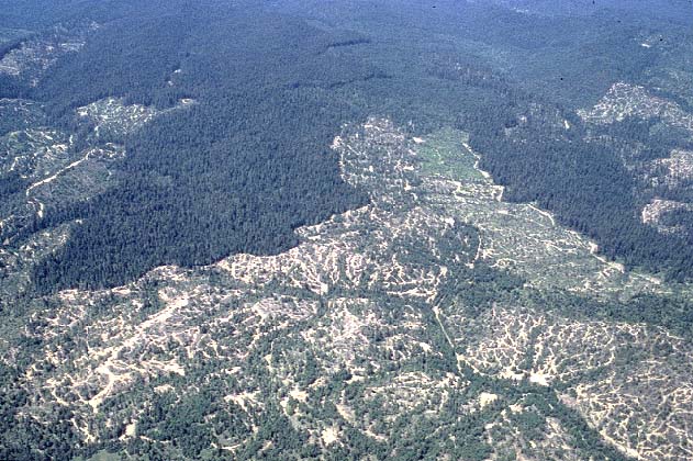
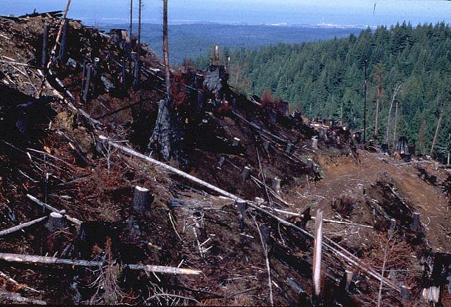
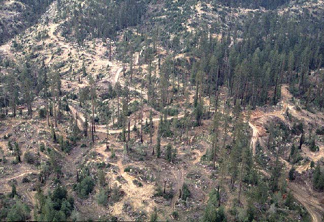
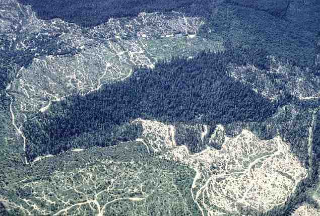
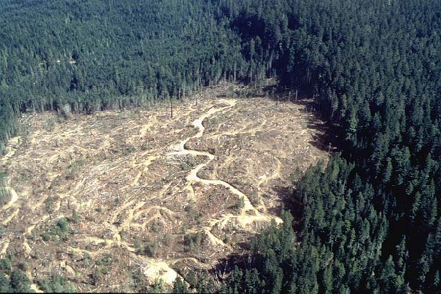
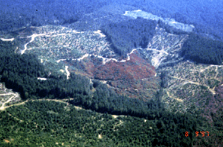
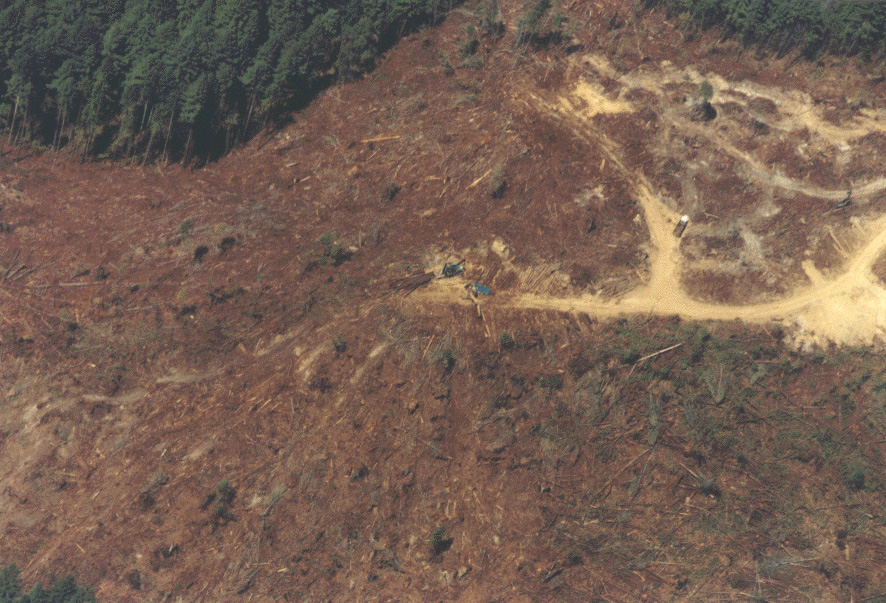
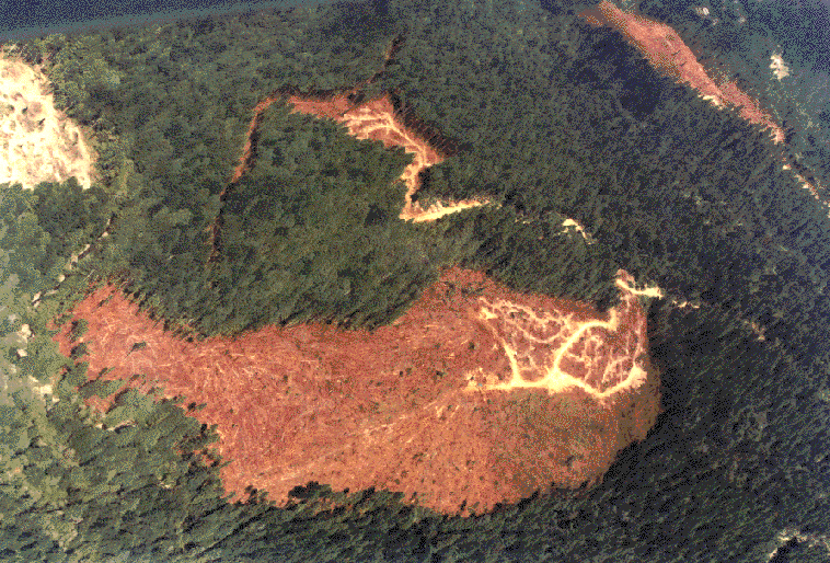
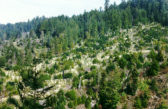
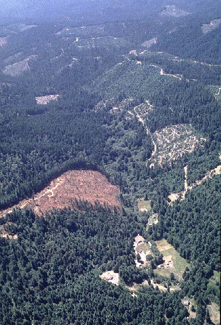
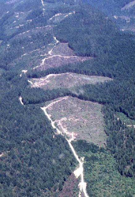
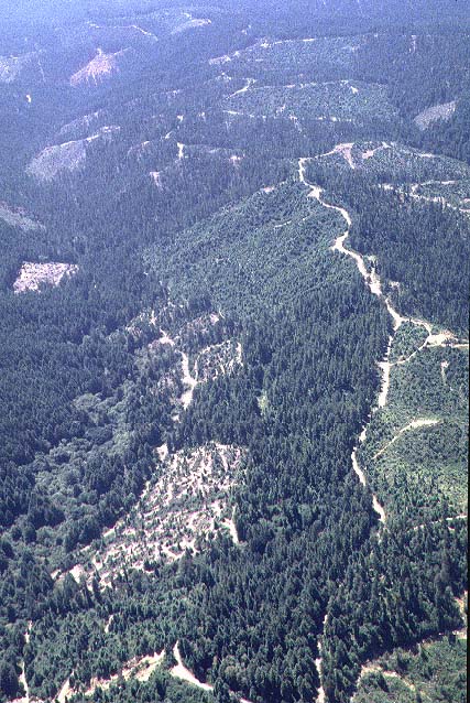
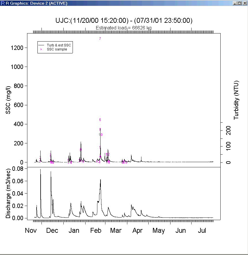
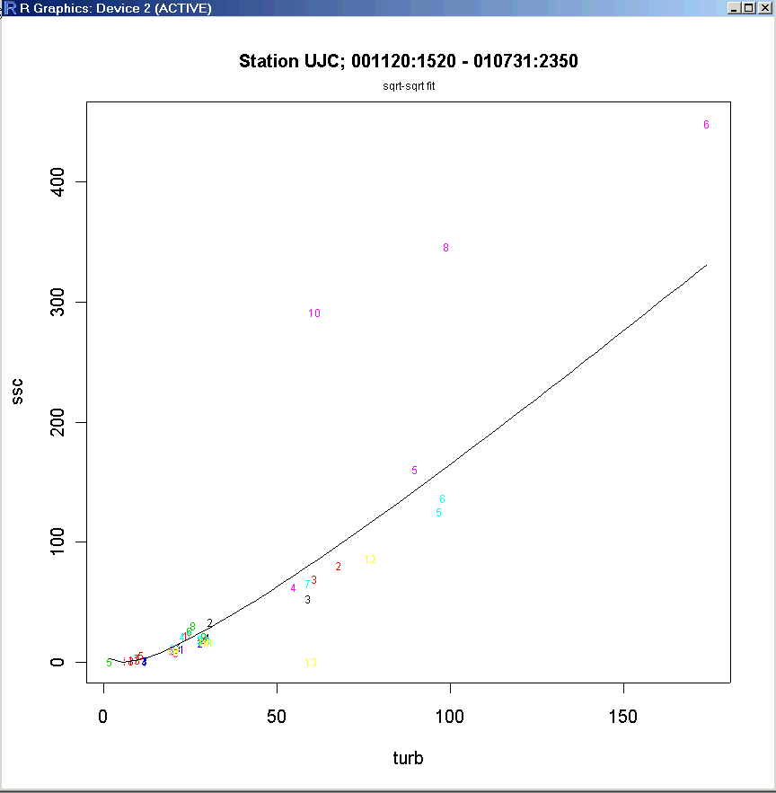
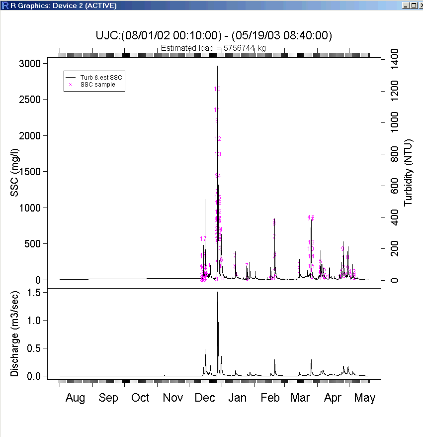
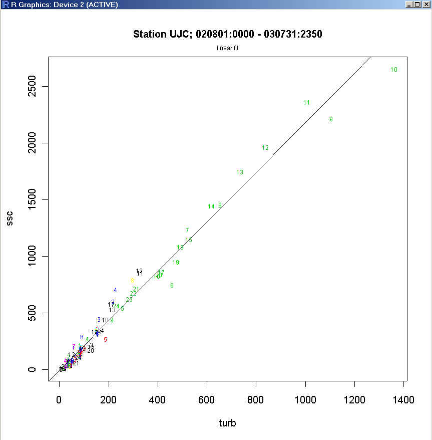
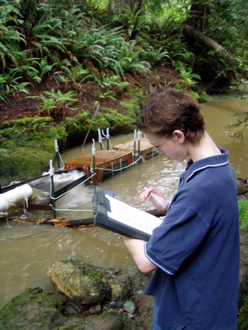
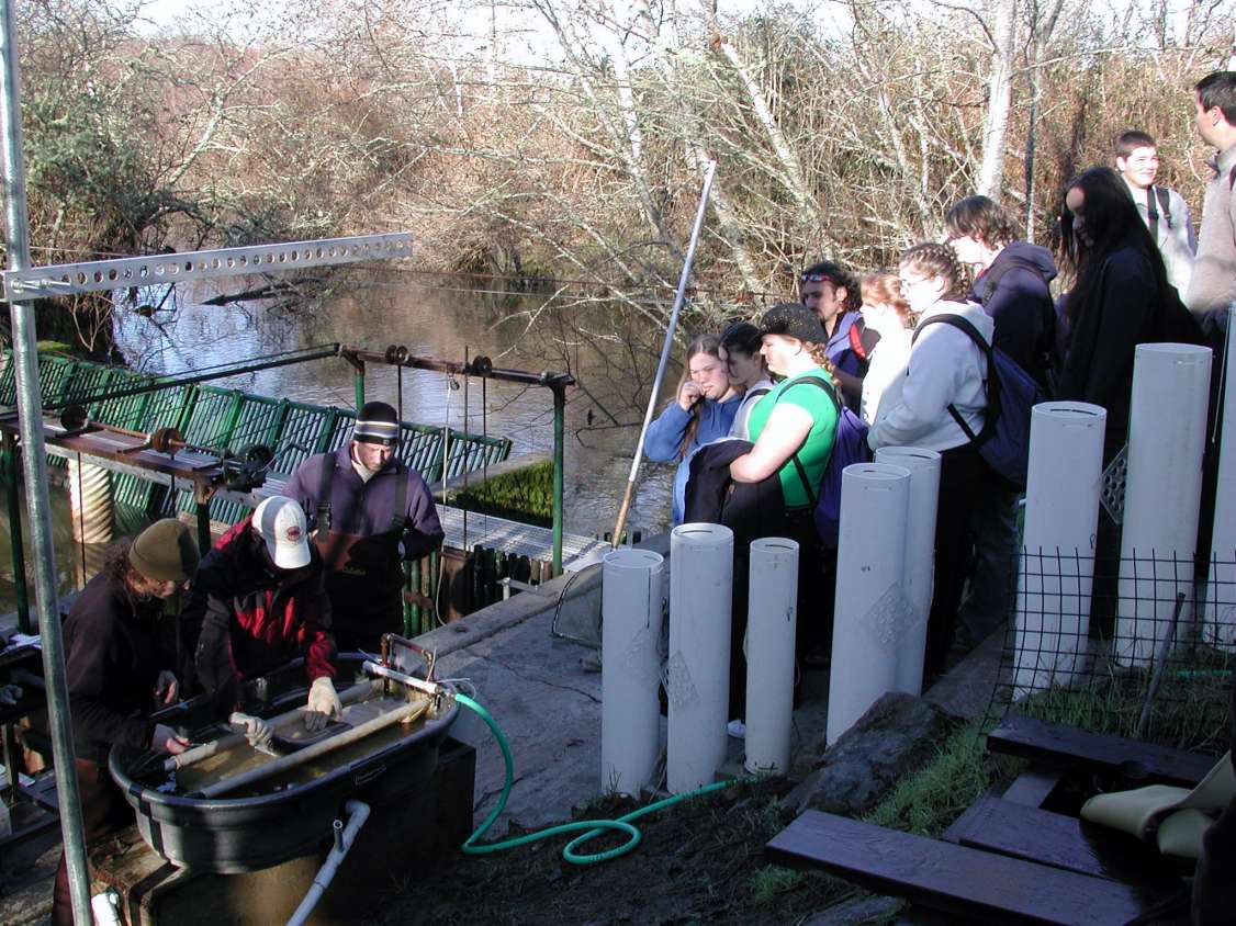
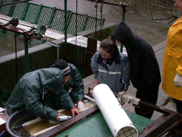
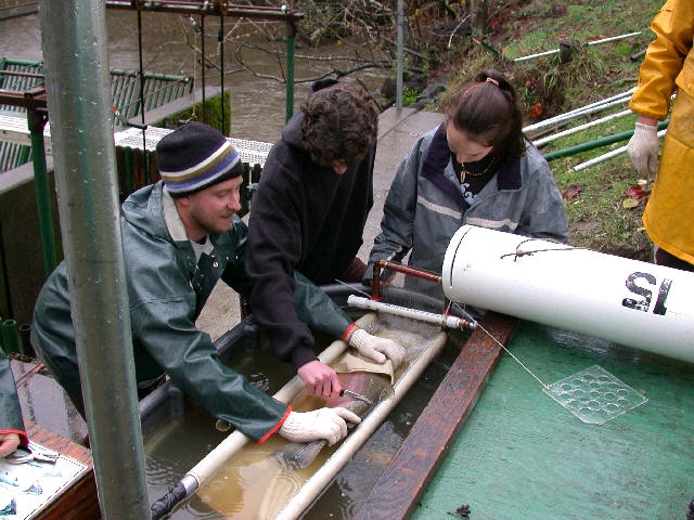
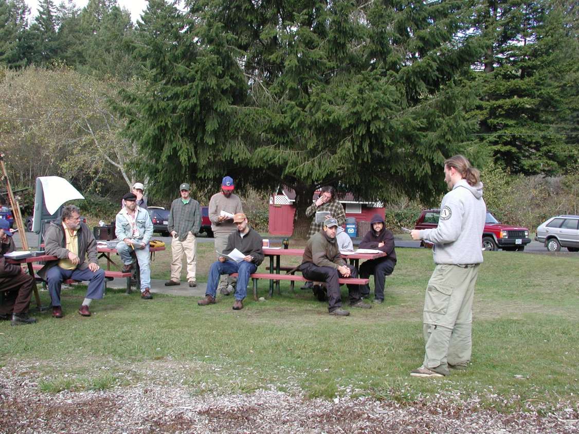
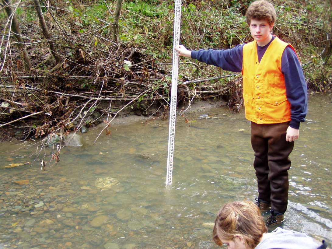
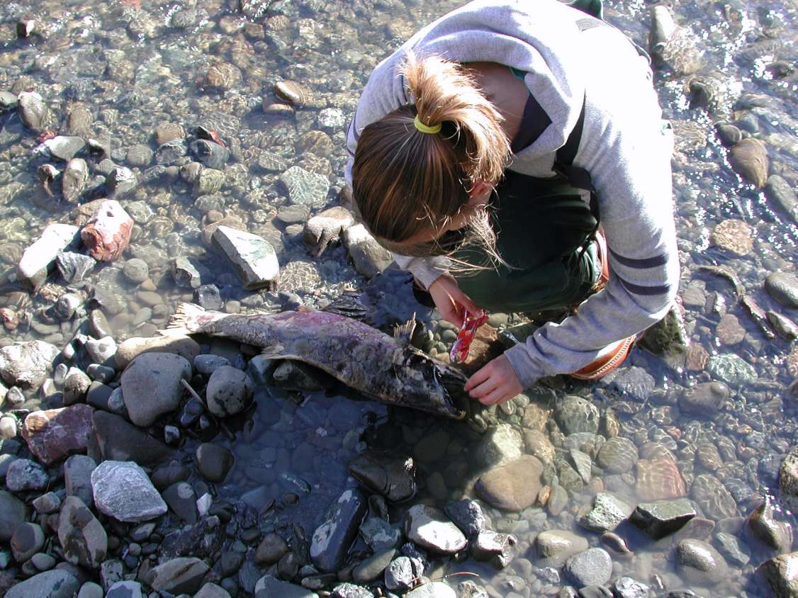
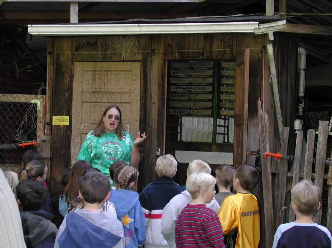
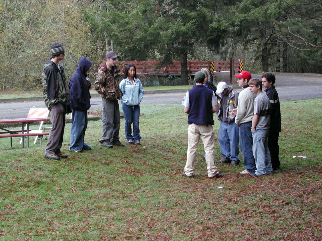
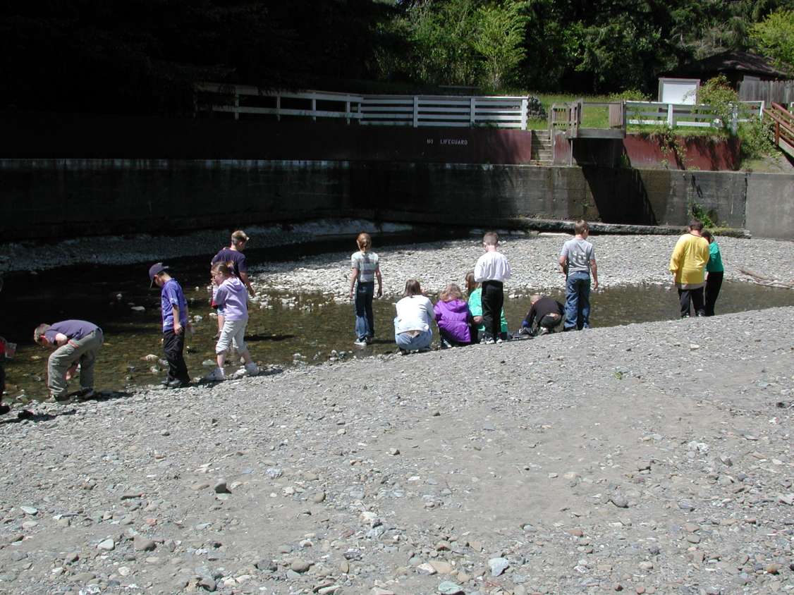
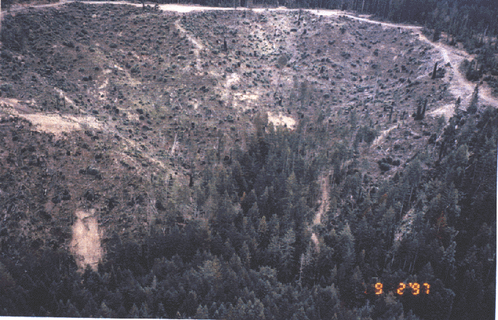
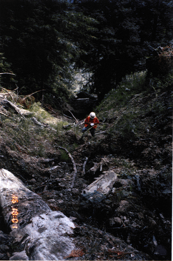
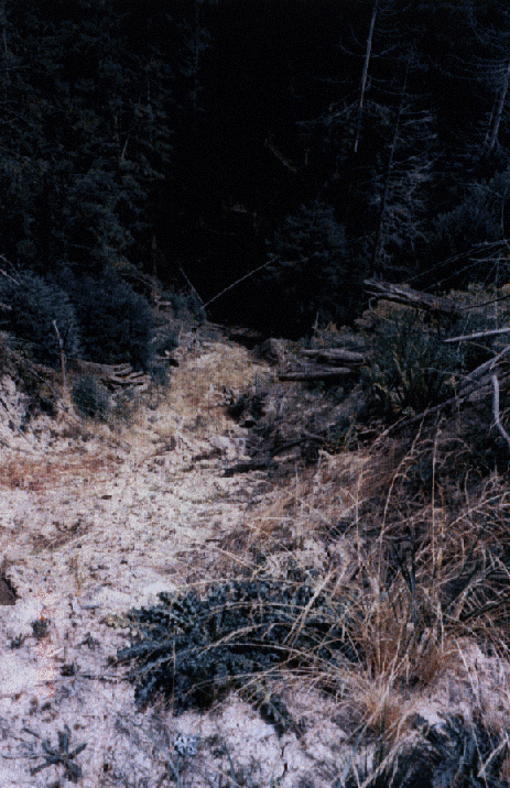
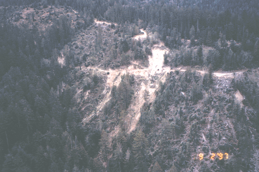
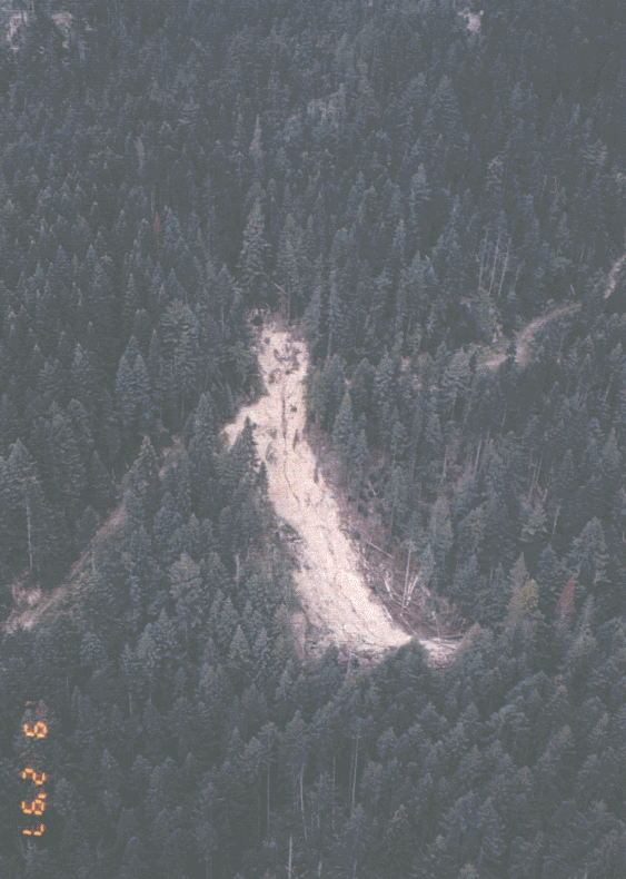
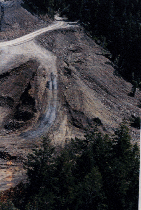
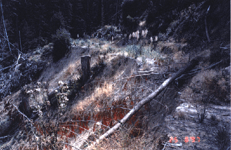
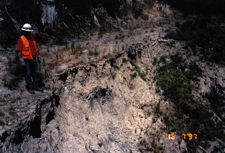
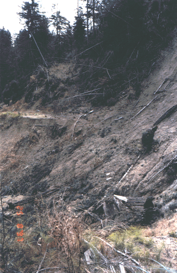
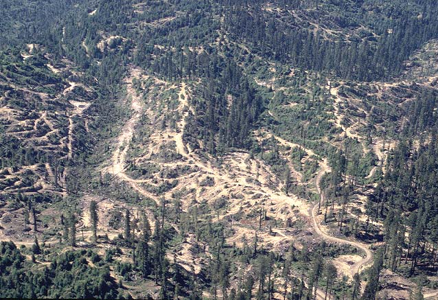
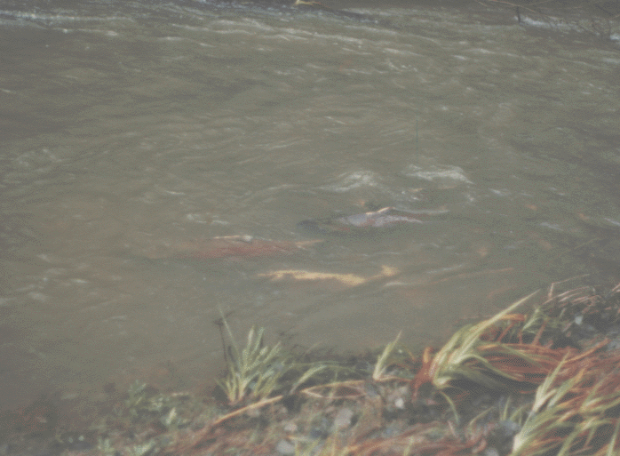
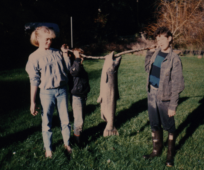
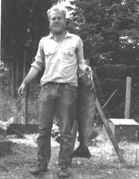
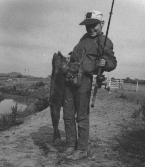
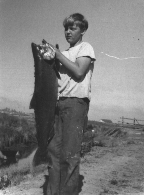
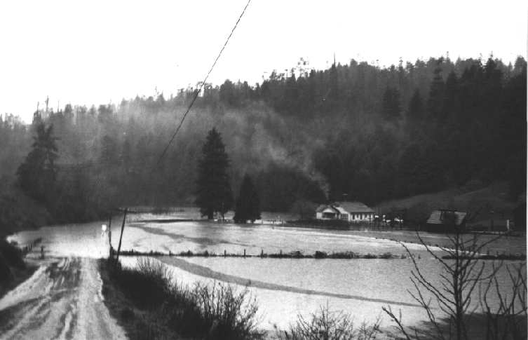
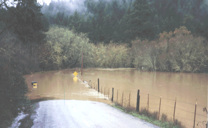
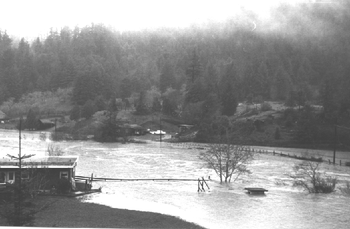
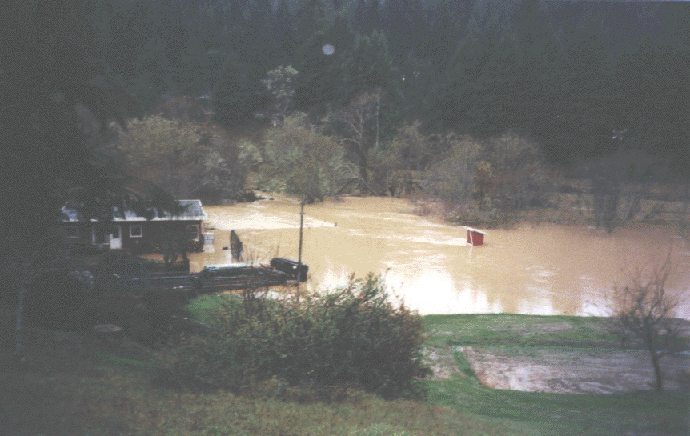
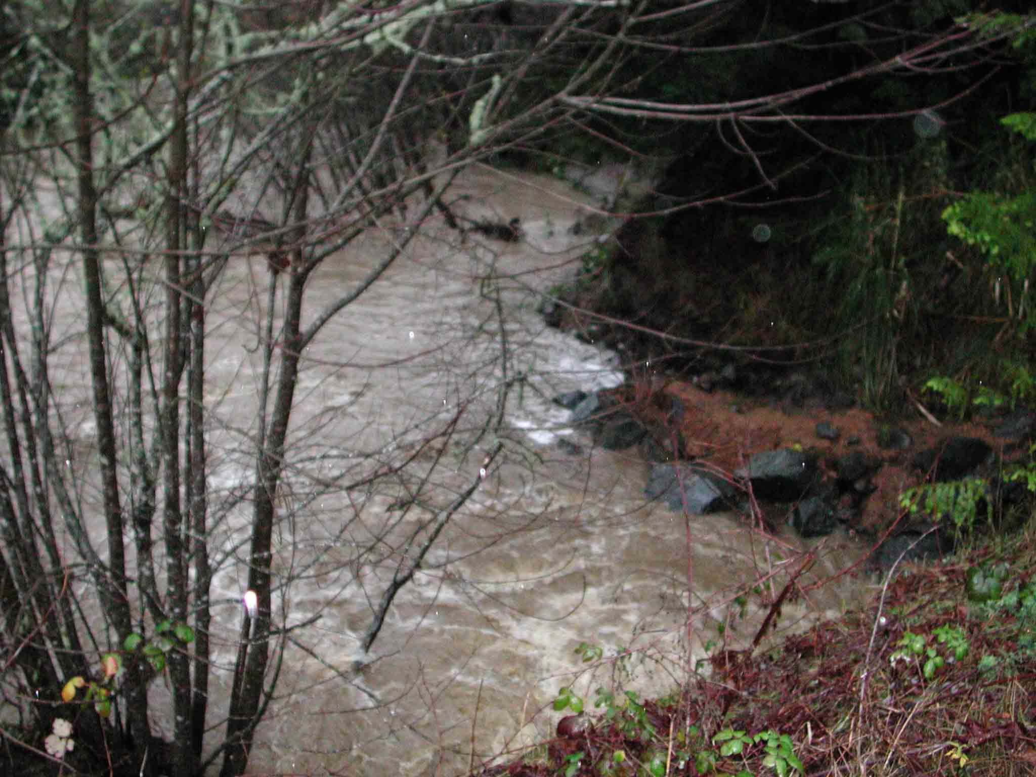
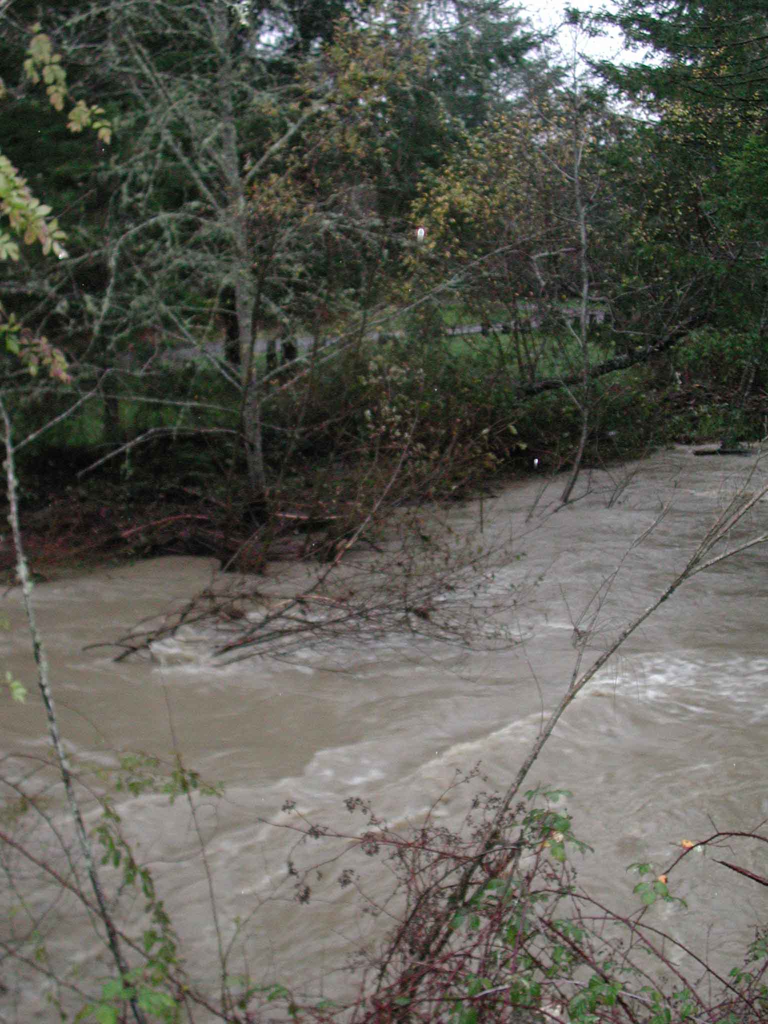
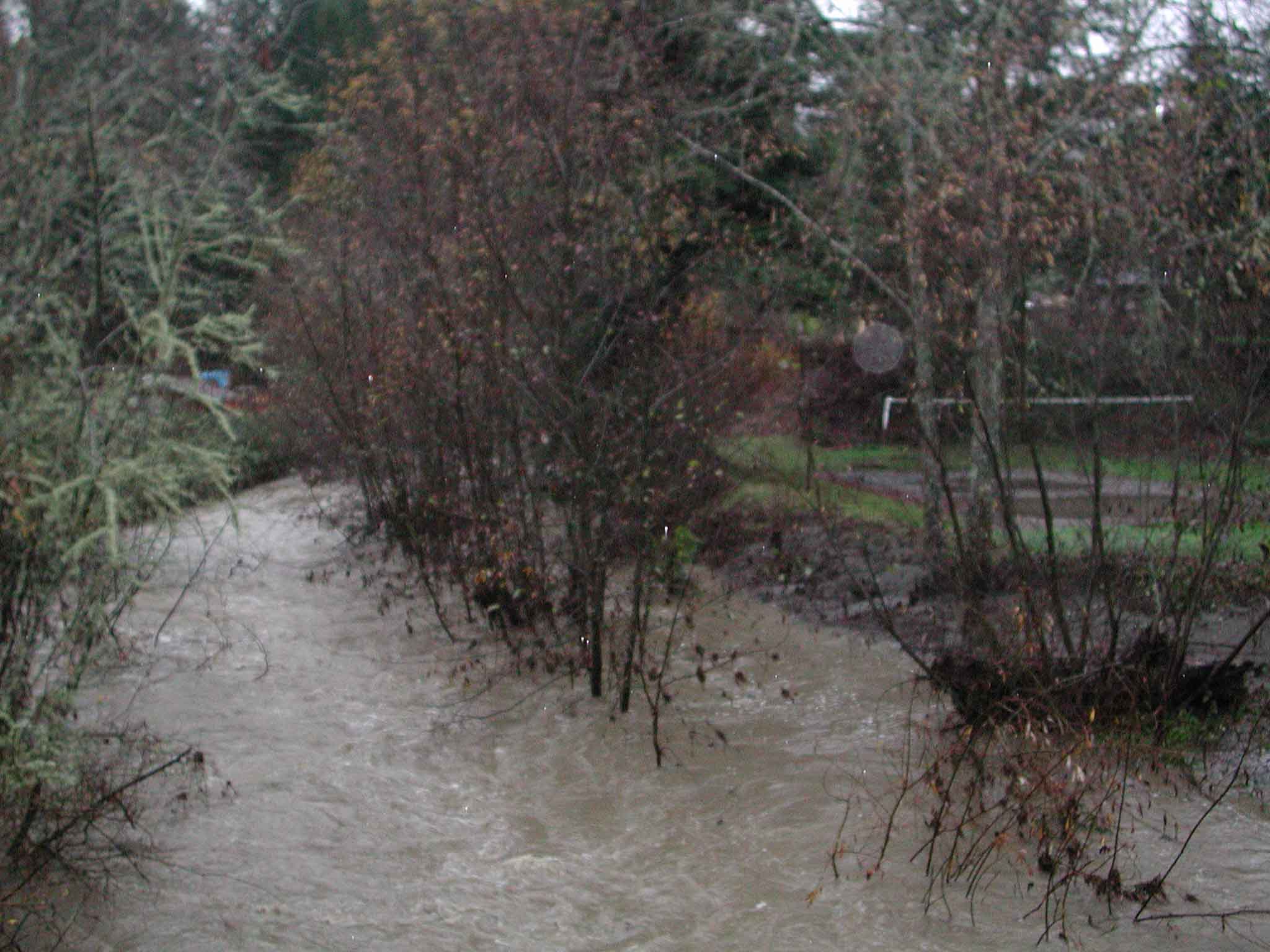
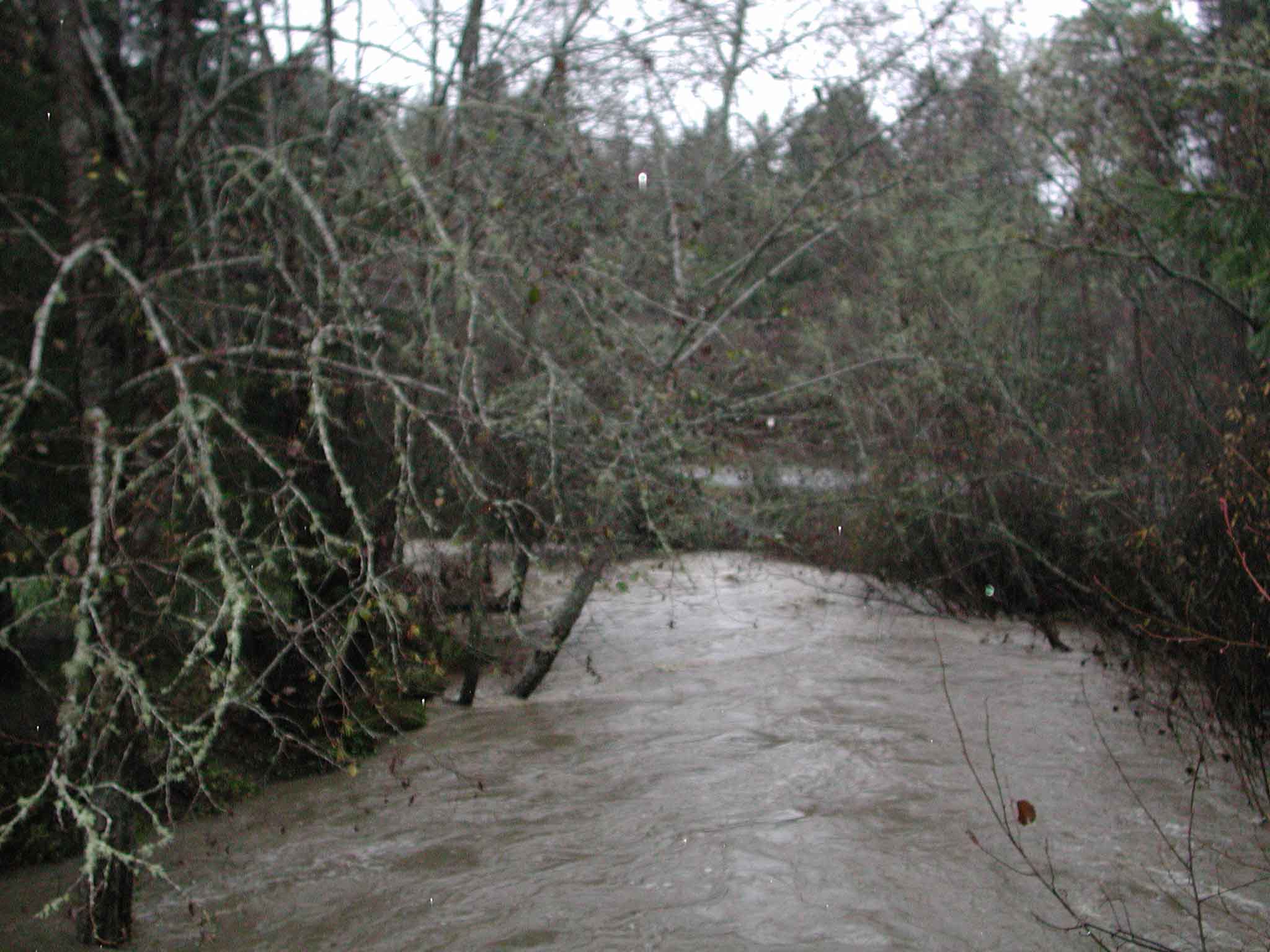
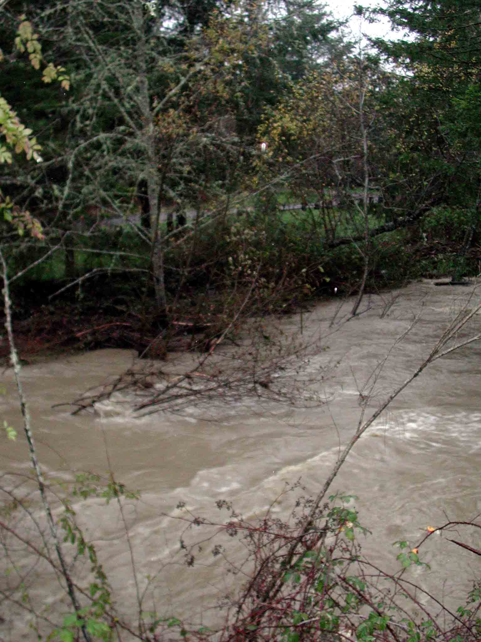
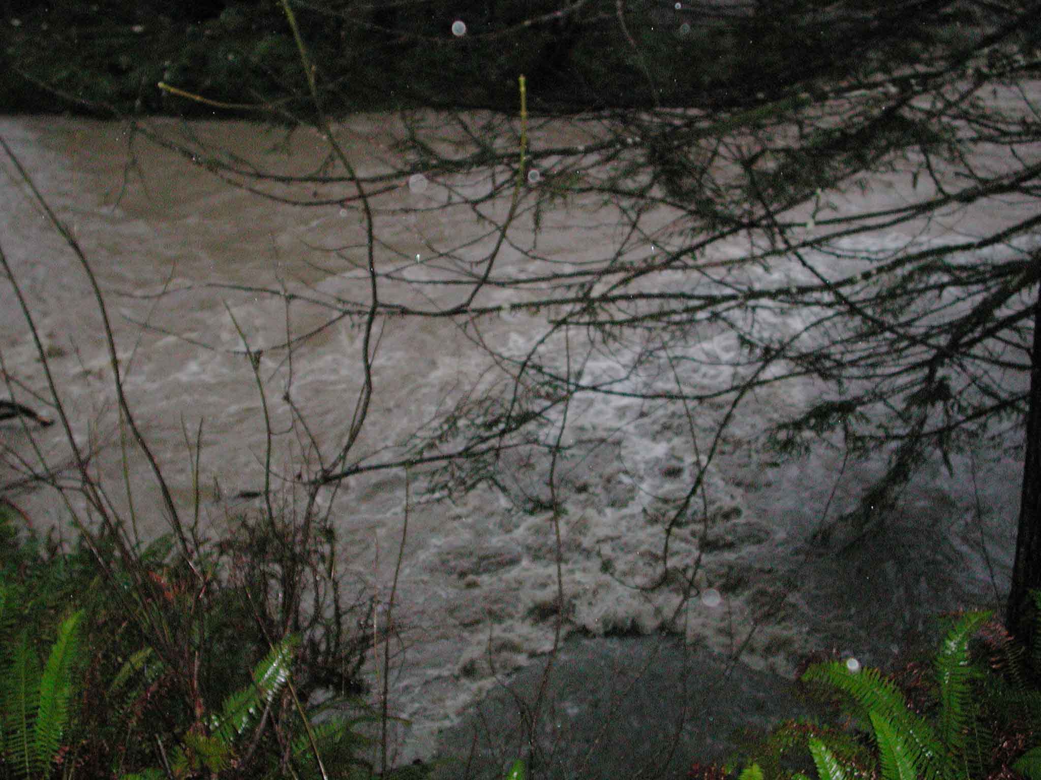
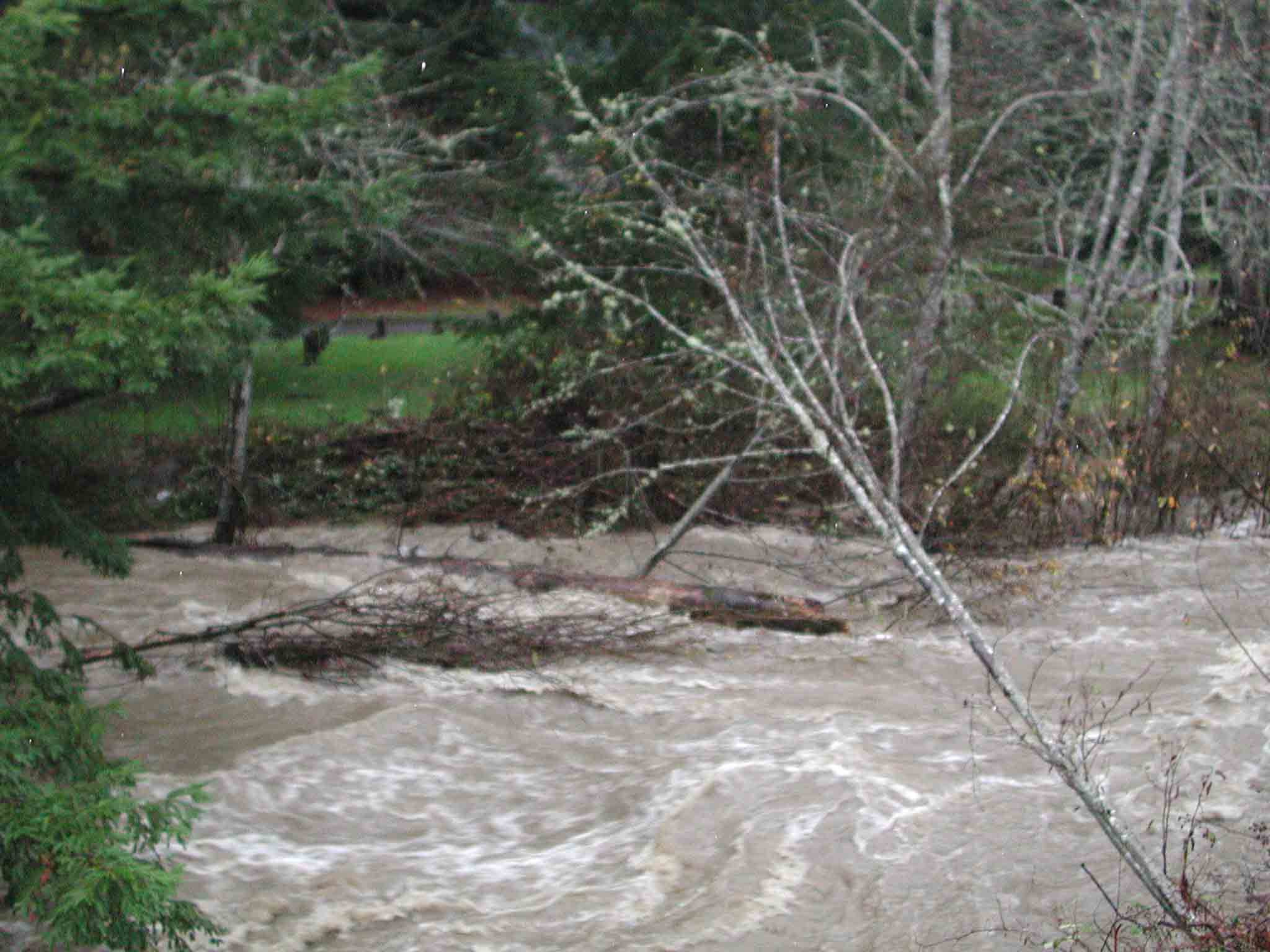
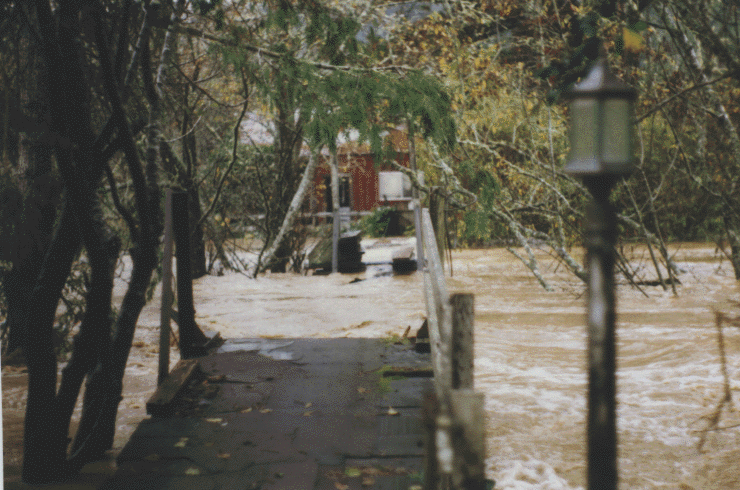
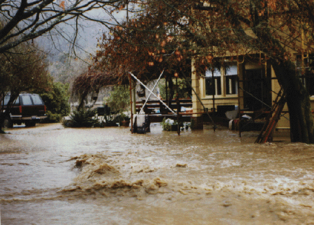
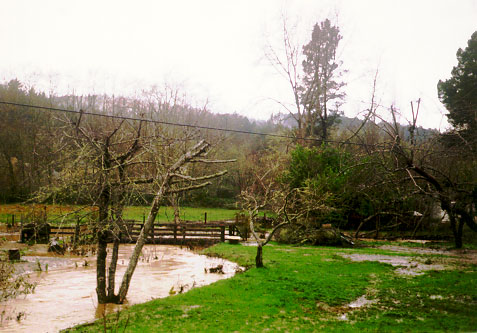
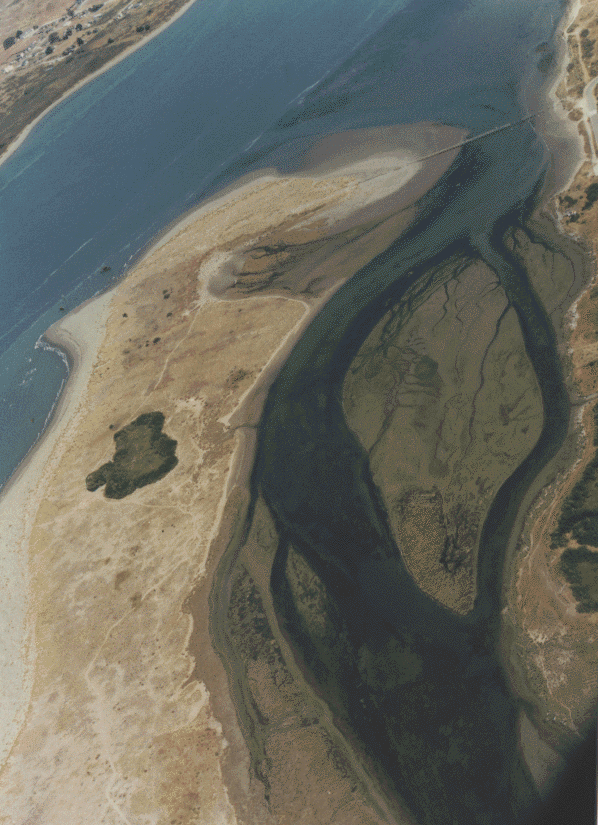
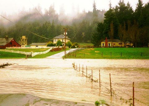
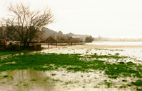
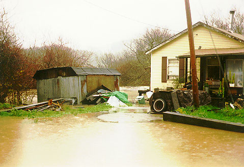
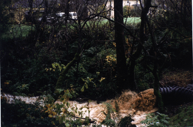
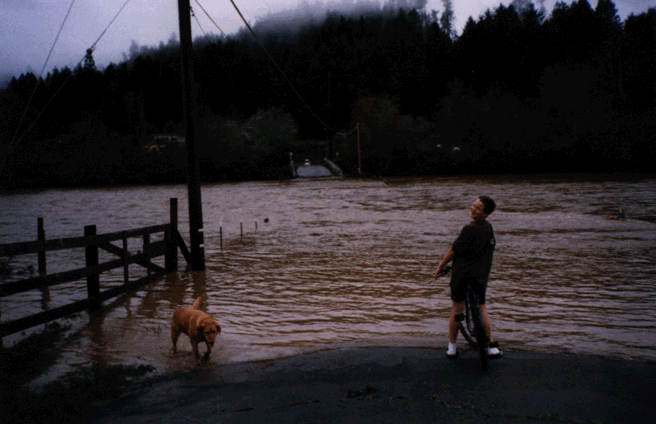
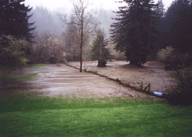
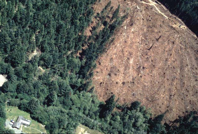
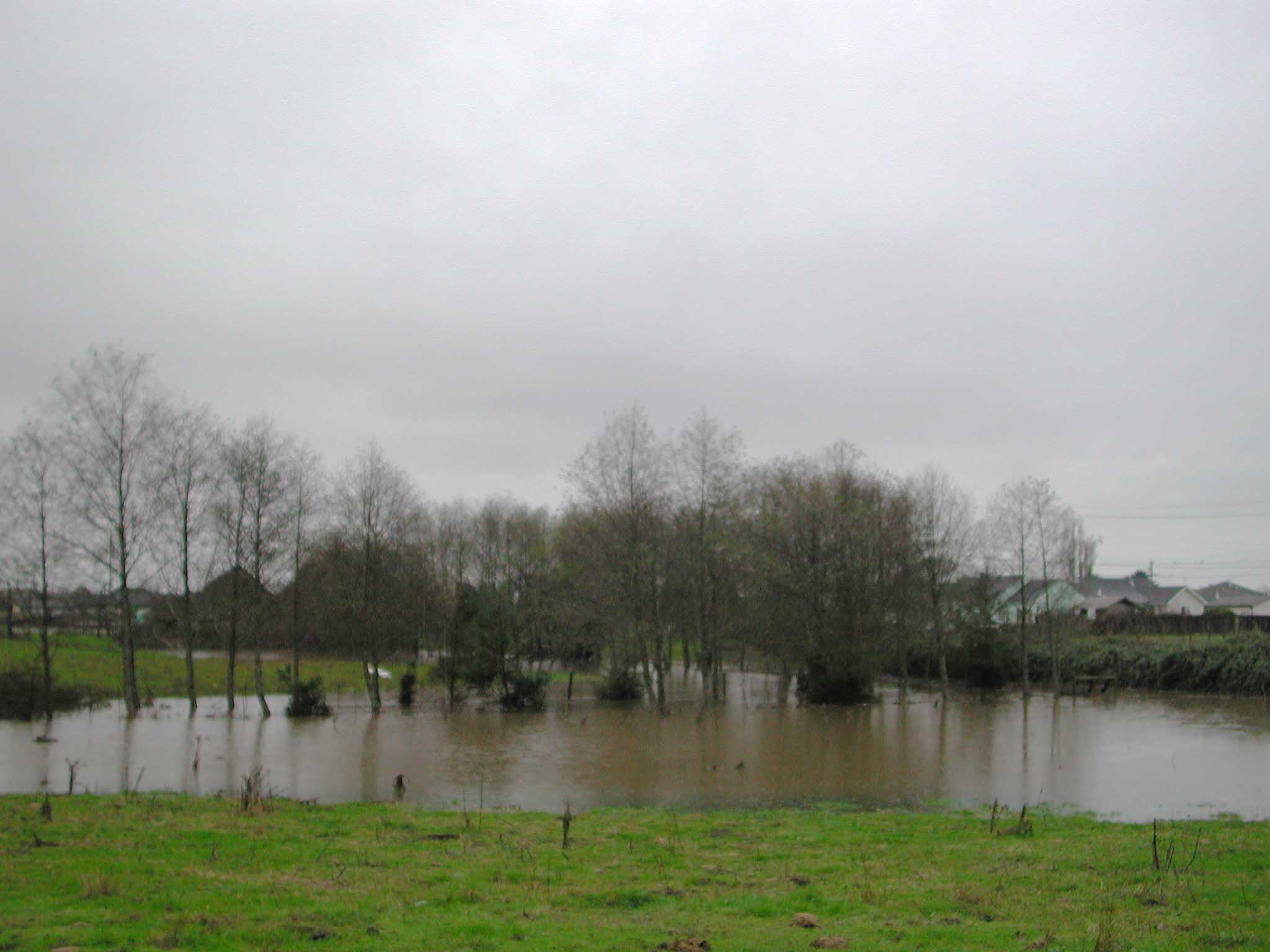
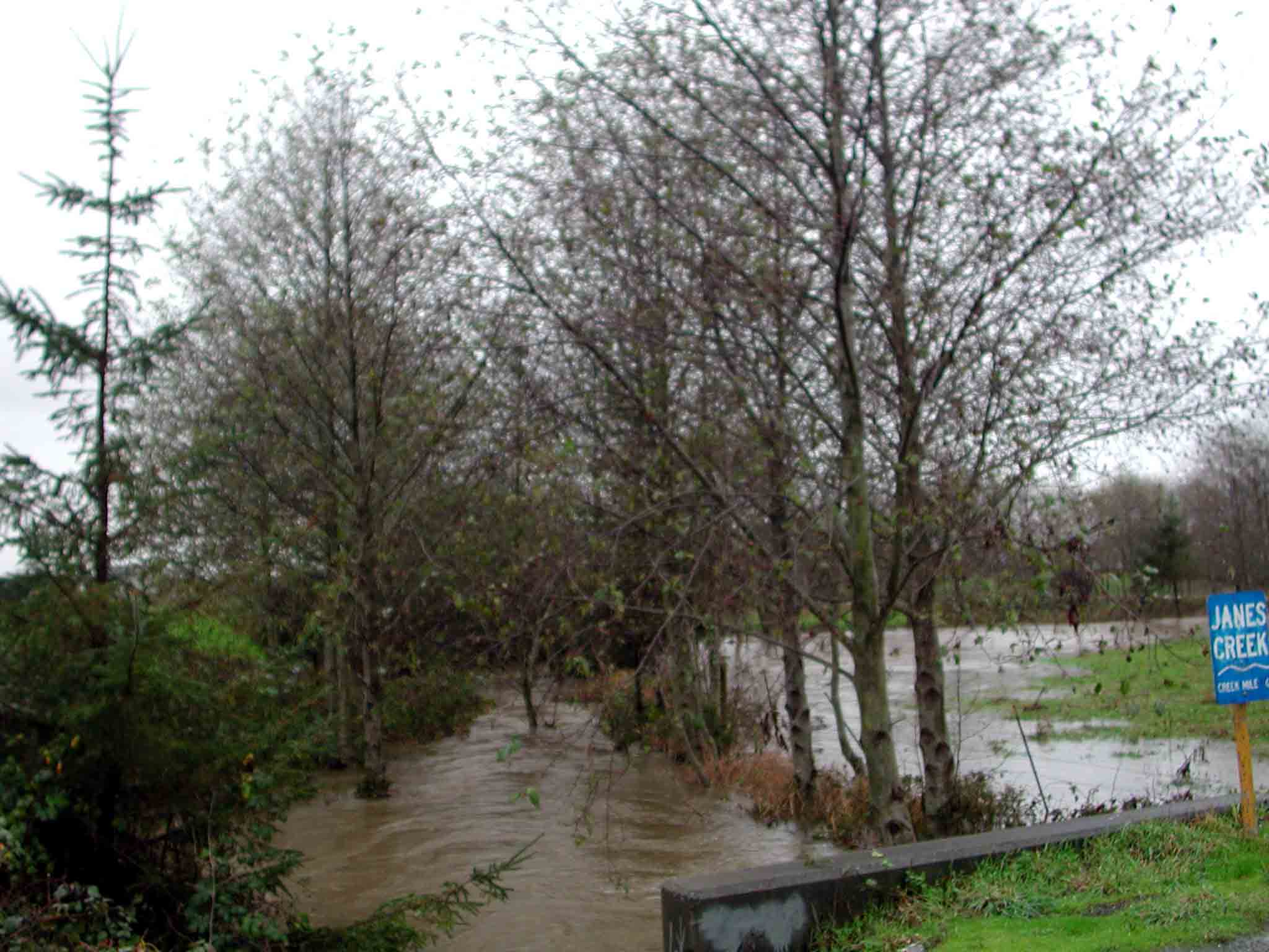
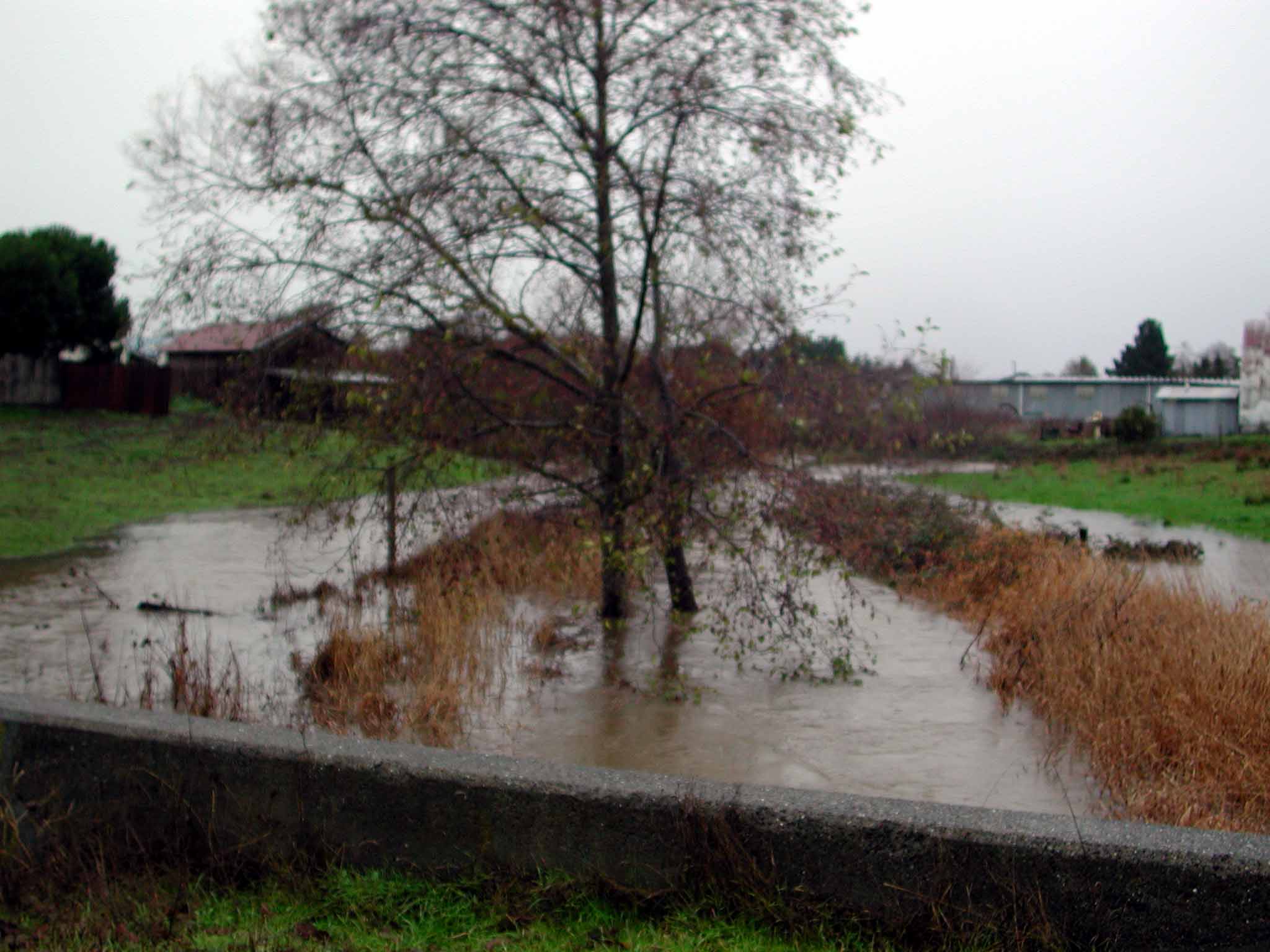
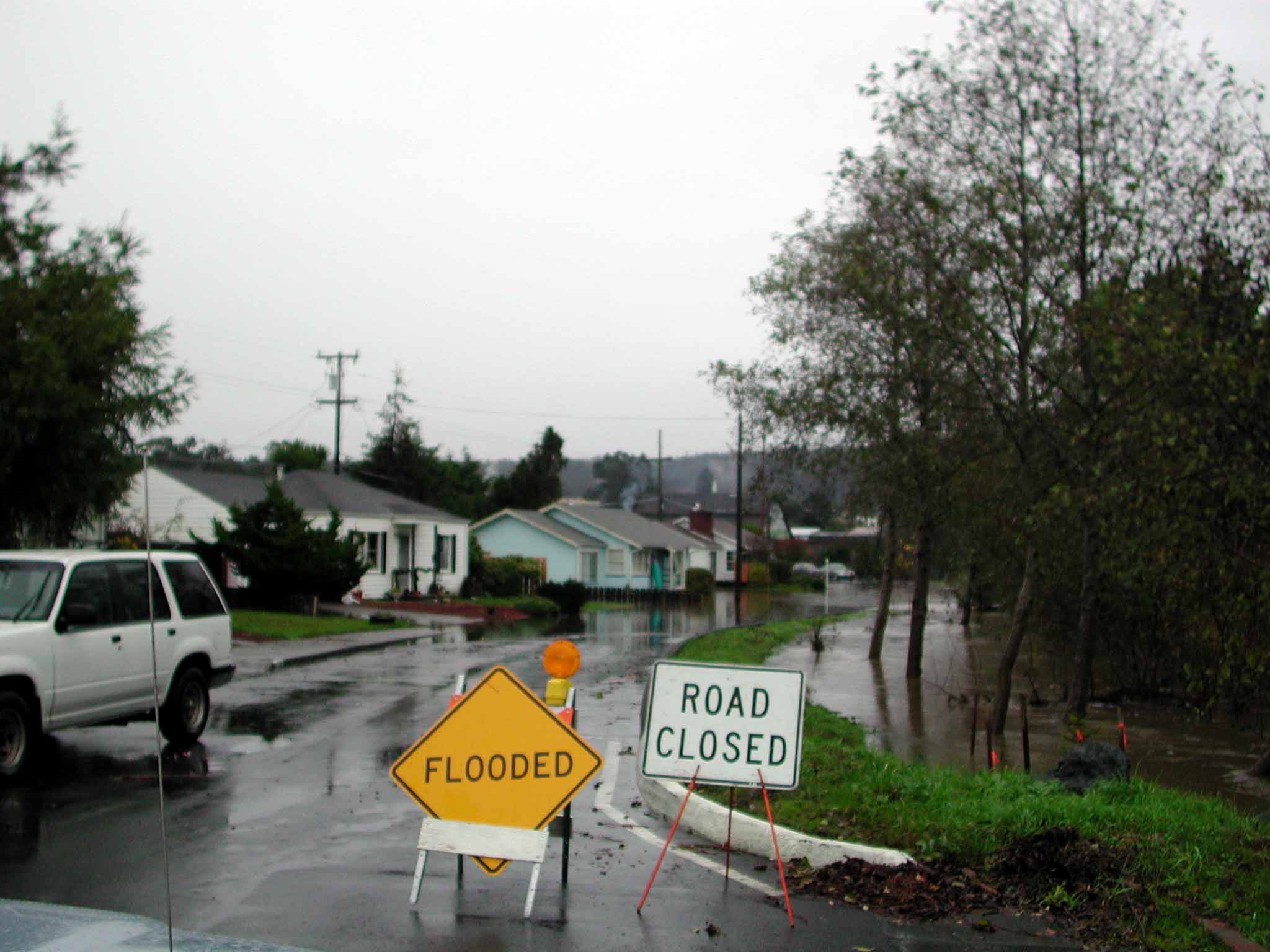
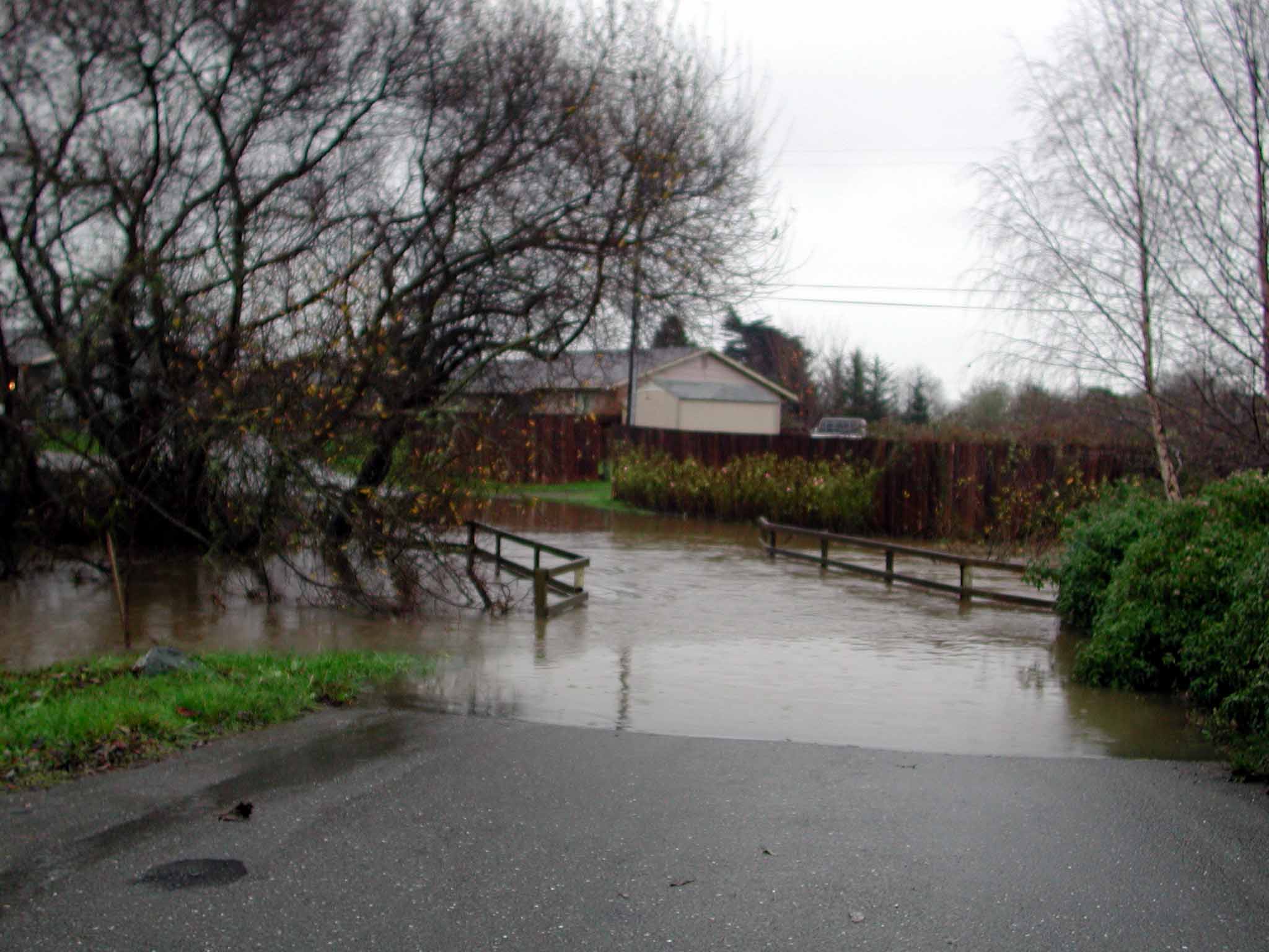
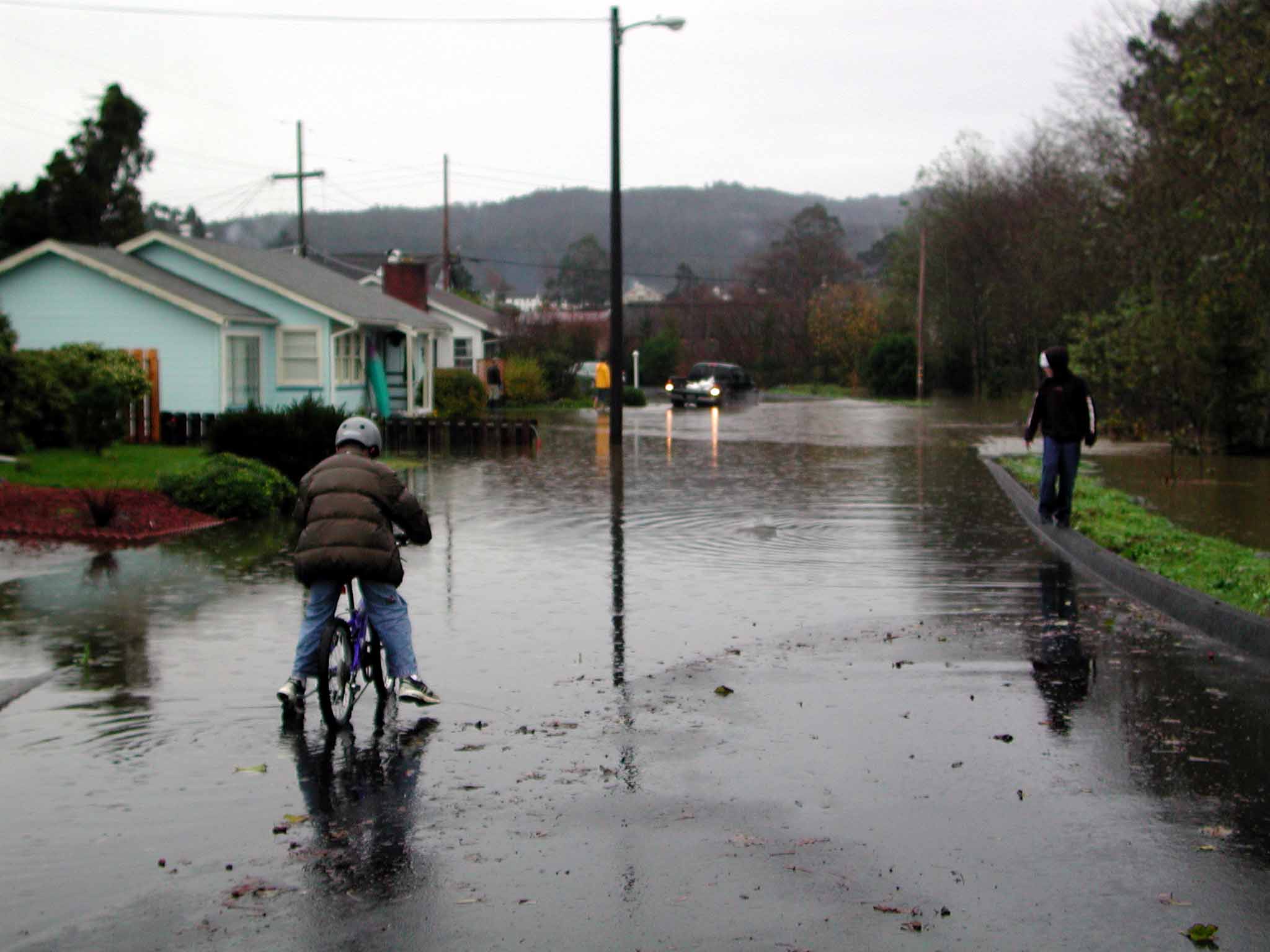
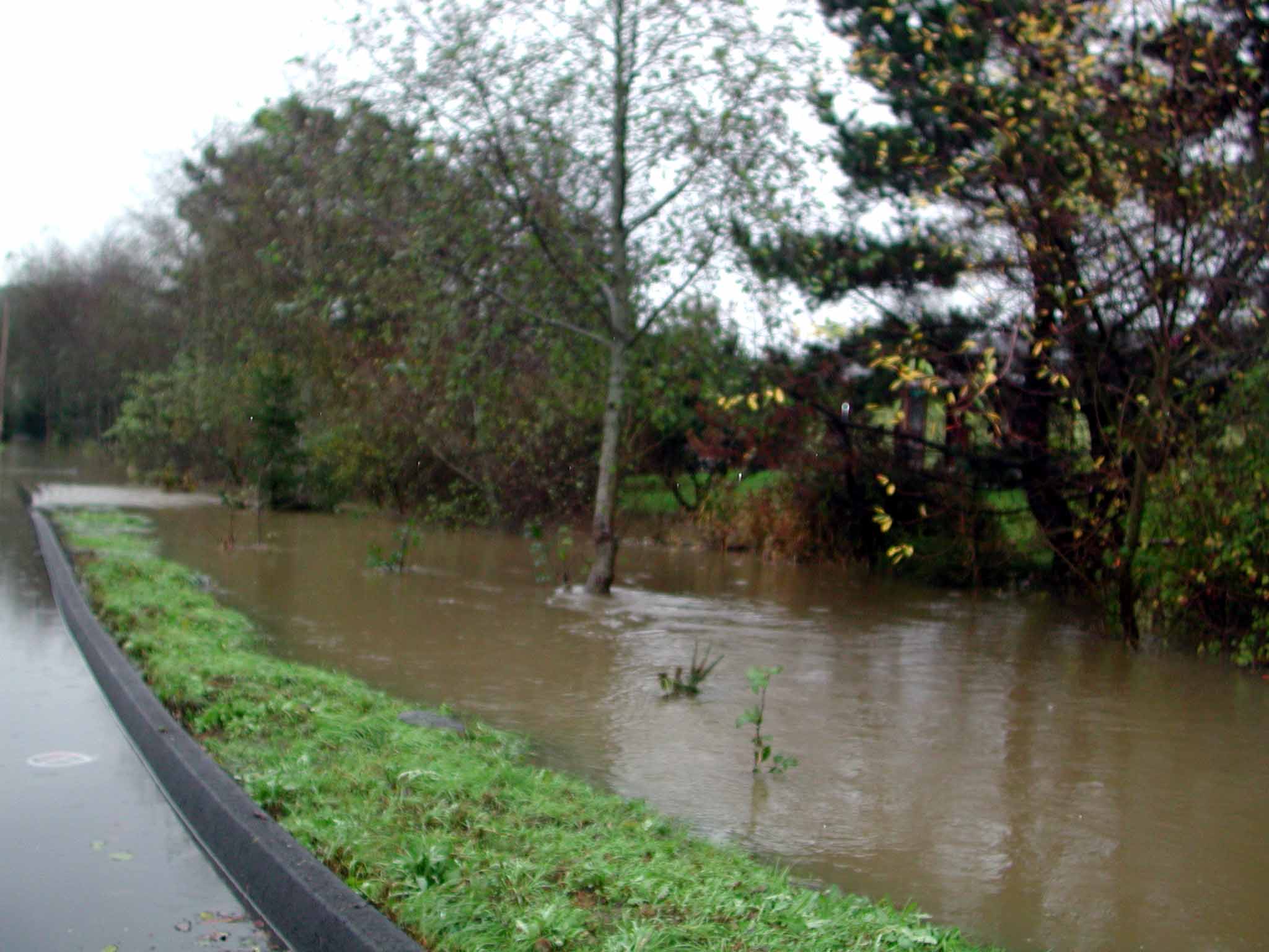
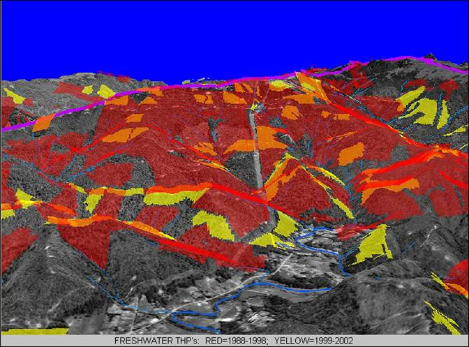
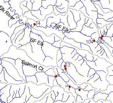
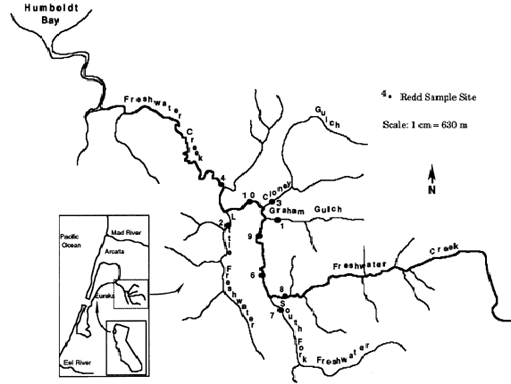
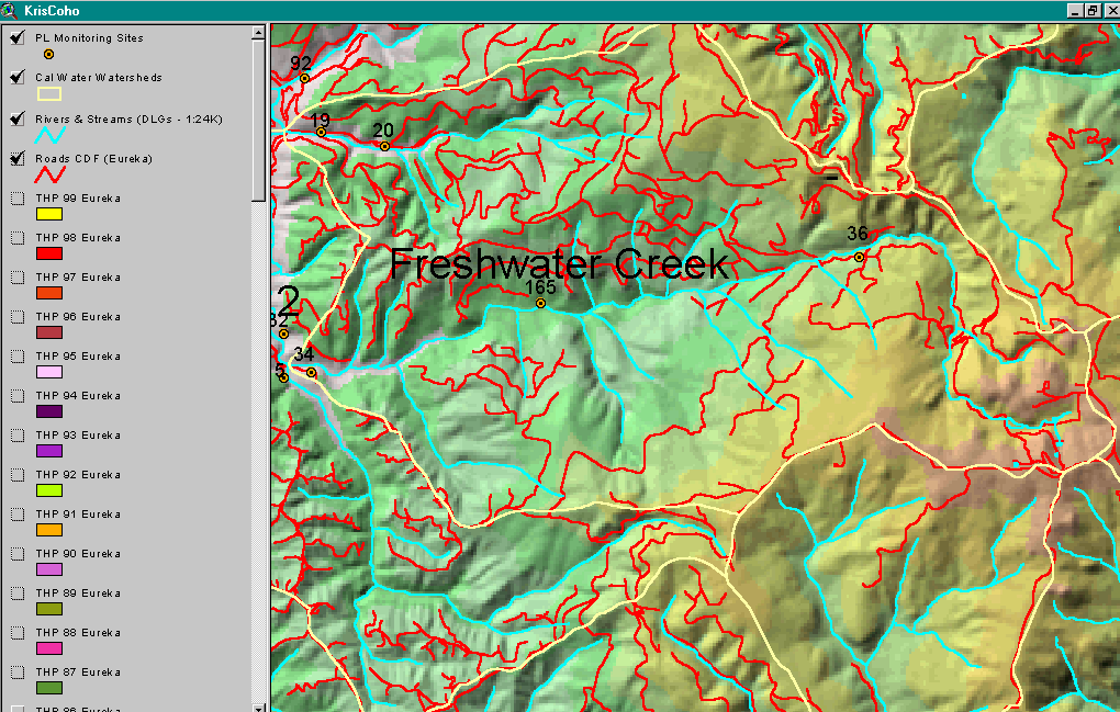
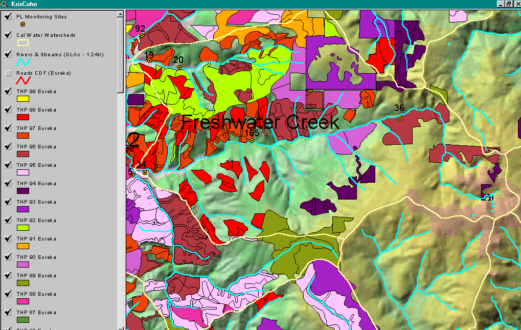
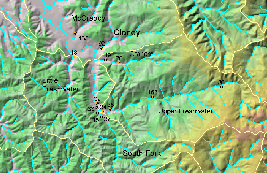
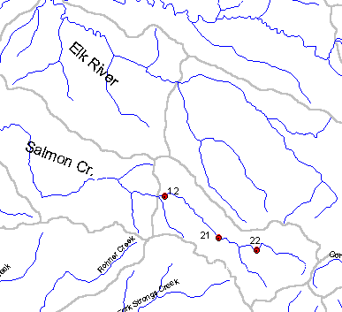
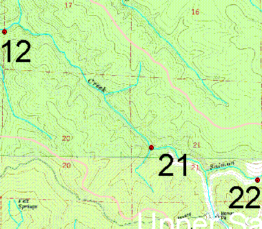
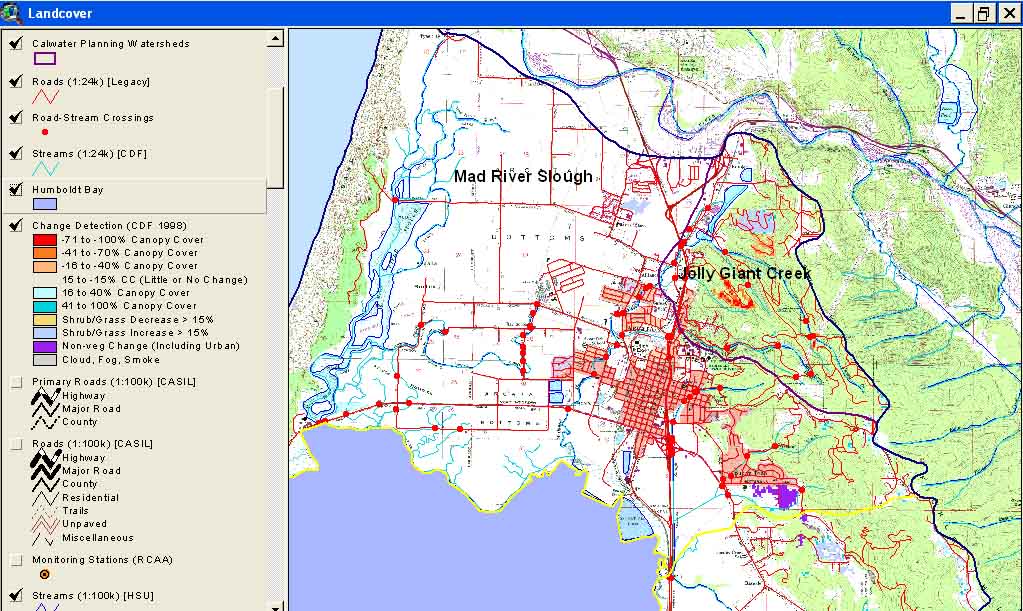
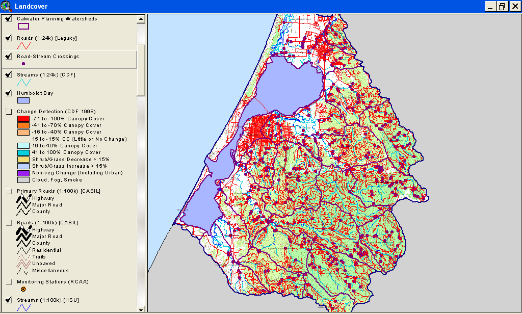
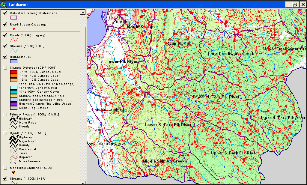
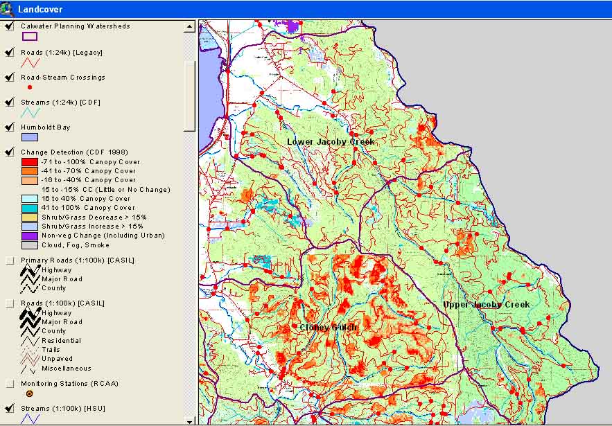
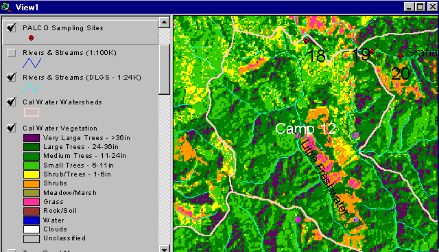
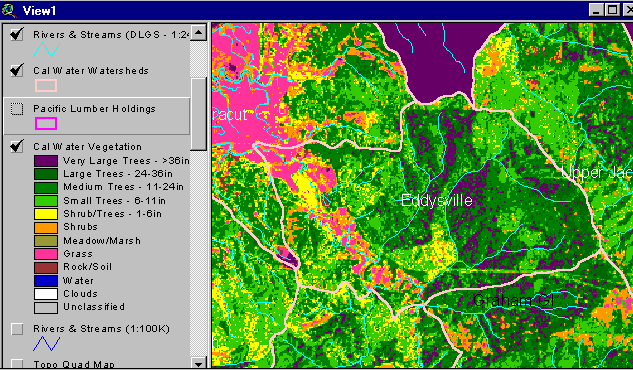
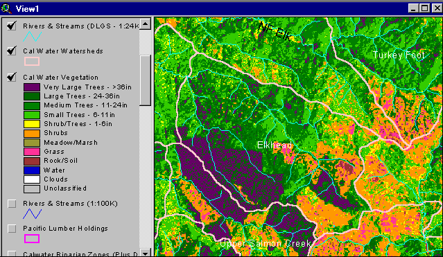
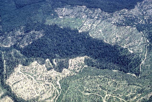
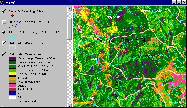
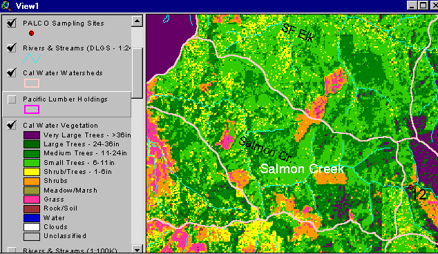
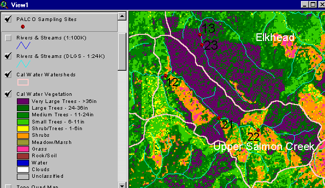
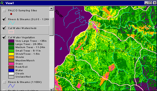
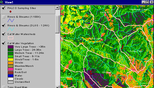
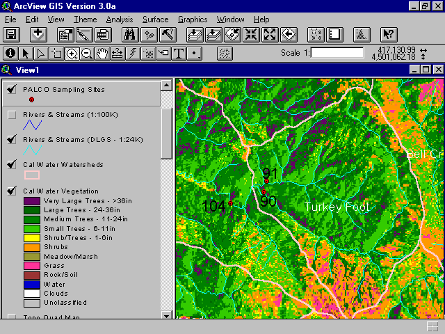
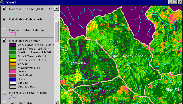
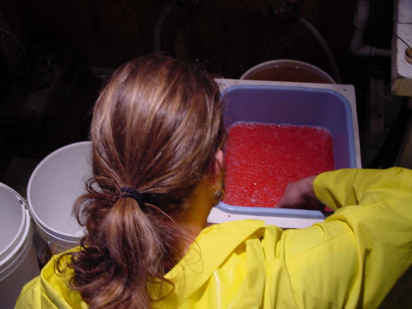
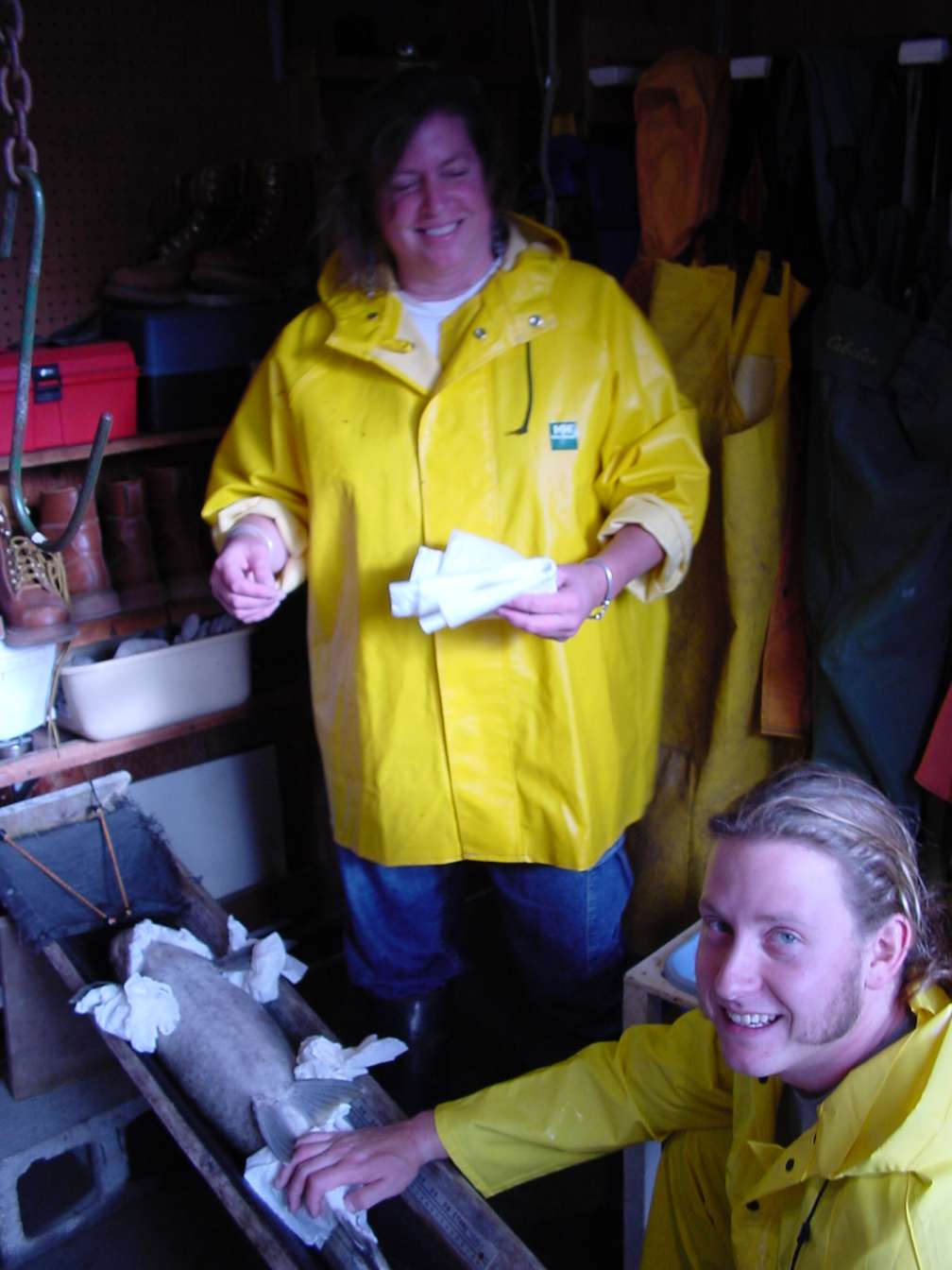
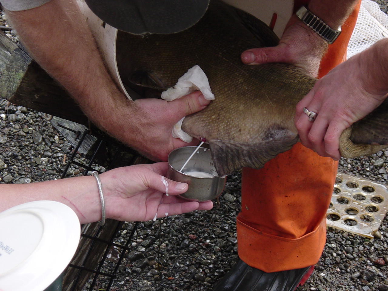
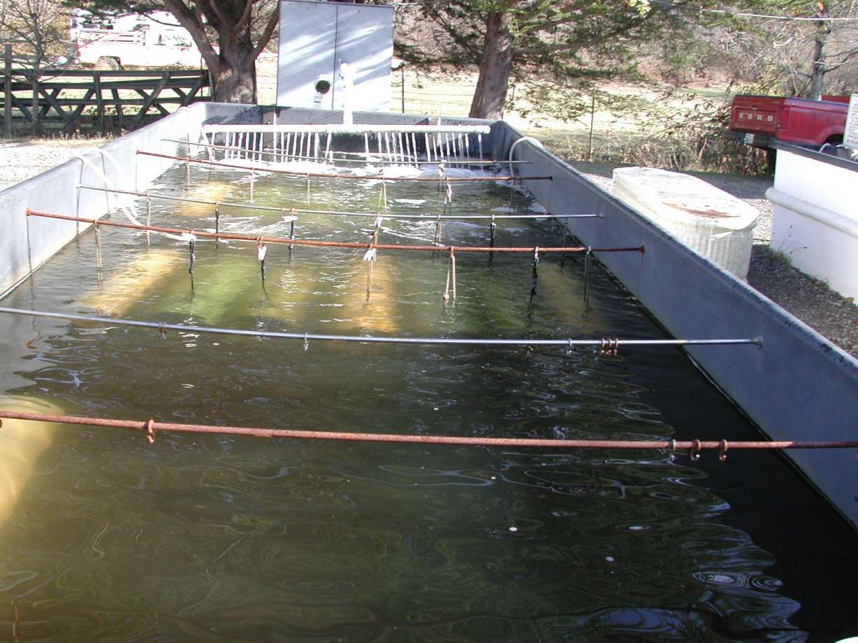
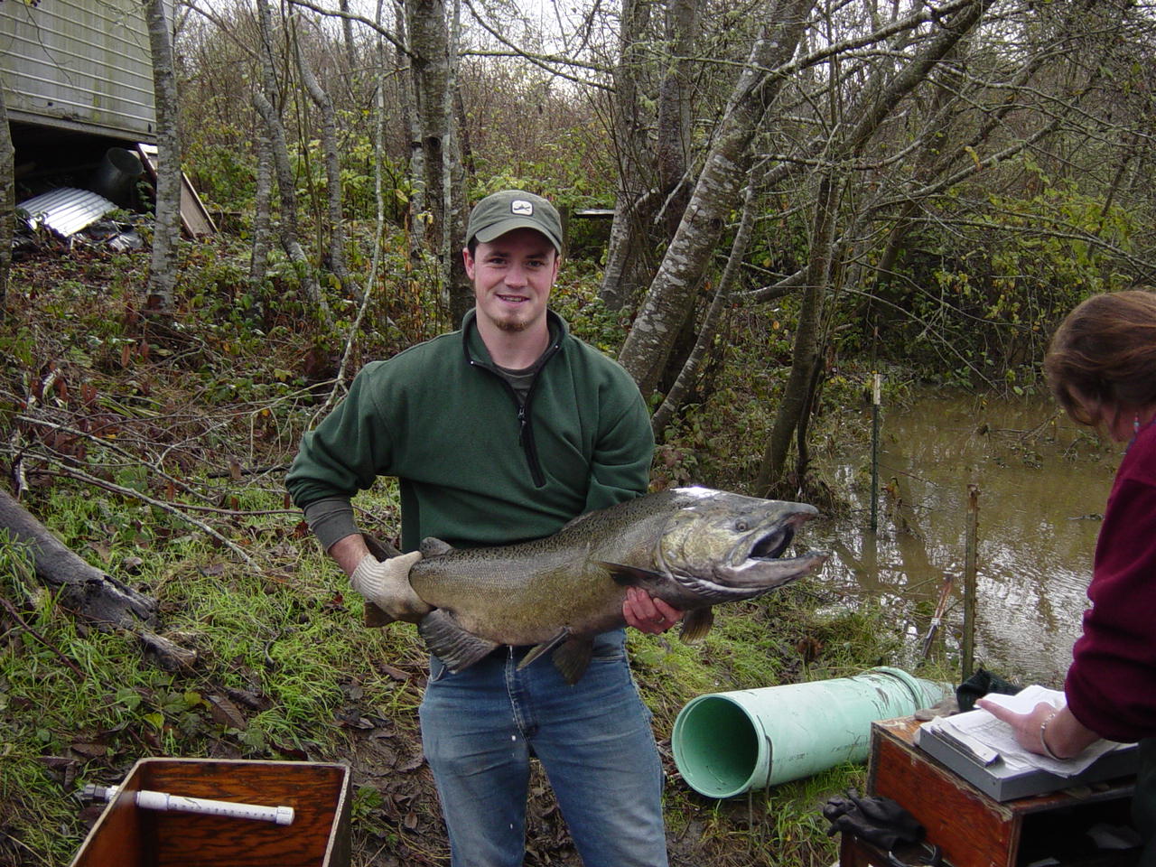
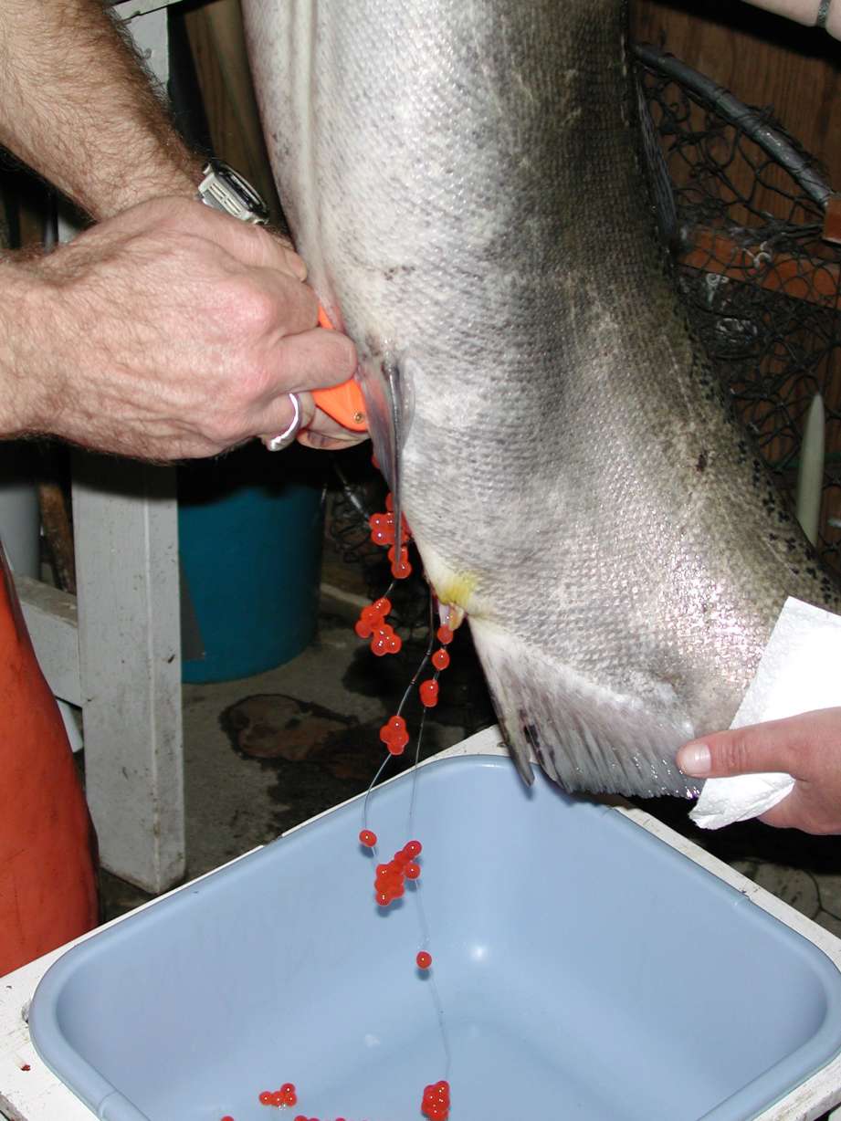
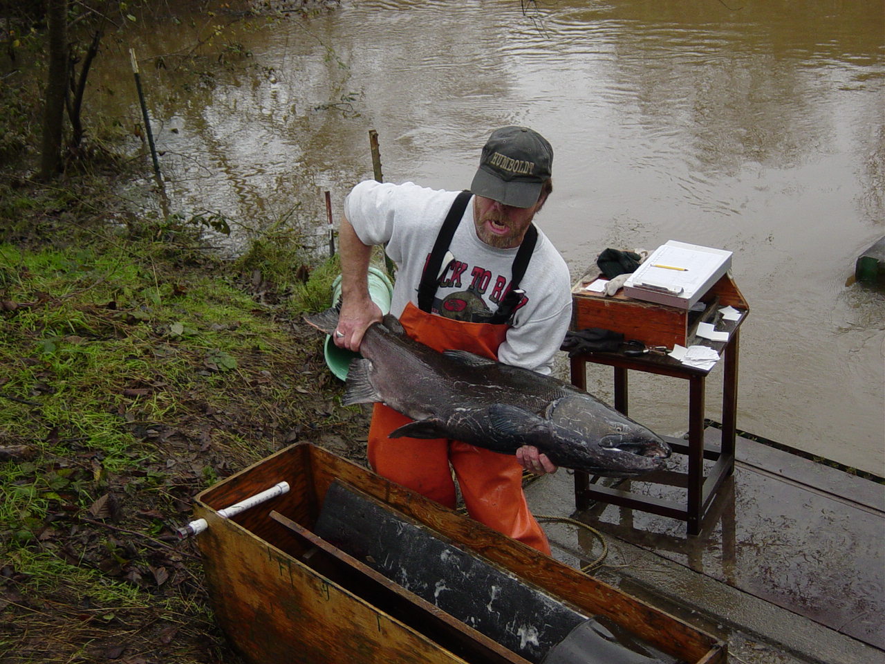
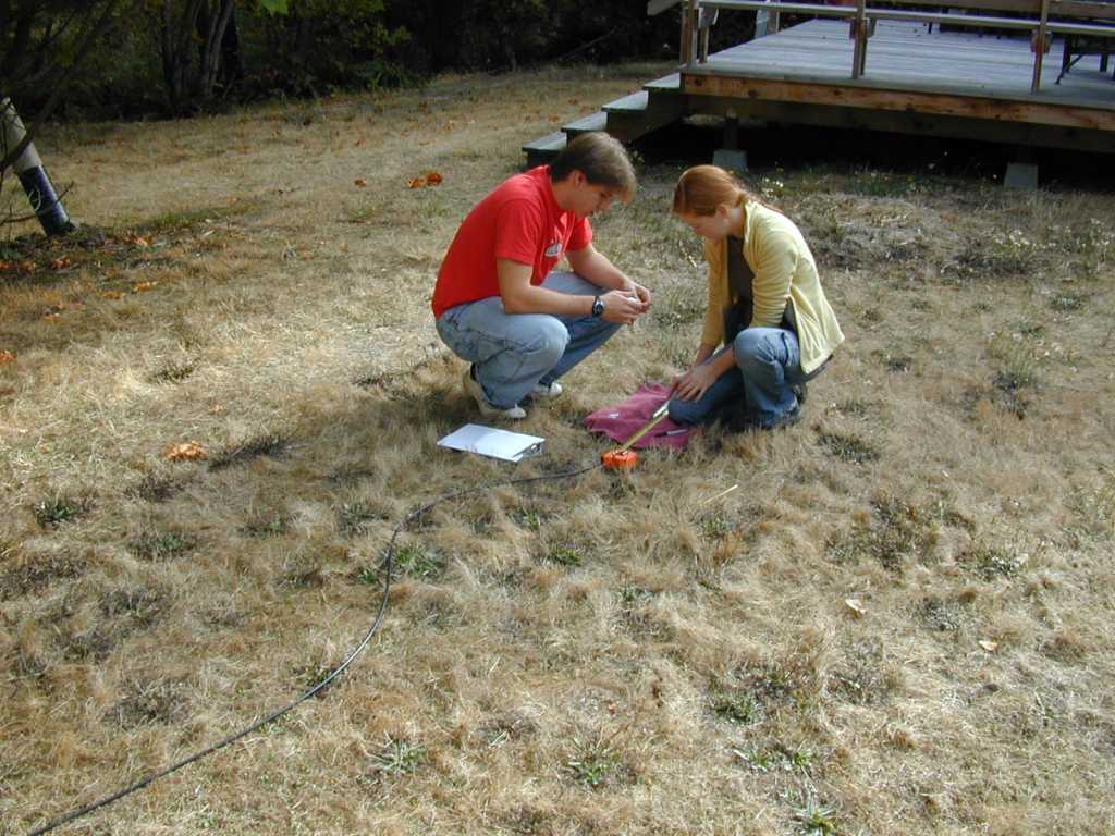
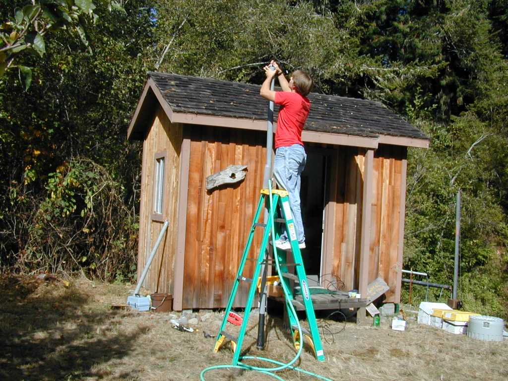
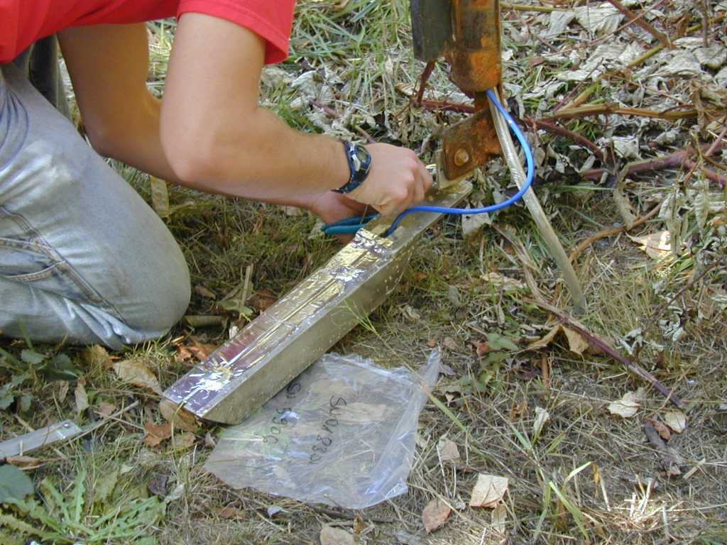
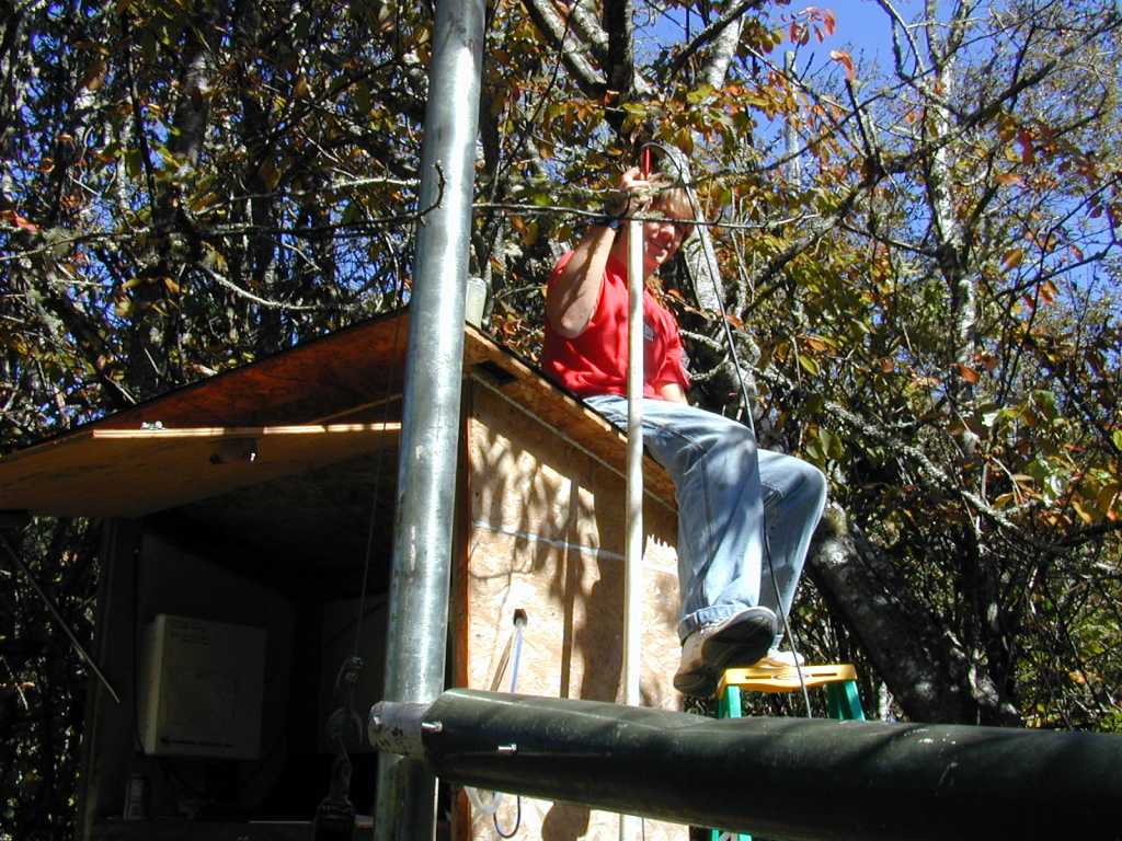
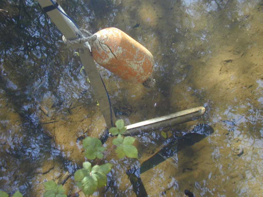
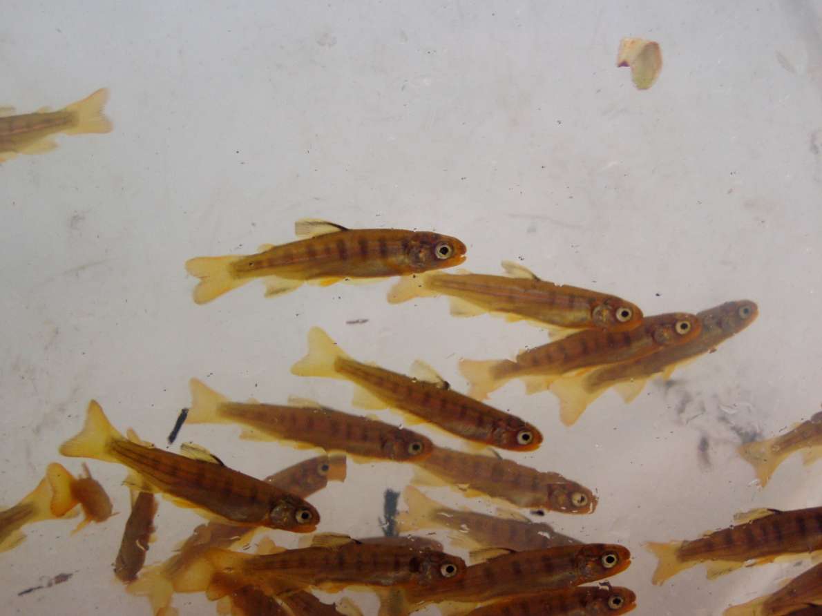
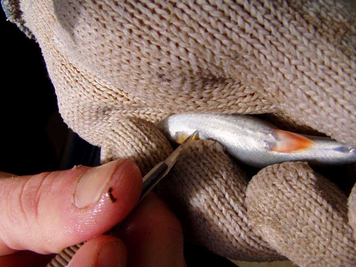
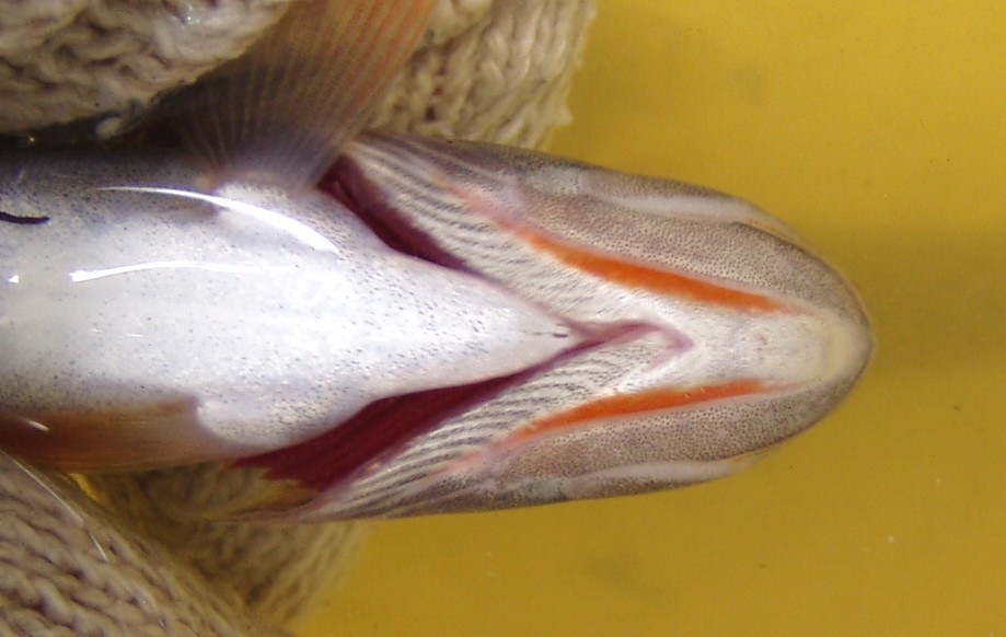
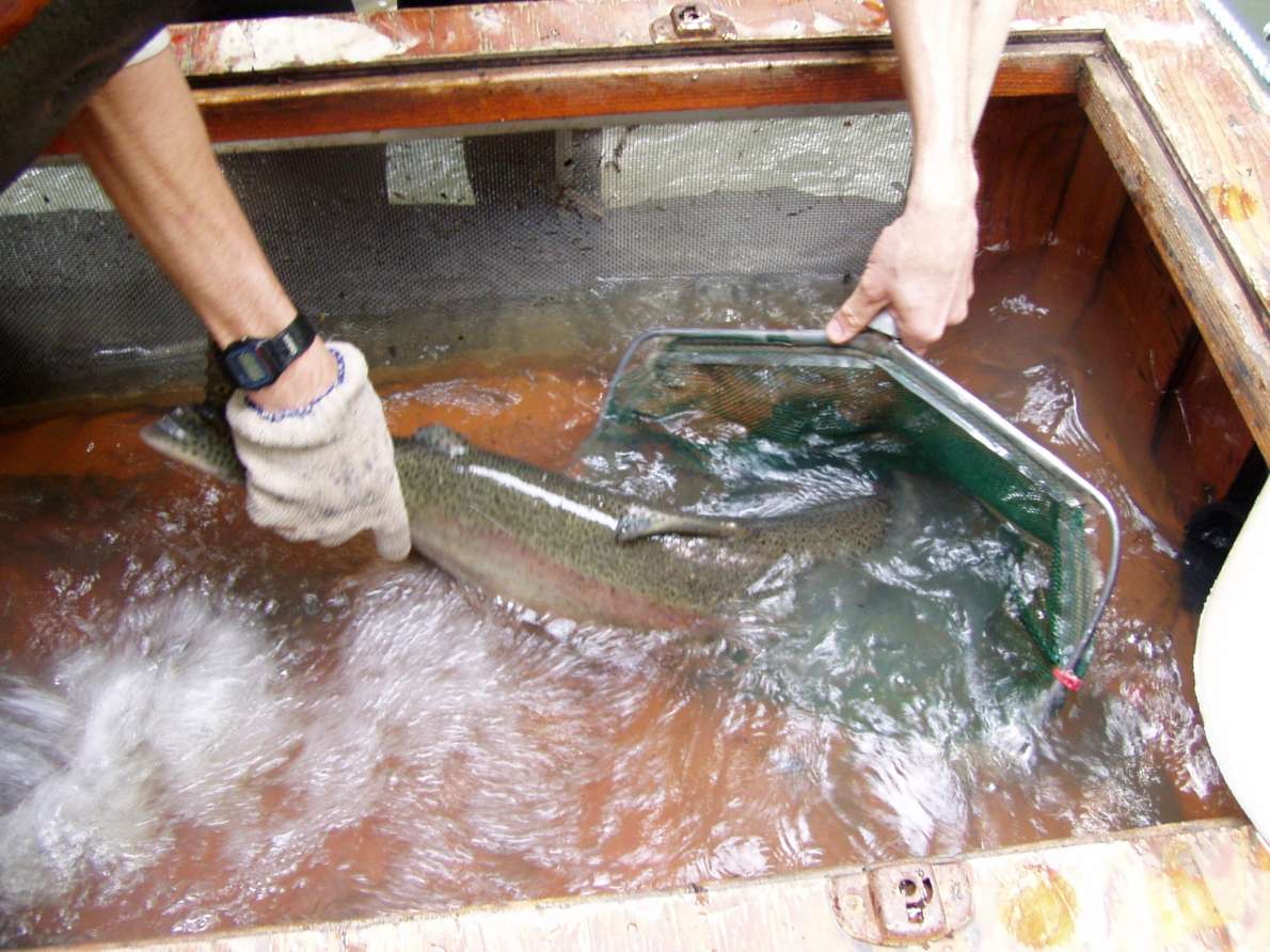
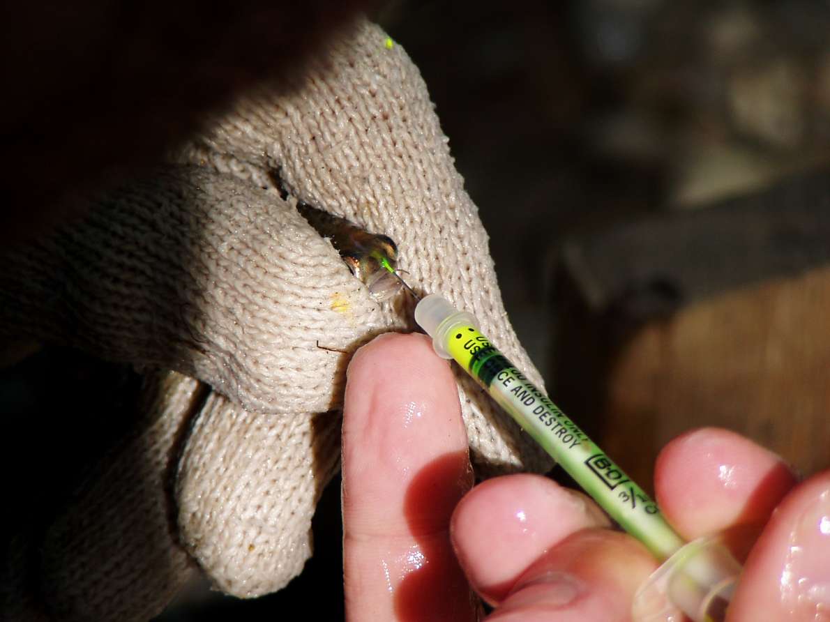
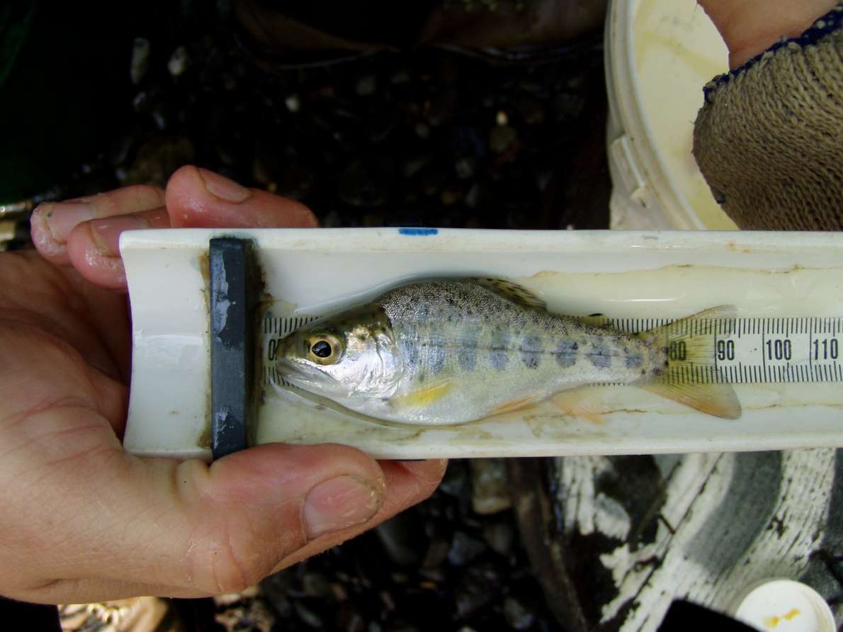
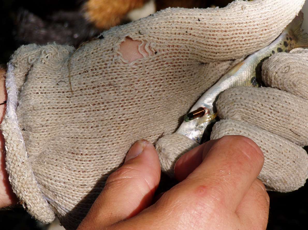
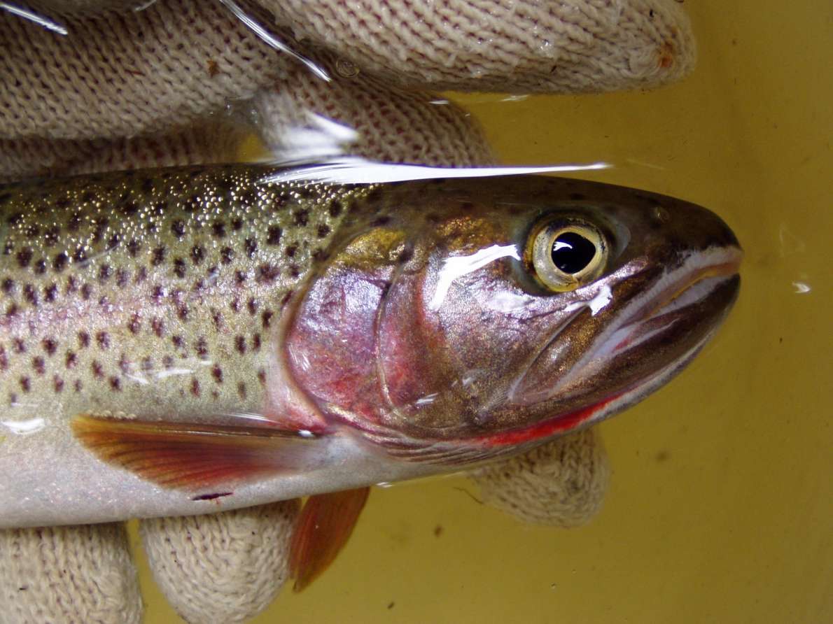
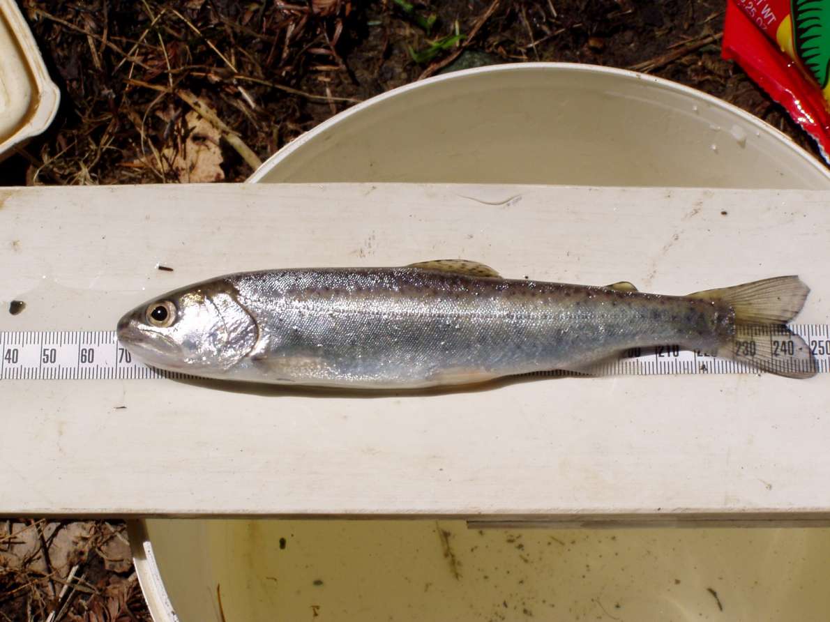
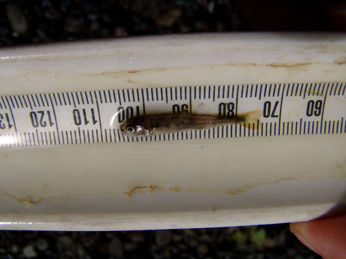
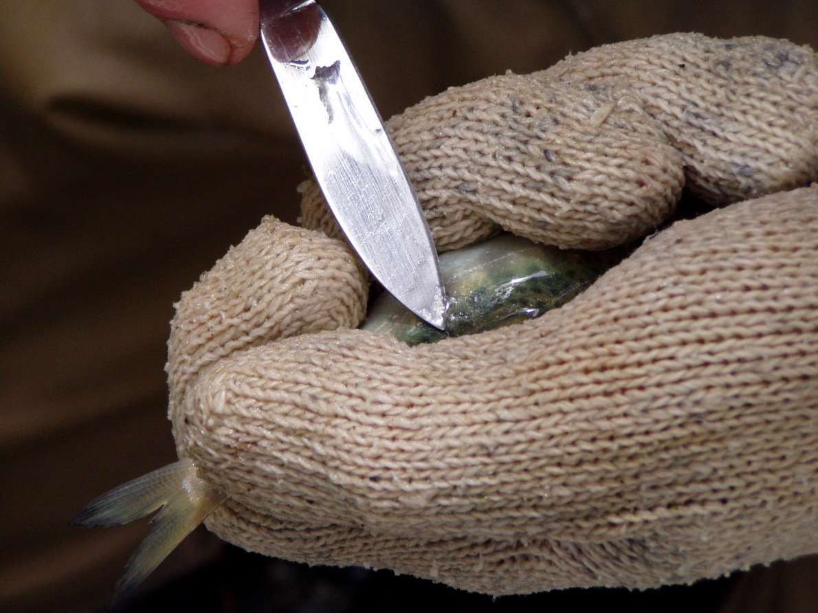
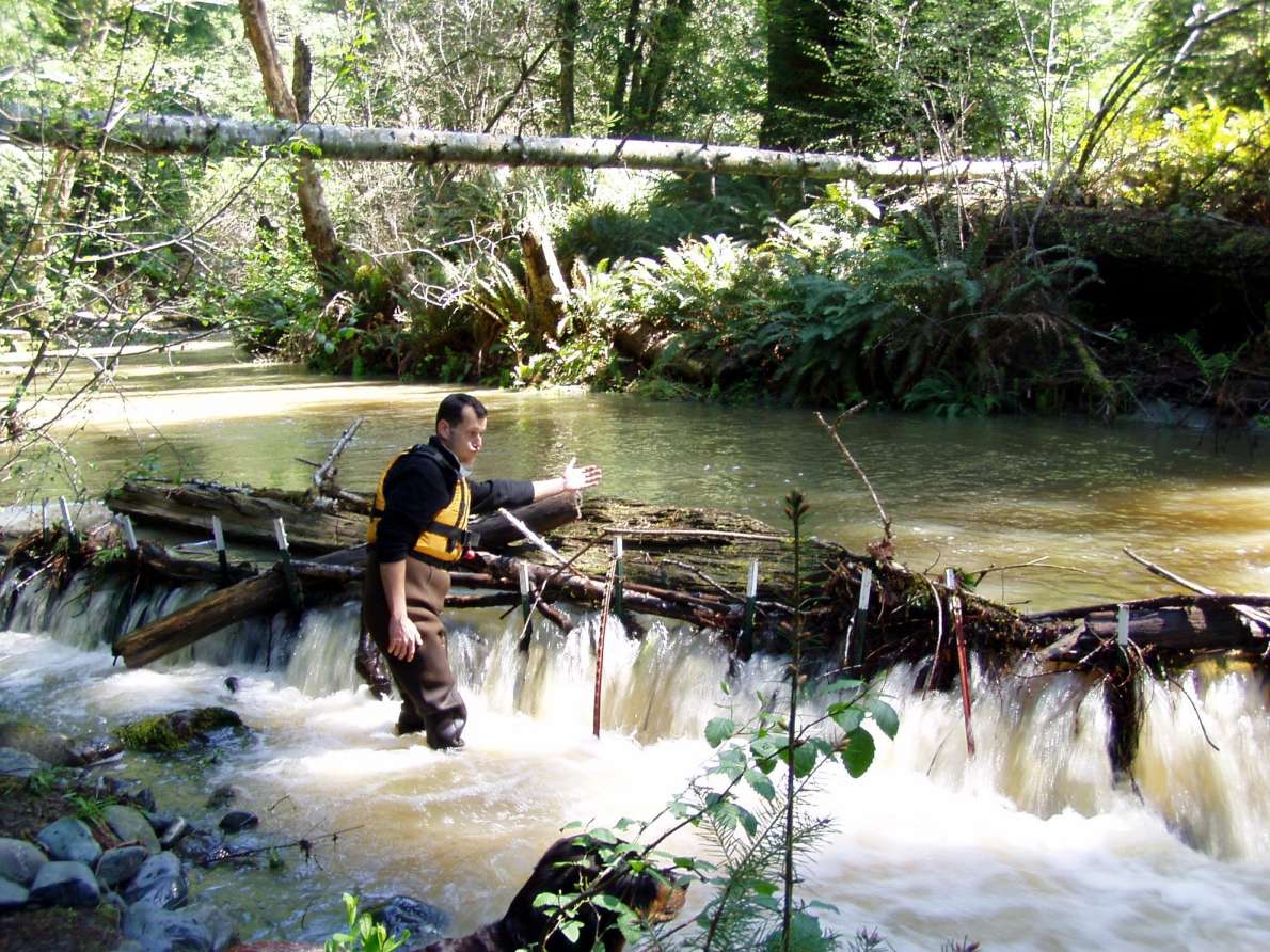
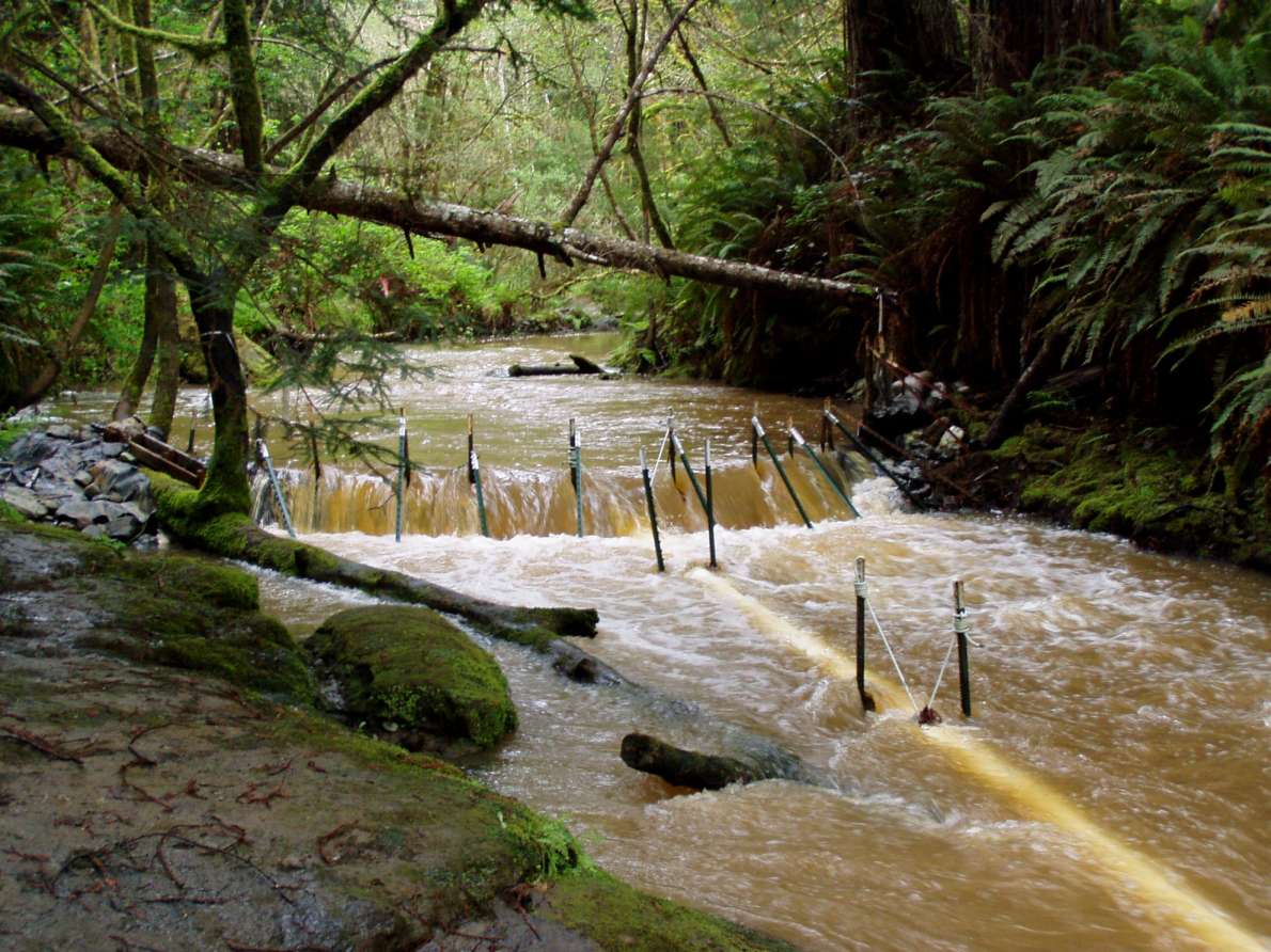
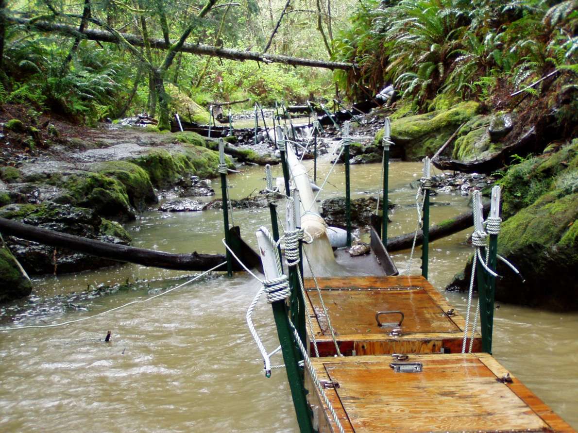
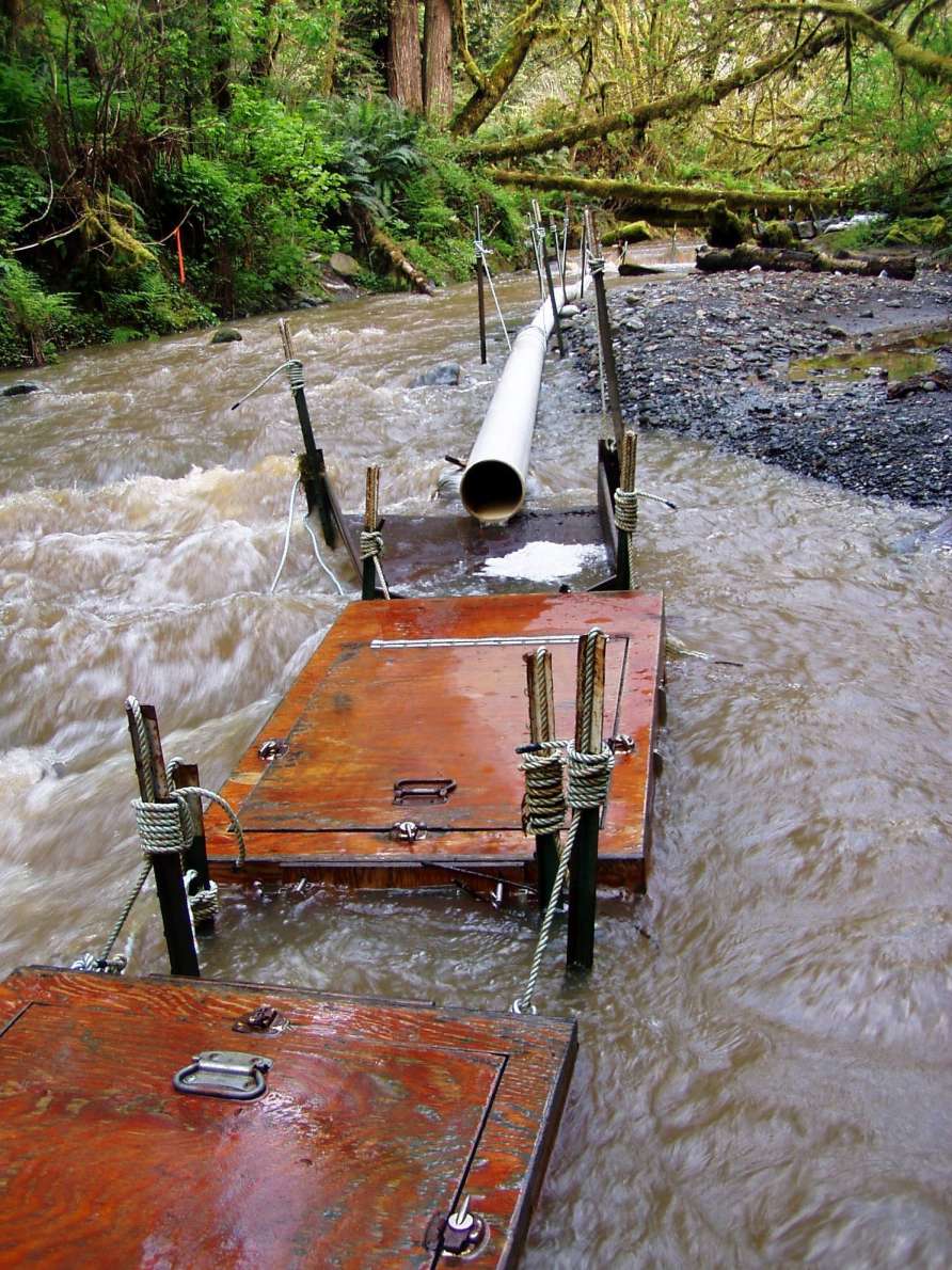
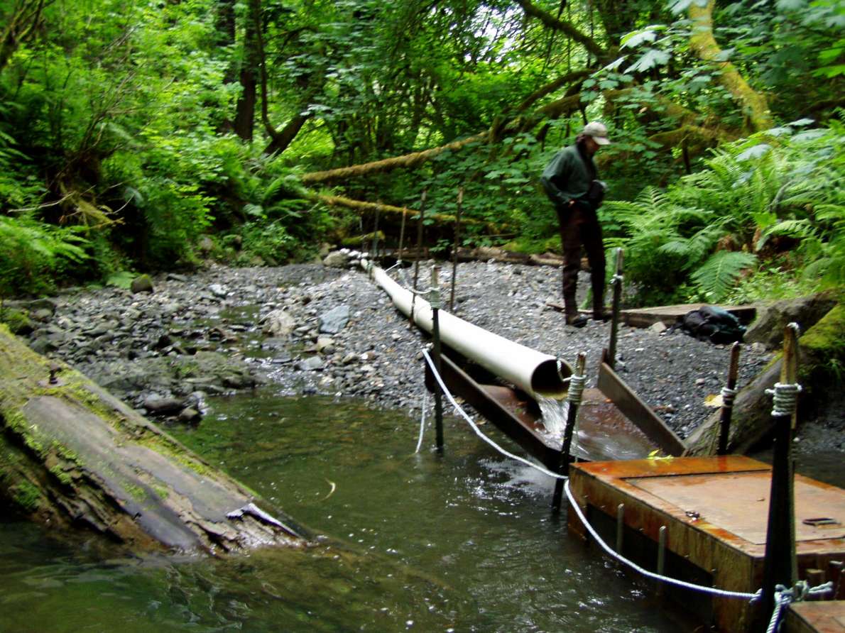
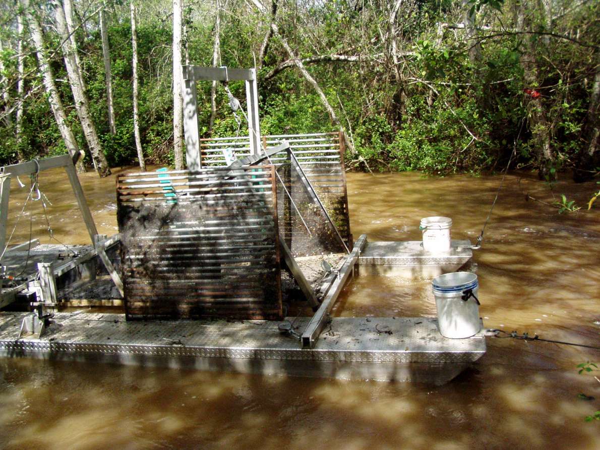
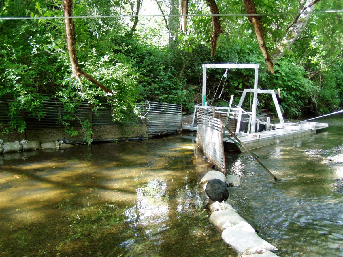
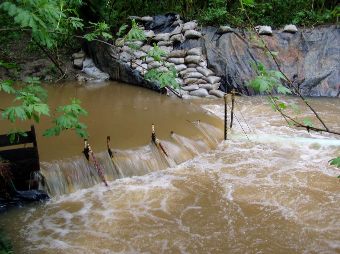
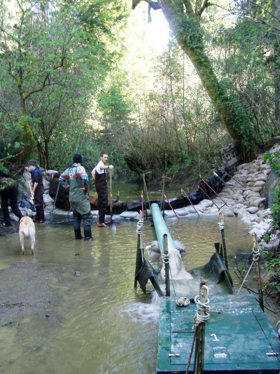
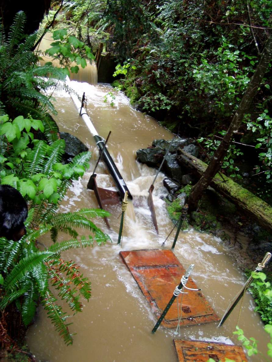
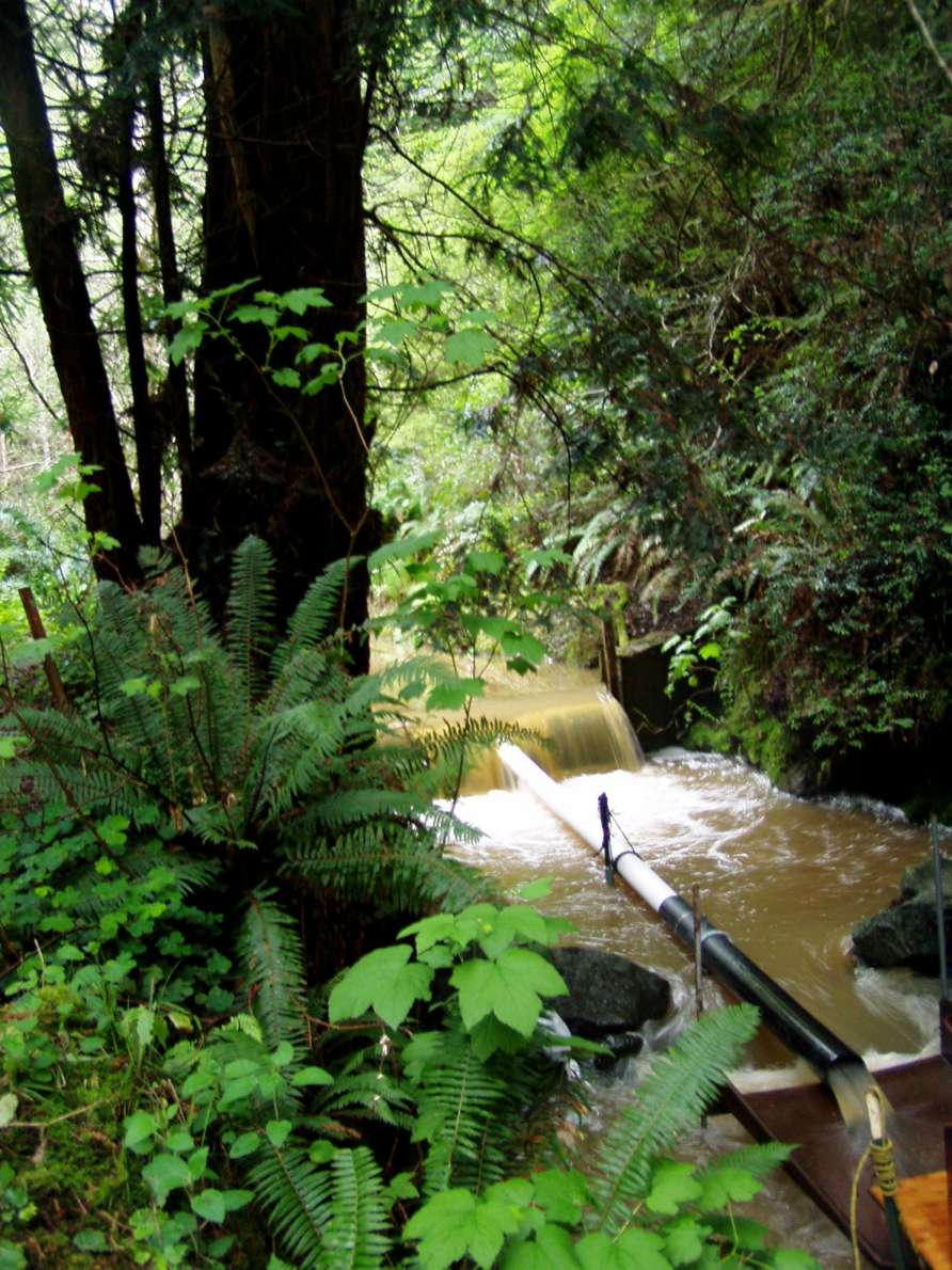
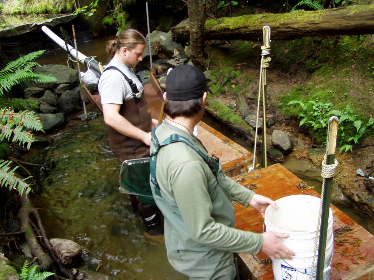
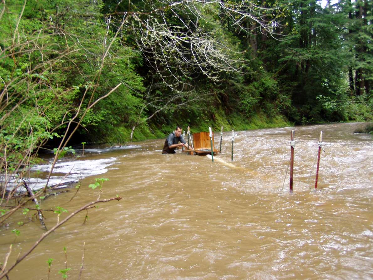
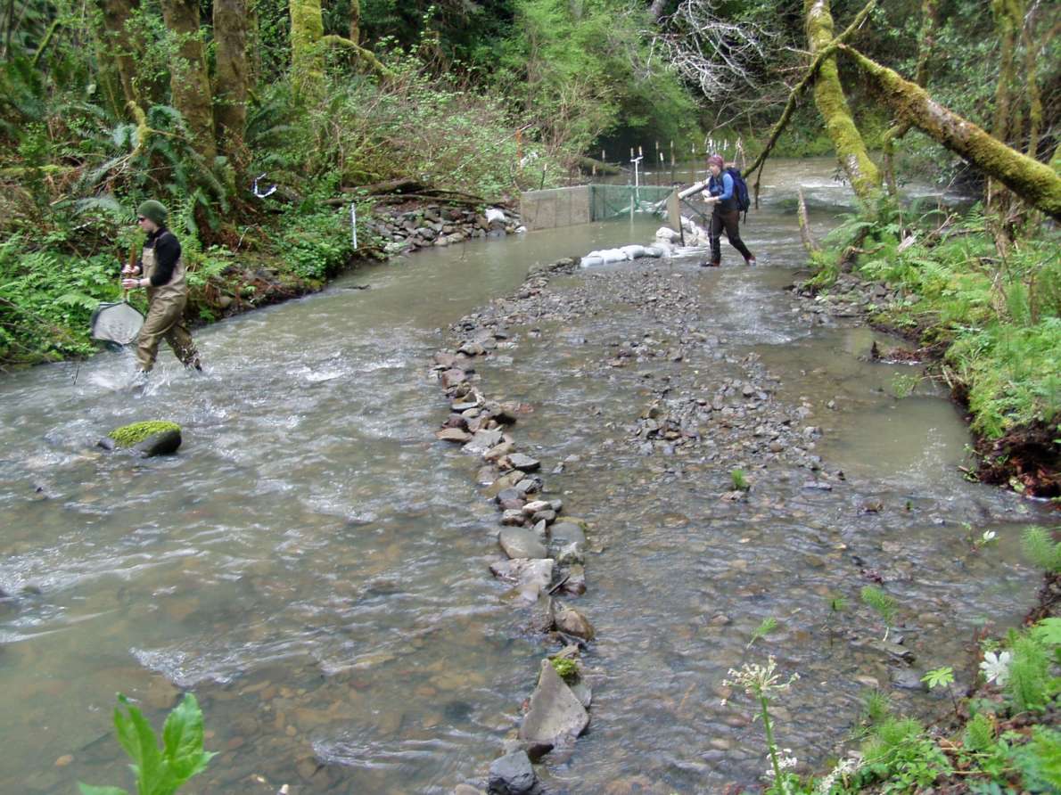
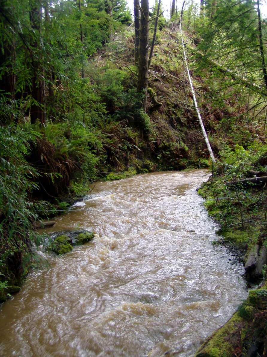
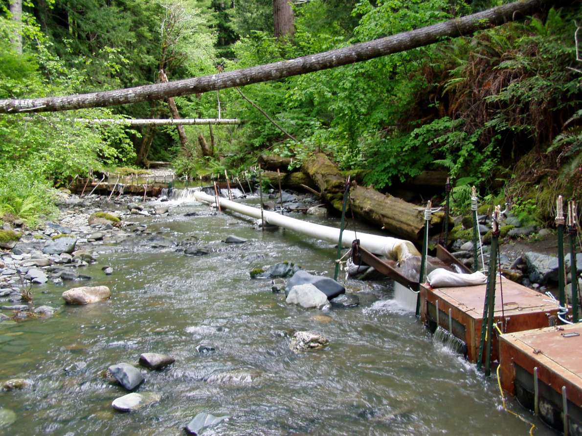
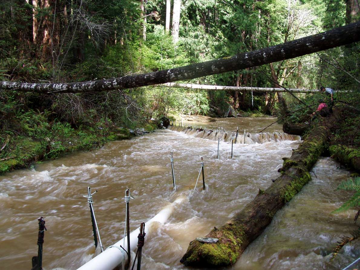
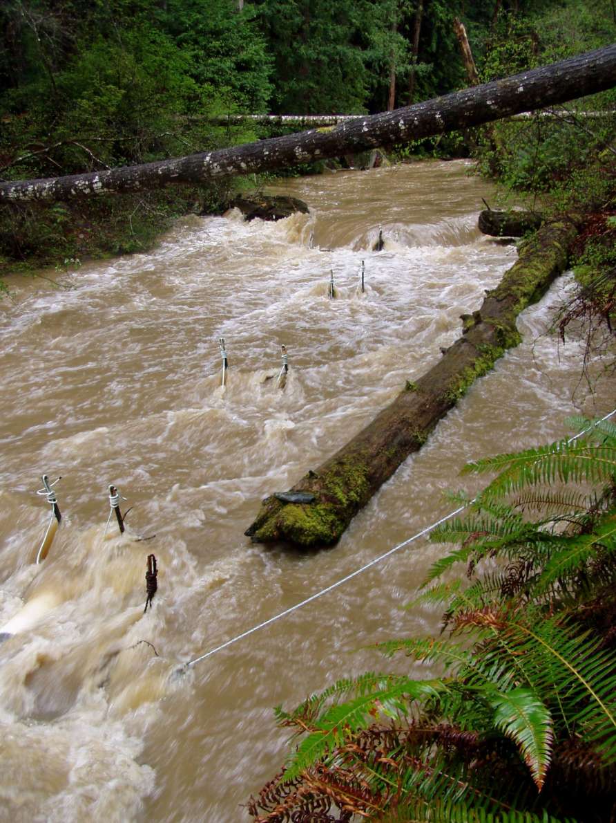
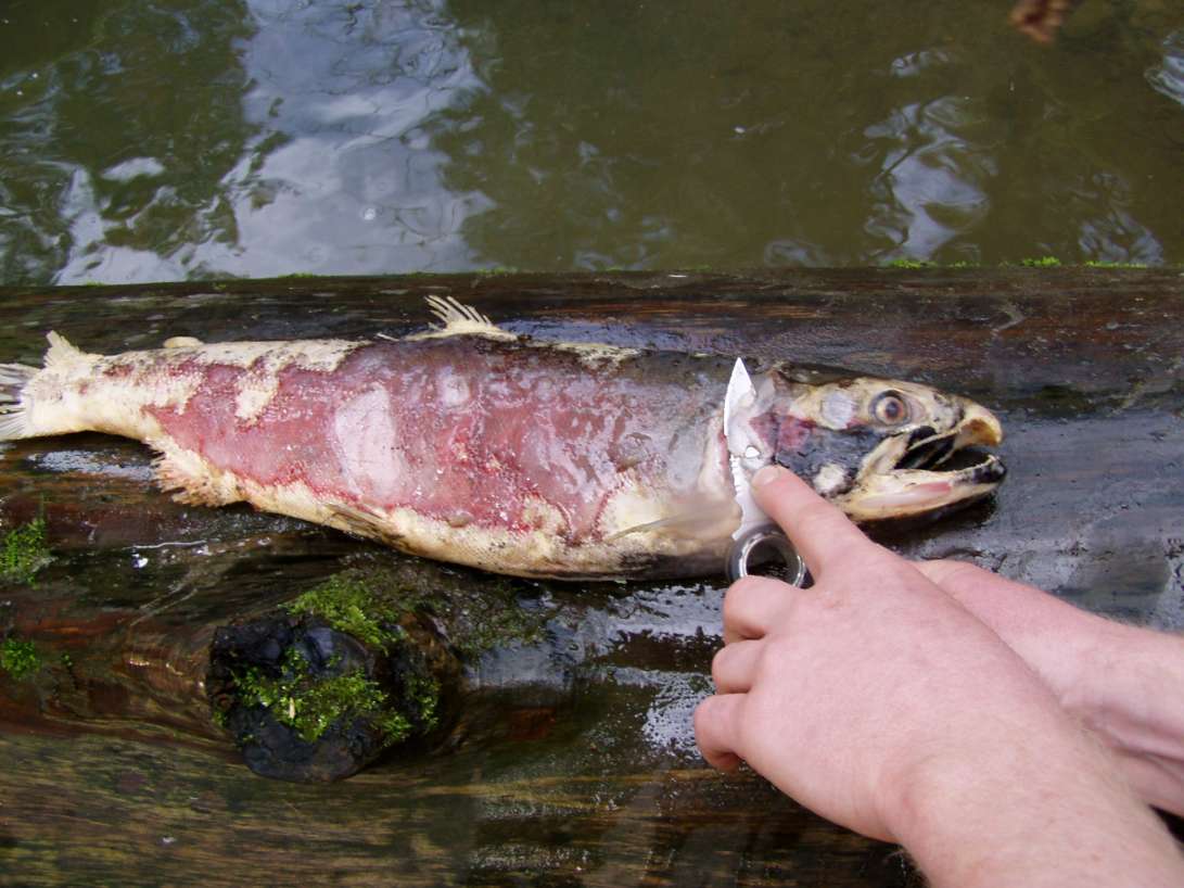
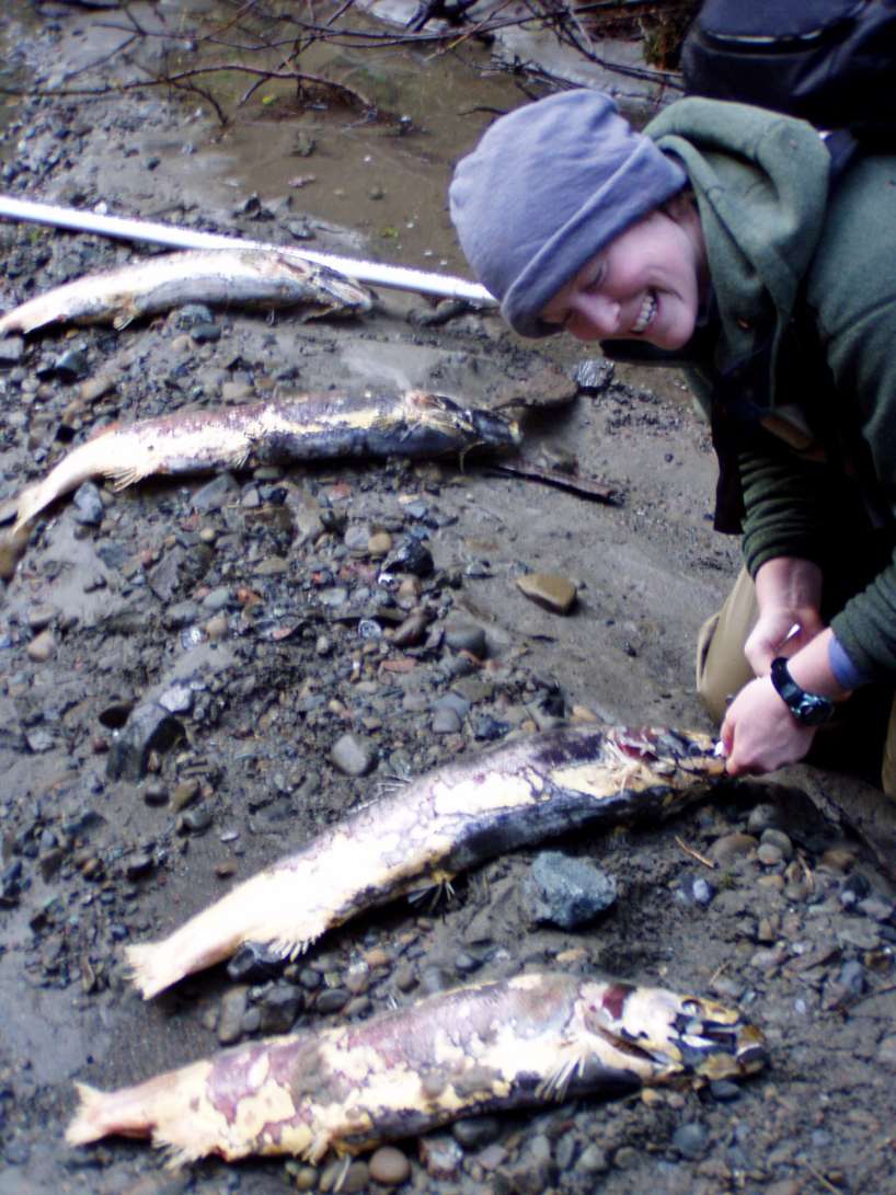
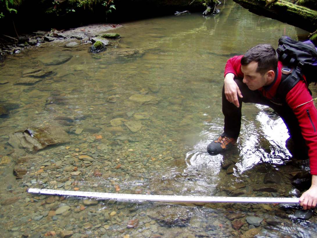
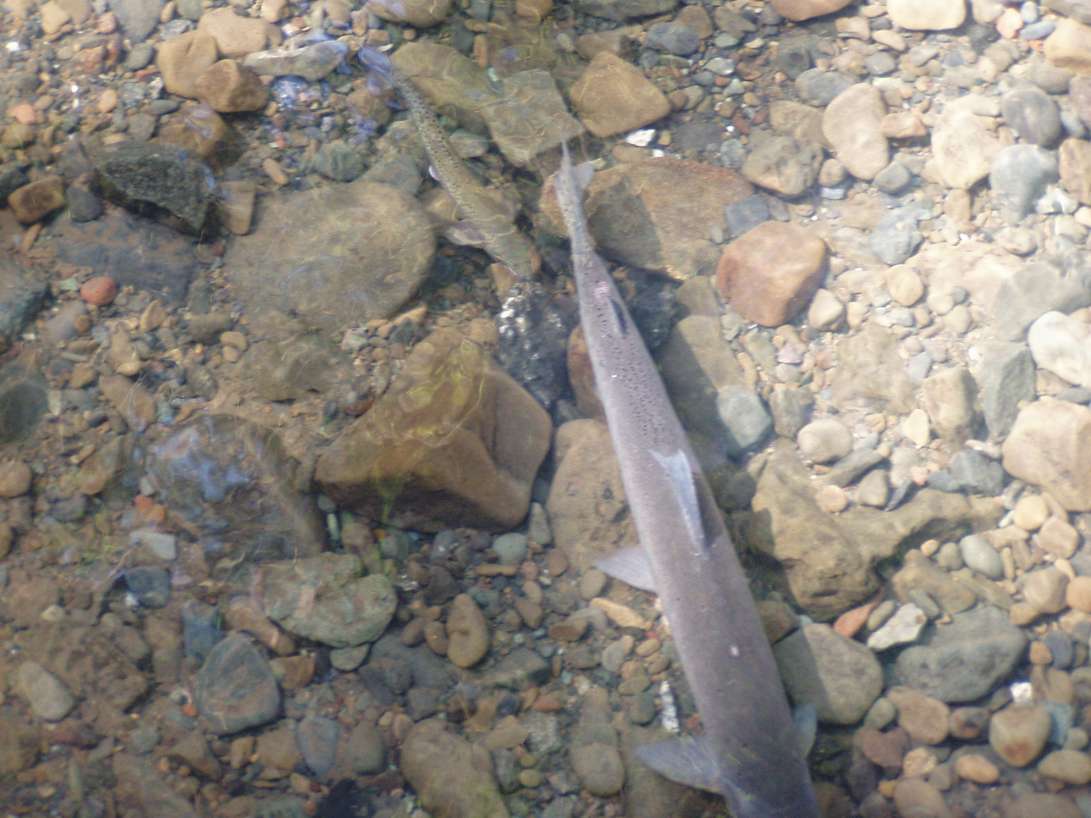
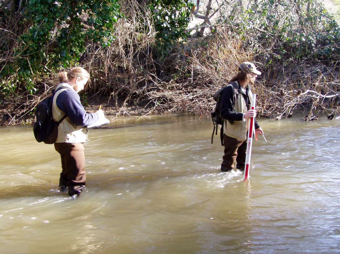
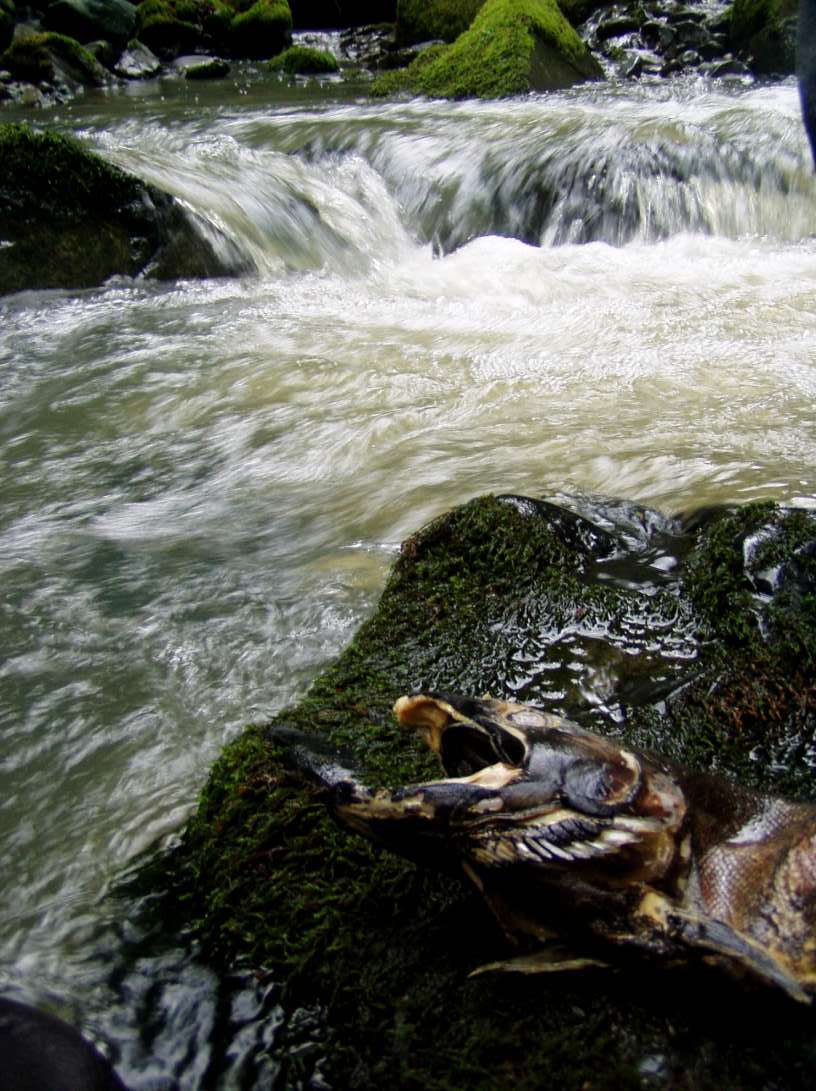
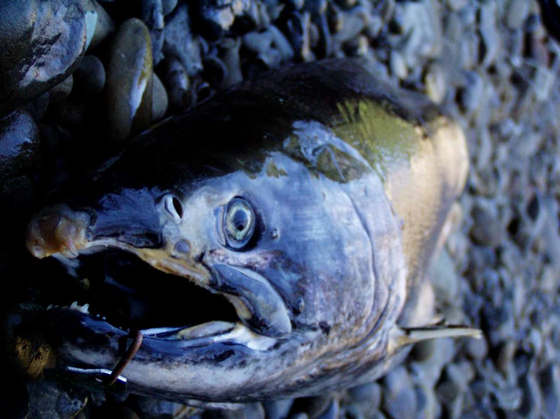
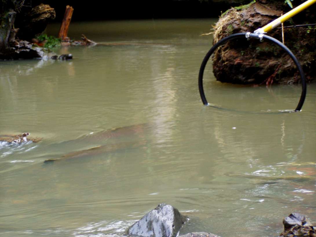
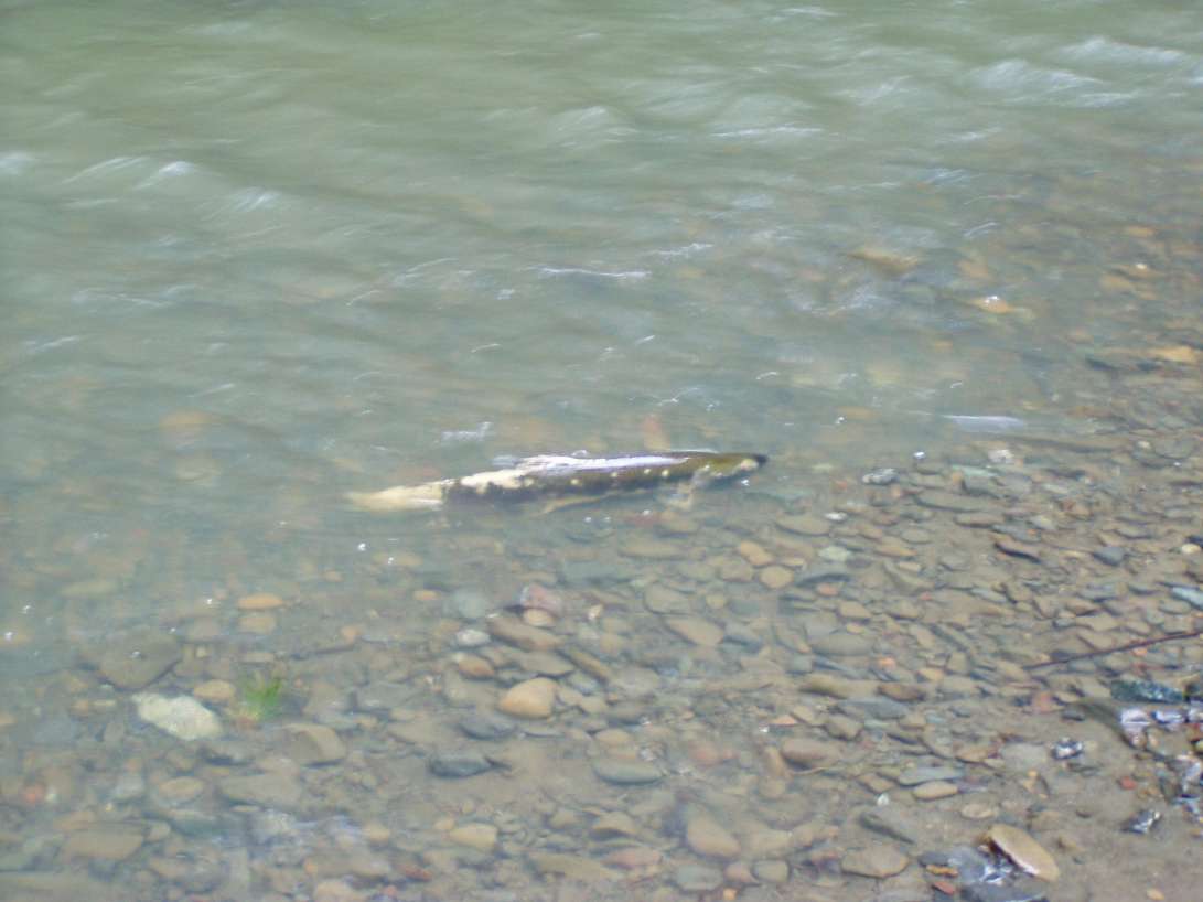
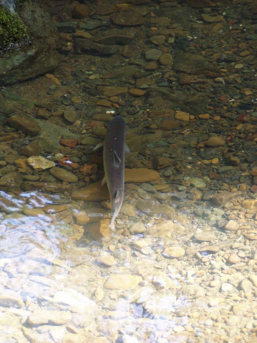
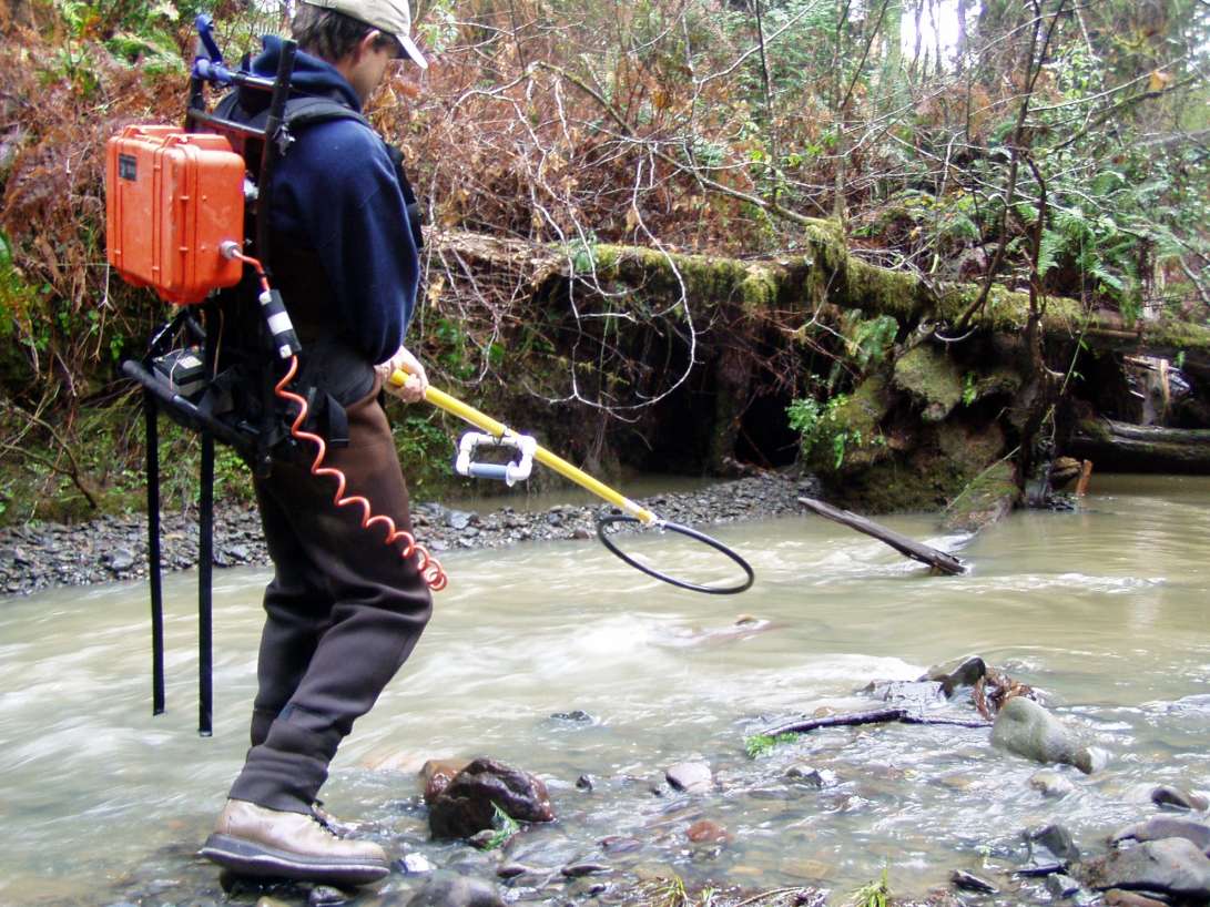
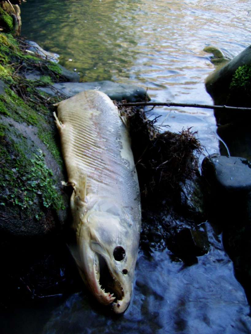
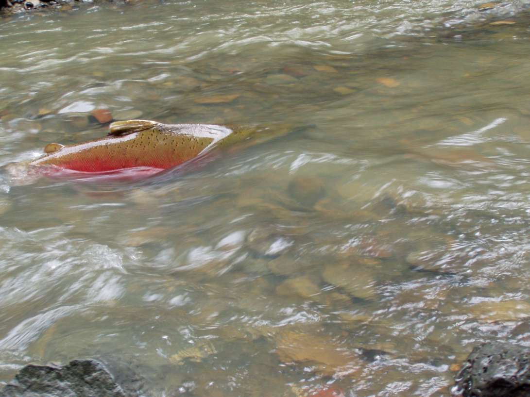
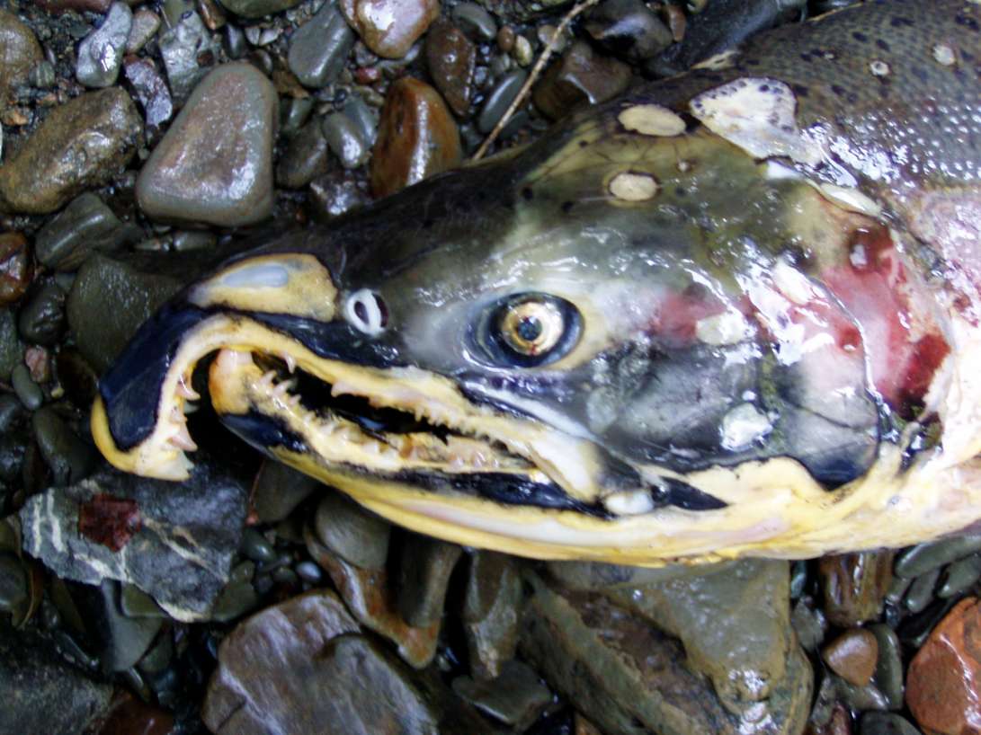
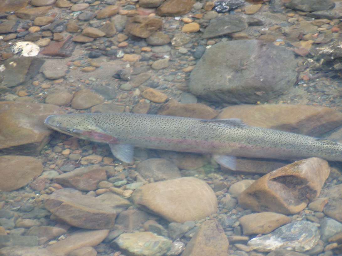
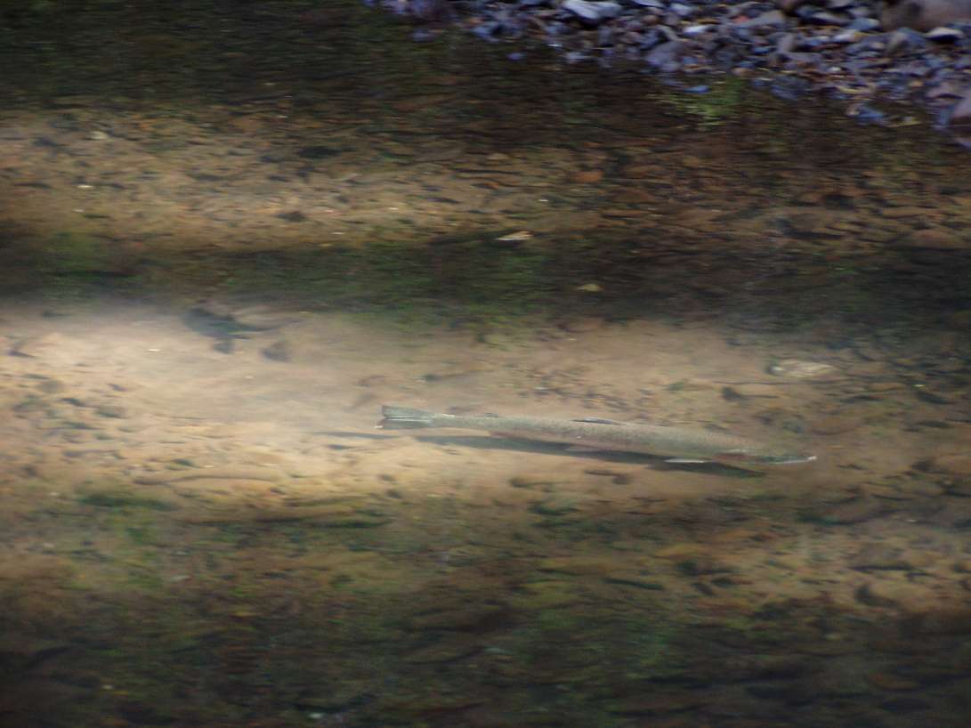
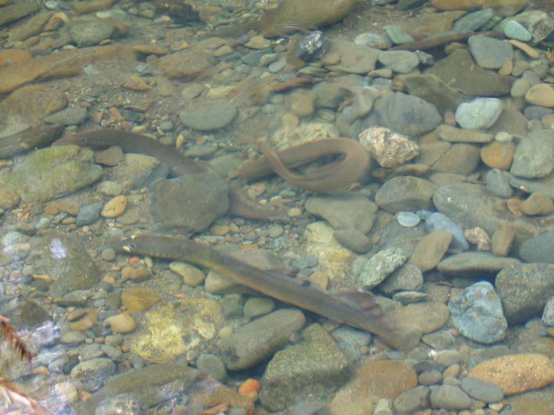
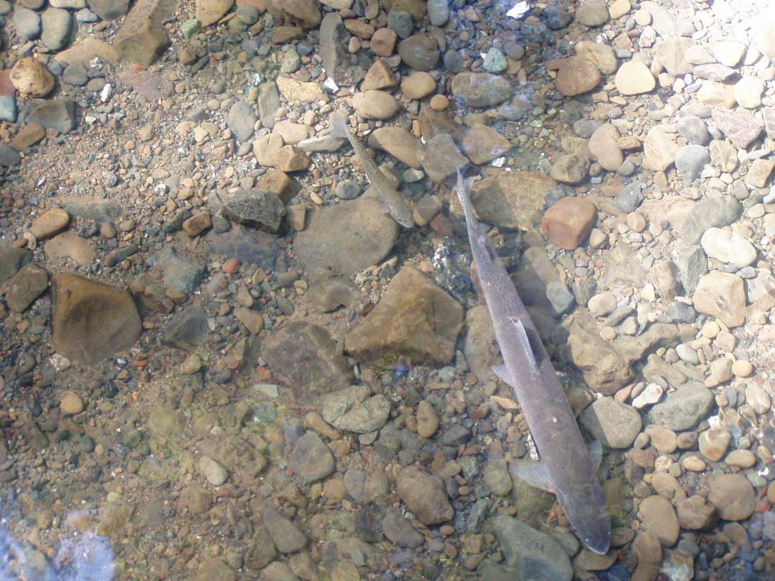
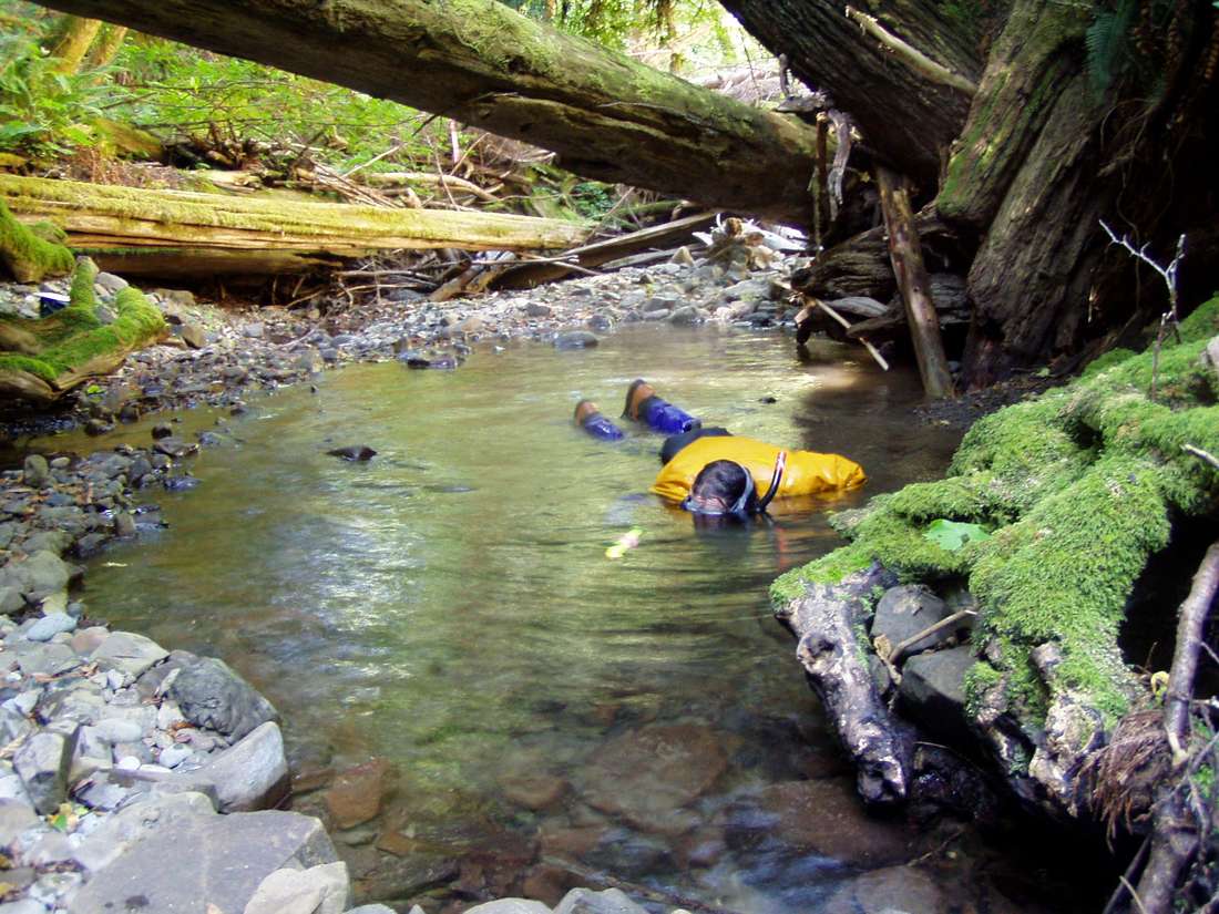
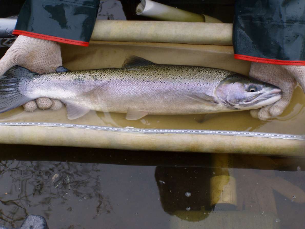
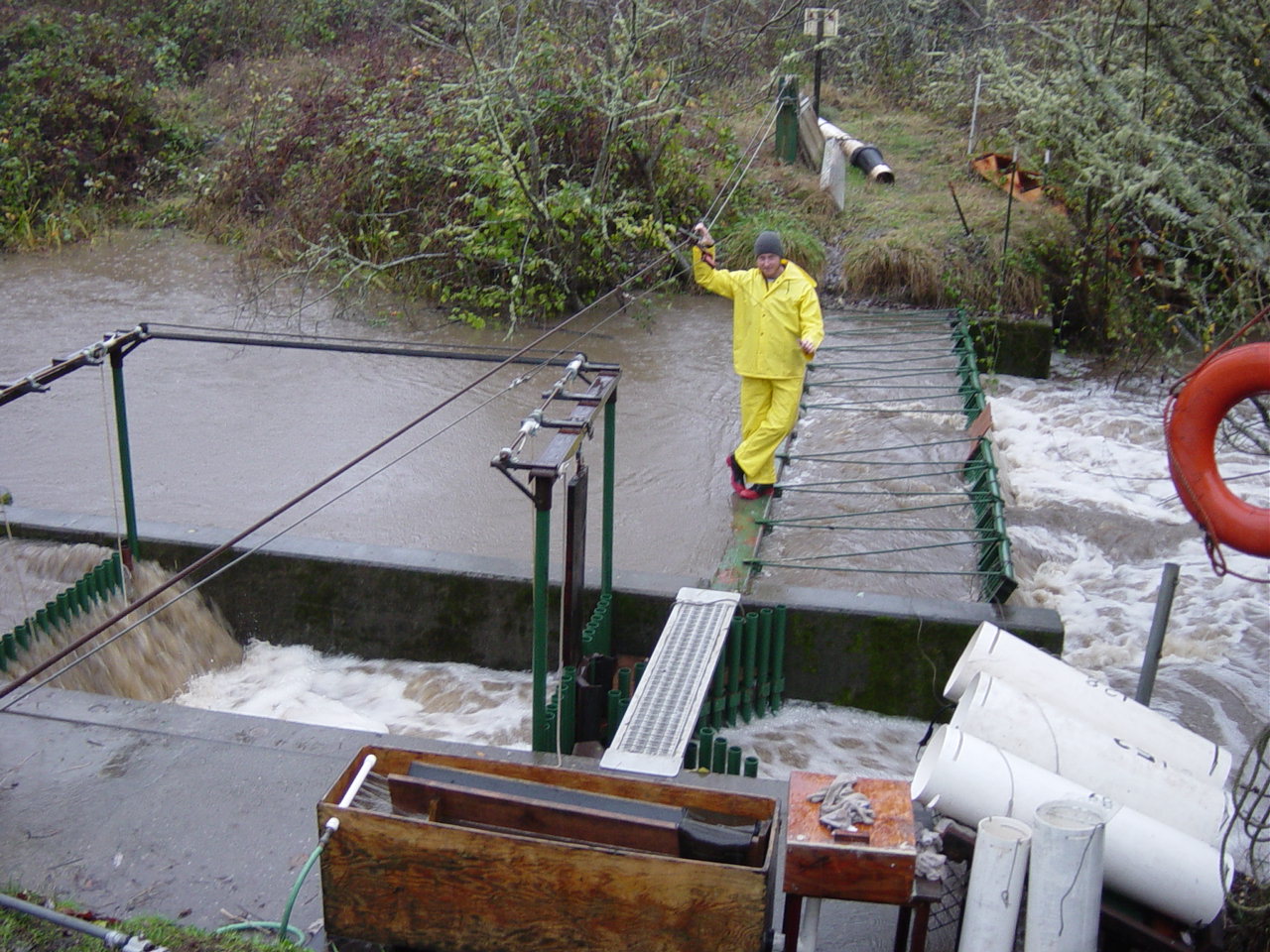
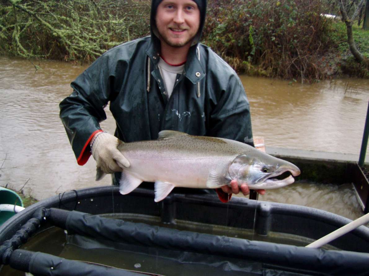
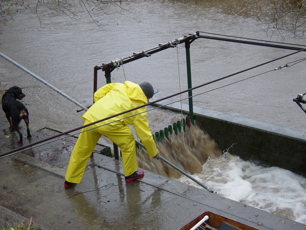
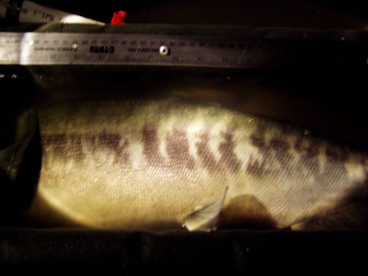
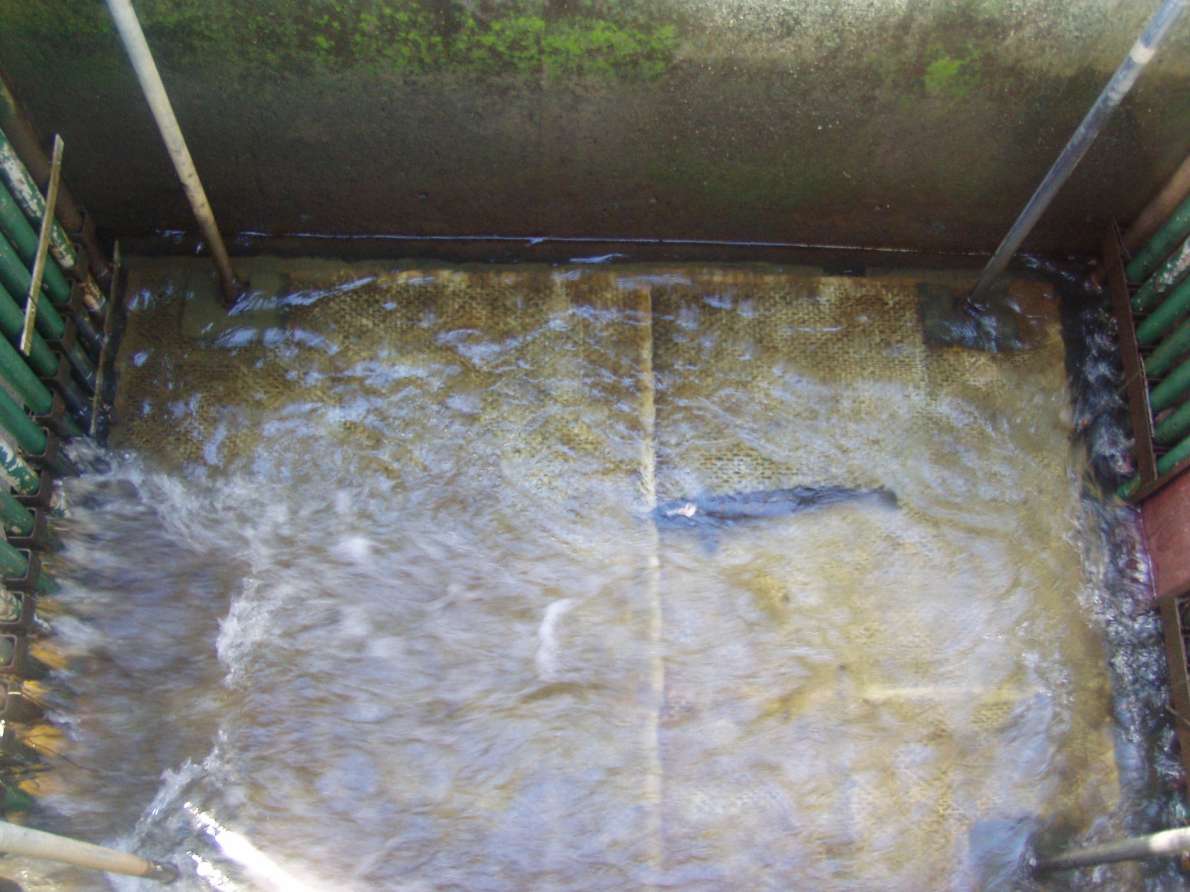
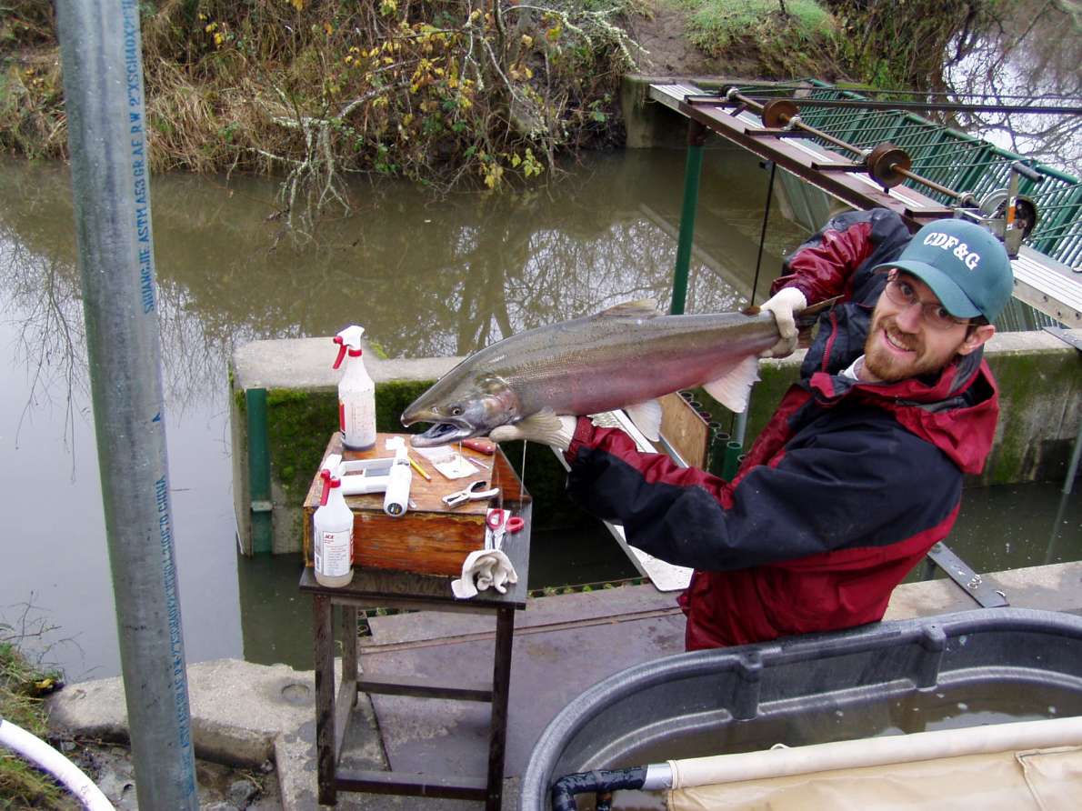
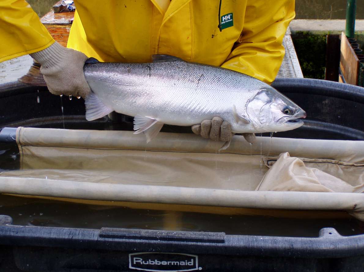
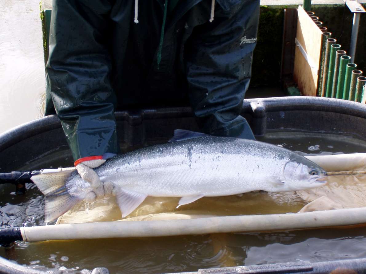
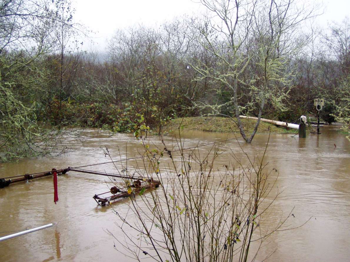
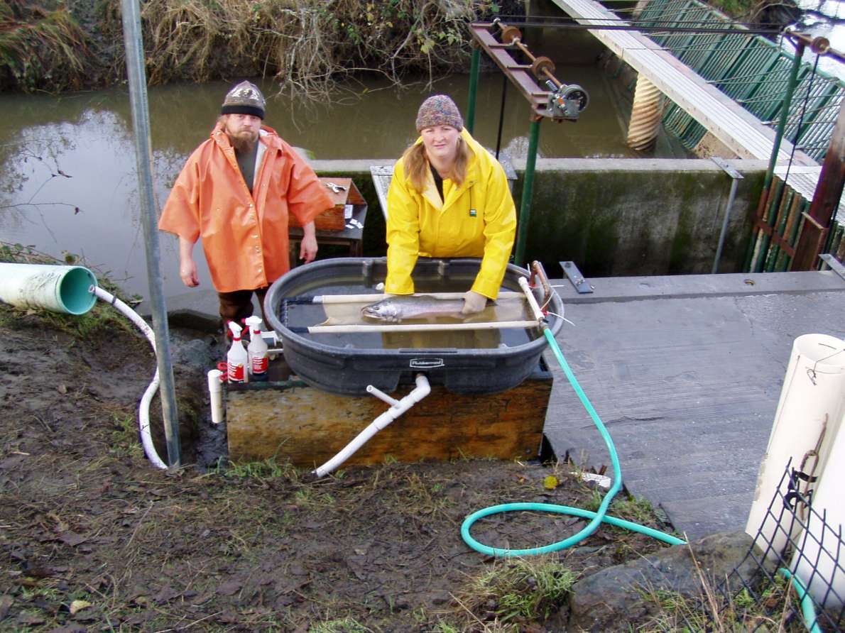
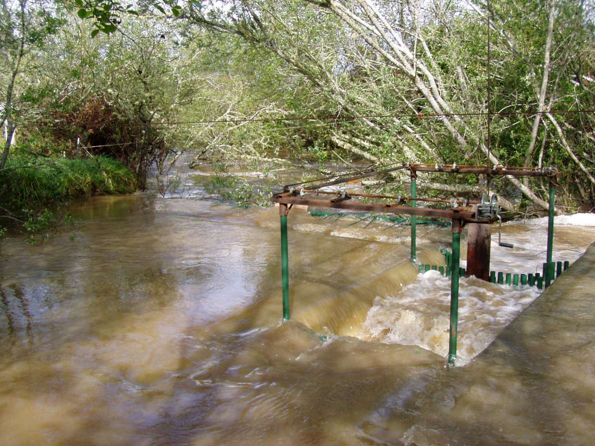
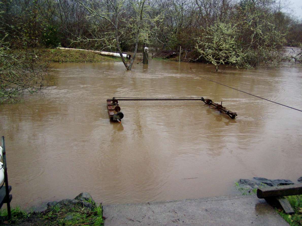
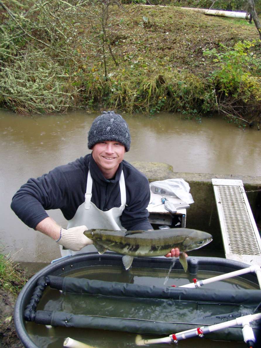
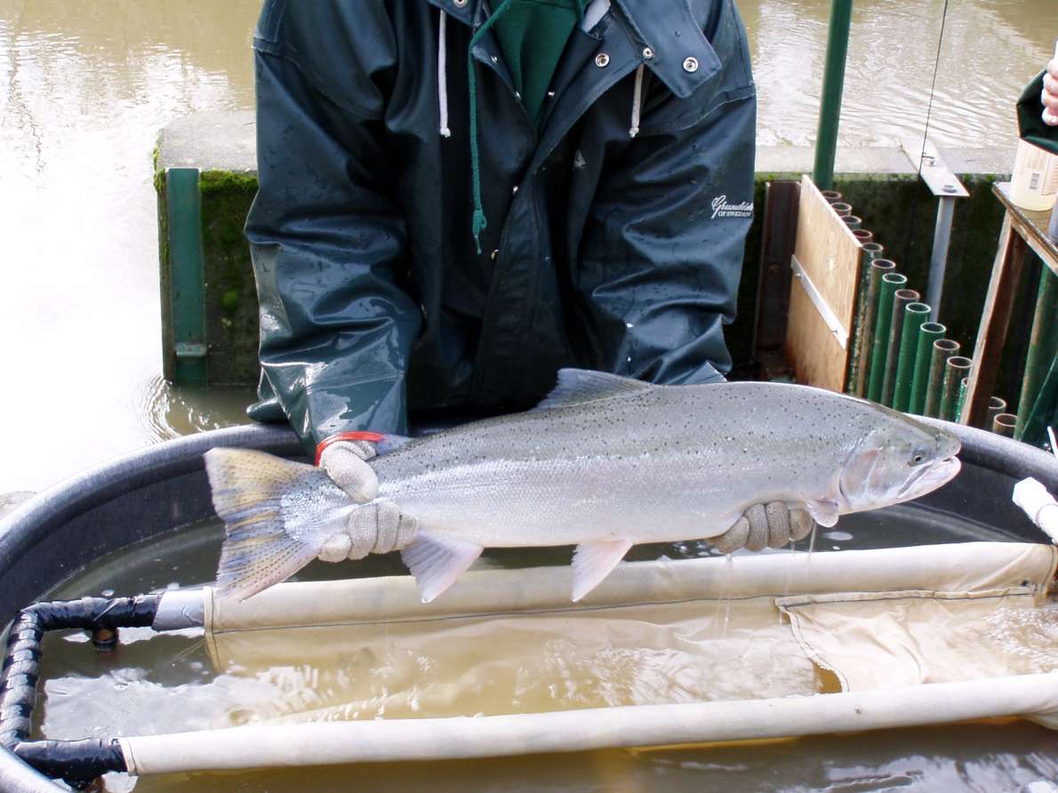
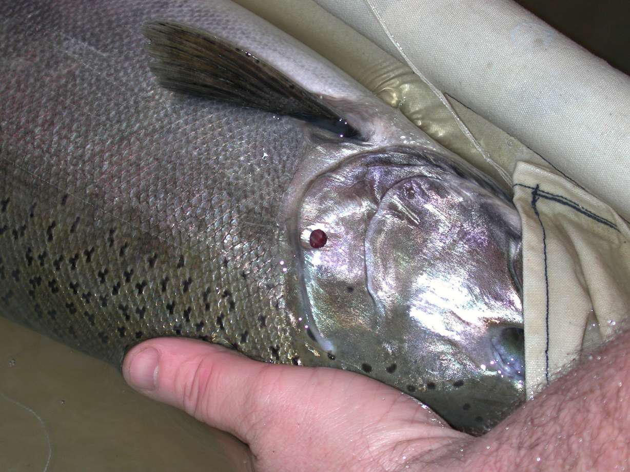
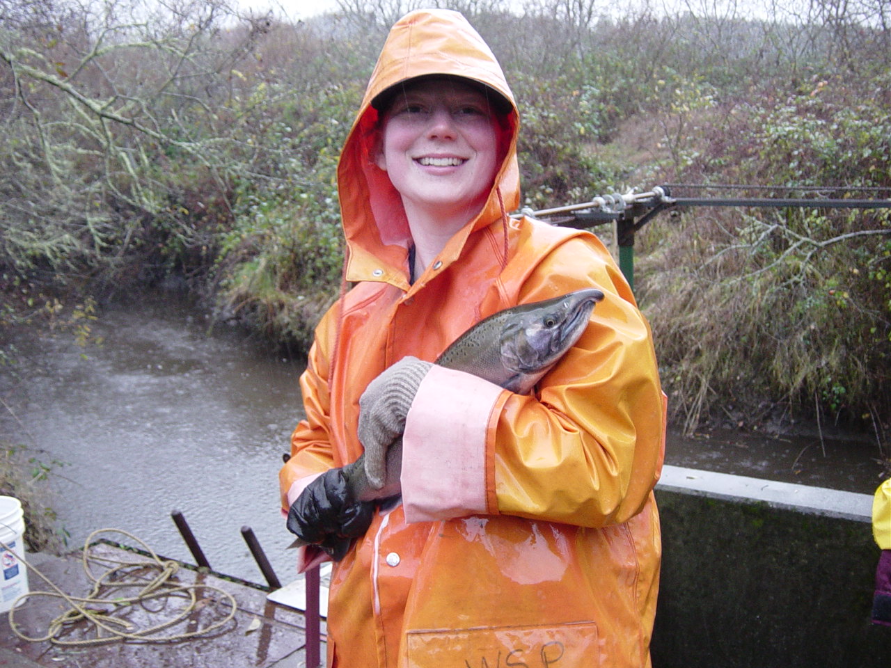
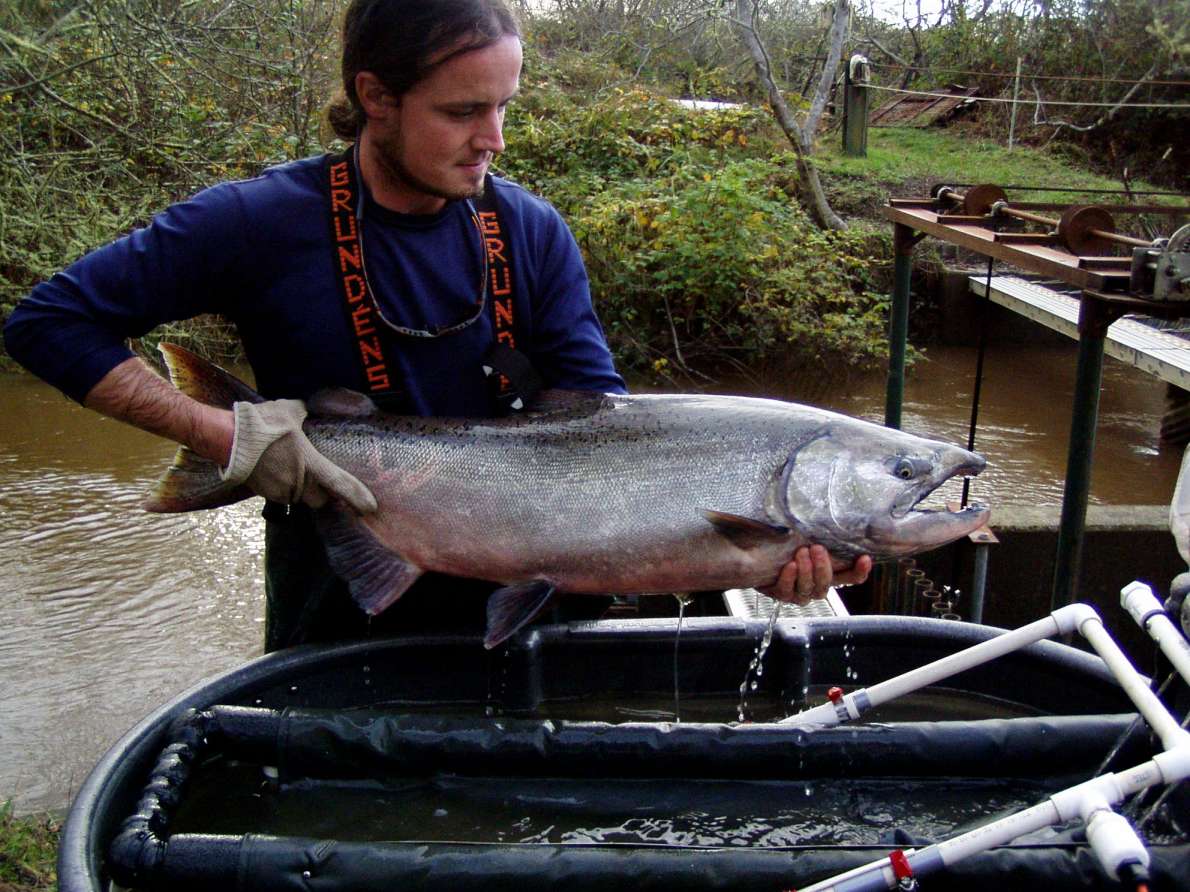
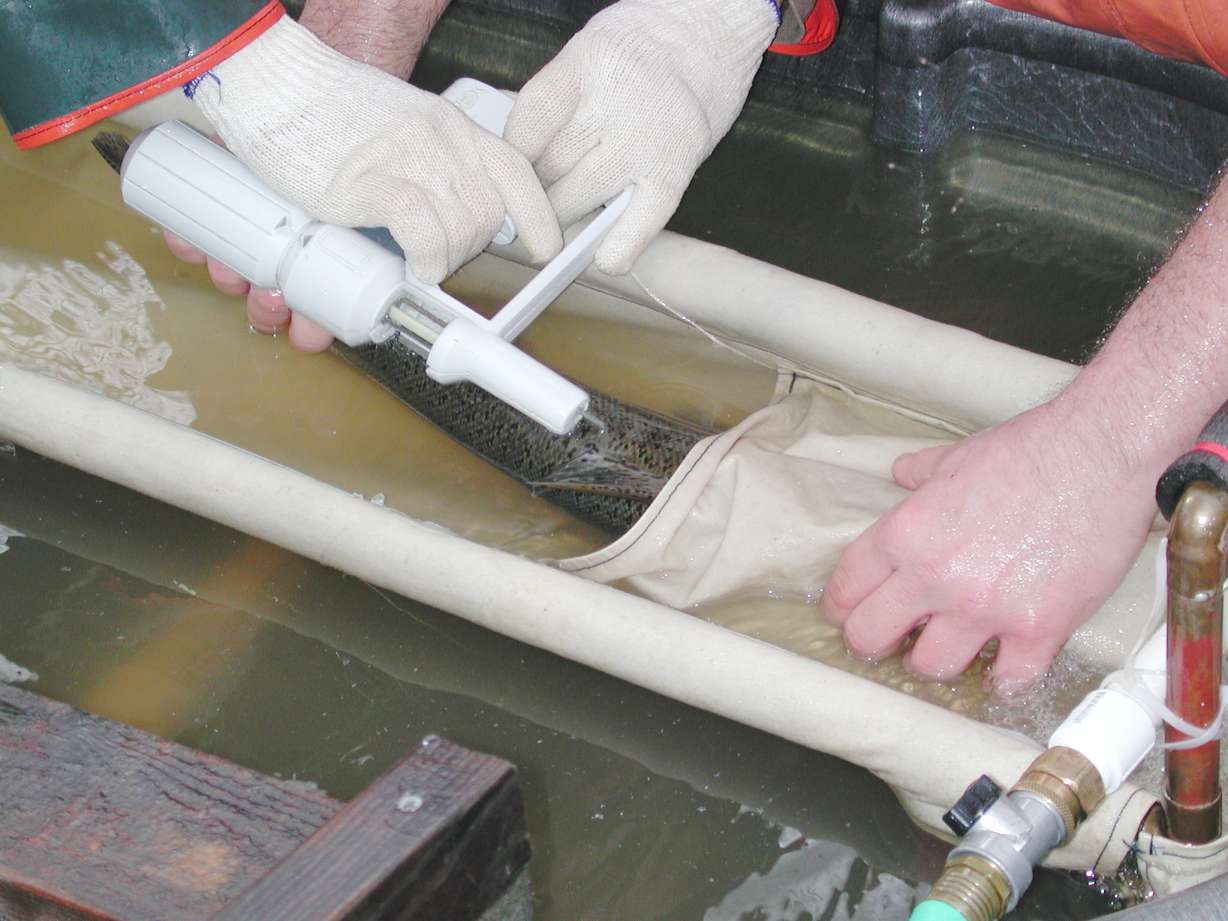
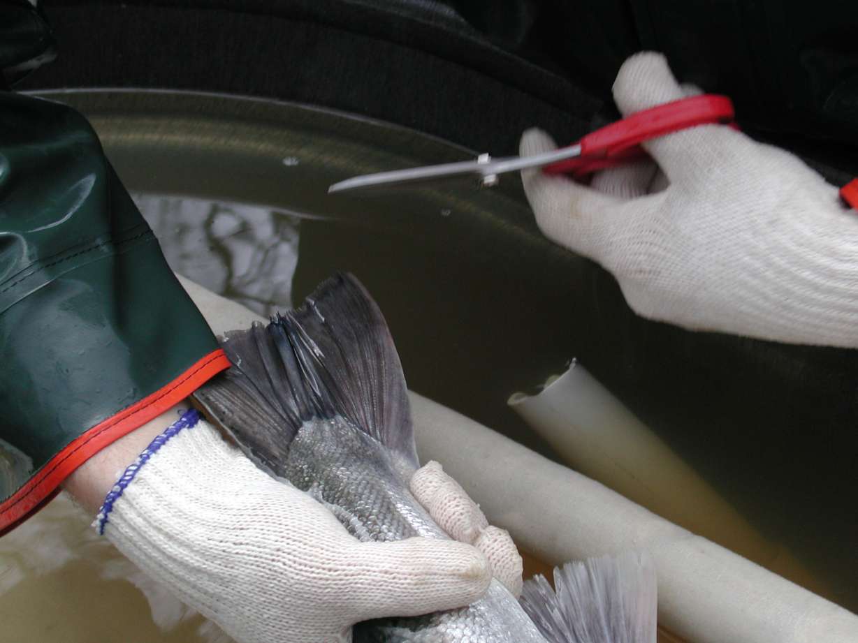
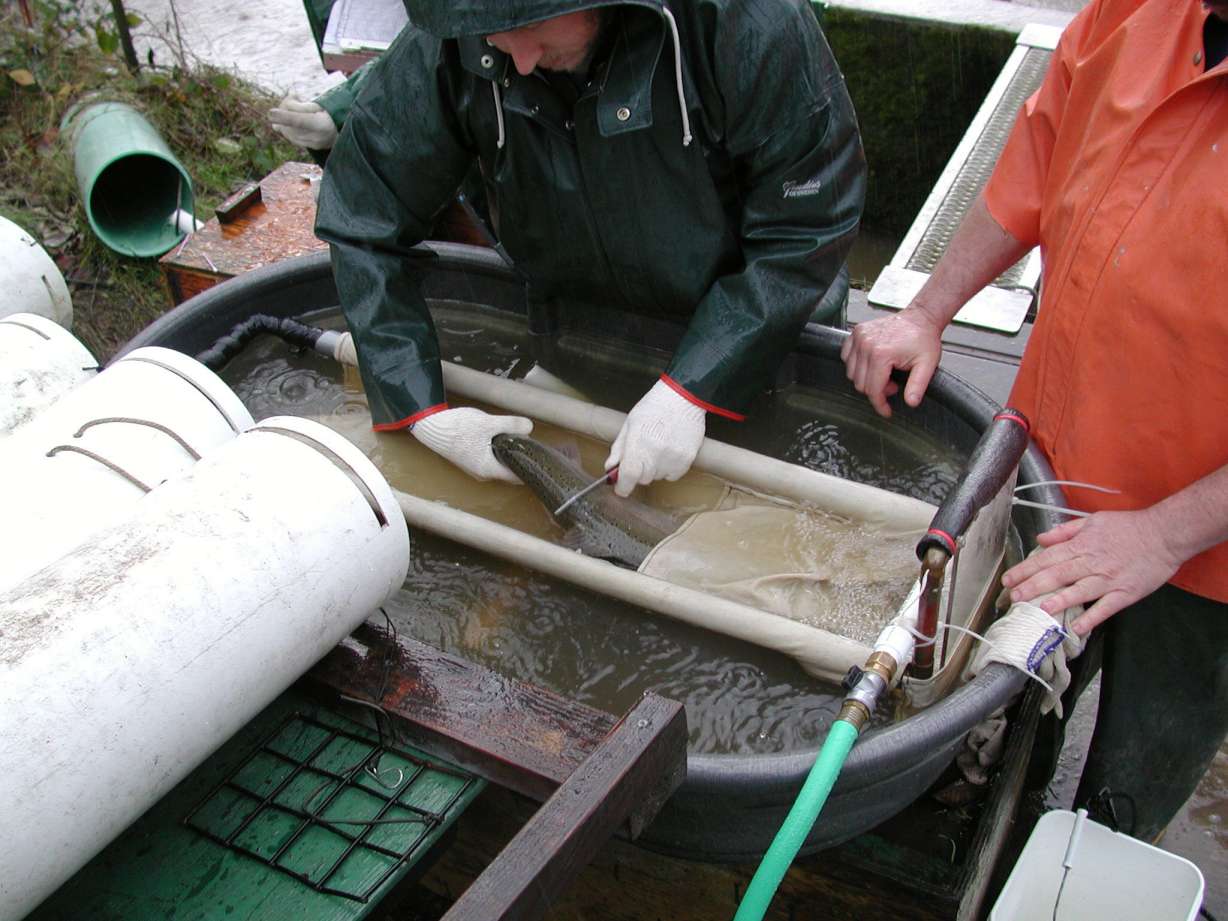
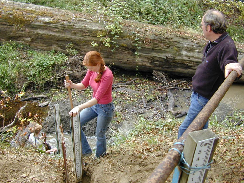
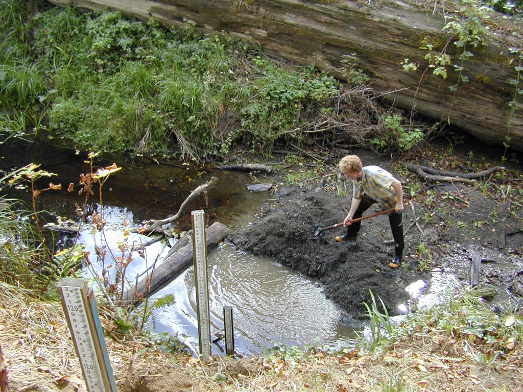
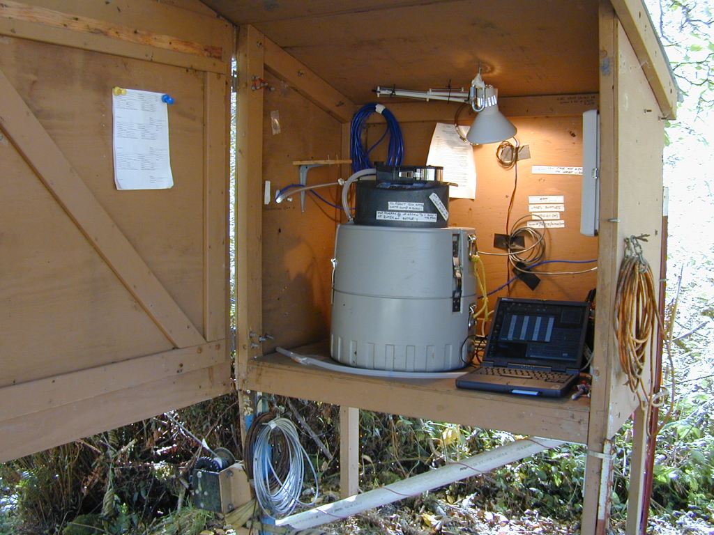
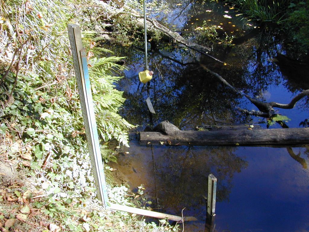
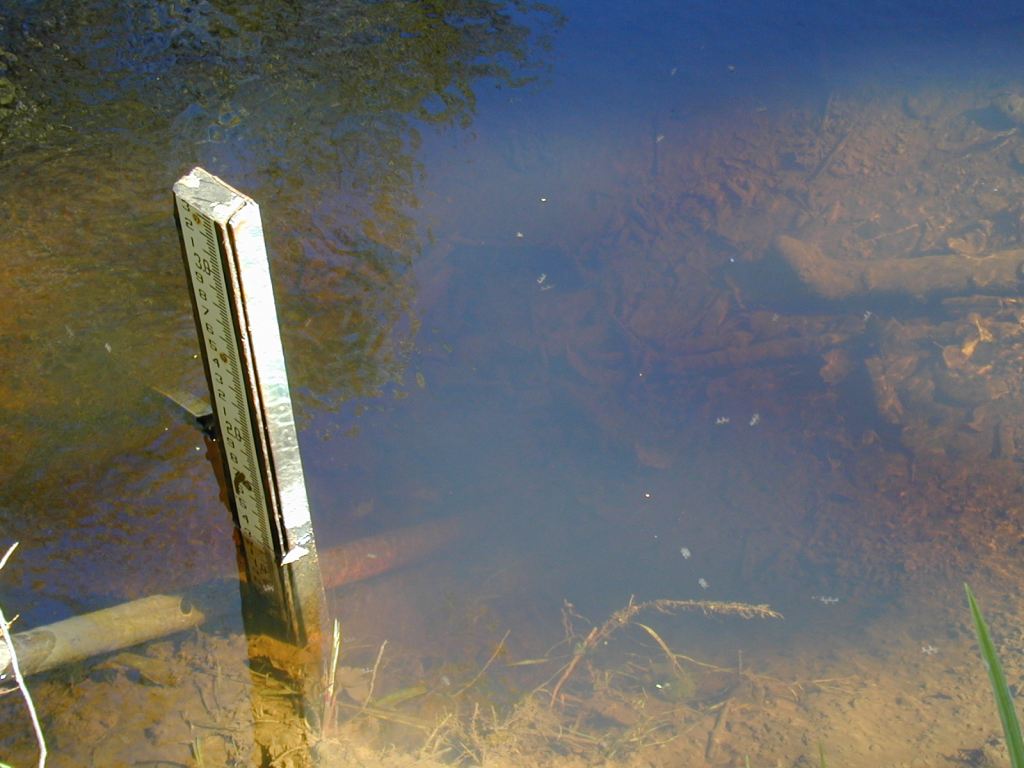
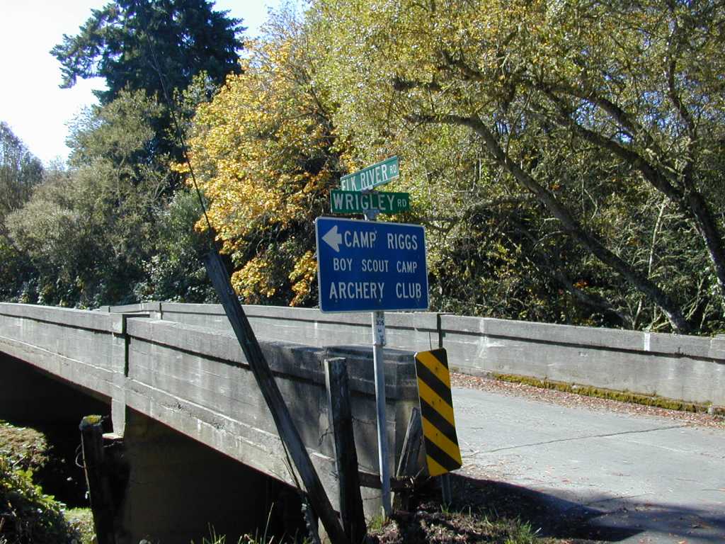
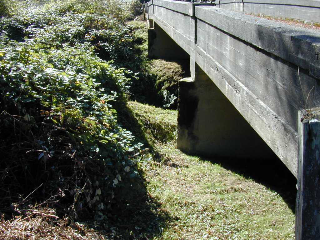
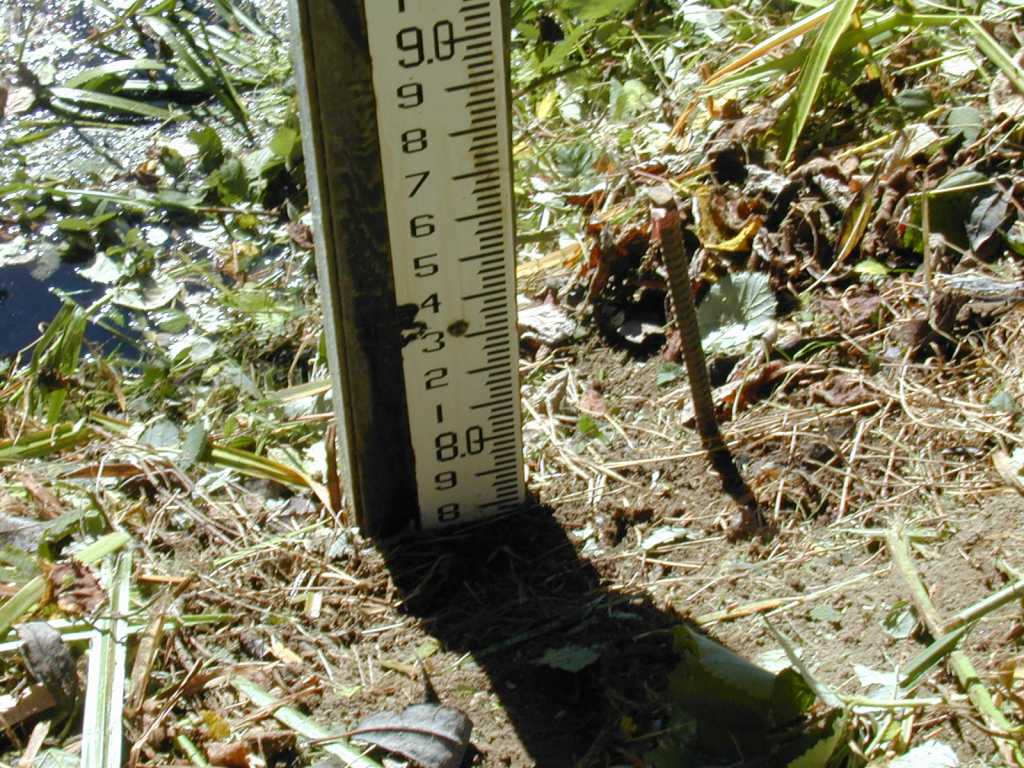
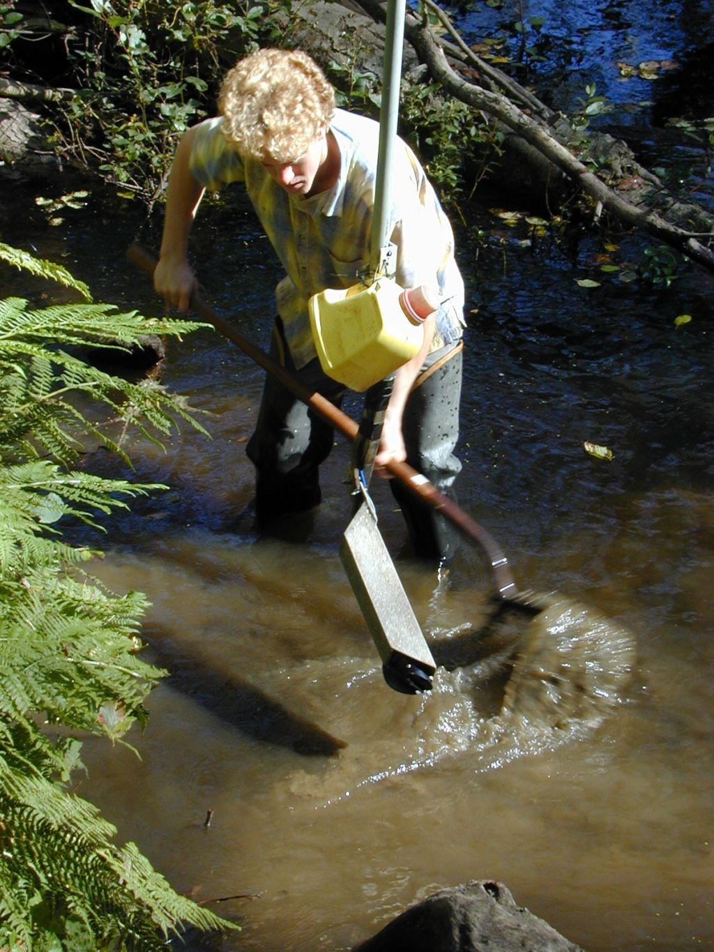
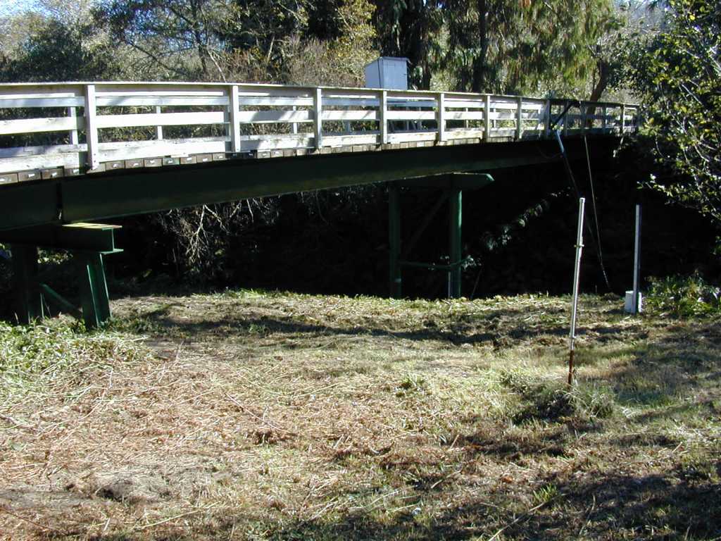
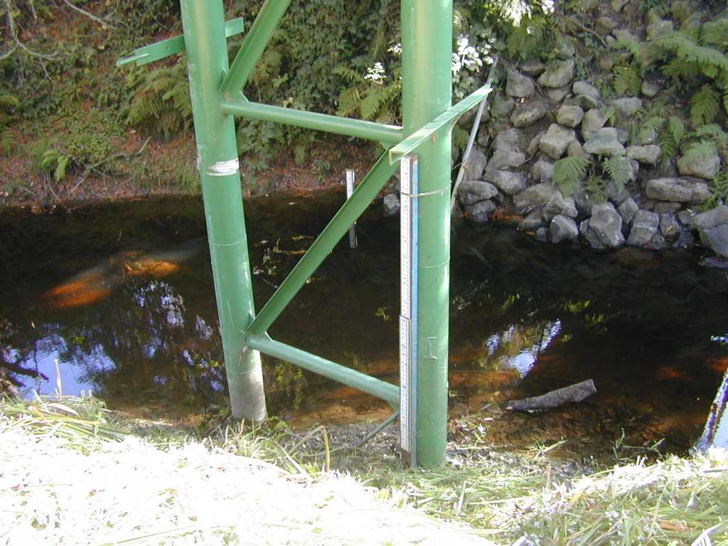
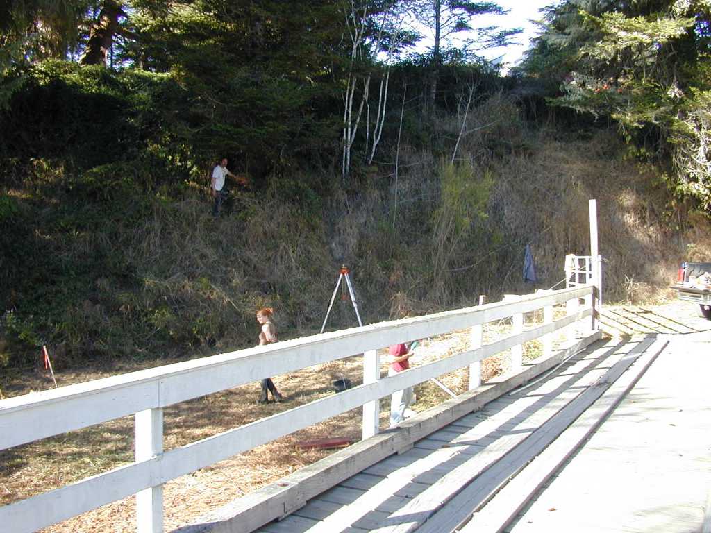
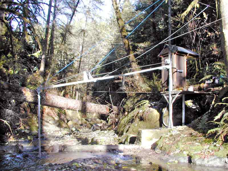
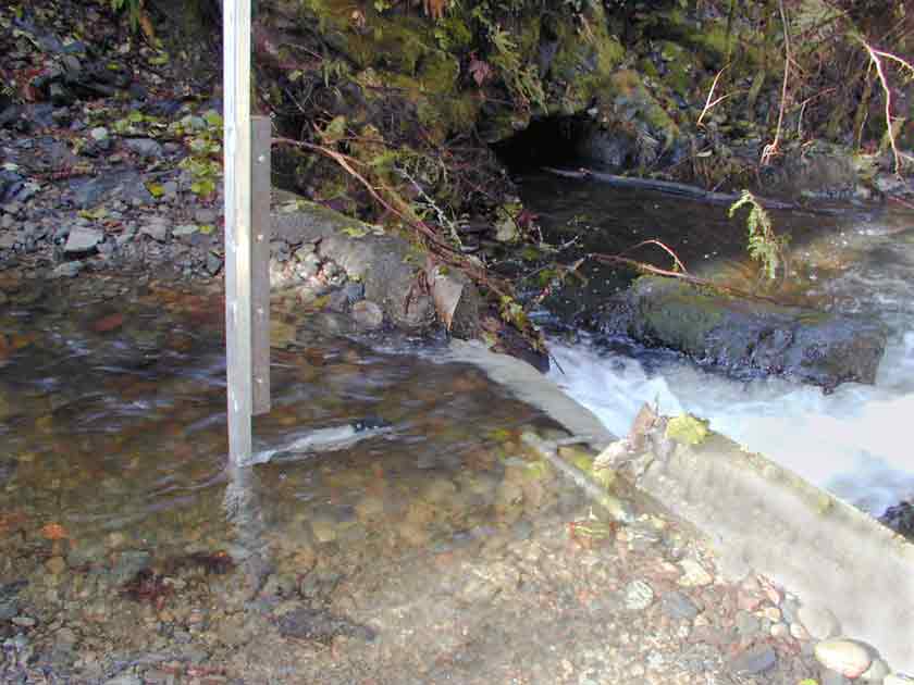
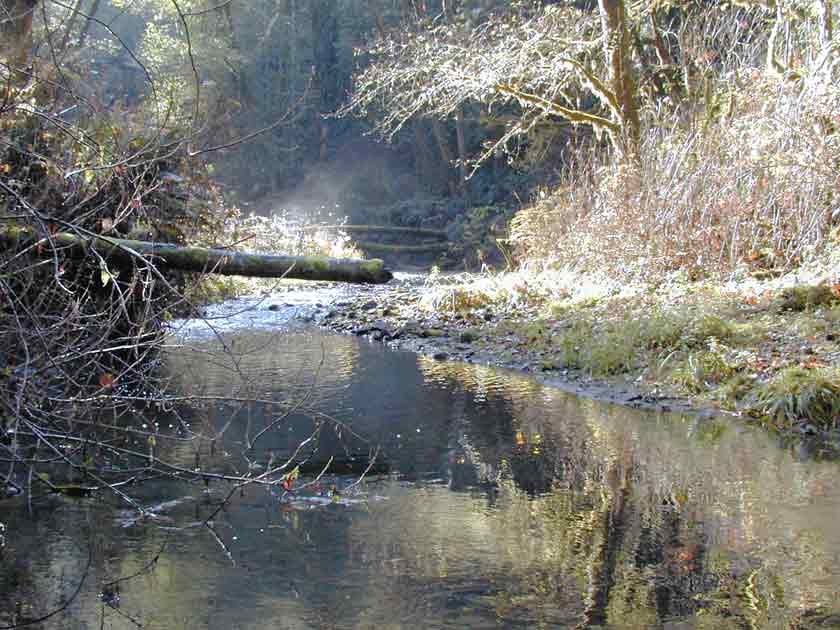
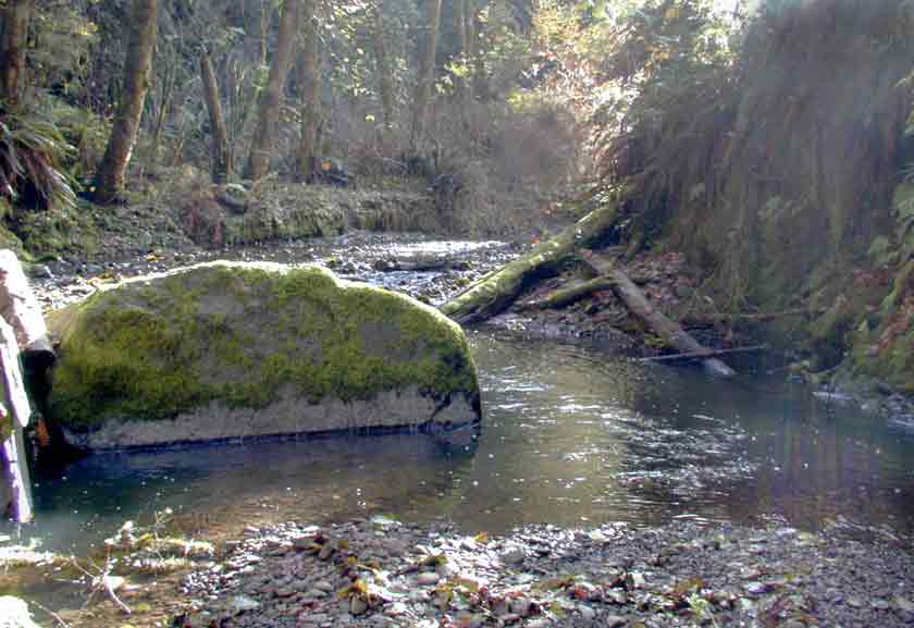
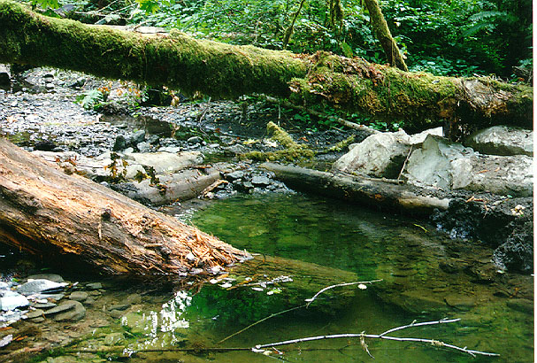
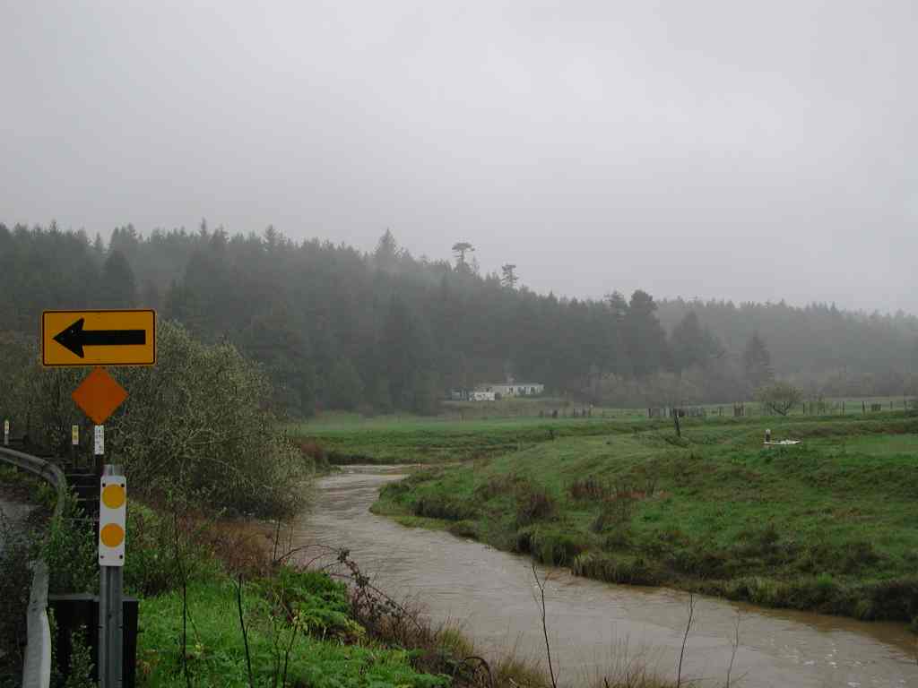
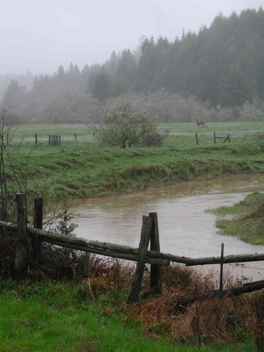
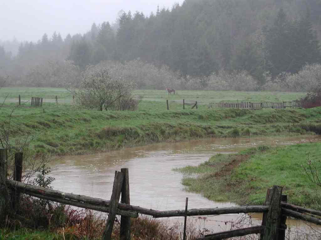
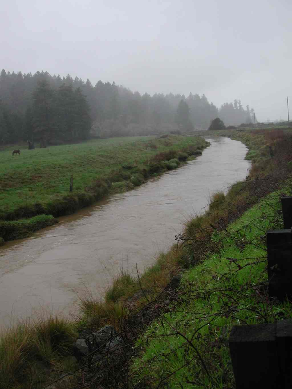
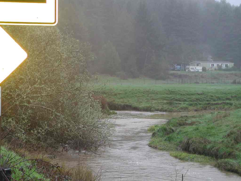
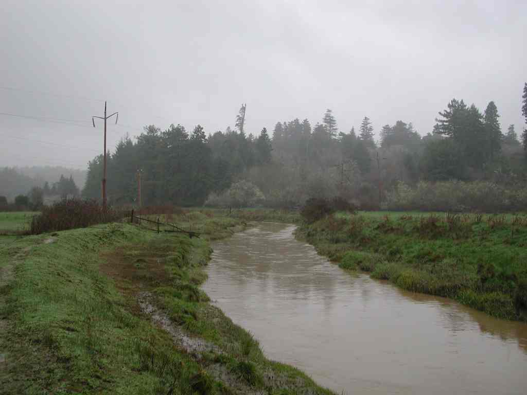
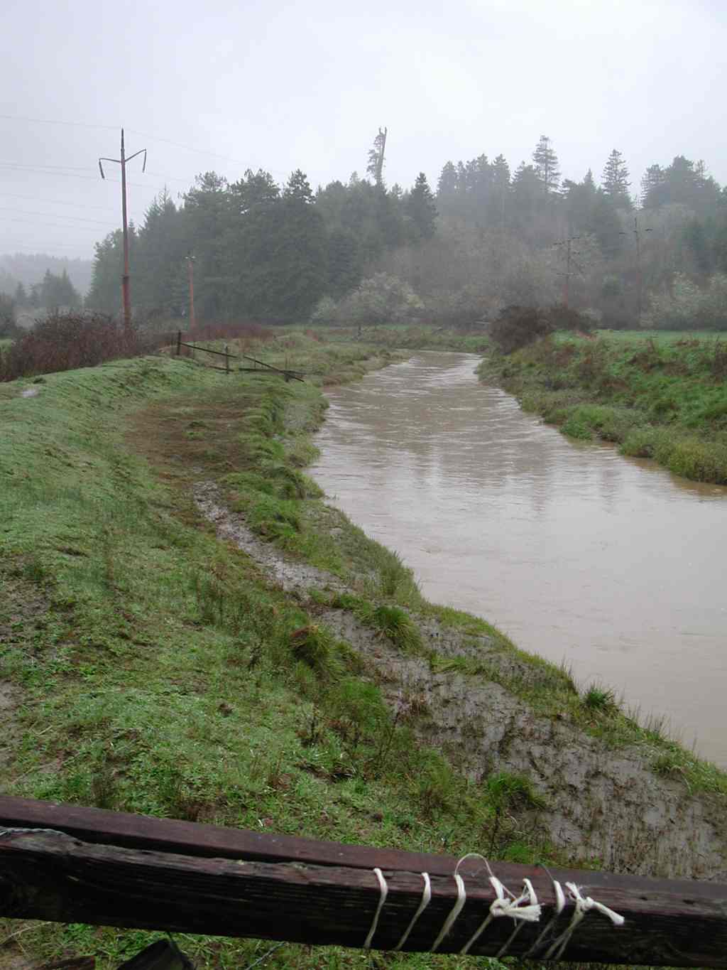
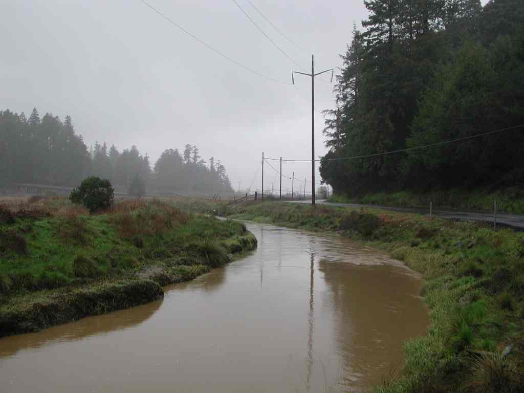
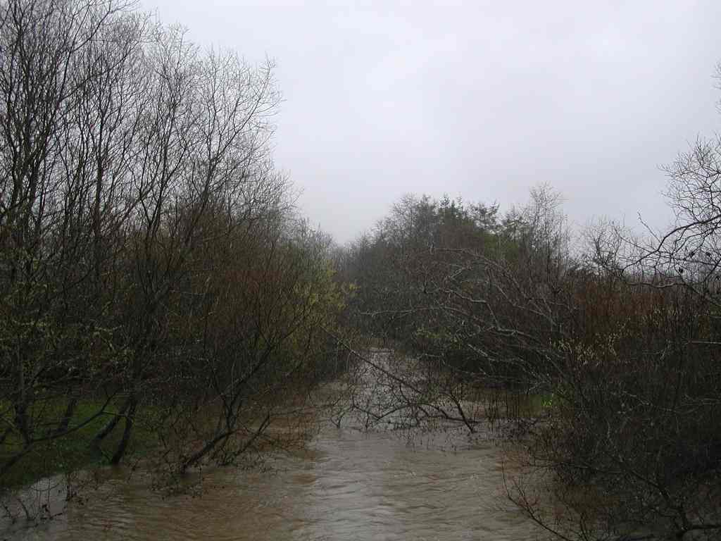
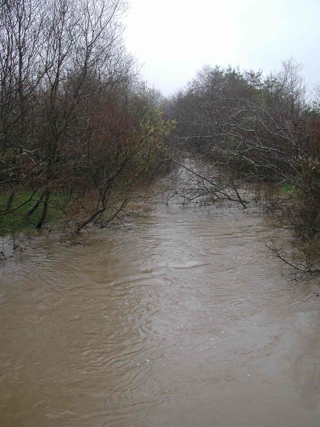
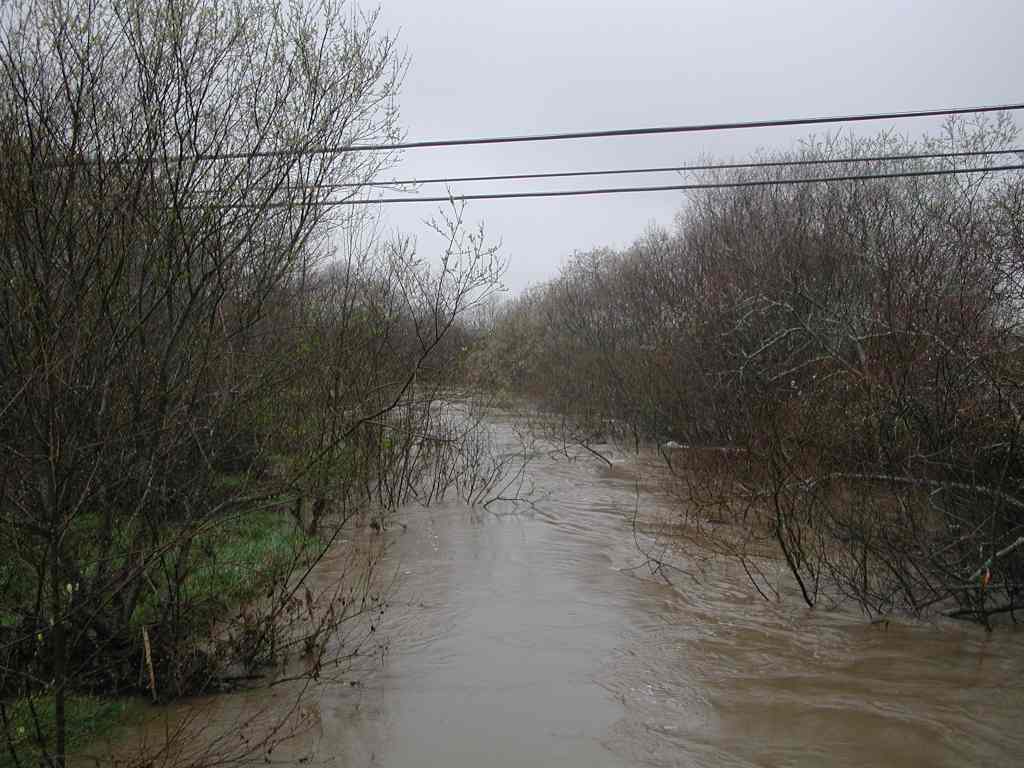
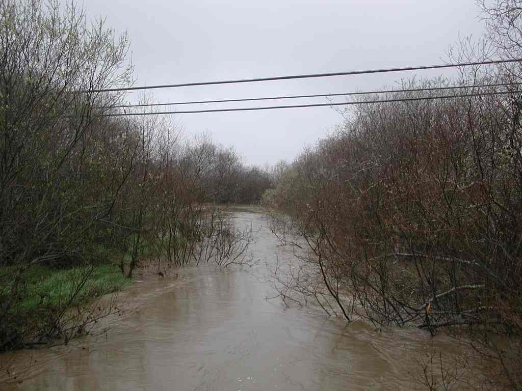
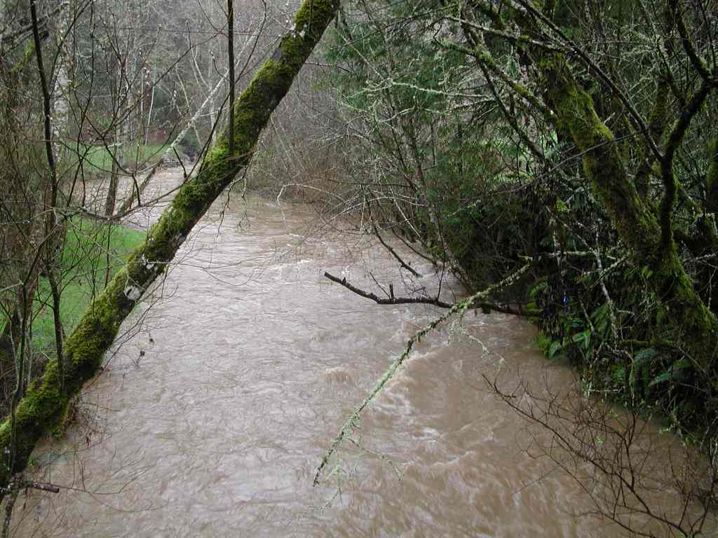
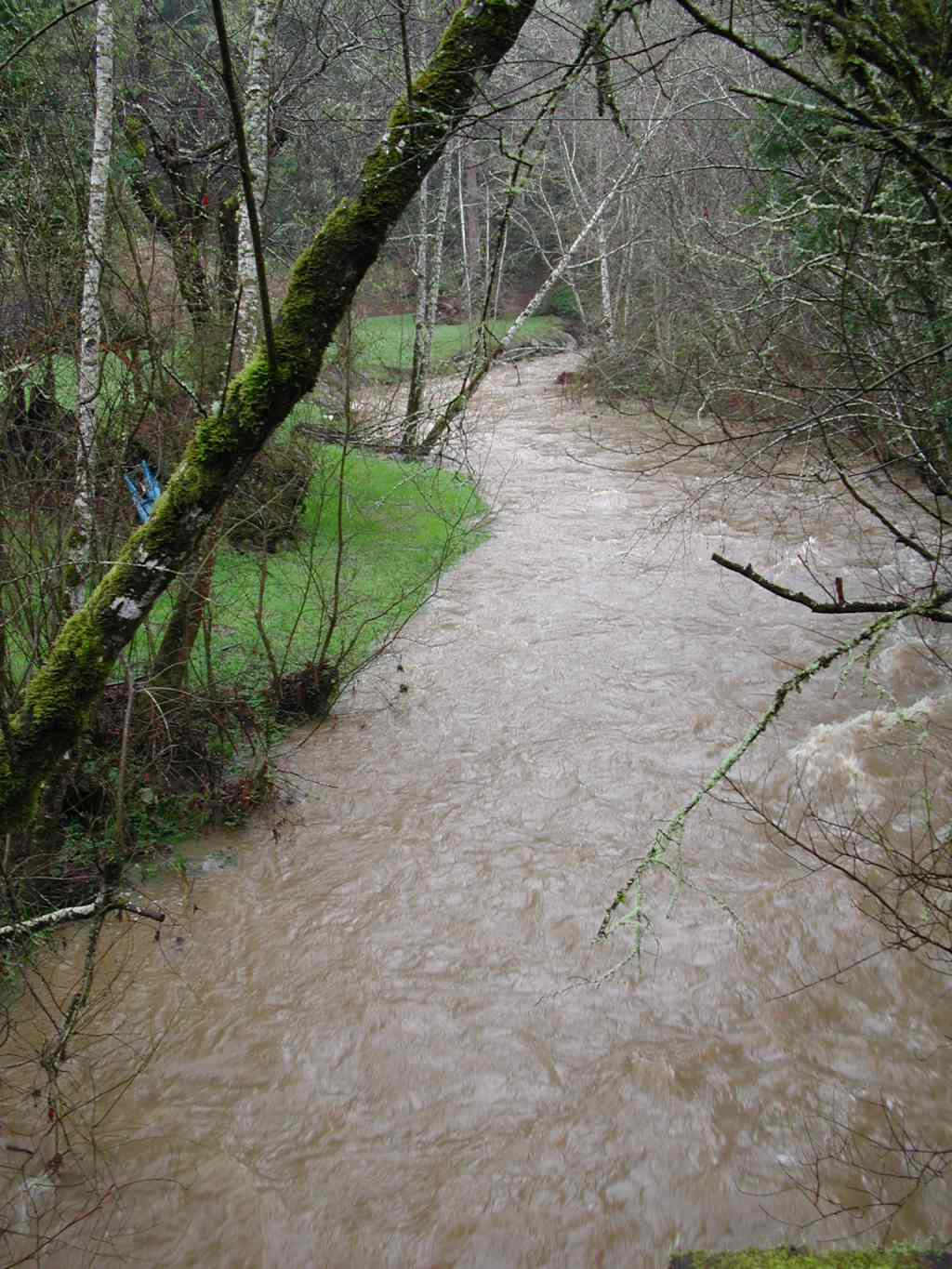
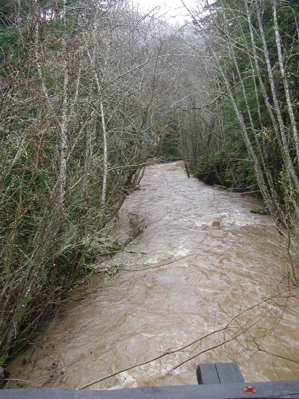
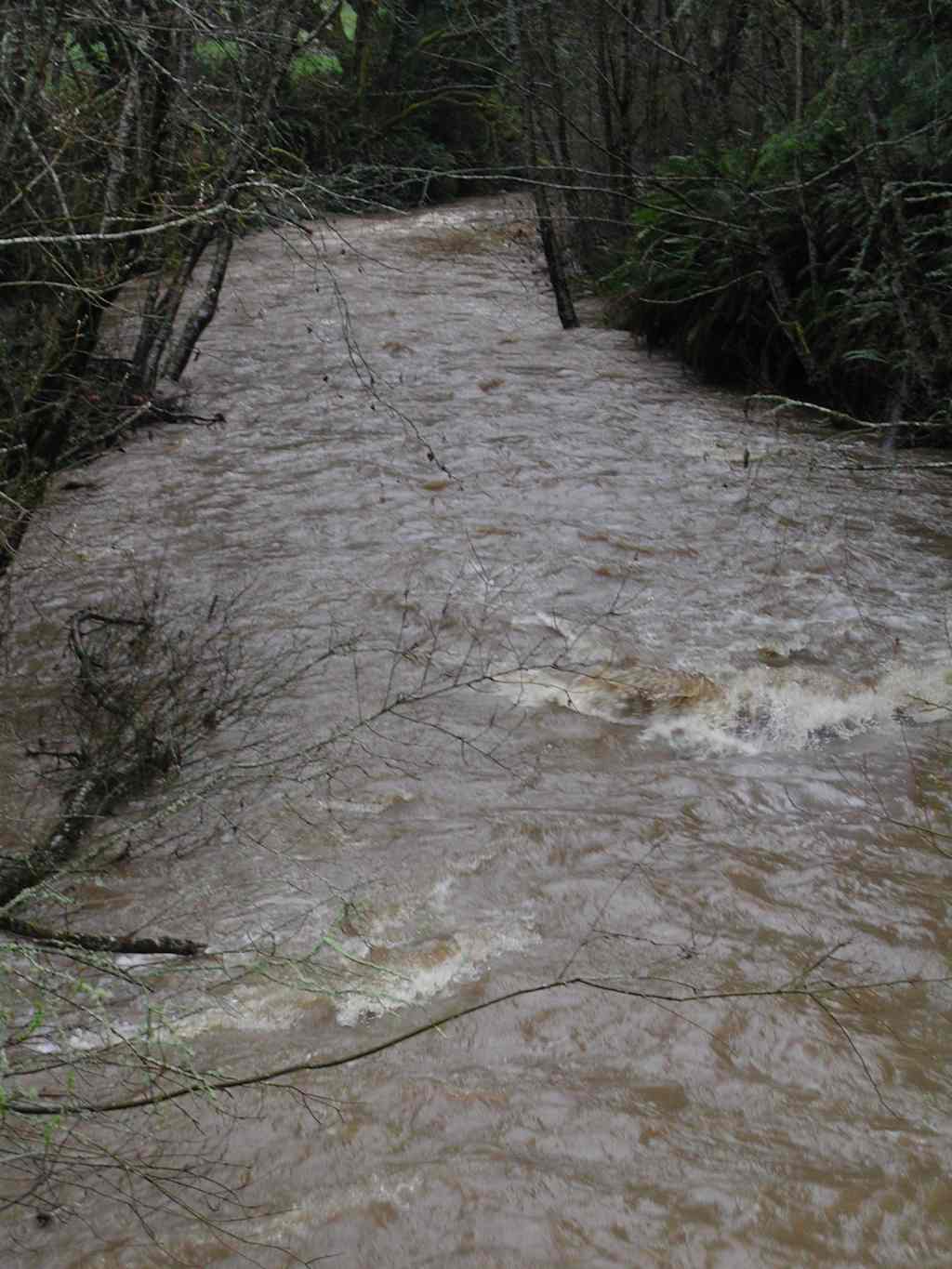
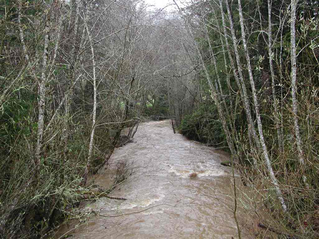
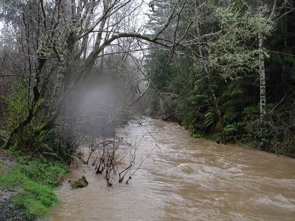
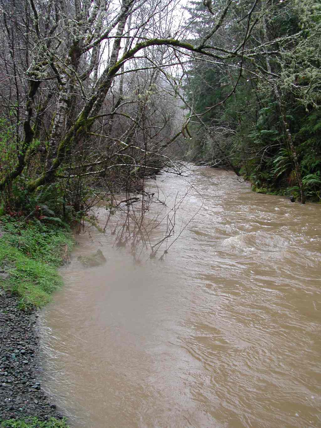
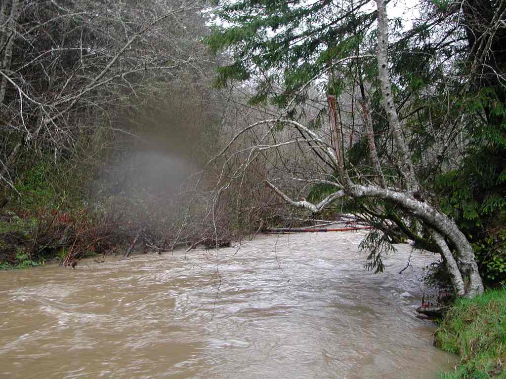
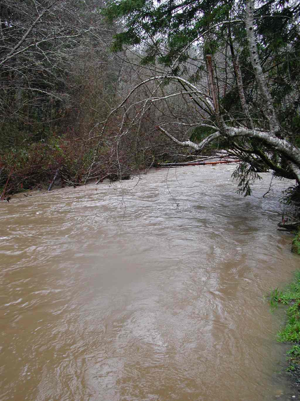
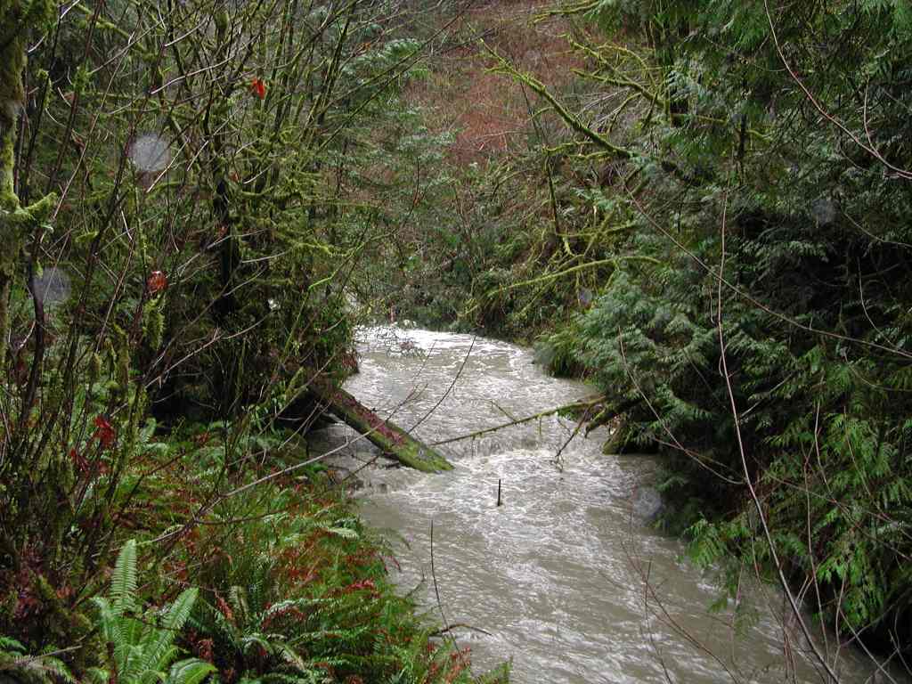
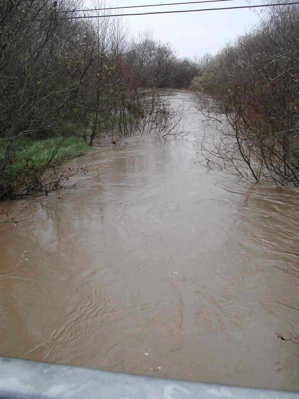
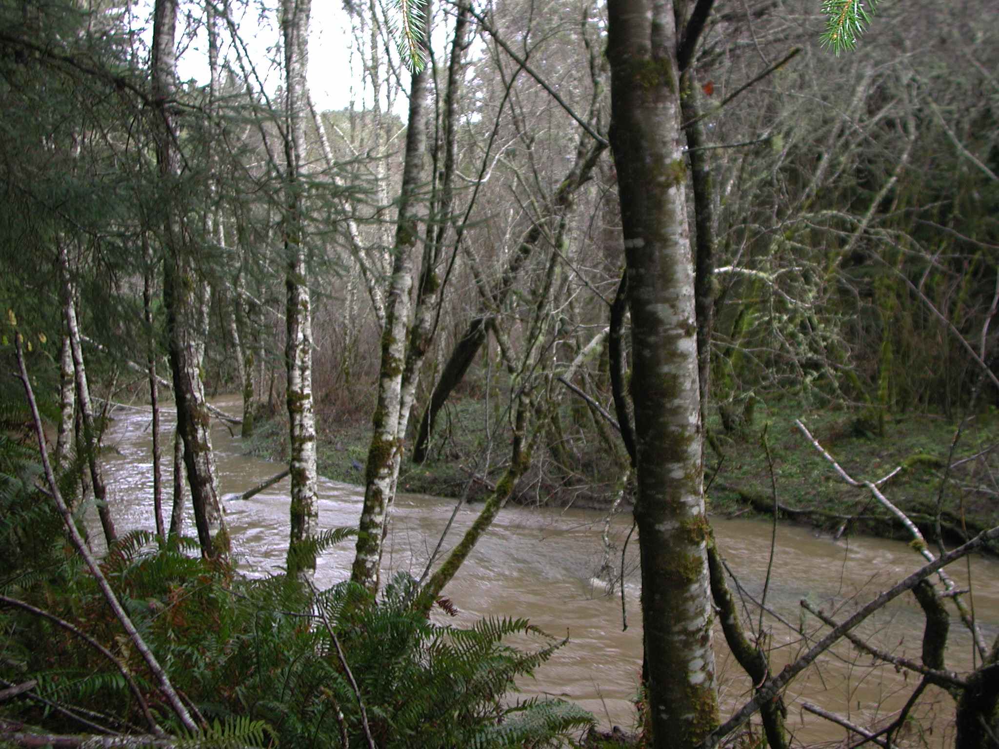
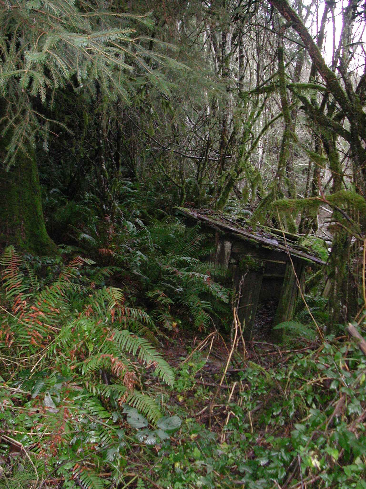
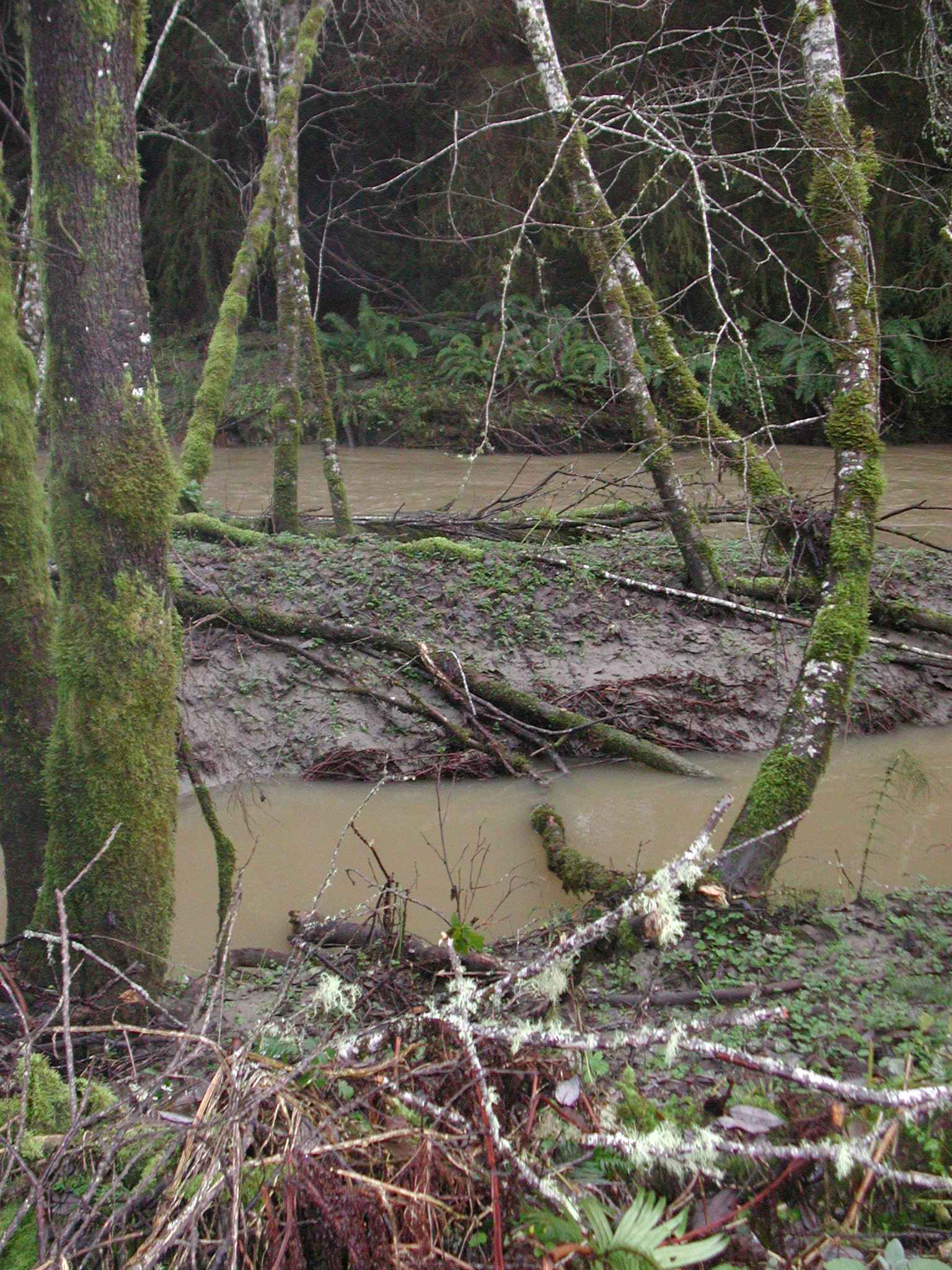
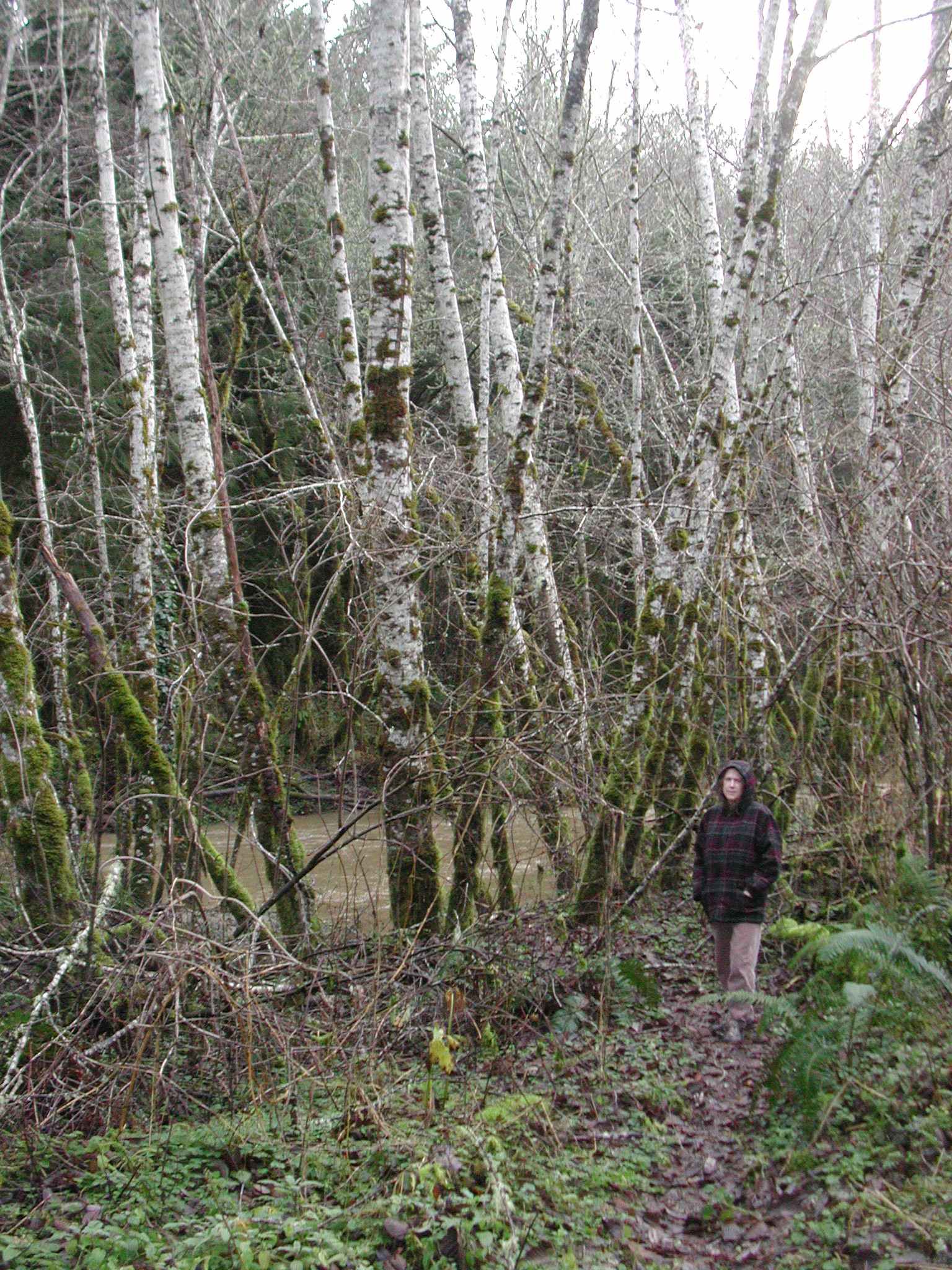
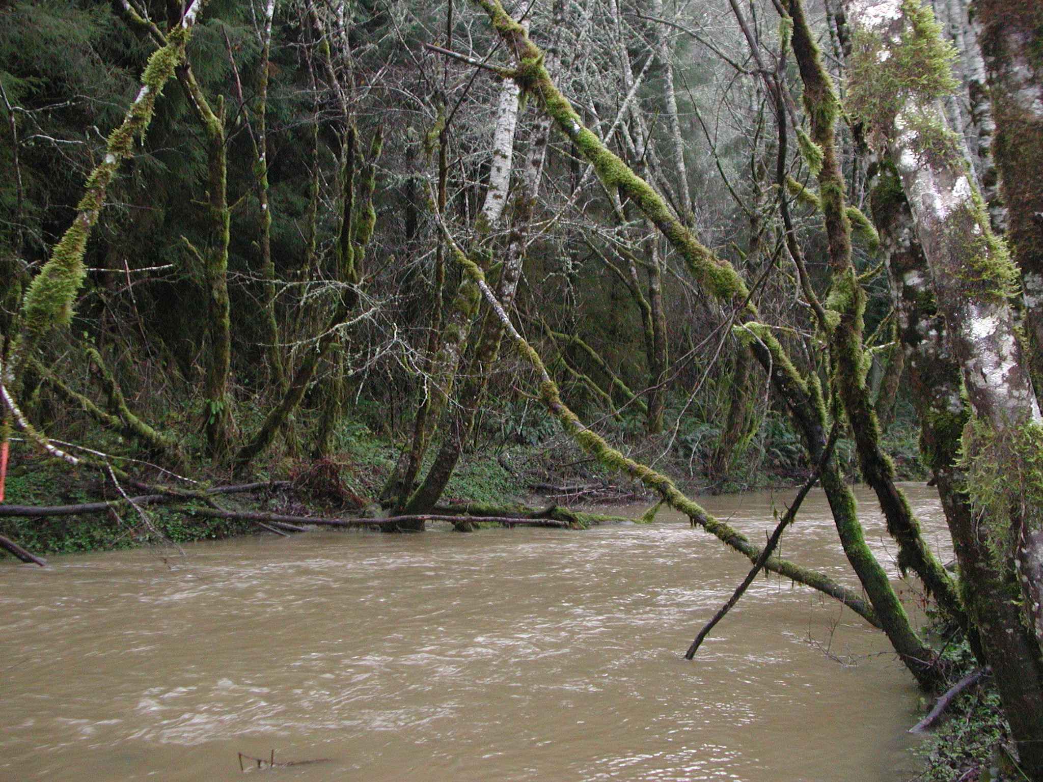
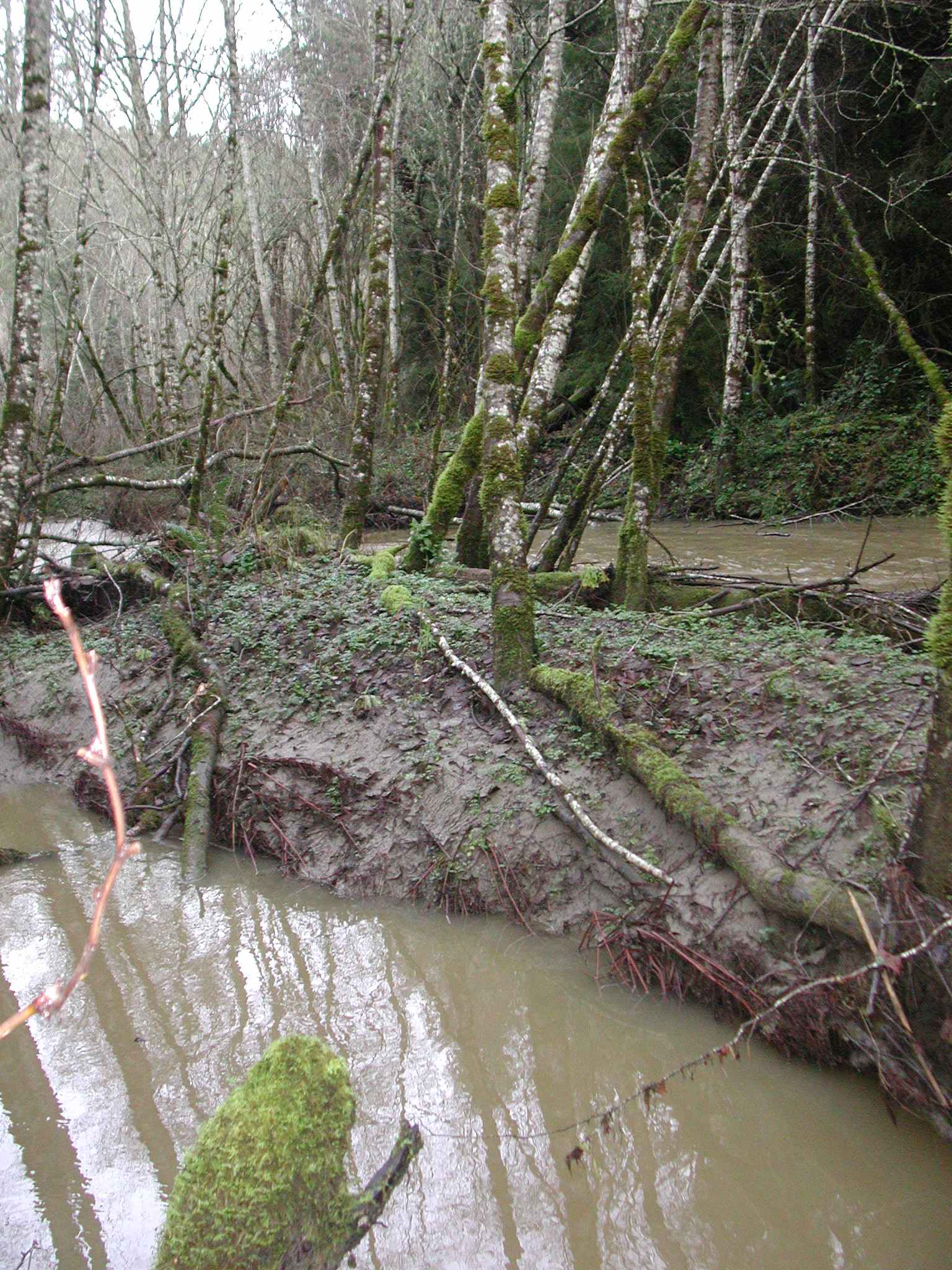
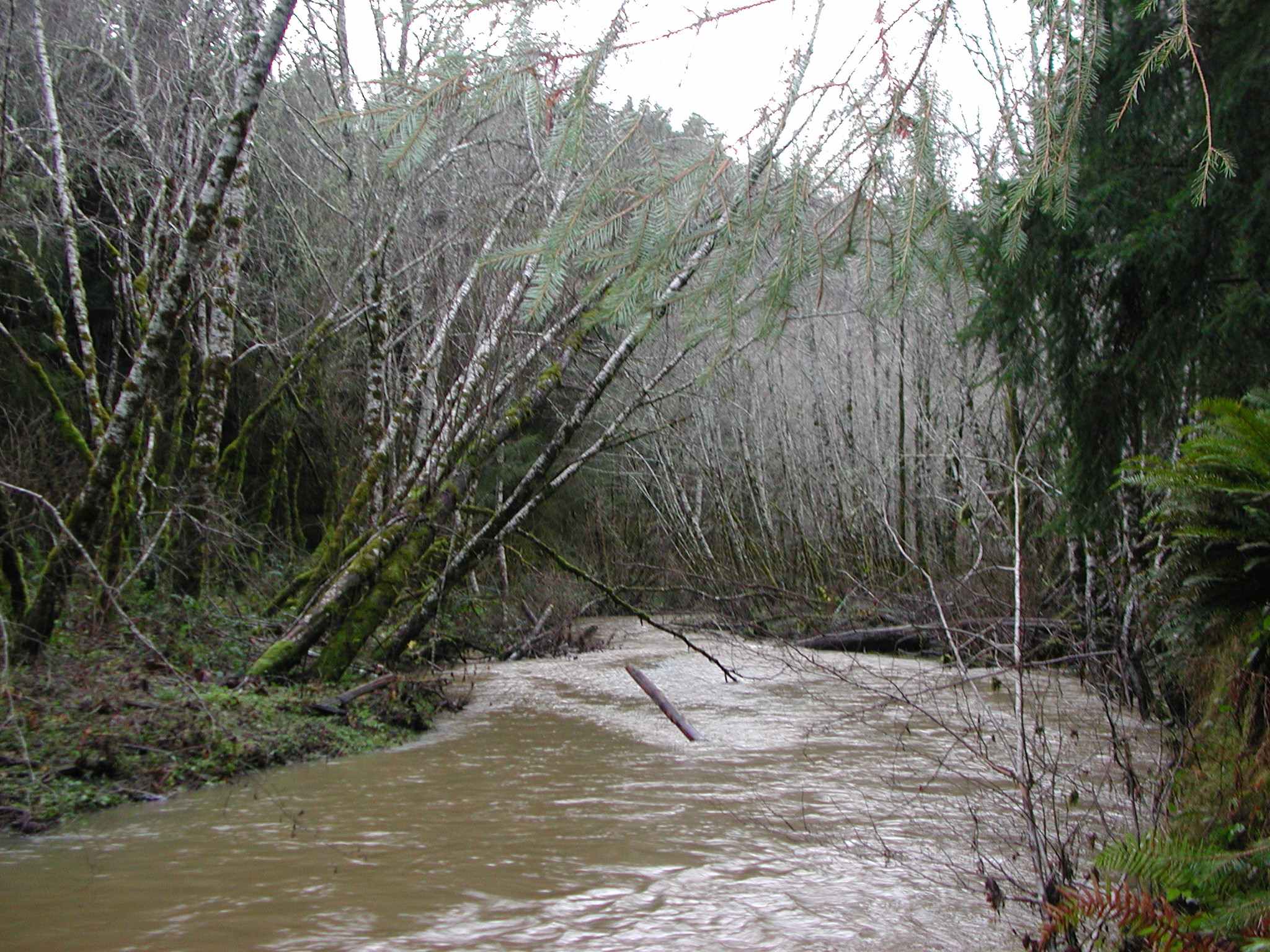
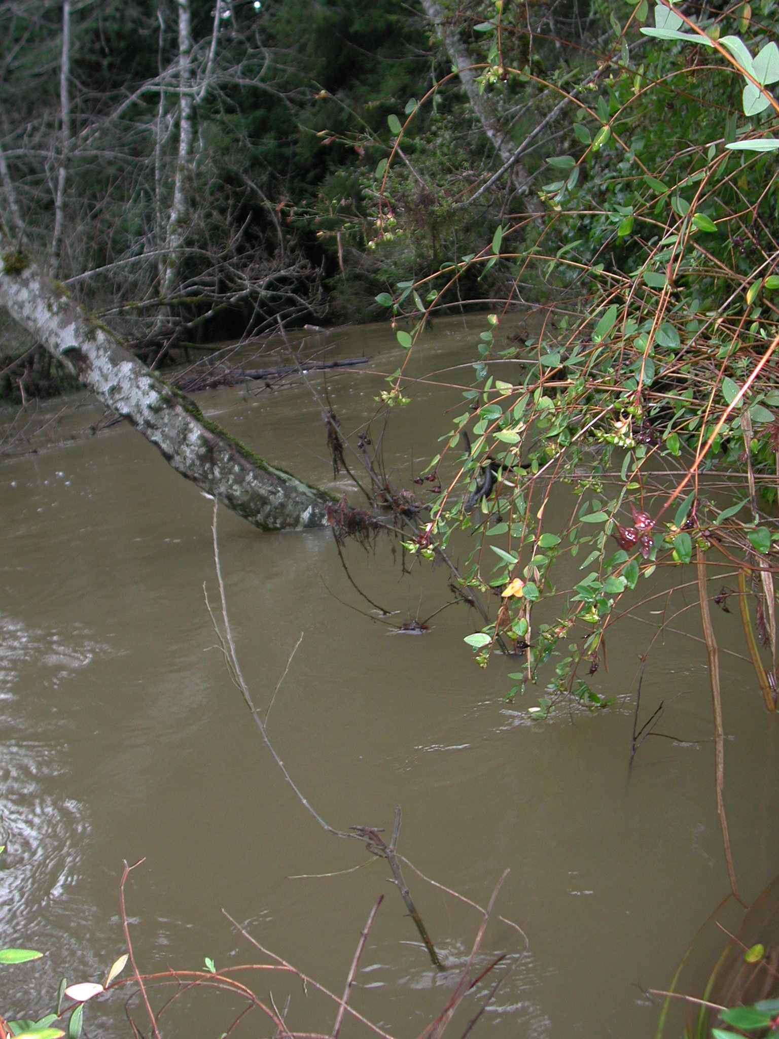
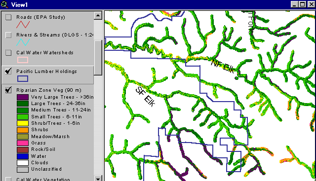
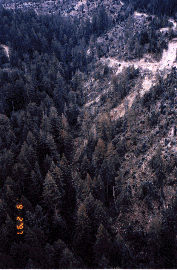
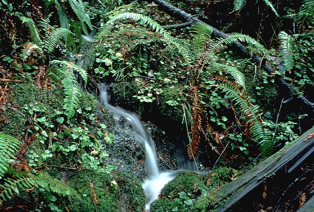
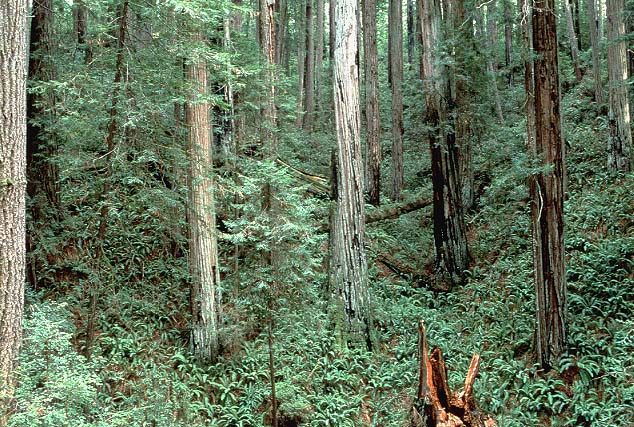
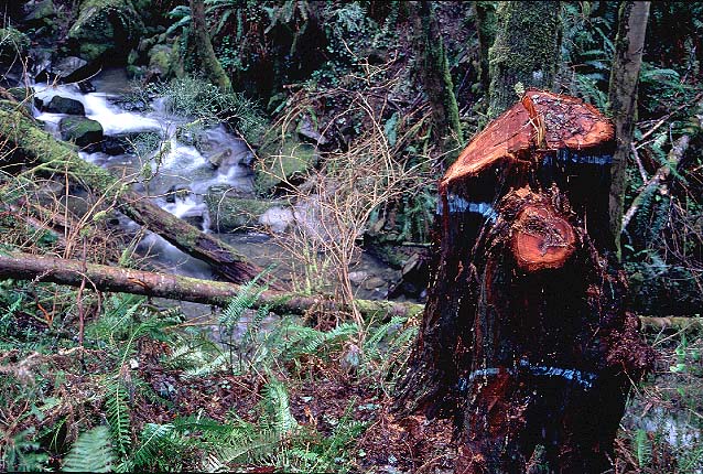
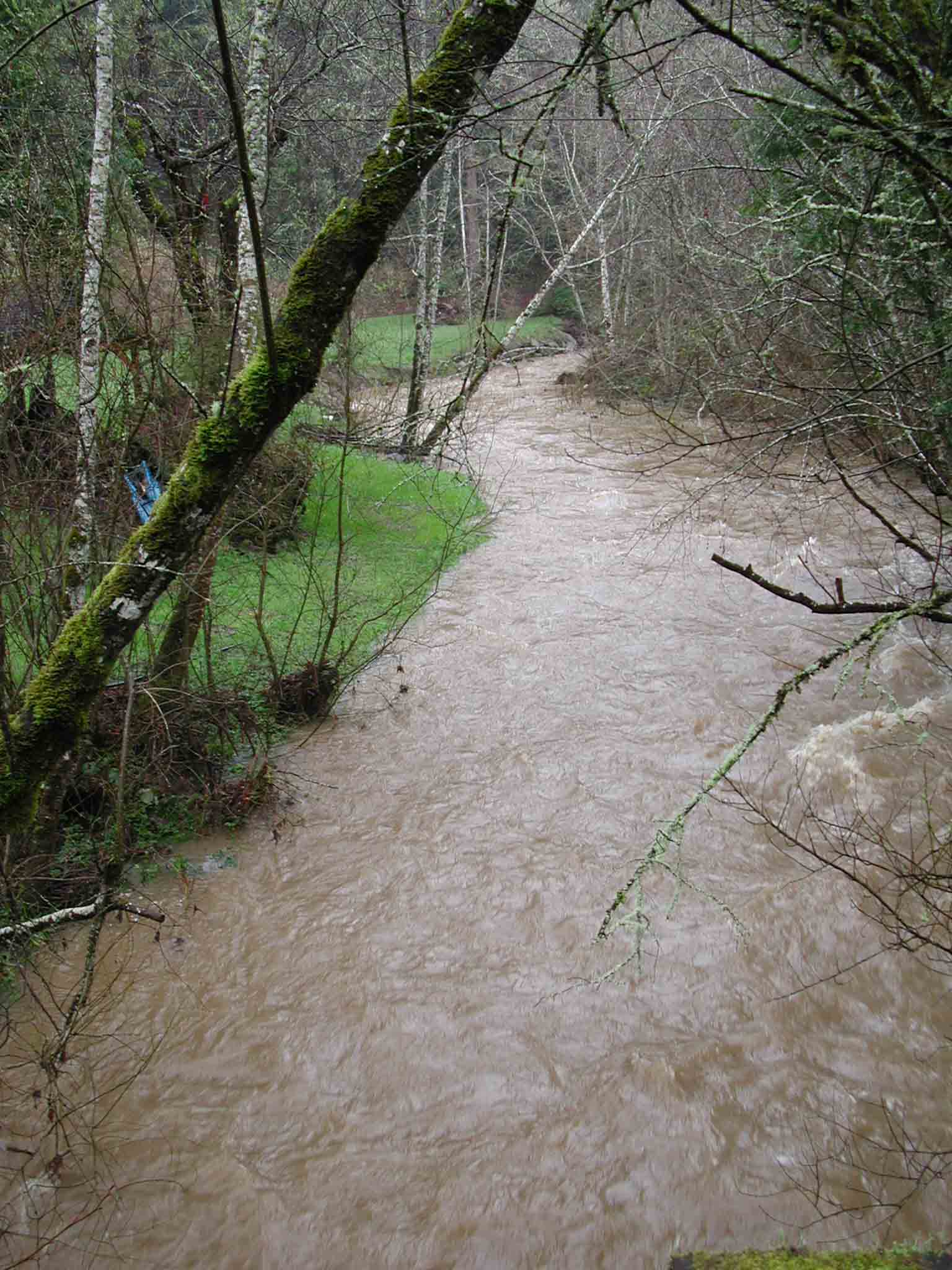
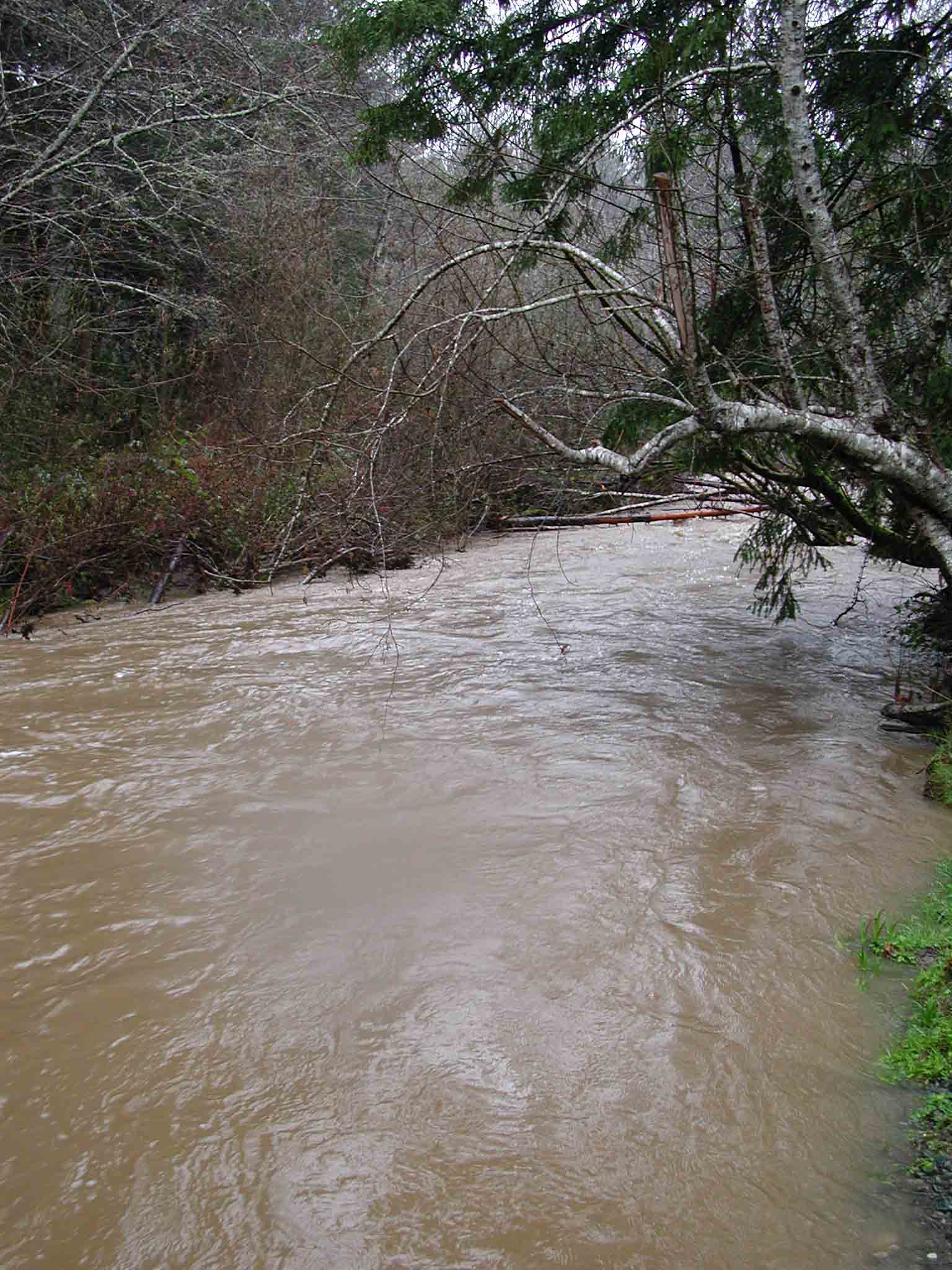
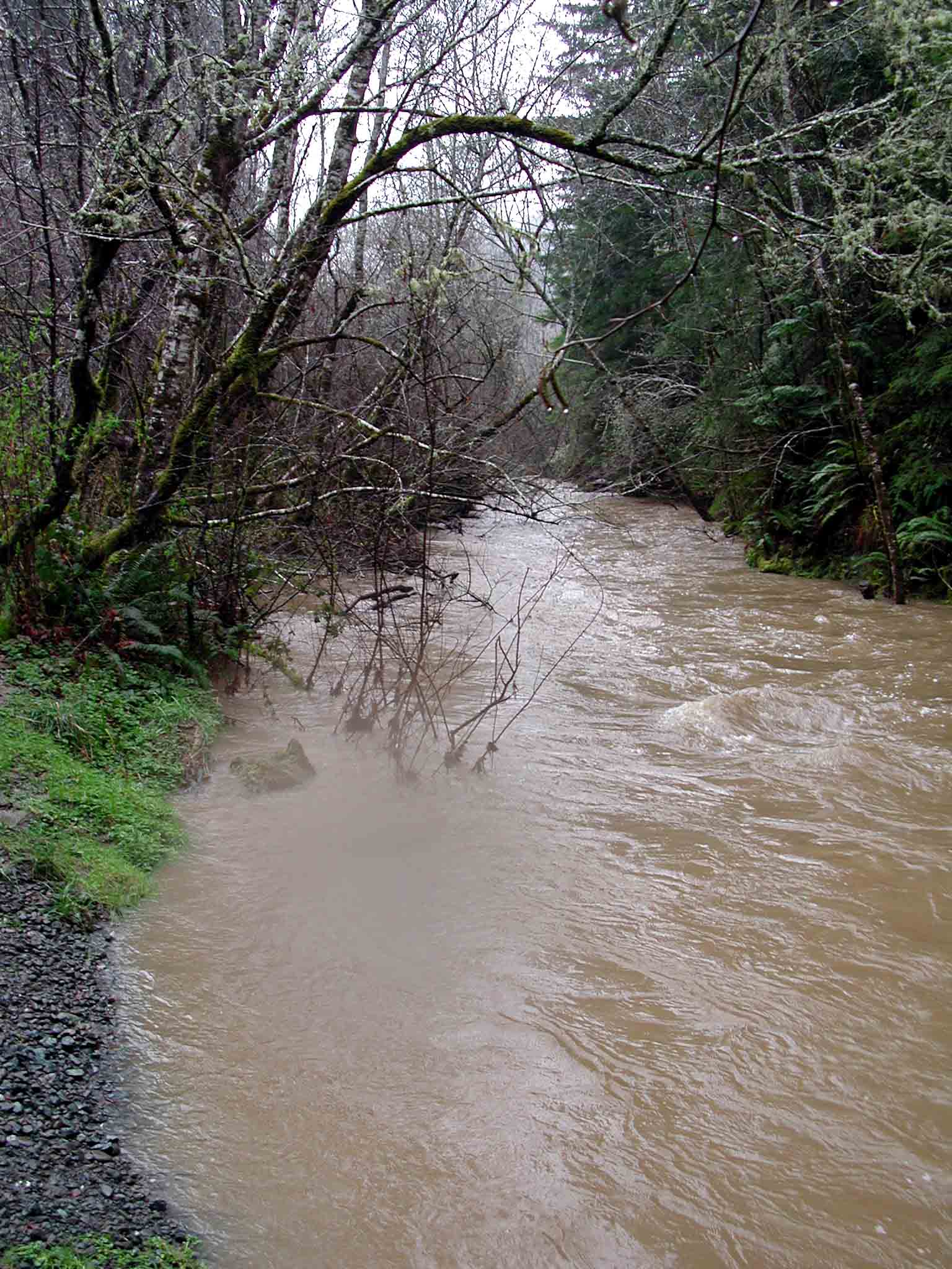
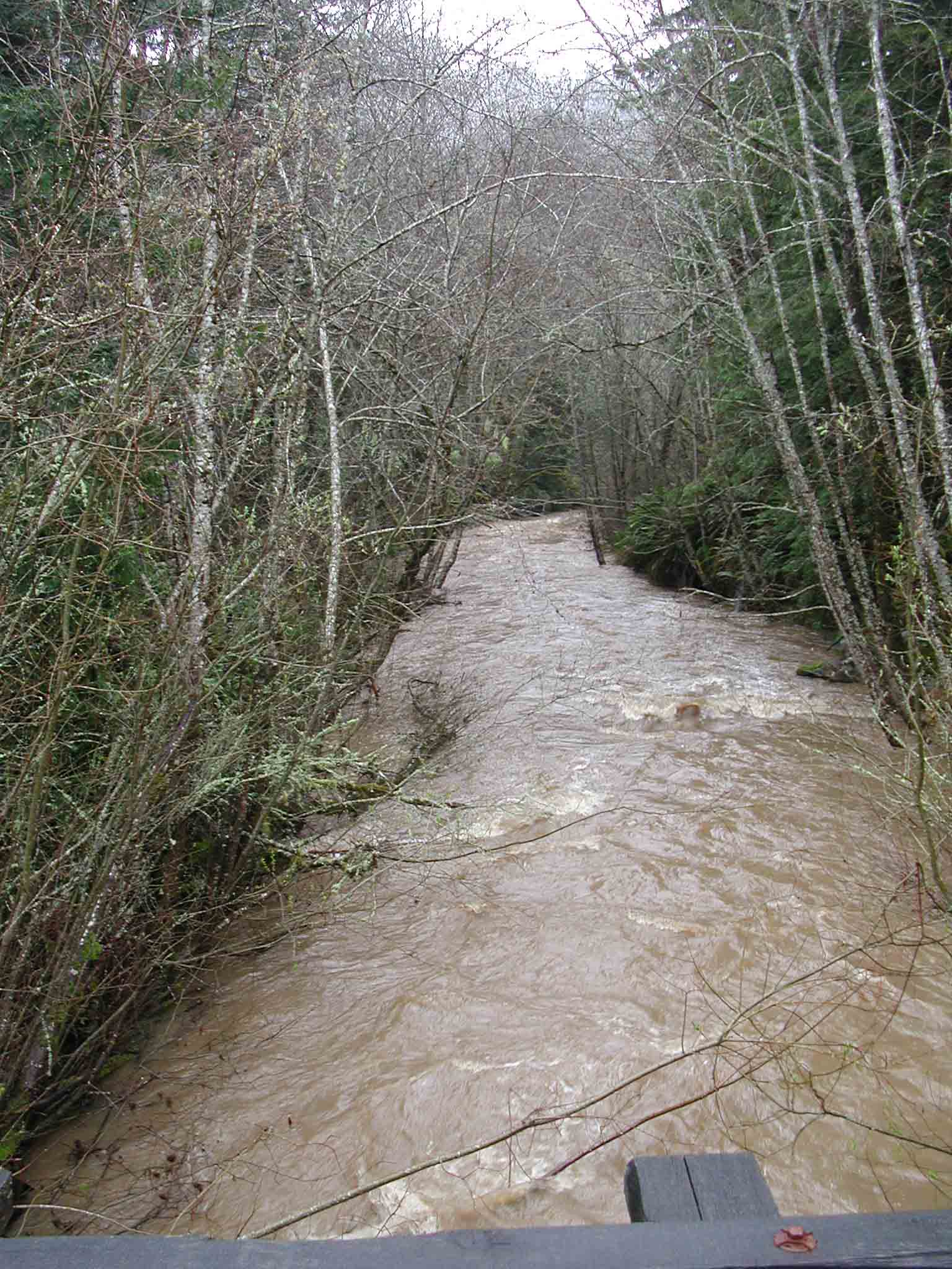
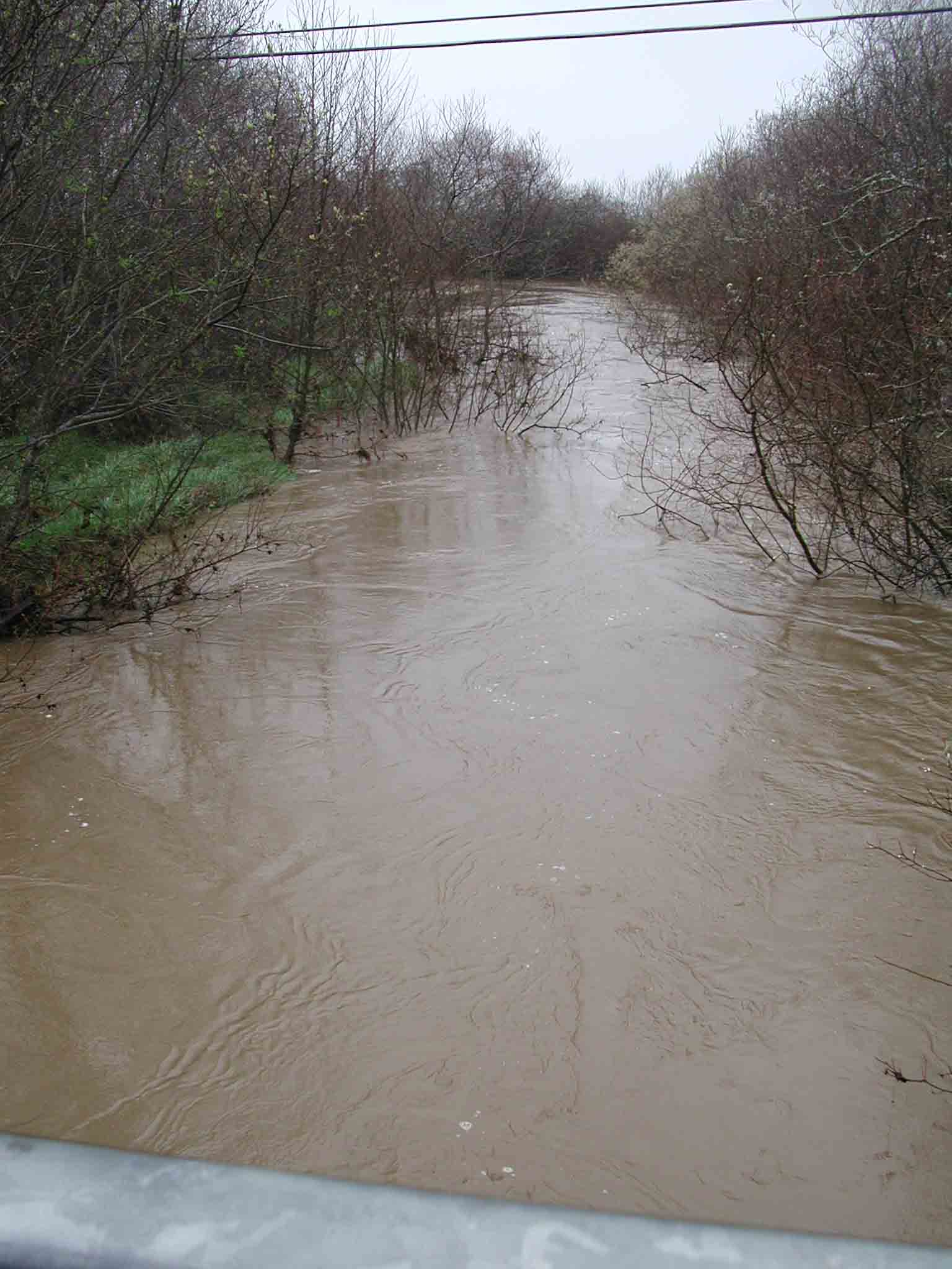
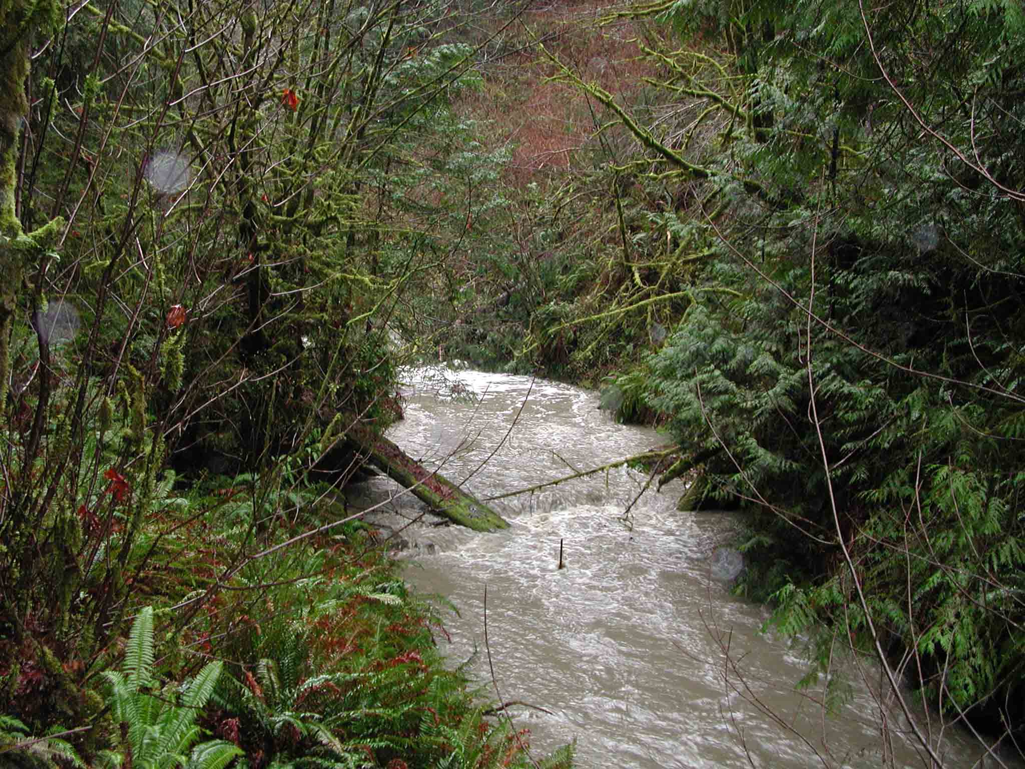
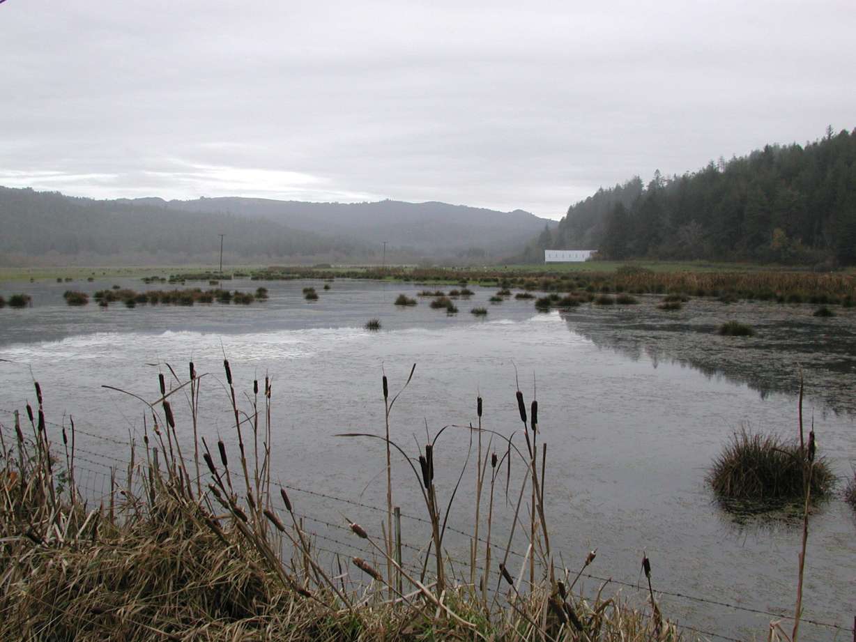
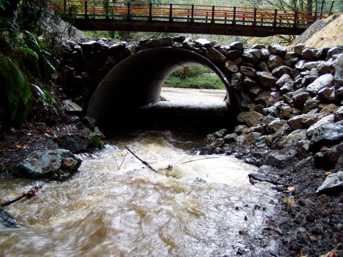
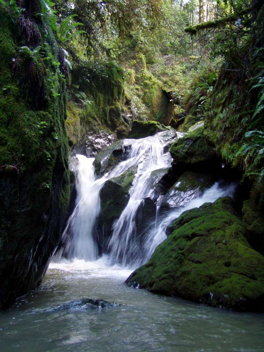
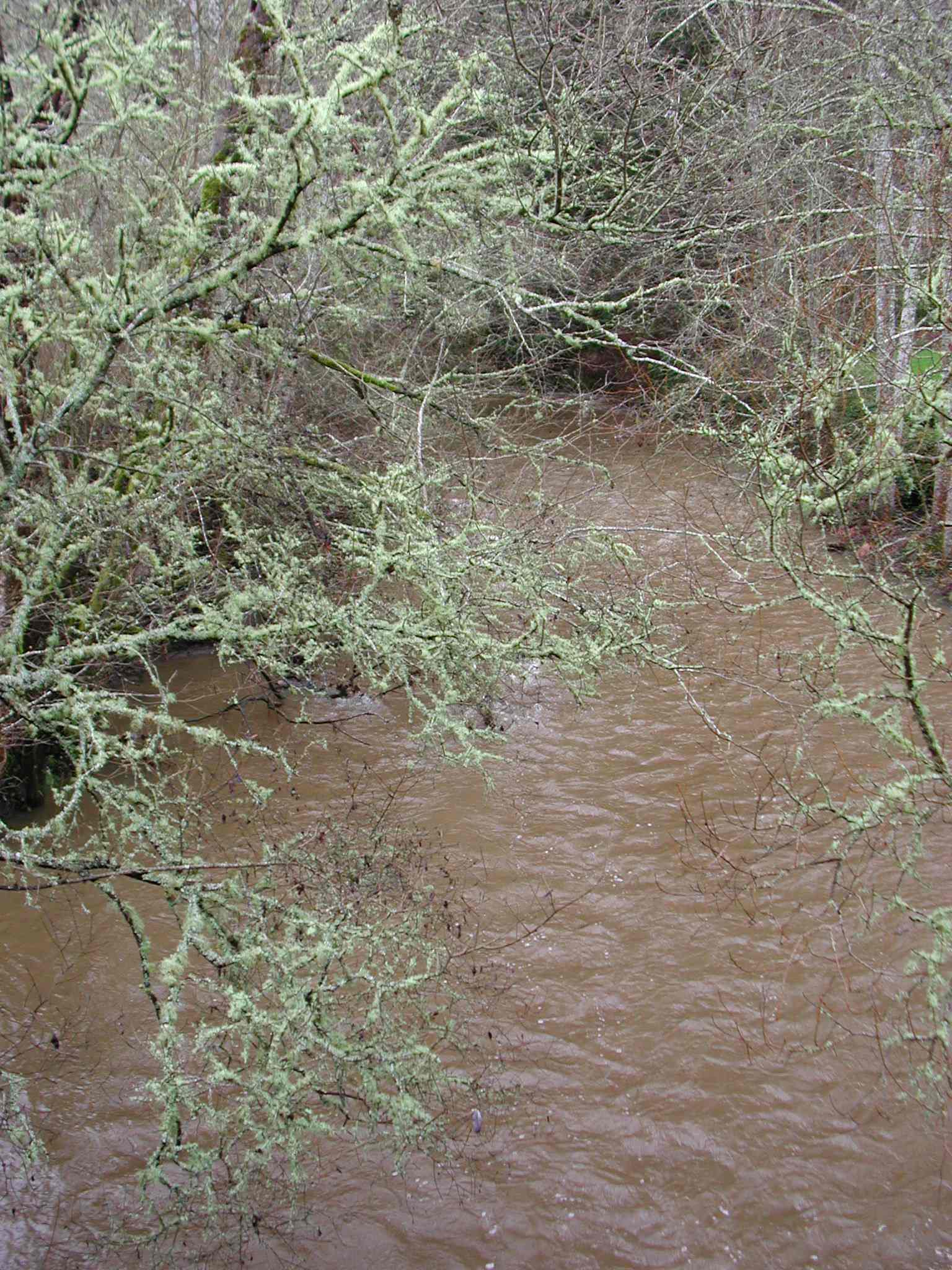
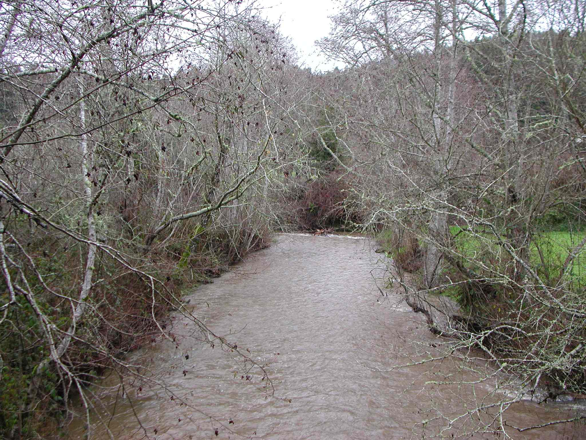
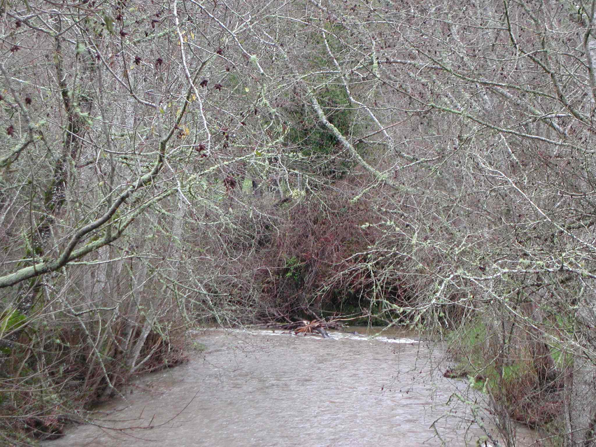
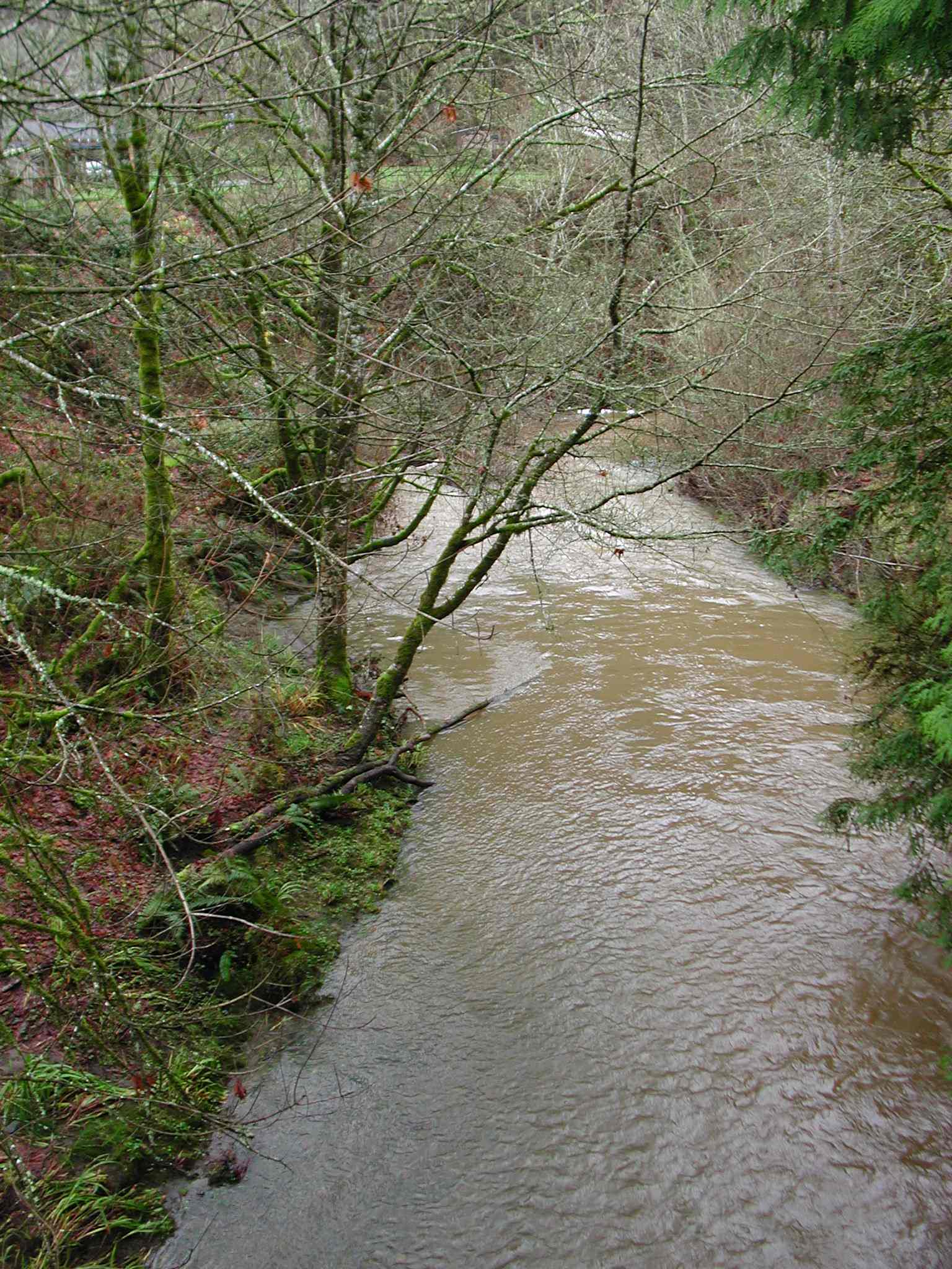
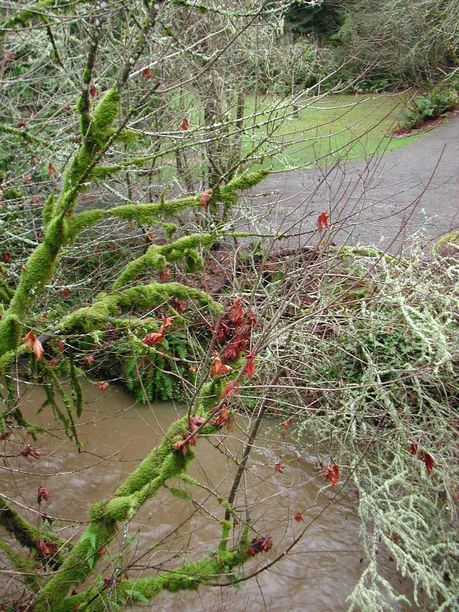
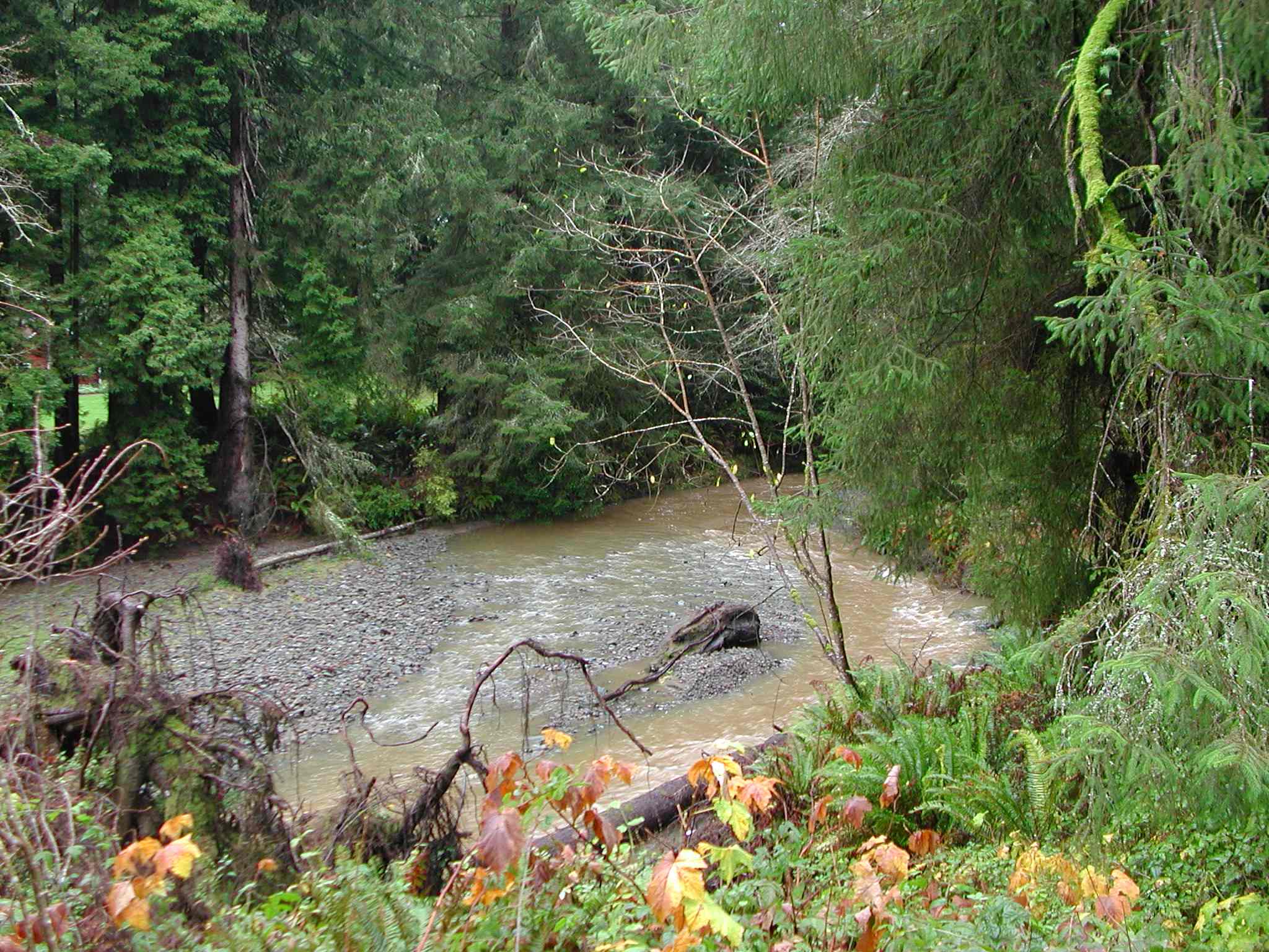
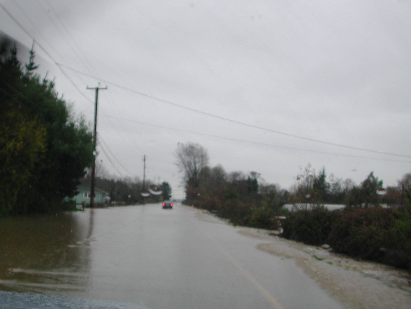
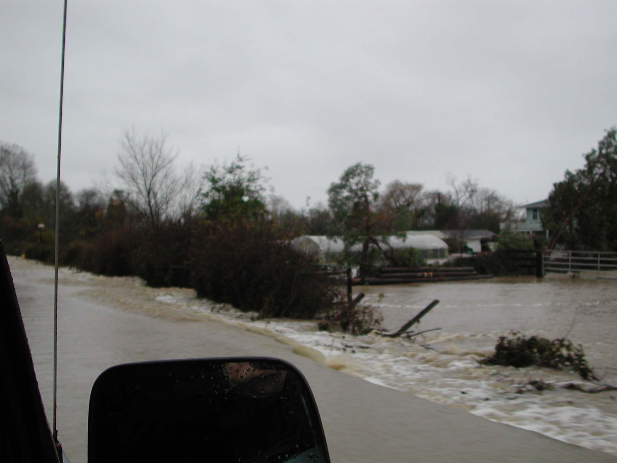
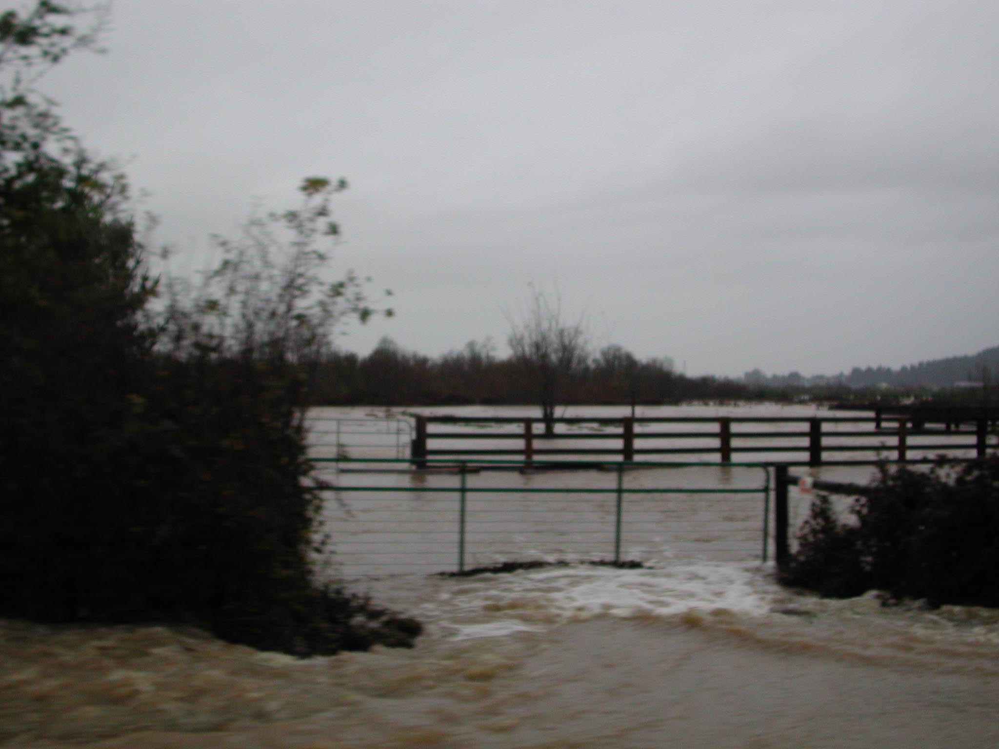
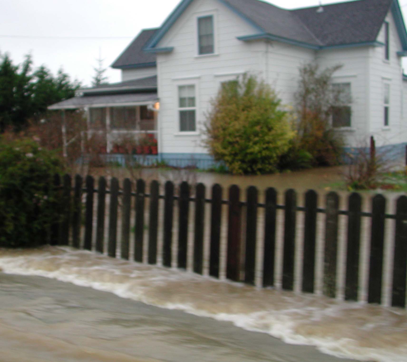
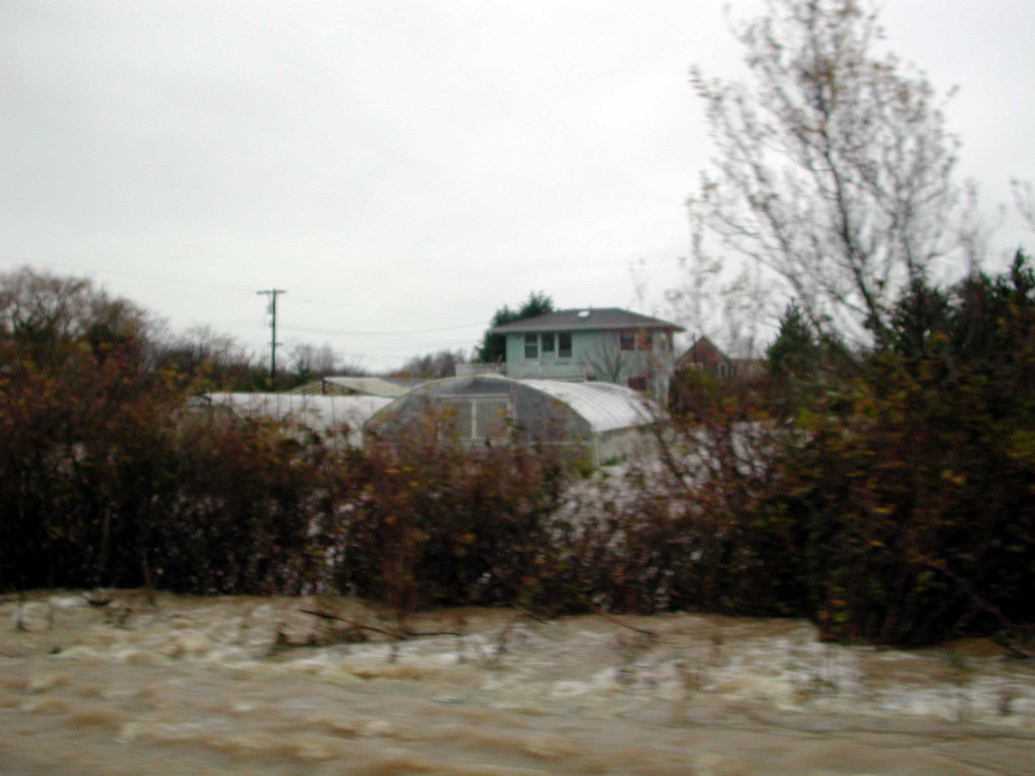
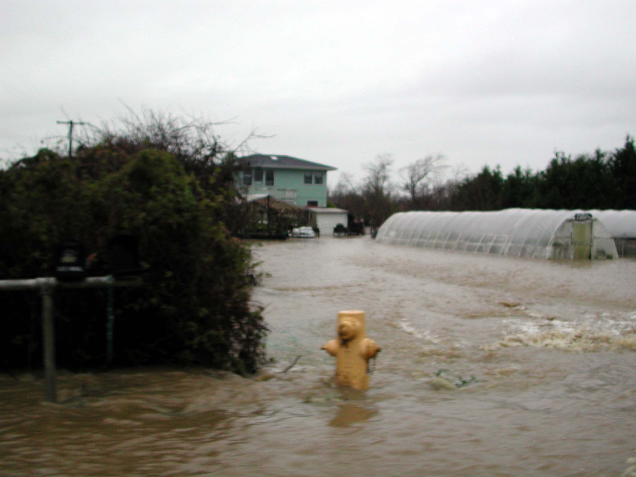
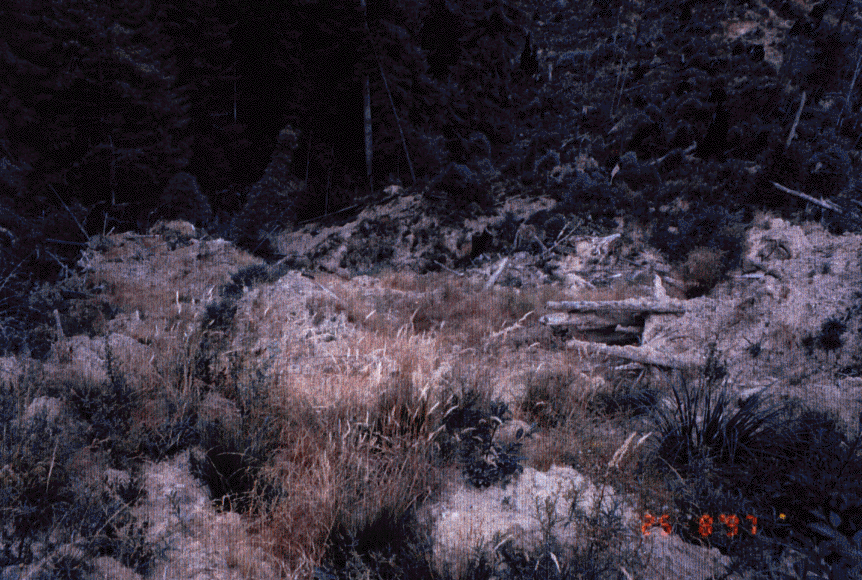
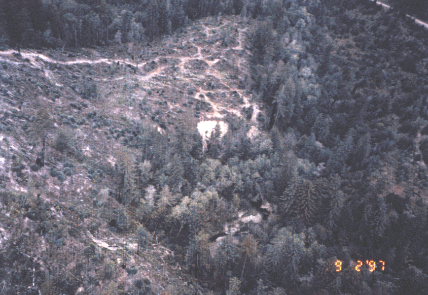
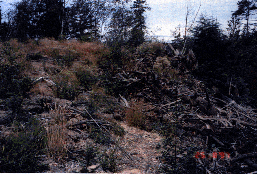
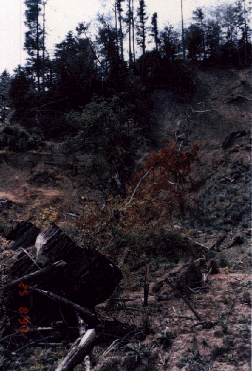
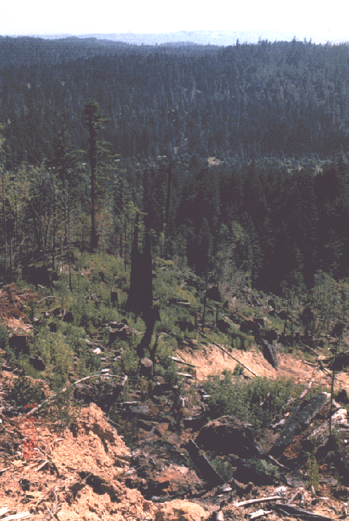
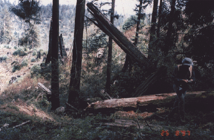
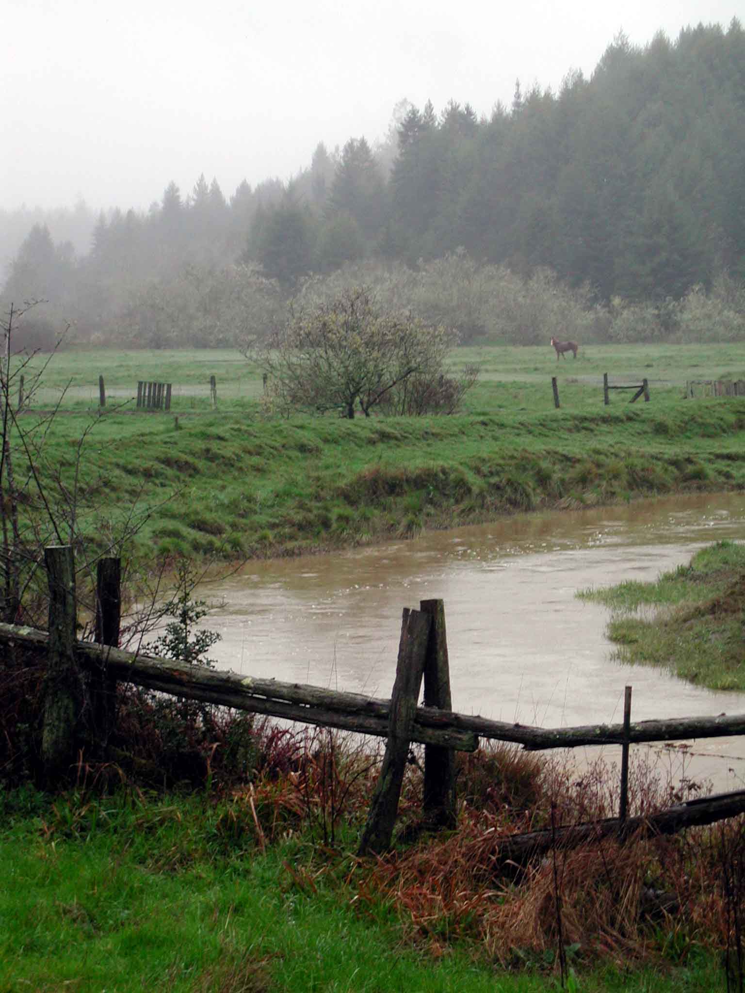
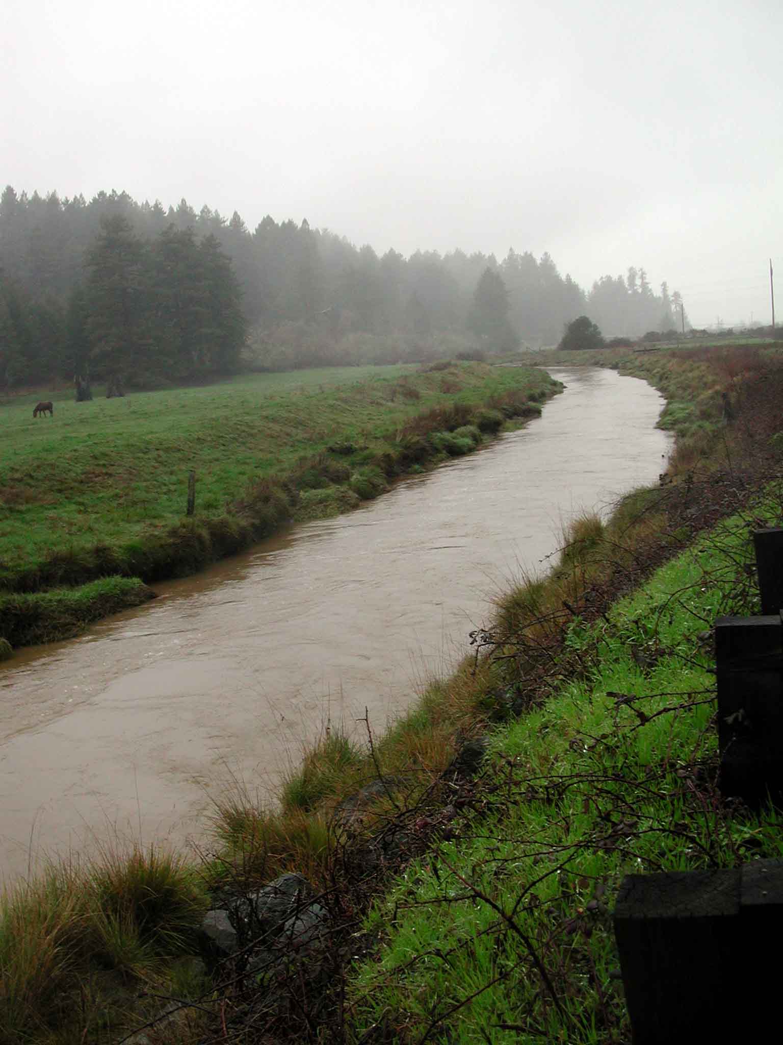
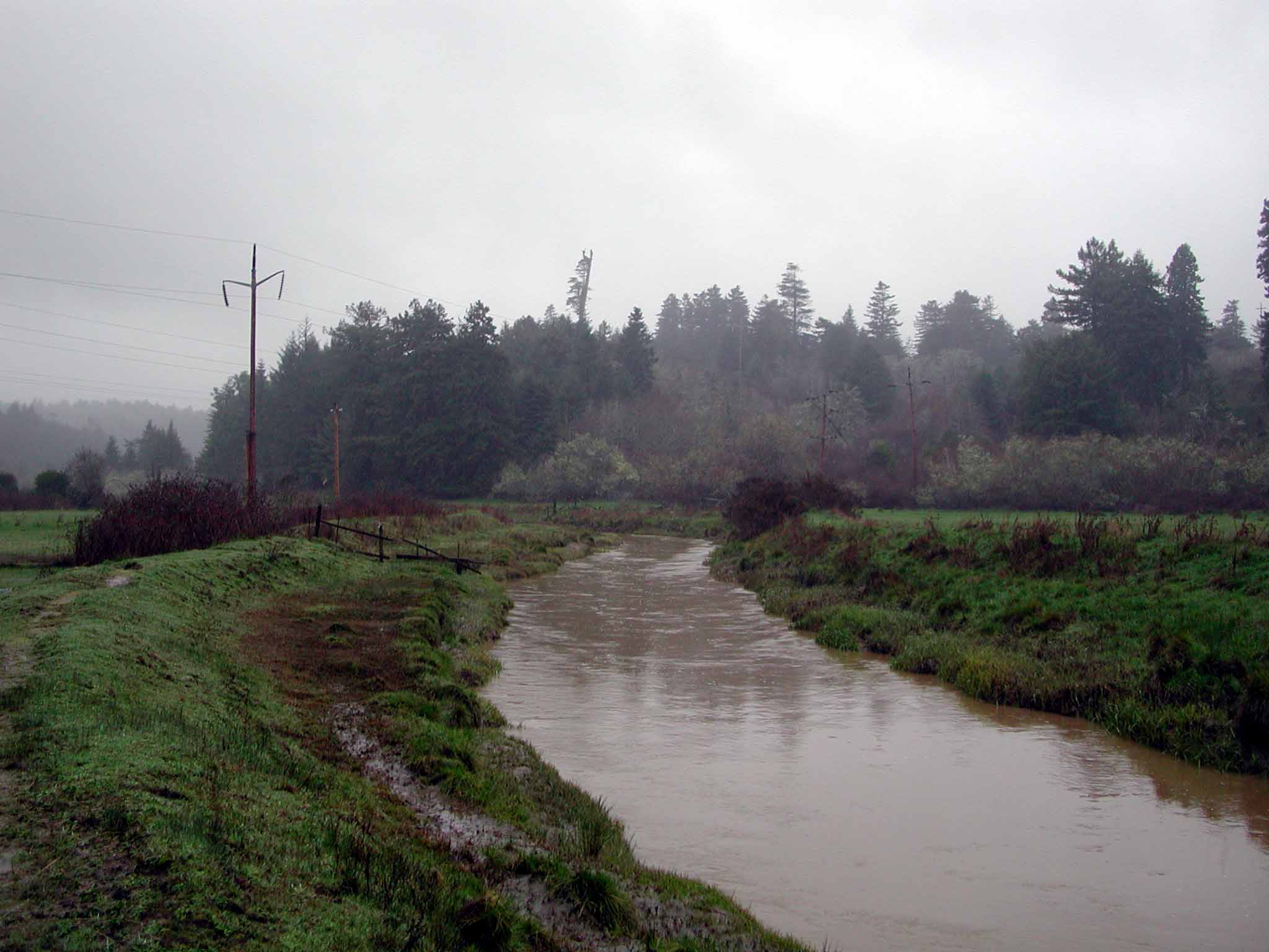
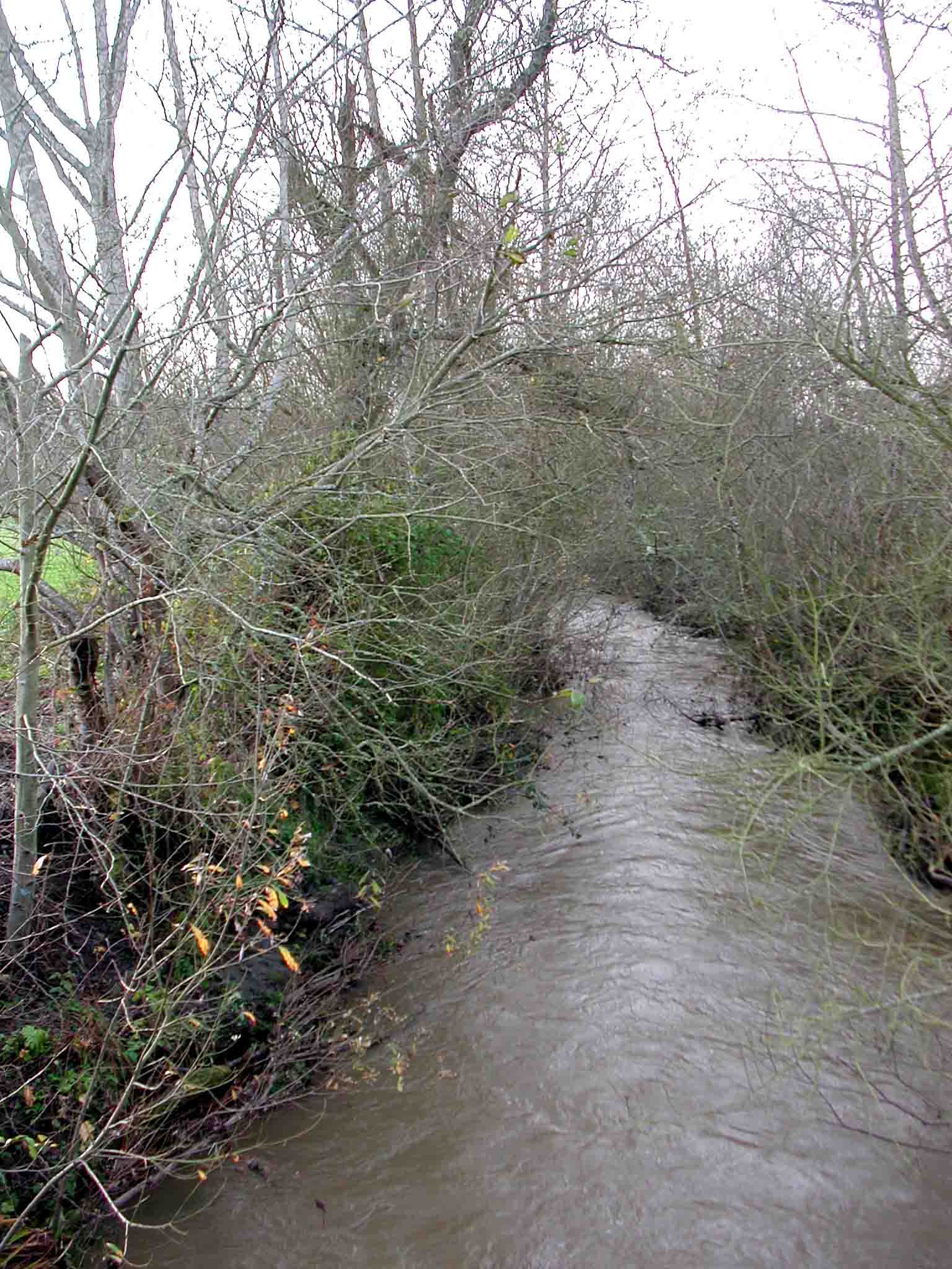
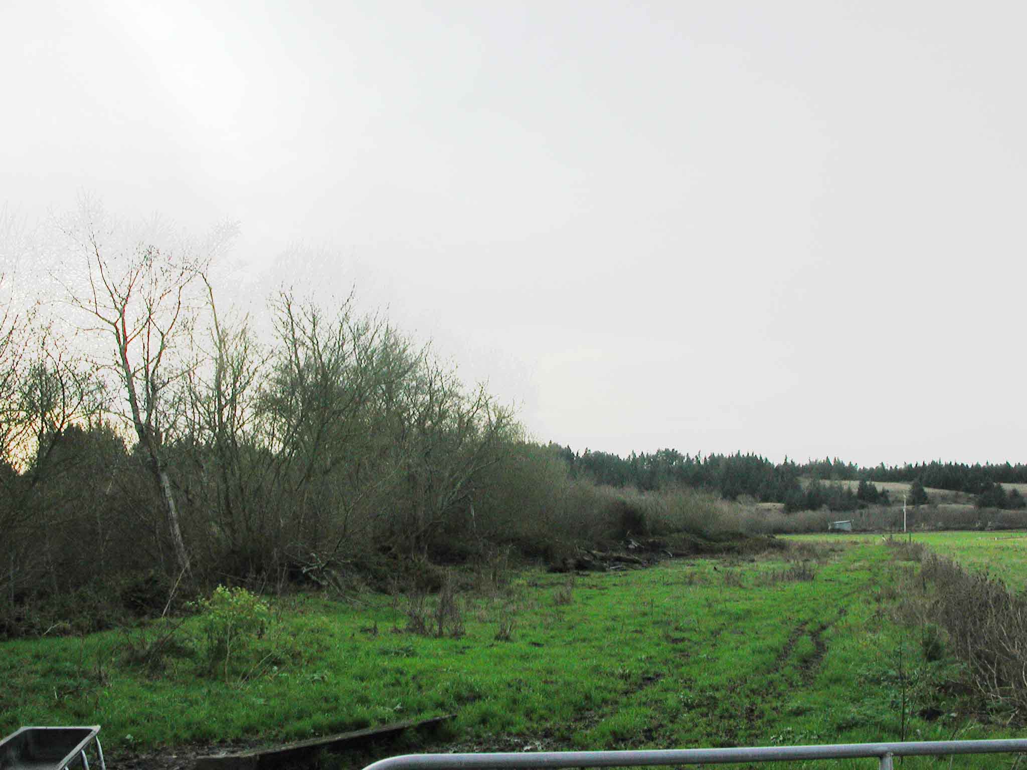
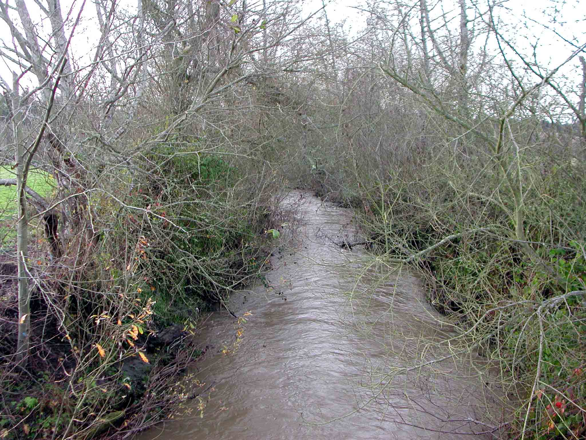
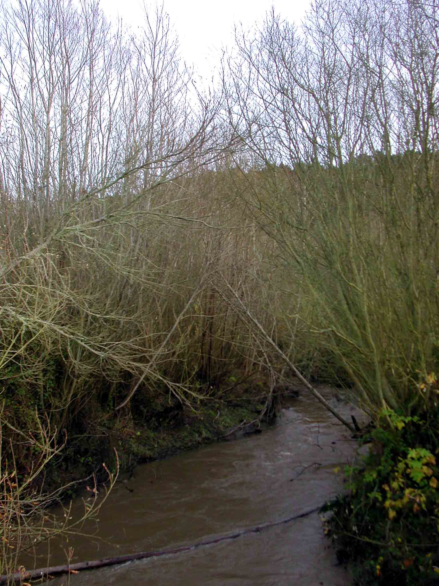
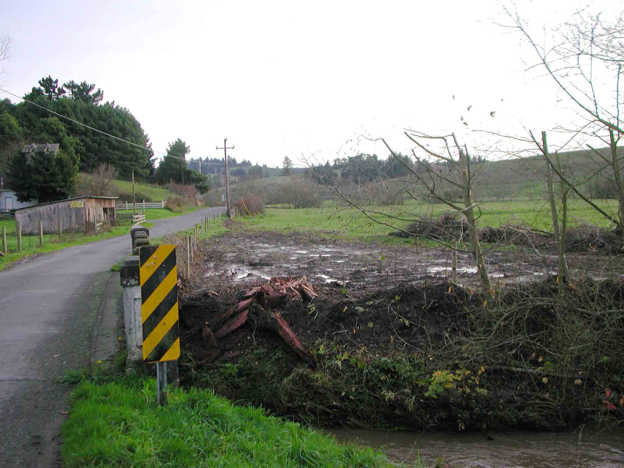
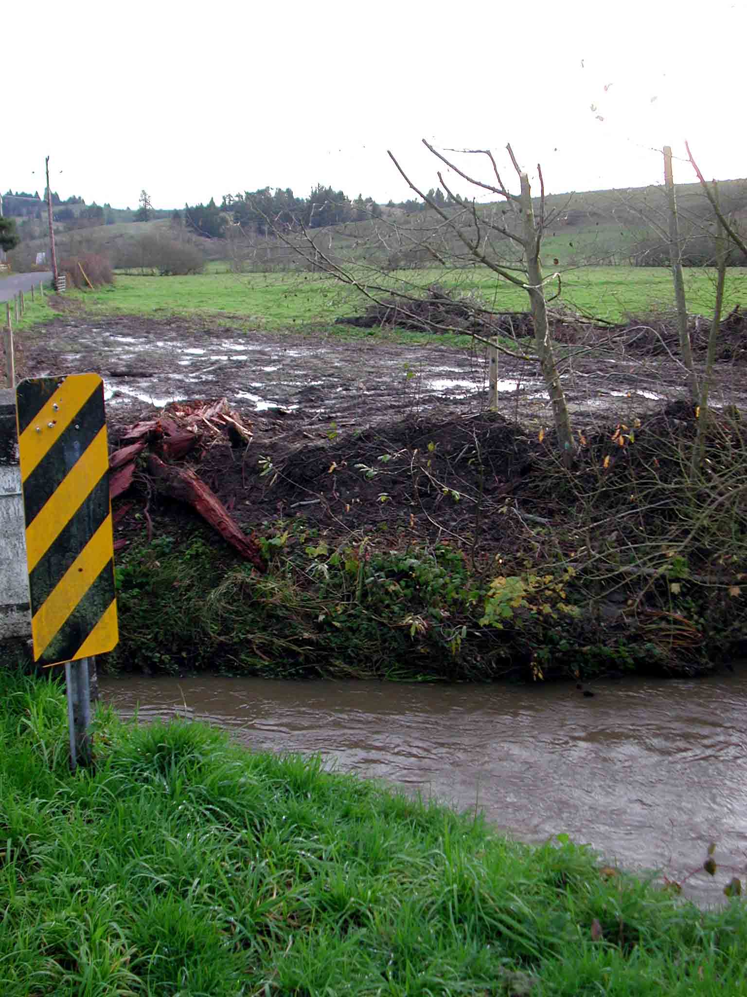
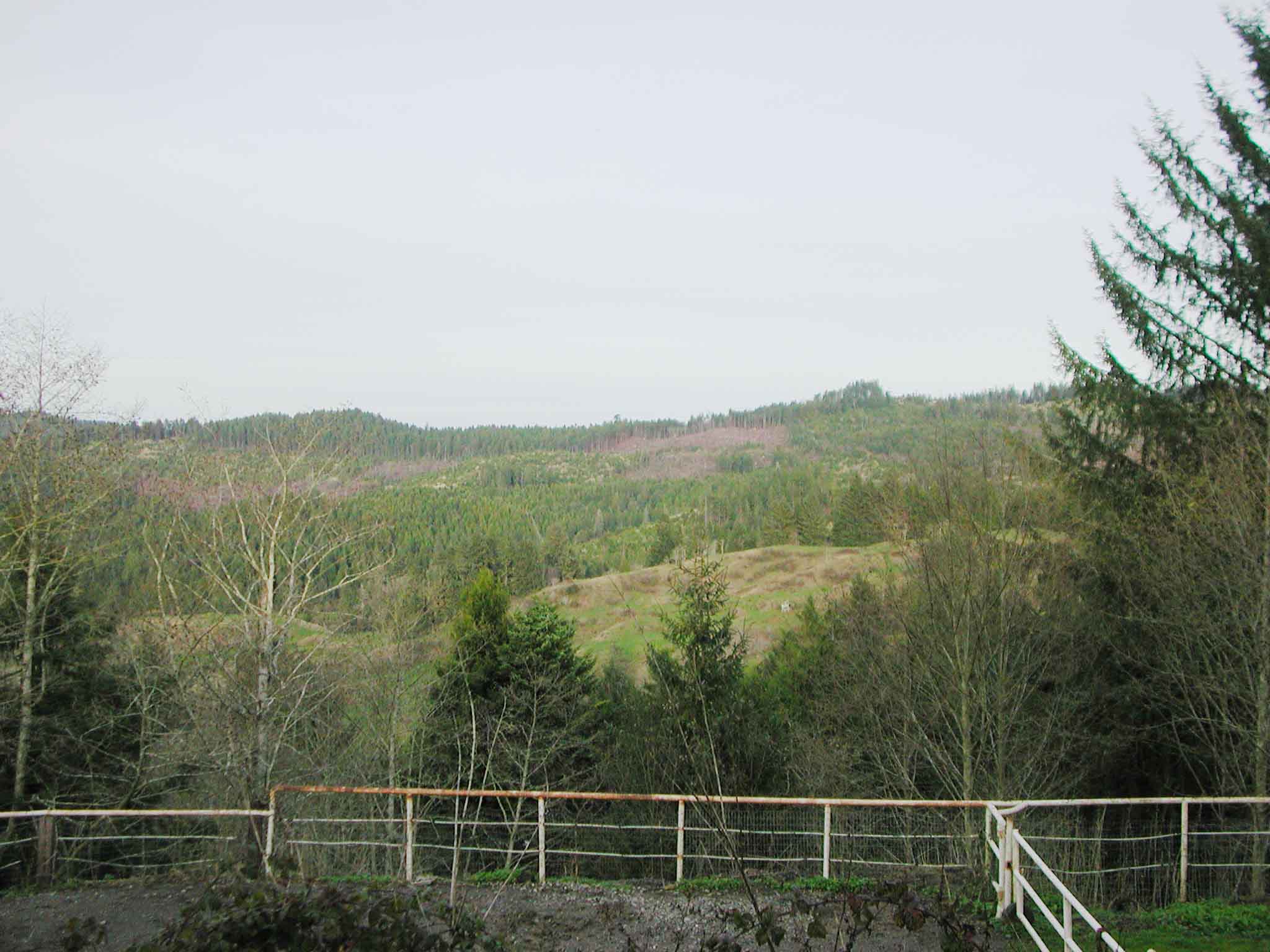
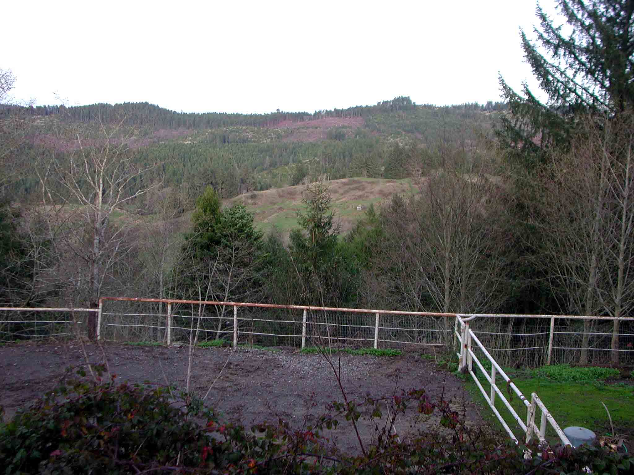
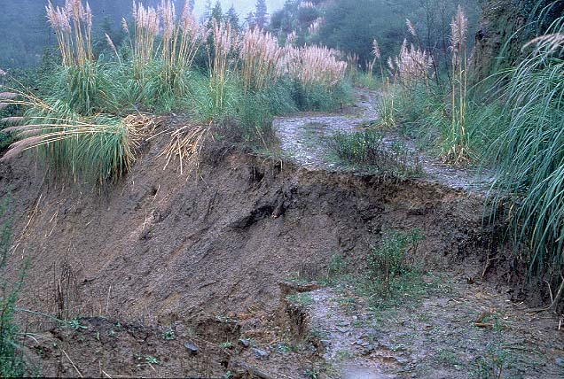
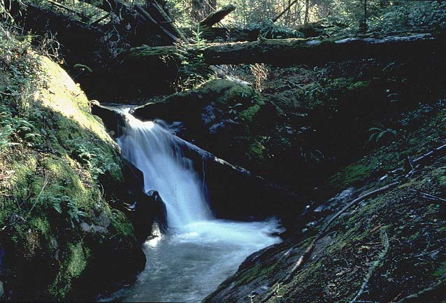