| Basin |
Sheepscot |
| Caption |
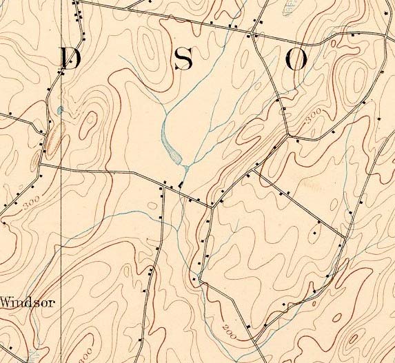
1893 topographic map of the Maxcys Mills area of the Sheepscot River. From the Vassalboro SE quads downloaded from http://docs.unh.edu/nhtopos/nhtopos.htm. |
| CaptionTemplate |
[Description] |
| Category |
Historical Topo Maps |
| Description |
1893 topographic map of the Maxcys Mills area of the Sheepscot River. From the Vassalboro SE quads downloaded from http://docs.unh.edu/nhtopos/nhtopos.htm. |
| Filename |
maxcys_mills_1893.jpg |
| Filesize |
99668 |
| Meta_Id |
UNH_topos |
| Notefile |
sheepscot.htm#UNH_topos |
| Path |
ws/maxcys_mills_1893.jpg |
| Series |
Historical Topo Maps- Maxcys Mills Area |
| SubBasin |
West Branch Sheepscot |
| Basin |
Sheepscot |
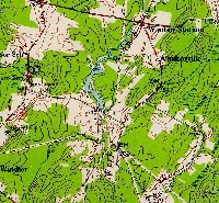
| Caption |
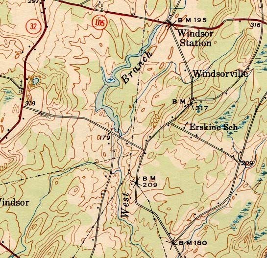
1943 topographic map of the Maxcys Mills area of the Sheepscot River. From the Vassalboro SE quads downloaded from http://docs.unh.edu/nhtopos/nhtopos.htm. |
| CaptionTemplate |
[Description] |
| Category |
Historical Topo Maps |
| Description |
1943 topographic map of the Maxcys Mills area of the Sheepscot River. From the Vassalboro SE quads downloaded from http://docs.unh.edu/nhtopos/nhtopos.htm. |
| Filename |
maxcys_mills_1943.jpg |
| Filesize |
132189 |
| Meta_Id |
UNH_topos |
| Notefile |
sheepscot.htm#UNH_topos |
| Path |
ws/maxcys_mills_1943.jpg |
| Series |
Historical Topo Maps- Maxcys Mills Area |
| SubBasin |
West Branch Sheepscot |
| Basin |
Sheepscot |
| Caption |
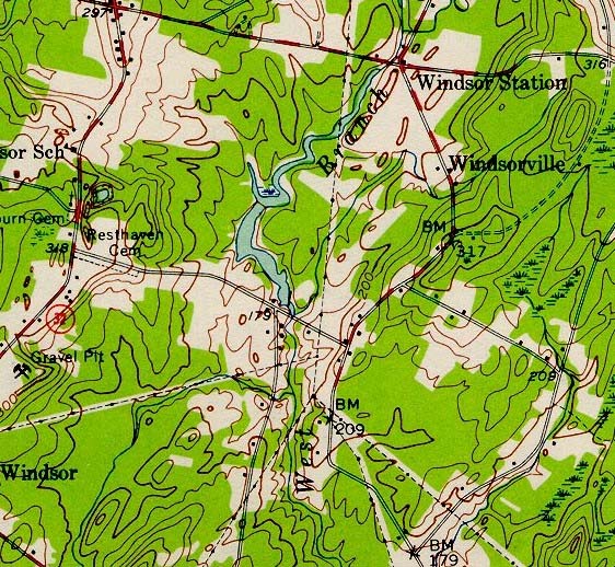
1956 topographic map of the Maxcys Mills area of the Sheepscot River. From the Vassalboro SE quads downloaded from http://docs.unh.edu/nhtopos/nhtopos.htm. |
| CaptionTemplate |
[Description] |
| Category |
Historical Topo Maps |
| Description |
1956 topographic map of the Maxcys Mills area of the Sheepscot River. From the Vassalboro SE quads downloaded from http://docs.unh.edu/nhtopos/nhtopos.htm. |
| Filename |
maxcys_mills_1956.jpg |
| Filesize |
158023 |
| Meta_Id |
UNH_topos |
| Notefile |
sheepscot.htm#UNH_topos |
| Path |
ws/maxcys_mills_1956.jpg |
| Series |
Historical Topo Maps- Maxcys Mills Area |
| SubBasin |
West Branch Sheepscot |