Photo Pages. Photos on this page are from sub-basin Mainstem Sheepscot
and series Historical Topo Maps- Whitefield Area.
Click on any thumbnail to see a larger photo.
For detailed information on these photos click here.
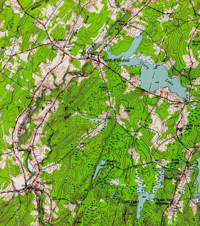
367 KB
1957 topographic map of the Whitefield area of the Sheepscot River. From the Wiscasset NE 1957 quad downloaded from http://docs.unh.edu/nhtopos/nhtopos.htm.
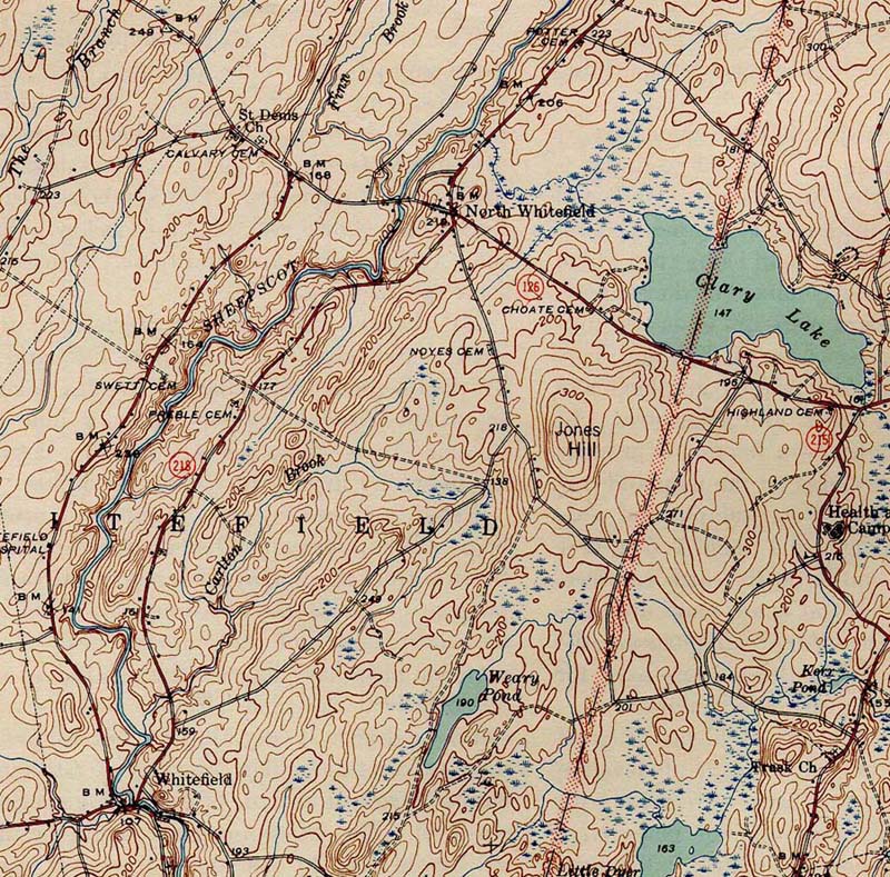
289 KB
1944 topographic map of the Whitefield area of the Sheepscot River. From the Wiscasset NE 1944 quad downloaded from http://docs.unh.edu/nhtopos/nhtopos.htm.
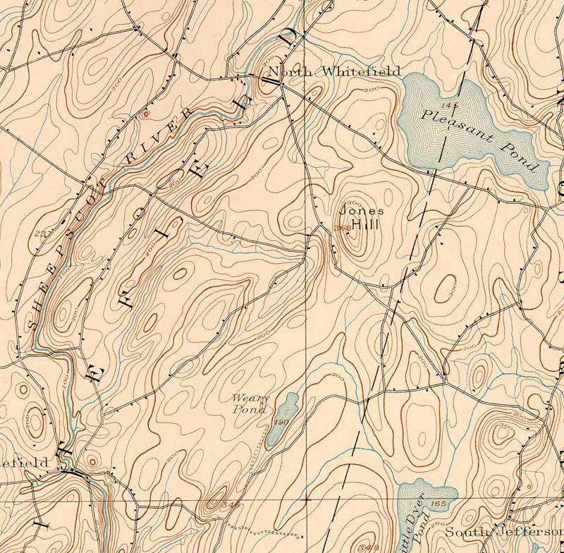
222 KB
1893 topographic map of the Whitefield area of the Sheepscot River. From the Wiscasset NE 1893 quad downloaded from http://docs.unh.edu/nhtopos/nhtopos.htm.
 289 KB
 222 KB