| Area |
West Branch Sheepscot |
| Topic |
Temperature: Floating Weekly Max - WB Sheepscot RKm 23.04, 2001-2003 |
To view a more detailed version of this map click
here
|
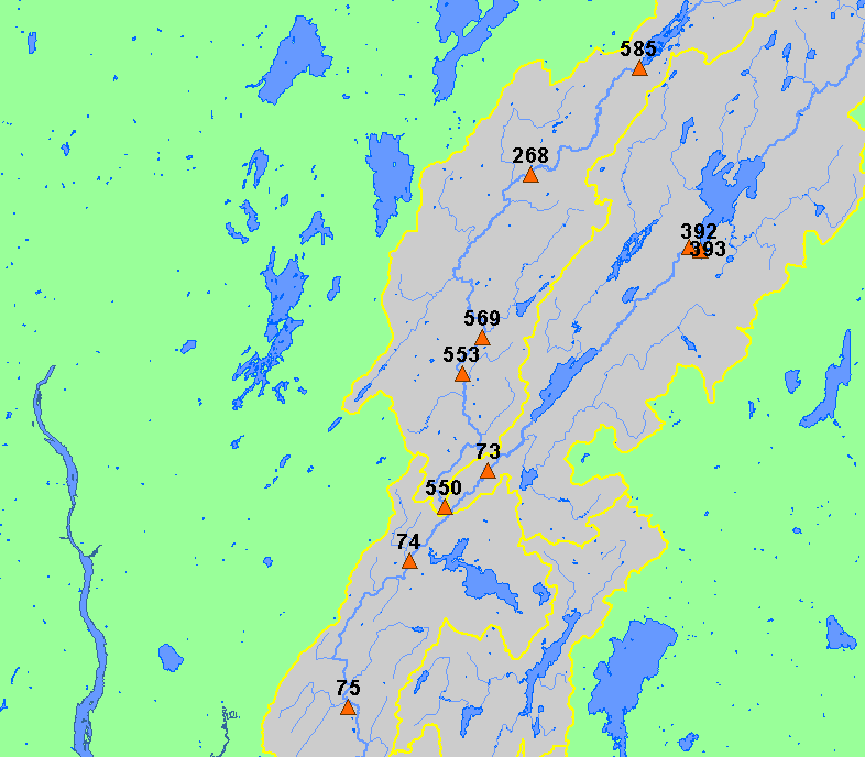
This map shows the location of Maine Department of Environmental Protection (biomonitoring program) stations in the Sheepscot River watershed
sub-basin, displayed along with 1:100,000 streams and lakes.
|
|
|
 |
 |
To view metadata about a map layer, click on a link in the table below.
If you obtain KRIS on a CD and install it on your hard drive as a desktop program, you will have access to increased map capabilities such as zooming in/out, turning layers on/off, adding layers and changing legends.