|
Area/Topic | Bibliography | Background | Hypotheses | Home |
Photo Pages: Meta Information
This page contains detailed information from the KRIS Photodatabase table about photos from sub-basin Novato and Miller Creeks and series Monitoring: Maps of Erosion Inventory Novato Creek 2001. For a list of photo pages sorted by series, click here. For a list of photo pages sorted by sub-basin, click here.
| Agency | Prunuske Chatham Inc. and Marin County Flood Control and Water Conservation District |
| Basin | East Marin-Sonoma |
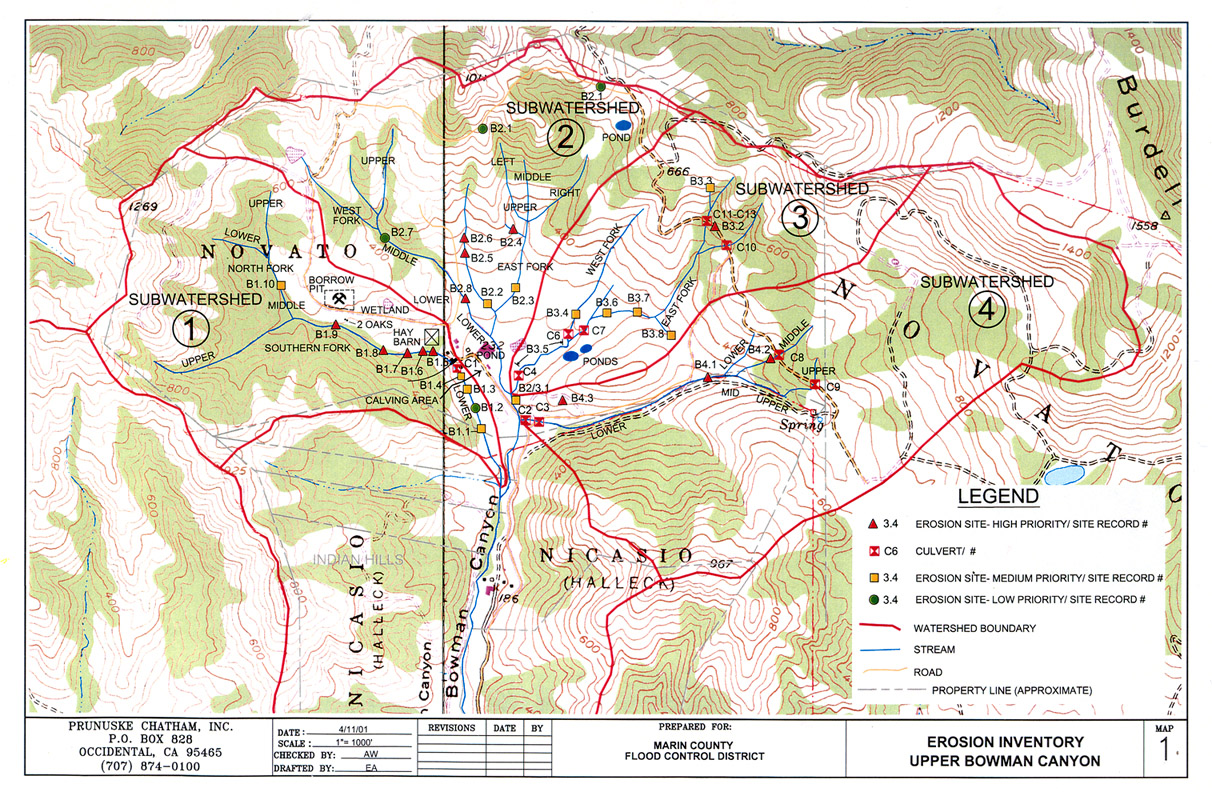
| Caption | This map show the results of an erosion inventory conducted in Upper Bowman Canyon, in the Novato Creek watershed, during 2001. Image provided courtesy of Prunuske Chatham Inc. and the Marin County Department of Public Works (PCI 2001). |
| CaptionTemplate | [Description] |
| Category | Monitoring |
| Description | This map show the results of an erosion inventory conducted in Upper Bowman Canyon, in the Novato Creek watershed, during 2001. Image provided courtesy of Prunuske Chatham Inc. and the Marin County Department of Public Works (PCI 2001). |
| Filename | pci_novato_erosionmap1.jpg |
| Filesize | 604635 |
| Meta_Id | PCI_photosmaps |
| Notefile | emarins.htm#photos |
| Path | topics/nm/pci_novato_erosionmap1.jpg |
| Photo Number | 1 |
| Restriction | None |
| Series | Monitoring: Maps of Erosion Inventory Novato Creek 2001 |
| SubBasin | Novato and Miller Creeks |
| UpdateDate | 8/26/2006 |
| UpdateName | JEA |
| Agency | Prunuske Chatham Inc. and Marin County Flood Control and Water Conservation District |
| Basin | East Marin-Sonoma |
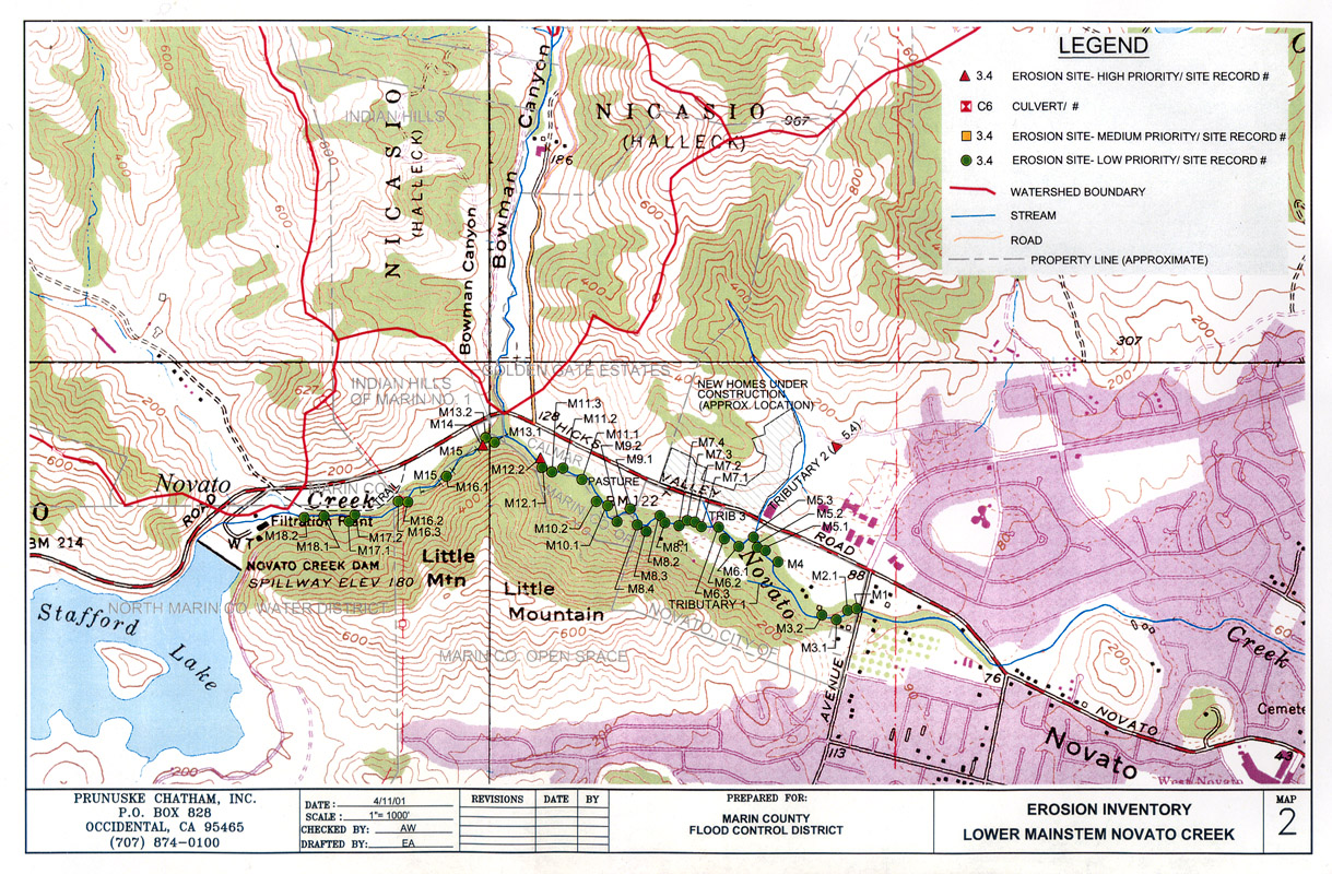
| Caption | This map show the results of an erosion inventory conducted along lower mainstem Novato Creek during 2001. Image provided courtesy of Prunuske Chatham Inc. and the Marin County Department of Public Works (PCI 2001). |
| CaptionTemplate | [Description] |
| Category | Monitoring |
| Description | This map show the results of an erosion inventory conducted along lower mainstem Novato Creek during 2001. Image provided courtesy of Prunuske Chatham Inc. and the Marin County Department of Public Works (PCI 2001). |
| Filename | pci_novato_erosionmap2.jpg |
| Filesize | 605108 |
| Meta_Id | PCI_photosmaps |
| Notefile | emarins.htm#photos |
| Path | topics/nm/pci_novato_erosionmap2.jpg |
| Photo Number | 2 |
| Restriction | None |
| Series | Monitoring: Maps of Erosion Inventory Novato Creek 2001 |
| SubBasin | Novato and Miller Creeks |
| UpdateDate | 8/26/2006 |
| UpdateName | JEA |
| www.krisweb.com |