|
Area/Topic | Bibliography | Background | Hypotheses | Home |
KRIS West Marin-Sonoma: Map Page
| Area | Americano Creek |
| Topic | Map: 1E. USFS Riparian Veg Size, Americano Creek Sub-basin 1994 |
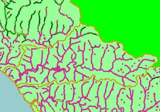
| This is a map of 1994 USFS Landsat vegetation size data within 90-meter riparian buffer zones in the Americano Creek sub-basin. There are few areas of mature riparian forest that show on this map, but the data are averaged into polygons at least one-hectare in size, so some individual trees or small patches may not be displayed. The vegetation classification is accurate at a one-hectare scale (approximately 11 pixels) and is suitable for stand classification. Data provided by the U.S. Forest Service Spatial Analysis Lab in Sacramento, CA. Scale = 1:134,317 . | |||
![]() |
![]() |
||
To view metadata about a map layer, click on a link in the table below.
| Name of Layer in Map Legend | Metadata File Name |
|---|---|
| Subbasins (no labels) | subbasins.shp.txt |
| Frame Project Outline | Unavailable |
| Lakes and Reservoirs (Marin only) | Unavailable |
| USFS Riparian Veg Size (1994) | vegsizebuf.tif.txt |
| USFS Vegetation Size (1994) | vegsize.tif.txt |
| Topo Map, North (1:24k scale) | Unavailable |
| Topo Map, South (1:24k scale) | Unavailable |
| Project Background | Unavailable |
| www.krisweb.com |