
| Area | Regional |
| Topic | Temperature: All West Marin-Sonoma Sites, MWAT by Year 1995-2002 |
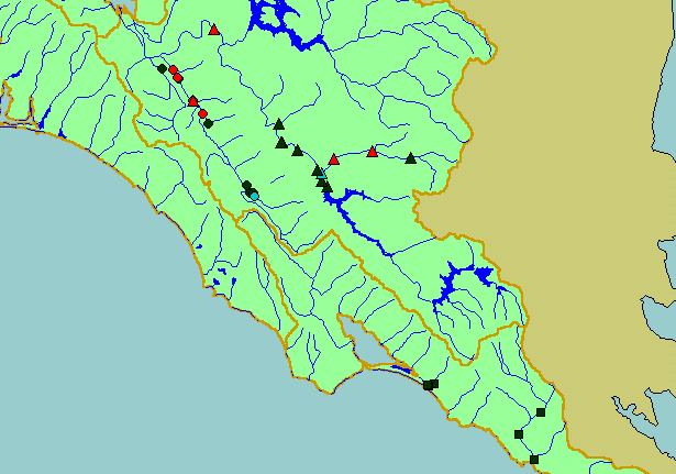
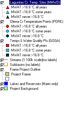
| This is a map of temperature monitoring sites in the KRIS West Marin-Sonoma Project Area, displayed on top of 1:100,000 USGS hydrography and KRIS sub-basins. This map shows temperature data provided by Point Reyes National Seashore (PORE), Golden Gate National Recreation Area (GOGA), and Marin Municipal Water District (MMWD). | |||
 |
 |
||
To view metadata about a map layer, click on a link in the table below.
| Name of Layer in Map Legend | Metadata File Name |
|---|---|
| Lagunitas Cr: Temp. Sites (MMWD) | mmwd_temps.shp.txt |
| Olema Cr:Temperature Points (PORE) | temploggers.shp.txt |
| Temps & Water Quality Pts (GOGA) | goga_wq_temps.shp.txt |
| Streams (1:100k scale)(no labels) | streams100.shp.txt |
| Subbasins (no labels) | subbasins.shp.txt |
| Frame Project Outline | Unavailable |
| Lakes and Reservoirs (Marin only) | Unavailable |
| Topo Map, North (1:24k scale) | Unavailable |
| Topo Map, South (1:24k scale) | Unavailable |
| Elevation (10 m resolution) | elev10.tif.txt |
| Project Background | Unavailable |
| www.krisweb.com |