
| Area | Lagunitas Creek |
| Topic | Map: 2C. Temperature Monitoring in Lagunitas Creek by MMWD |
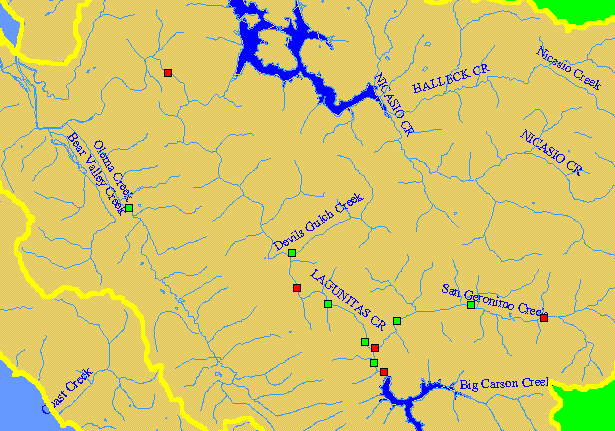
| This is a map of Marin Municipal Water District water temperature and water quality monitoring stations on Lagunitas Creek and its tributaries, displayed on top of 1:24,000 scale USGS hydrography and KRIS sub-basins. Stations shown in red are hotlinked to temperature charts. To view a chart, click on a red point. Scale = 1:110,275 . | |||
 |
 |
||
To view metadata about a map layer, click on a link in the table below.
| Name of Layer in Map Legend | Metadata File Name |
|---|---|
| MMWD Temperature Sites | mmwd_temps.shp.txt |
| KRIS subbasins | subbasins.shp.txt |
| Streams (1:24,000 scale) | streams24.shp.txt |
| Streams (100k scale)(w/ labels) | streams100.shp.txt |
| Project Frame | Unavailable |
| Lakes and Reservoirs | Unavailable |
| Topo Map, South (1:24k scale) | Unavailable |
| Project Background | Unavailable |
| www.krisweb.com |