
| Area | Stemple Creek |
| Topic | Climate: Stemple Creek Annual Rainfall 1953-2000 |
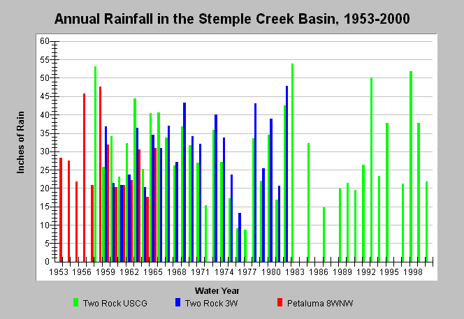
| Caption: This chart shows annual rainfall totals recorded at California Department of Water Resources gauging stations within the Stemple Creek watershed between 1953 and 2000. The stations are in the Upper Stemple Calwater and are as follows: Two Rock USCG (DWR # F90 9117 02), Two Rock 3W (DWR # E10 9117 02), and Petaluma 8WNW (DWR # F90 6826 05). Blank years indicate no data. See Map for gauge locations and Info Links for more information. | |
 |
To learn more about this topic click Info Links .
To view additional information (data source, aquisition date etc.) about this page, click Metadata .
To view the table with the chart's data, click Chart Table web page.
To download the table with the chart's data, click rain_annual_esterodesanantonio.dbf (size 2,082 bytes) .
| www.krisweb.com |