| Area | Stemple Creek |
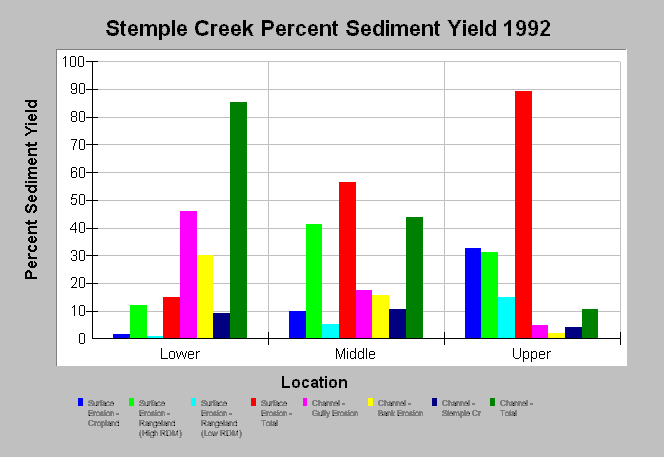
| Topic | Sediment: Stemple Cr Percent Sediment Yield Surface/Channel 1992 |
| Caption: This chart shows percent sediment yield from surface and channel erosion sources in the Stemple Creek basin. Channel erosion is dominant in Lower Stemple Creek while sheet and rill erosion are dominant in Middle and Upper Stemple Creek. These data were derived in 1992 by the U.S. Department of Agriculture - Soil Conservation Service for the Marin Resource Conservation District. | |
 |
To learn more about this topic click Info Links .
To view additional information (data source, aquisition date etc.) about this page, click Metadata .
To view the table with the chart's data, click Chart Table web page.
To download the table with the chart's data, click sediment_stemple_pct_surfchannel.dbf (size 634 bytes) .
To view the table with the chart's source data, click Source Table web page.
To download the table with the chart's source data, click sediment_stemple_tons_scs.dbf (size 828 bytes)
| www.krisweb.com |
