
| Area | S Marin/Redwood Creek |
| Topic | Flow: Morses Gulch 1967-1969 |
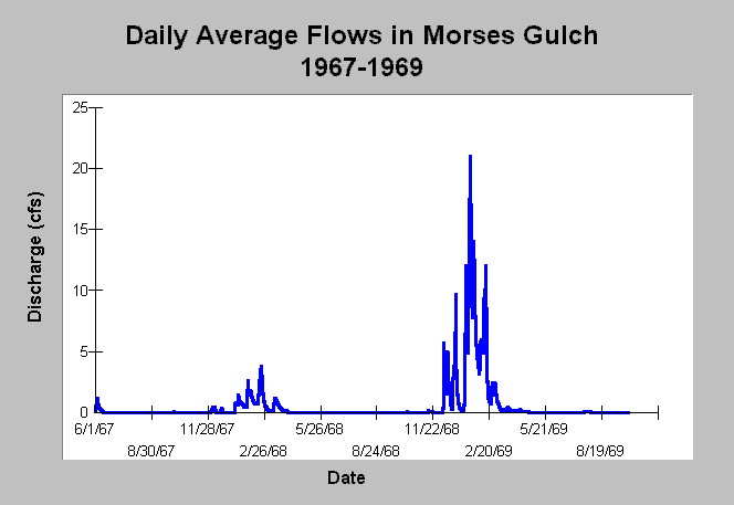
| Caption: This chart displays average daily flows in cubic feet per second by water year for Morses Gulch near Bolinas at the U.S. Geological Survey (USGS) gauge beginning with water year 1967 and extending to 1969. These were the only years of record available for this site. The water year runs from October 1 to September 30. See Info Links for more information. | |
 |
To learn more about this topic click Info Links .
To view additional information (data source, aquisition date etc.) about this page, click Metadata .
To view the table with the chart's data, click Chart Table web page.
To download the table with the chart's data, click flow_morses_usgs_1967_1969.dbf (size 17,158 bytes) .
| www.krisweb.com |