| Area |
Salmon Creek |
| Topic |
Tour: Lower Finley Creek Easement Photo Points 2001 |
 Click on image to enlarge (83K). Click here to display a larger version (575K).
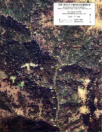
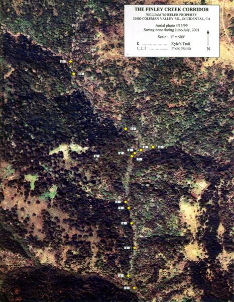
This aerial shows photo points for the Finley Creek riparian corridor easement held by the Bodega Land Trust. The photo was taken on April 13, 1999 and provided courtesy of the Bodega Land Trust.
 Click on image to enlarge (45K). Click here to display a larger version (189K).
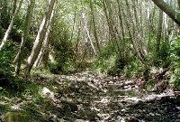
This photo was taken about 20 yards north of Kyle's Trail from the middle of Finley Creek looking upstream at Photo Point #11 in the previous aerial. The stream has a cobble and gravel bed suitable for spawning steelhead. The alder canopy is all of even age suggesting disturbance that caused a channel reset some time in the past (not >30 years?). Alders today provide excellent shade and nutrients but lack longevity as woody debris once contributed to the stream. Photo taken during summer 2001 and provided courtesy of the Bodega Land Trust.
 Click on image to enlarge (39K). Click here to display a larger version (169K).
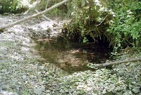
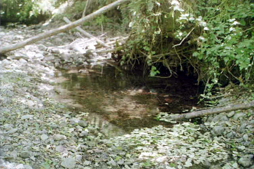
This picture was taken at Photo Point #8 in the previous aerial and shows an isolated pool in Finley Creek, scoured out from under a stump just north of Kyle's Trail, which serves as an excellent nursery area for steelhead fingerlings. Isolated pools are often fed by cool water from under the gravel bar, the streams hyporheic zone. From here north the number of ponds with fingerlings increases. This water has good clarity. Photo taken during summer 2001 and provided courtesy of the Bodega Land Trust.
 Click on image to enlarge (104K).
This photo was taken at Photo Point #6 in the previous aerial, approximately 50 yards upstream of the lower easement boundary on Finley Creek. Upstream the creek becomes very narrow and incised. This photo was taken from the south side of a large draw joining the creek from the west. Photo taken during summer 2001 and provided courtesy of the Bodega Land Trust.
 Click on image to enlarge (40K). Click here to display a larger version (180K).
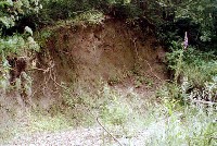
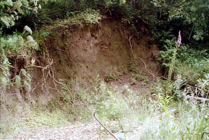
This picture was taken at Photo Point #3 in the previous aerial and shows stream bank erosion about 200 yards north of the southern corridor boundary. The picture was taken from the middle of the Finley Creek looking upstream. Photo taken during summer 2001 and provided courtesy of the Bodega Land Trust.
 Click on image to enlarge (38K). Click here to display a larger version (161K).
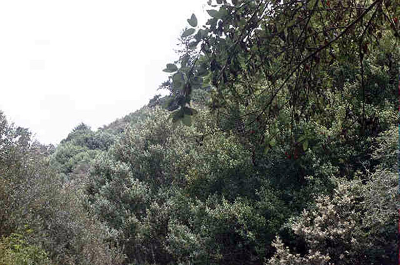
This photograph shows hardwoods and chaparral in uplands above Finley Creek at Photo Point #2 in the previous aerial. Photo taken during summer 2001 and provided courtesy of the Bodega Land Trust.
 Click on image to enlarge (109K).
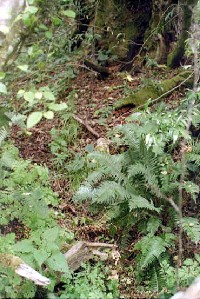
This picture was taken at Photo Point #1 in the previous aerial and shows the southern boundary marker of the Lower Finley Creek easement represented by the remnants of the old fence post at lower left in the photo. Old woven sheep fence is hidden by leaves but runs to the old fire-damaged bay at top, right. Lush understory in the riparian here is comprised of ferns, grasses, mosses and shrubs. This photo was taken from the terrace (possibly a fragment of old logging road) above the actual property corner in the middle of the Finley Creek. Photo taken during summer 2001 and provided courtesy of the Bodega Land Trust.
To learn more about this topic click Info Links
To view additional information (data source, aquisition date etc.) about this page, click Metadata

 Click on image to enlarge (83K). Click here to display a larger version (575K).
 Click on image to enlarge (45K). Click here to display a larger version (189K).
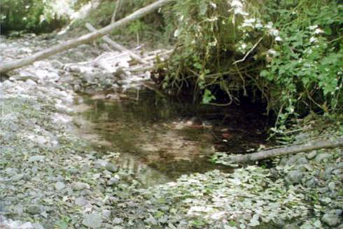 Click on image to enlarge (39K). Click here to display a larger version (169K).
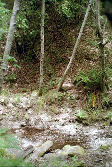 Click on image to enlarge (104K).
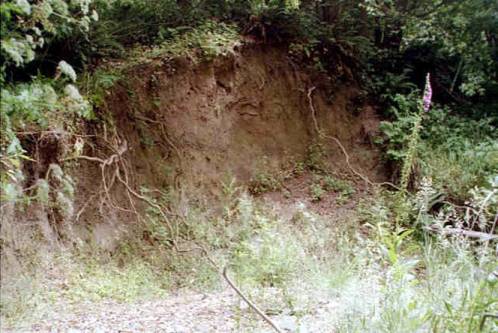 Click on image to enlarge (40K). Click here to display a larger version (180K).
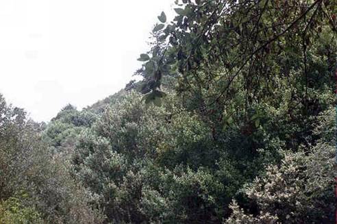 Click on image to enlarge (38K). Click here to display a larger version (161K).
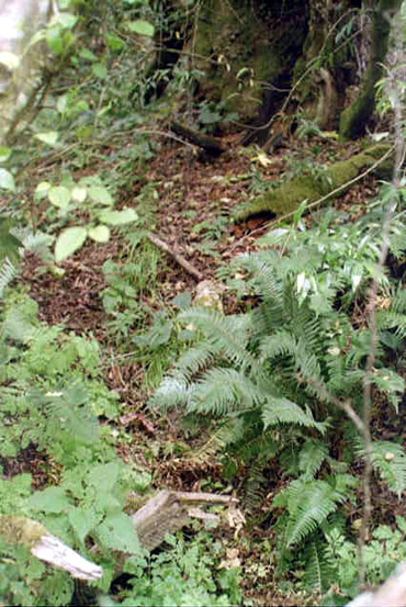 Click on image to enlarge (109K).