| Area |
Hare Creek |
| Topic |
USFS VegTypes: Hare Cr CalWater 1994 |
 Click on image to enlarge (115K). Click here to display a larger version (428K).
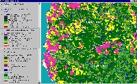
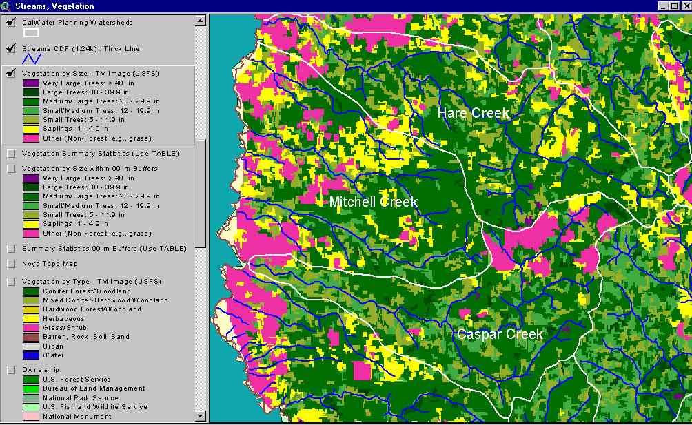
The image above shows USFS vegetation stand types for the Hare Creek Calwater planning watershed based on a 1994 Landsat image. The stand types are only accurate at the one-hectare scale. Large patches of Non-Forest and Saplings (<5" diameter trees) occur in the west of the watershed due to urbanization. Patches of similar vegetation in interior basin areas are likely the result of recent clear cuts. Medium-Large Trees (20-29.9") occur in large patches throughout the watershed. Patches of young forest show as Small and Small/Medium trees. See Info Links for more information. Taken from the KRIS Big River Map project.
 Click on image to enlarge (134K).
The image above comes from the KRIS Big River Map project and shows changes in vegetation between 1994 and 1998 according to CDF FRAP change scene detection. Patches clear cut in the late 1980s and early 1990s in the North Fork Caspar Creek showed increases in canopy cover while upper Hare Creek showed a decrease in canopy. Smaller patches in the Mitchell Creek CalWater and in the west of Hare Creek are likely related to increasing development and urbanization.
 Click on image to enlarge (195K).
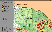
The timber harvest map from CDF taken from the KRIS Big River Map project shows timber harvests in upper Hare Creek which are responsible for early seral conditions in the 1994 Landsat and change scene results from 1994 to 1998.
To learn more about this topic click here

 Click on image to enlarge (115K). Click here to display a larger version (428K).
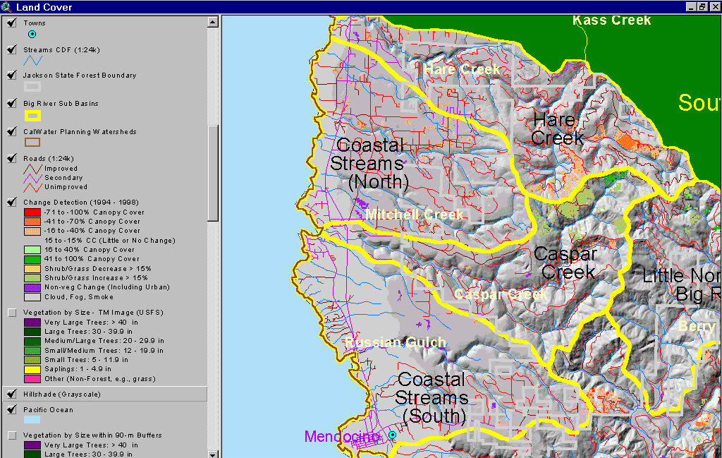 Click on image to enlarge (134K).
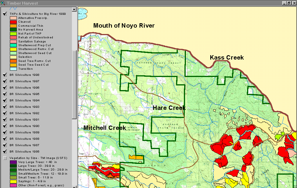 Click on image to enlarge (195K).
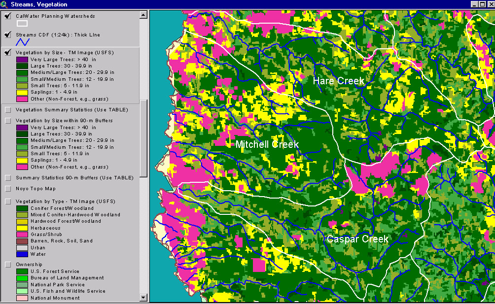