
| Area | Middle Garcia |
| Topic | Sediment: Road Densities by Calwater Planning Watershed, Mid-Garcia |
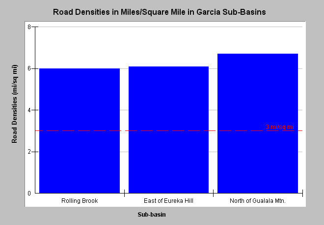
| Caption: This chart displays road densities for the Middle Garcia sub-basin by Calwater Planning Watershed as reported by the California Department of Forestry. CDF has updated electronic maps associated with timber harvests in the Garcia River basin and adjacent coastal sub-basins. Properly functioning condition for a watershed according to the National Marine Fisheries Service (1996) is less than 3 miles per square mile (mi/sq mi), a value shown for reference. Road densities in all Middle Garcia sub-basins are twice that value, and only main haul roads are mapped. Click on InfoLinks for more background information. | |
 |
To learn more about this topic click Info Links .
To view additional information (data source, aquisition date etc.) about this page, click Metadata .
To view the table with the chart's data, click Chart Table web page.
To download the table with the chart's data, click road_dens_cdf_mg.dbf (size 1,080 bytes) .
| www.krisweb.com |