|
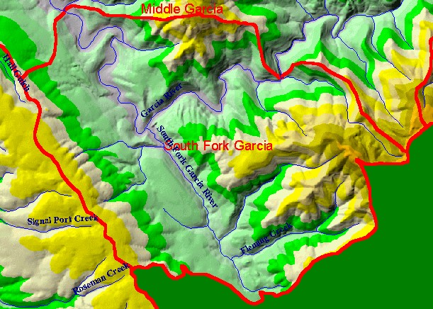
This is a map of the 1:24,000 scale USGS hydrography in the South Fork Garcia sub-basin, overlaid on top of an elevation hillshade
and KRIS sub-basins. The San Andreas Fault runs underneath and parallel to the South Fork of the Garcia River. There are
various conventions for naming the streams in the upper portion of the South Fork. The labels shown here correspond to the U.S.
Geologic Survey (USGS) topographic map. Mendocino Redwoods Company refers to the tributary north of (and parallel to)
Flemming Creek as Little South Fork Garcia River, while the USGS map names it South Fork Garcia River. Data were contributed
by the California Department of Forestry. Scale = 1:47,216 .
|
|