
|
Area/Topic | Bibliography | Background | Hypotheses | Home |
|
Map Page.
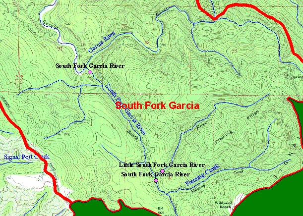
You selected the area South Fork Garcia and the topic Sediment: SF Garcia ab Little SF - Gravel Permeability, MRC 2000 |
| This is a map of Mendocino Redwoods Company (MRC) channel and sediment monitoring stations for the years 1998-2001 in the South Fork Garcia sub-basin, overlaid with KRIS sub-basins and 1:24,000 scale streams. | |||
|
|
||
To view metadata about a map layer, click on a link in the table below.
| Name of Layer in Map Legend | Metadata File Name |
|---|---|
| Project Frame | Unavailable |
| Channel Sites (MRC)(1998-2001) | channelsites.shp.txt |
| Sub-basins (w/ labels) | subbasins.shp.txt |
| Streams (1:24k scale)(w/ labels) | streams24.shp.txt |
| Topo Map (1:24k scale)(USGS) | Unavailable |
| Grayscale Hillshade ((TIFF) | grayscale_light.tif.txt |
| Project Background | Unavailable |
| www.krisweb.com |