 |
 |
| Background | Hypotheses | Bibliography | Maps | Home |
|
|
| Background | Hypotheses | Bibliography | Maps | Home |
KRIS Web Background Pages: Road and Erosion
![]()
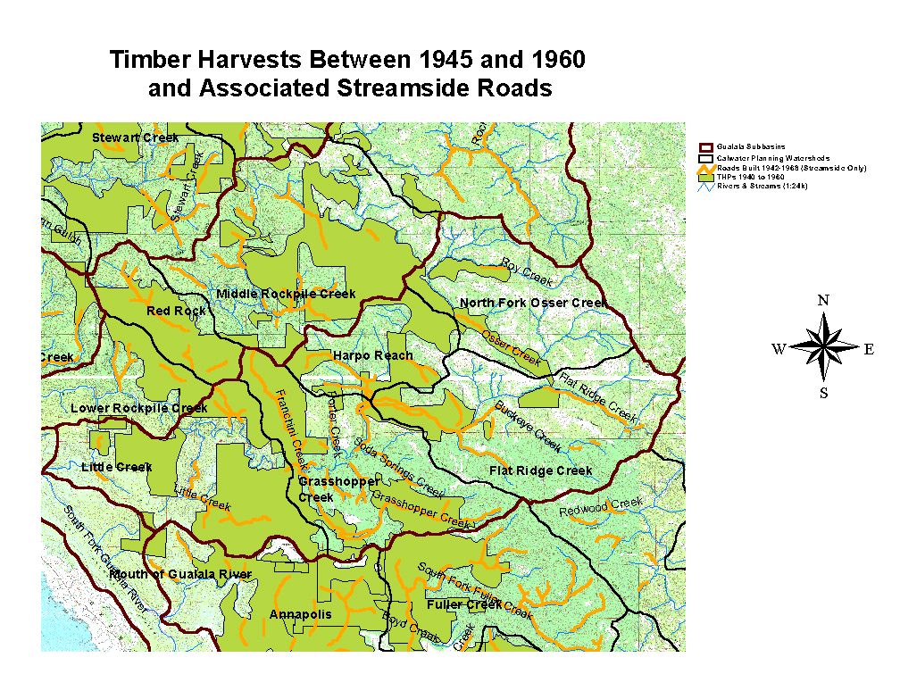
Road densities in KRIS Gualala were calculated from spatial data provided by the University of California ICE project which digitized roads from recent aerial photographs. Road density calculations include main haul roads, but not skid trails and spur roads, which also contribute to erosion. The road mapping project was funded by the North Coast Regional Water Quality Control Board (NCRWQCB), which has been engaged in a sediment source analysis of the Gualala River watershed pursuant to the Clean Water Act TMDL process (CRWQCB, 2001). That document found that roads are a the most significant erosion source in the Gualala River basin (see the KRIS Web Sediment Background page for more information). The data from the NCRWQCB study is used in KRIS Gualala as the best available estimate for understanding current sediment sources.
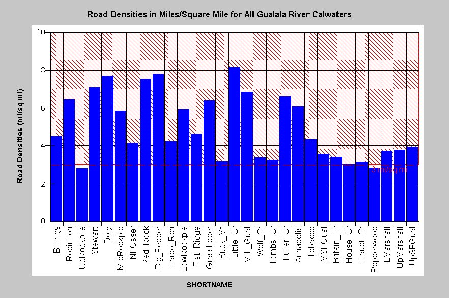
Road densities in the Gualala Basin average 4.8 miles per square mile. KRIS Gualala charts show roads per square mile by sub-basin compared to a threshold of 3 miles of road per square mile. The latter is taken from the National Marine Fisheries Service (1996) working guidelines for salmon conservation (see Table below). The guidelines characterize watersheds over this threshold as "not properly functioning". Valley bottom roads are a significant concern in the Gualala River because many logging haul roads are parallel and proximate to stream courses.
| Properly Functioning Condition | At Risk | Not Properly Functioning |
|
|
|
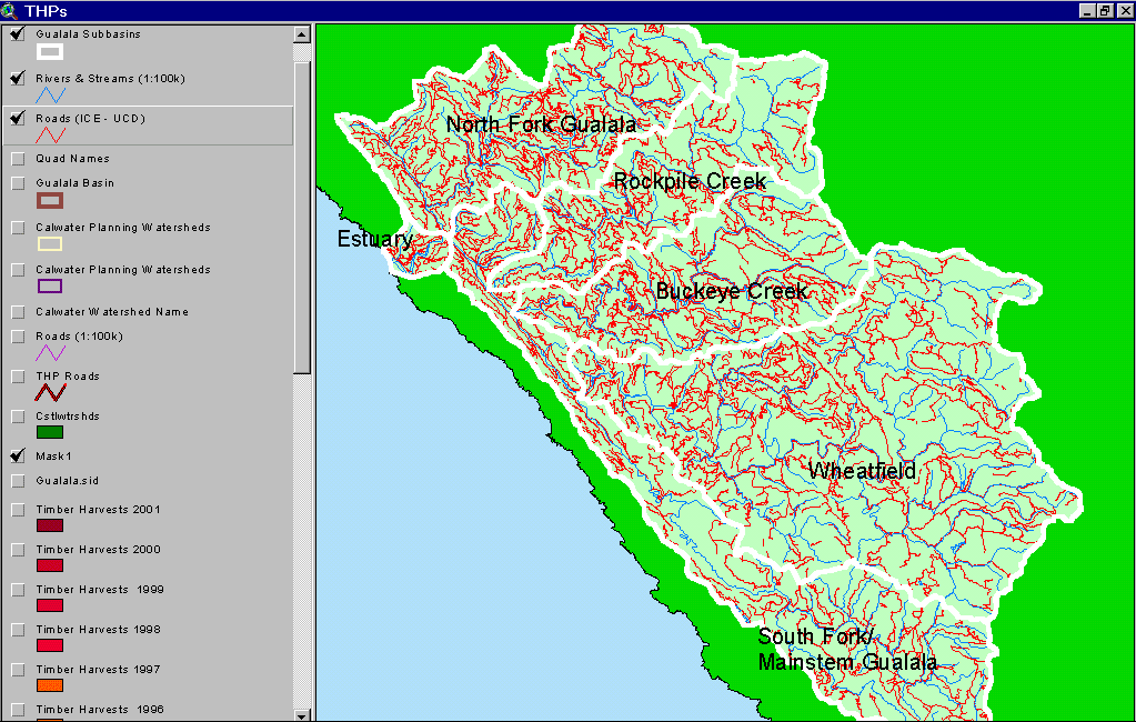
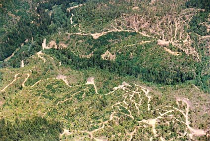
Recognition of road and erosion problems in the Gualala River basin has lead to a number of road improvement and erosion control projects in recent years. Two notable projects are the upgrading of Kelly Road and road erosion-proofing of the Fuller Creek basin. See Gualala Restoration Background pages to learn more about these efforts.
IFR staff used intersections of stream and road electronic map layers to generate stream crossing data. Road crossing failures are one of the major sources of erosion during storm events. Variability of the USGS 1:24000 hydrography maps make crossings look more numerous in areas with a higher mapped stream density. Pictures displayed below are courtesy of Brian McFadden, North Coast Regional Water Quality Control Board and Don Morse, California Department of Forestry (FRAP), North Coast Watershed Assessment Program.
|
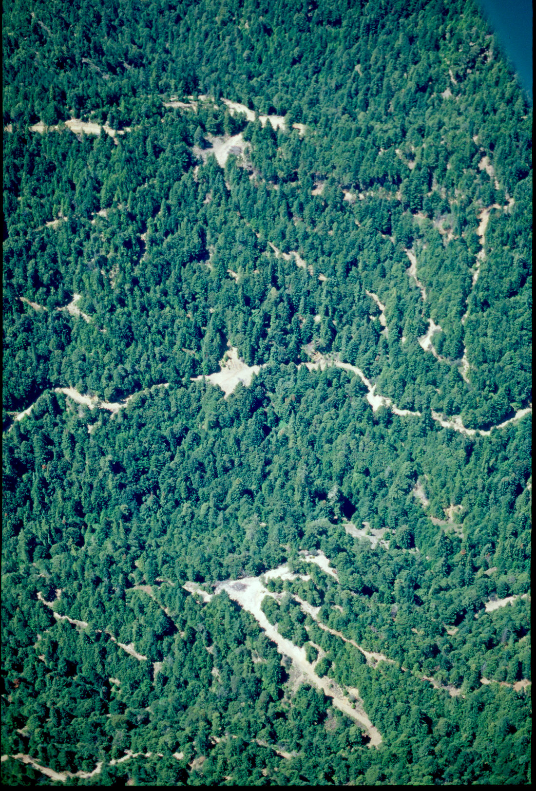
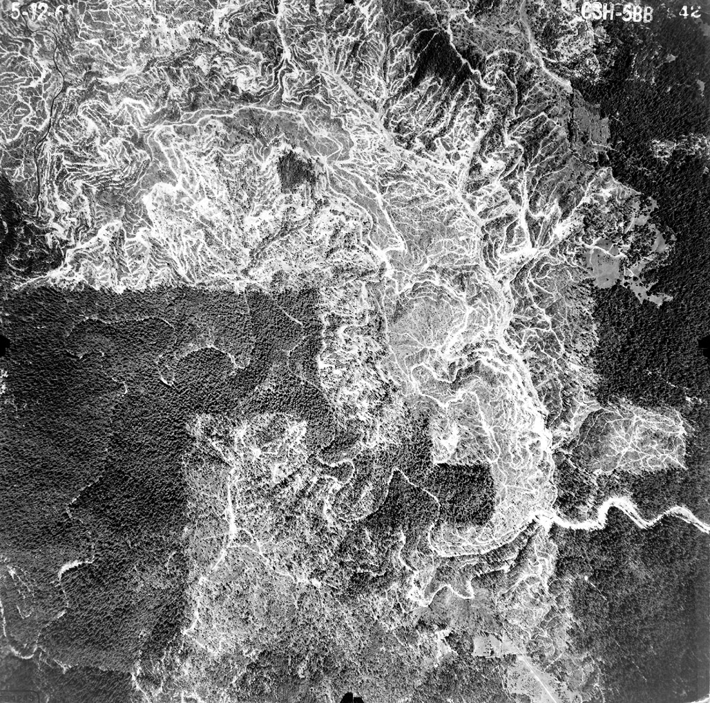
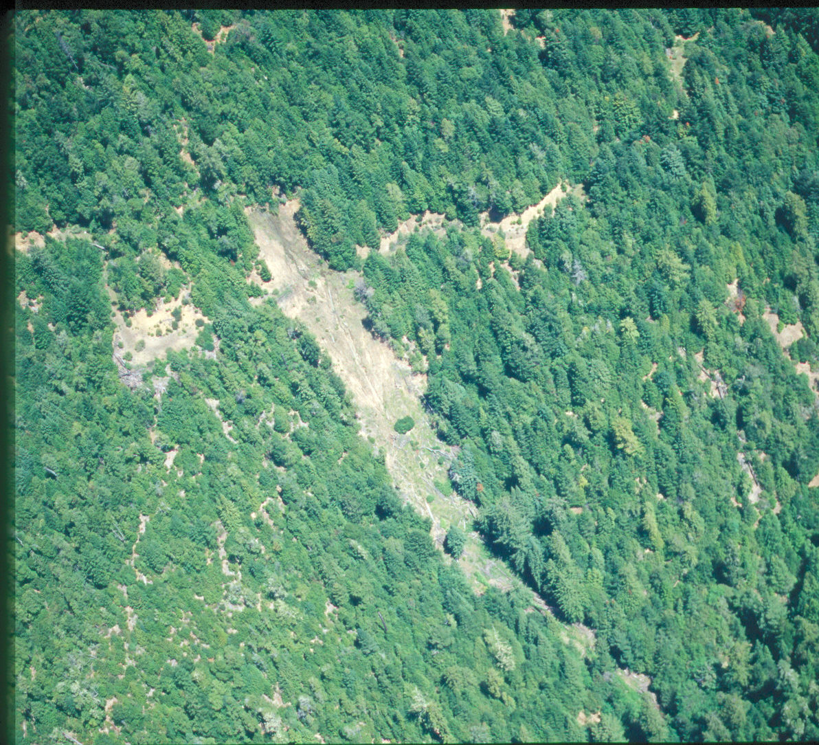
Some
areas of the Gualala watershed show a dense network of roads, skid roads
and skid trails from which sediment can be contributed to streams as surface
erosion. Road densities in the Gualala basin only consider main haul roads;
therefore, calculations of road density are very conservative. Depending
on temporary haul road and skid trail layouts, the actual densities may
be two to ten times higher.
|

|
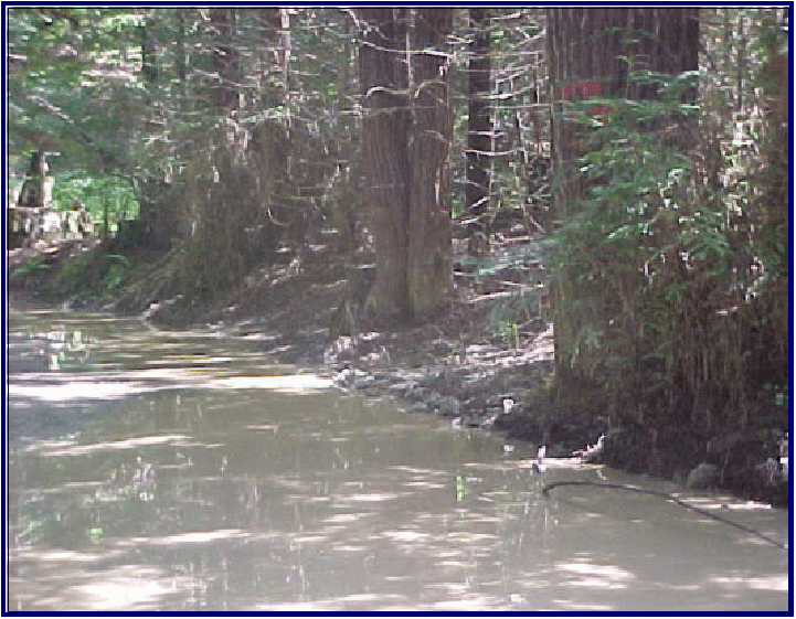
This
plugged culvert exemplifies a huge problem in the Gualala watershed resulting
from past logging and road building. After about 25 years, culverts are
likely to collapse from rot. Plugged culverts often take the road prism
with them when they wash out. Picture provided by Brian McFadin.
|

|
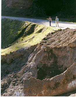
The
picture at left shows where a culvert plugged and road fill on both sides
of the culvert was washed away. Roads are a major part of sediment problems
in the Gualala basin (see Sediment Information in
KRIS Gualala Background page). Picture provided by Brian McFadin.
|
|
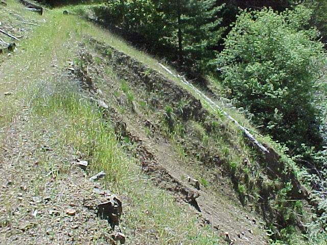
Gully erosion off of Kelly Road in the upper Wheatfield drainage is depicted at left. While Kelly Roads has had drainage improvements pursuant to its transfer from the Army Corp of Engineers to private parties, it has not been out-sloped and instead an in-board ditch has been maintained. The erodible terrain of the Central Belt Franciscan melts under culverts discharging water from the ditch to the hillslope. Photo by Pat Higgins |
|
|
|
|
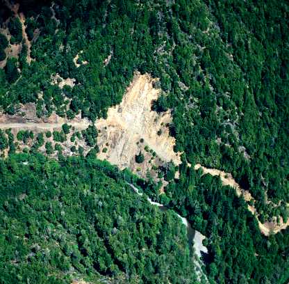
| The image above shows a large slide associated with a road immediately adjacent to a major tributary of the Gualala River. This road location is high risk in that it is on steep slopes right above the watercourse in an "inner gorge" location. Photo by Brian McFadin. | This picture typifies a cut and fill road failure, which triggered a very large debris slide on a steep slope above a Gualala River tributary. The road does not appear to have been in active use at the time of this failure. Picture provided by Brian McFadin. | Close up of fill failure near a road at some location in the Gualala watershed. Side cast material from road grading can over-steepen slopes, become saturated with water during storms, and trigger a fill failure. In some cases such slides take the rest of the road prism. Photo by Brian McFadin. |
![]()
References
California Regional Water Quality Control Board (CRWQCB). 2001. Technical Support Document for the Gualala River Watershed Water Quality Attainment Action Plan for Sediment. CRWQCB, Region 1. Santa Rosa, CA. 147 pp.
Cedarholm, C.J., L.M. Reid and E.O. Salo. 1981. Cumulative effects of logging road sediment on salmonid populations of the Clearwater River, Jefferson County, Washington. Pages 38-74 in Proceedings of Conference on Salmon Spawning Gravel: A Renewable Resource in the Pacific Northwest? Report 19. Wash. State University, Water Research Center, Pullman, WA.
Flanagan, S.A., M.J. Furniss, T.S. Ledwith, M.A. Love, K. Moore, and J. Ory. 1998. Methods for inventory and environmental risk assessment of road drainage crossings. Water/Road Interaction Technology Series. 9877 1809-SDTDC. USDA Forest Service, Technology and Development Program. San Dimas, CA. 52 pp.
Hagans, D.K., W.E. Weaver and M.A. Madej. 1986. Long term on-site and off-site effects of logging and erosion in the Redwood Creek basin, Northern California. In: Papers presented at the American Geophysical Union meeting on cumulative effects (1985 December); National Council on Air and Streams, Tech. Bull. No. 490, pp.38-66.
Harr, R.D. and R.A. Nichols. 1993. Stabilizing Forest Roads to Help Restore Fish Habitats: A Northwest Washington Example. Fisheries 18(4): 18-22.
Keithley, Chris. California Department of Forestry, Fire and Resources Assessment Project, Sacramento, CA.
Klamath National Forest. In Press. Salmon River Restoration Plan. Klamath National Forest, Yreka, CA in cooperation with Salmon River Restoration Council, Sawyers, Bar, CA.
Matthews & Associates. 1999 . Sediment source analysis and preliminary sediment budget for the Noyo River. Weaverville, CA. (Contract 68-C7-0018. Work Assignment #0-18.) Prepared for Tetra Tech, Inc. Fairfax, VA.
Morrison, P.H. 1975. Ecological and Geomorphological Consequences of Mass Movements in the Alder Creek Watershed and Implications for Forest Land Management. B.A. Thesis. University of Oregon, Eugene, OR. 102 p.
Weaver, W.E., and D.K. Hagans. 1994. Handbook for Forest and Ranch Roads - A Guide for Planning, Designing, Constructing, Reconstructing, Maintaining and Closing Wildland Roads. Prepared for the Mendocino County Resource Conservation District, Ukiah, California. 161 pp.
![]()
| www.krisweb.com |
