
| Area | Basin-wide/General |
| Topic | Habitat: Habitat Types by Percent Survey Length (All) |
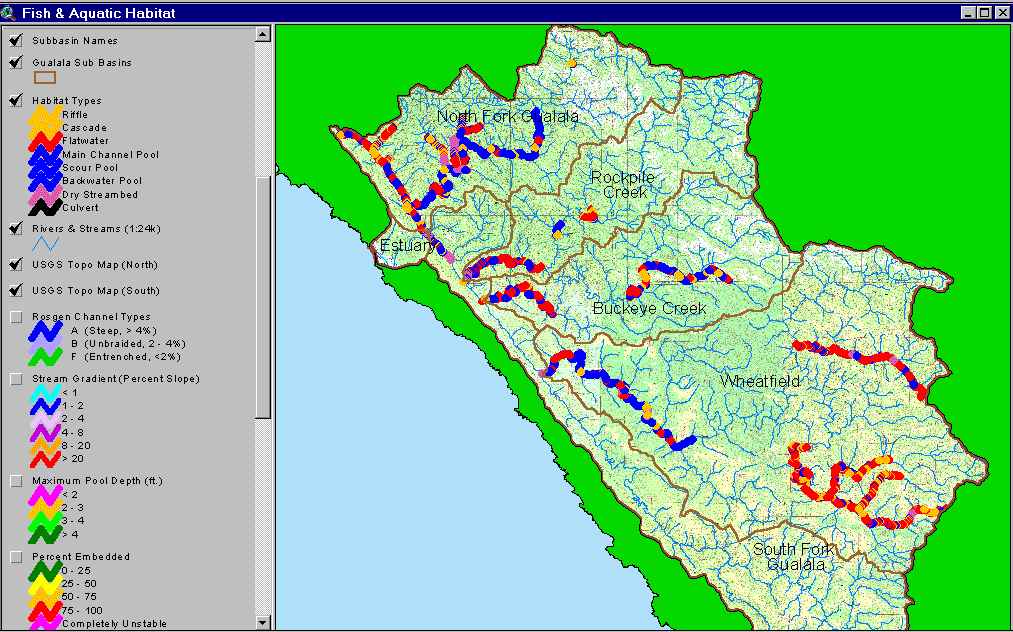
The image above shows the habitat frequency results of the CDFG 2001 Gualala habitat typing surveys. The blue symbols indicate occurrence of pool habitat in the North Fork Gualala, Wheatfield, and upper Buckeye Creek reaches showing the highest occurrence. Tombs Creek, House Creek and lower Buckeye Creek are dominated by flat water and riffles. Note that dry reaches include lower Rockpile, Wheatfield Fork, North Fork tributaries, and the lower South Fork below Big Pepperwood Creek. Spatial data provided by the California Department of Fish and Game. See Info Links for more information. Image from the KRIS Gualala Map project
 Click on image to enlarge (130K).
To learn more about this topic click Info Links
| www.krisweb.com |