
| Area | North Fork |
| Topic | Temperature: Max MWAT of Lower North Fork Gualala by Station |
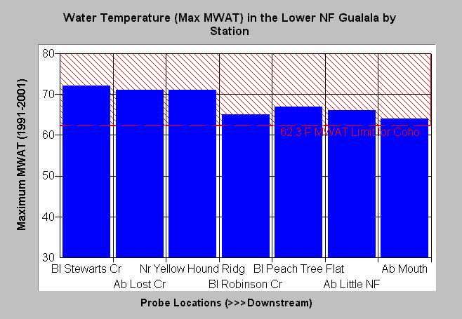
| Caption: This chart shows the maximum of all values from 1991 to 2001 of the floating weekly average water temperature at seven locations of the lower North Fork Gualala River. The pattern in the temperatures is as expected in upstream locations as water temperatures come off melange terrain very warm and cool as they flow west through coniferous forest and toward the fog. The increase in temperature below Robinson Creek is not as expected, however. Data summary from the North Coast Regional Board with data collected by Gualala Redwoods, Inc. See Info Links for more information. | |
 |
To learn more about this topic click Info Links .
To view a table of information about this data click Metadata .
To view the table with the chart's data, click Chart Table web page.
To download the table with the chart's data, click temp_lower_nf_chart_table.dbf (size 308 bytes) .
| www.krisweb.com |