| Area | Middle Klamath |
| Topic | Tour: USFS Restoration Structures Beaver Cr (Lower) 1994 and 1997 |
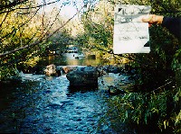
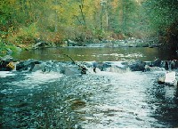
Beaver Creek just upstream of Highway 96 in November 1994, with boulder clusters and weirs installed in 1992 by the U.S. Forest Service with funds from the California Wildlife Conservation Board. See Picture #2 for a comparison of the same reach after the 1997 storm. Most of the rock work proved to be too small to withstand flows from the January 1997 rain-on-snow flood. Photo courtesy of USFS Oak Knoll RD taken 694 feet above the Klamath River. Press F1 for help in use of Picture tools.
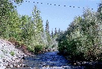
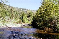
Photo taken just upstream of Highway 96 in August 1997. Boulder weirs formerly occupied this site prior to the January 1997 flood. High flows have scoured back encroaching riparian. Photo by Pat Higgins taken as part of the Mid-Program Evaluation of the Klamath Basin Fisheries Restoration Program (Kier Assoc., 1999). Click on Info Links for more information.
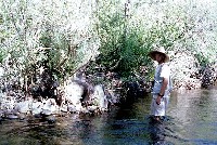
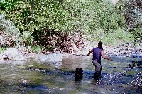
The January 1997 flood dislodged the central portion of this boulder weir. The location is similar to Picture #1 on lower Beaver Creek just upstream of Highway 96. Jason Johnson pictured at right near boulders in the margin, which were not washed out. Photo by Pat Higgins taken as part of the Mid-Program Evaluation of the Klamath Basin Fisheries Restoration Program (Kier Assoc., 1999). Click on Info Links for more information.
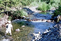
The boulder clusters in the photo were part of fish habitat enhancement funded by the California Wildlife Conservation Board and installed by the USFS in 1992. These structures survived the January 1997 rain-on-snow flood, because an adjacent terrace provided flood relief. Photo by Pat Higgins taken as part of the Mid-Program Evaluation of the Klamath Basin Fisheries Restoration Program (Kier Assoc., 1999). Click on Info Links for more information.
The boulder clusters in the photo were part of fish habitat enhancement funded by the California Wildlife Conservation Board and installed in 1992 by the USFS. These structures were in the vicinity of the campground on lower Beaver Creek, approximately 1636 feet above the Klamath River. The January 1997 rain-on-snow flood altered this reach substantially (See Picture #6). Photo courtesy of USFS Oak Knoll RD.
This photo was taken in August 1997, in the vicinity of the USFS campground on lower Beaver Creek. Small particle size distribution suggests that aggradation took place in this reach during the January 1997 storm. In-stream structures may be buried by shifting bedload during major storm events (see Indian Creek). Photo by Pat Higgins taken as part of the Mid-Program Evaluation of the Klamath Basin Fisheries Restoration Program (Kier Assoc., 1999). Click on Info Links for more information.
The large rocks at left are the remnants of a Beaver Creek boulder weir funded by the California Wildlife Conservation Board and installed by the USFS in 1992. The structure was destroyed by high flows from the January 1997 rain-on-snow flood. Nels Brownell in photo at right. Photo by Pat Higgins taken as part of the Mid-Program Evaluation of the Klamath Basin Fisheries Restoration Program (Kier Assoc., 1999). Click on Info Links for more information.
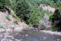
The large rocks at left are the remnants of a Beaver Creek boulder weirs installed by the USFS in 1992. The structures were fragmented by high flows of the January 1997 rain-on-snow flood. The boulders may still cause small pools to scour out and provide some habitat benefits. Photo by Pat Higgins taken as part of the Mid-Program Evaluation of the Klamath Basin Fisheries Restoration Program (Kier Assoc., 1999). Click on Info Links for more information.
 Click on image to enlarge (109K).
 Click on image to enlarge (79K).
 Click on image to enlarge (76K).
 Click on image to enlarge (85K).
 Click on image to enlarge (73K).
 Click on image to enlarge (79K).
 Click on image to enlarge (119K).
 Click on image to enlarge (122K).
To learn more about this topic click Info Links
To view additional information (data source, aquisition date etc.) about this page, click Metadata
| www.krisweb.com |
