| Area | Middle Trinity |
| Topic | Tour: New River Big Creek Stream Survey Maps and Photos |
Map#1 from stream survey report conducted on July 30-31, 1980 by Mark Coleman and Joe Zustak. Map is of lower reaches of stream (see Picture #2 for upper reaches of survey). Photos from July survey too dark to capture. Pictures actually taken as part of April 8, 1980 stream survey by Paul Brouha and Mary Bacon as part of the "Mechanical" Timber Sale. The reach survey by Brouha and Bacon is from approximately where the P4 on this map and the convergence below P6.
Map#2 of the upper reaches of Big Creek from stream survey report conducted on July 30-31, 1980 by Mark Coleman and Joe Zustak.
Mary Bacon looking at Big Creek on April 1980 survey. Survey as part of environmental assessment for Mechanical Timber Sale. Note large wood in and adjacent to stream channel. Photo from the files of the Weaverville Ranger District, Shasta Trinity National Forest.
Large and small woody debris in stream channel of Big Creek. Photo taken as part of environmental review for Mechanical Timber Sale. Photo from the files of the Weaverville Ranger District, Shasta Trinity National Forest. 1980.
Past logging above Big Creek in the area adjacent to the Mechanical Timber Sale. Photo from the files of the Weaverville Ranger District, Shasta Trinity National Forest. April 1980.
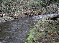
Big Creek in April 1980 in the vicinity of the Mechanical Timber Sale. Channel looks like it may have been aggraded or altered by previous land use judging from the flat, straight channel, high fine sediment and small particle size distribution. Photo from the files of the Weaverville Ranger District, Shasta Trinity National Forest.
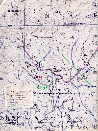 Click on image to enlarge (142K).
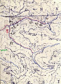 Click on image to enlarge (137K).
 Click on image to enlarge (51K).
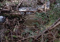 Click on image to enlarge (74K).
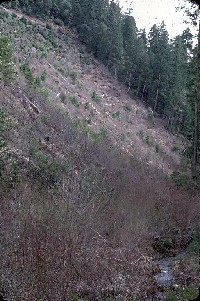 Click on image to enlarge (71K).
 Click on image to enlarge (78K).
To learn more about this topic click Info Links
To view additional information (data source, aquisition date etc.) about this page, click Metadata
| www.krisweb.com |
