
| Area | Salmon River |
| Topic | Map: Salmon River Digital Orthophotos (DOQ's) |
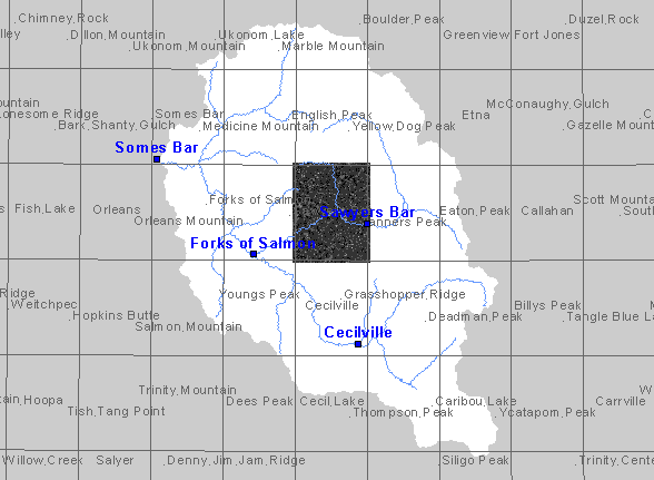
| This is a map showing digital orthoepist quarter-quadrangles (DOQs) of the Salmon River Project Area. | |||
 |
 |
||
To view metadata about a map layer, click on a link in the table below.
| Name of Layer in Map Legend | Metadata File Name |
|---|---|
| Towns | towns.shp.txt |
| Quad Index | quad_index.shp.txt |
| Basin Buffer | buffer_basinboundary.shp.txt |
| Streams (1:500k scale) | Unavailable |
| Elevation.tif | sr_elevation.tif.txt |
| Hillshade.tif | srhillshade.tif.txt |
| Sawyers | Unavailable |
| Somes Bar | Unavailable |
| Tanners | Unavailable |
| Cecilville | Unavailable |
| Forks | Unavailable |
| Grasshopper Ridge | Unavailable |
| Orleans Mountain | Unavailable |
| Youngs Peak | Unavailable |
| www.krisweb.com |