| Area |
Salmon River |
| Topic |
Map: Salmon River Fire |
|
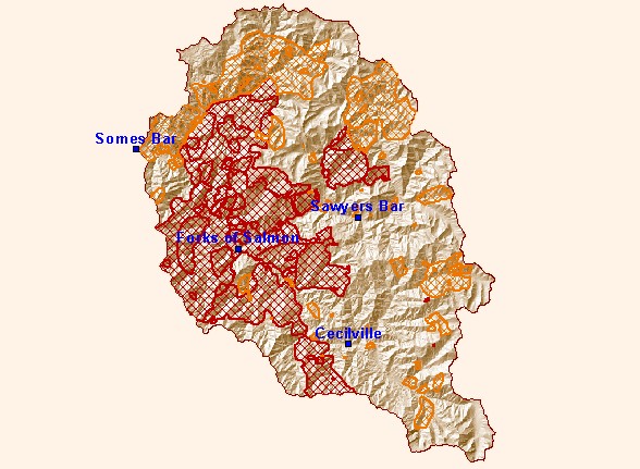
This is a map of fire history in the Salmon River Project Area. Fire perimeters were obtained from 1:126720 Ranger District Fire
Atlases. District Atlases contain all fires greater than 40 acres in size. The dates covered are from 1911 to present. Since 1911, a
total of 44% of the Basin has burned, while 29% of the Basin has burned since the mid 1970s. The risk of catastrophic fire is
identified by managers as the number one threat to Salmon River ecosystem health.
|
|
|
 |
 |
To view metadata about a map layer, click on a link in the table below.