
| Area | Scott River |
| Topic | Climate: Rainfall at Ft Jones 1936-1999 |
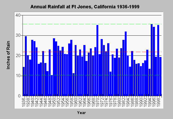
| Caption: This is the annual cumulative rainfall at Ft Jones, California in the Scott River valley from 1936-1999. The red line is average rainfall, whereas, the dashed green lines are the maximum and minimum values for all years measured. Data are from the California Data Exchange Center. Click on Info Links for more information. | |
 |
To learn more about this topic click Info Links .
To view additional information (data source, aquisition date etc.) about this page, click Metadata .
To view the table with the chart's data, click Chart Table web page.
To download the table with the chart's data, click ftjannualrain.dbf (size 2,722 bytes) .
To view the table with the chart's source data, click Source Table web page.
To download the table with the chart's source data, click ftjnrain.dbf (size 21,634 bytes)
| www.krisweb.com |