| Area | Scott River |
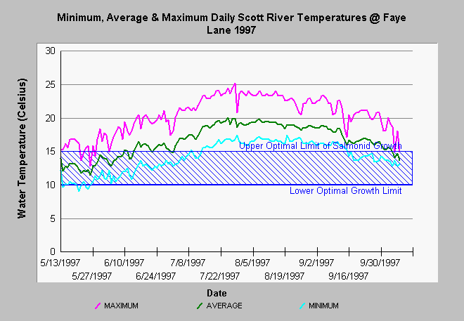
| Topic | Temperature: 1997 Min/Max/Ave Scott @ Faye Lane |
| Caption: This chart shows the daily maximum, average and minimum water temperatures of the Scott River at Fay Lane (River Mile 52.6) from mid May to early October 1997. The maximum temperature exceeded stressful levels for the salmonids from mid-June through September, 1997. Data were collected using HoboTemp data recorders by Lorrie Bundy, Siskiyou Resource Conservation District. See Info Links for more Information. See Info Links for more information. | |
 |
To learn more about this topic click Info Links .
To view additional information (data source, aquisition date etc.) about this page, click Metadata .
To view the table with the chart's data, click Chart Table web page.
To download the table with the chart's data, click faysum.dbf (size 10,443 bytes) .
To view the table with the chart's source data, click Source Table web page.
To download the table with the chart's source data, click rsc52_67.dbf (size 108,974 bytes)
| www.krisweb.com |
