 |
 |
| Background | Hypotheses| Bibliography | Maps | Home |
|
|
| Background | Hypotheses| Bibliography | Maps | Home |
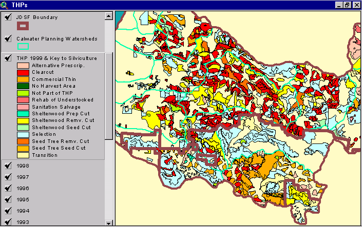
MAPS: Timber Harvest Plans View
![]()
The California Department of Forestry in Santa Rosa provided the timber harvest plan (THP) maps, which comprise one of the KRIS Noyo Map views. Timber harvests in the Noyo River basin from 1986 through 1999 can be viewed by year or by timber harvest type. Timber harvest may sometimes negatively impact salmonid habitat in northern California streams (NMFS, 1996). Consequently, information about THPs is very useful for watershed assessment.
 |
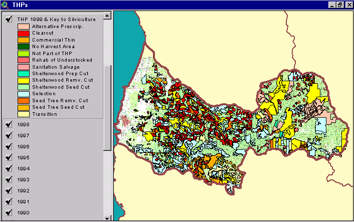
This image shows THPs by harvest type approved by the CDF between 1986 and 1999 for the central and western portions of the Noyo River basin . The Jackson Demonstration State Forest boundary is in the center of the image. The pattern of silviculture on JDSF appears markedly different than on adjacent private lands, with clear cuts less prevalent on JDSF. |
![]()
References
National Marine Fisheries Service (NMFS). 1996. Factors for Decline: A supplement to the Notice of Determination for West Coast Steelhead under the Endangered Species Act. NMFS Protected Species Branch (Portland, OR) and NMFS Protected Species Management Division (Long Beach, CA). 82 pp. http://www.nwr.noaa.gov/1salmon/salmesa/pubs/stlhffd.pdf
![]()
| www.krisweb.com |