
| Area | Lower Ten Mile |
| Topic | USFS VegTypes: Mouth of the Ten Mile River Calwater 1994 |
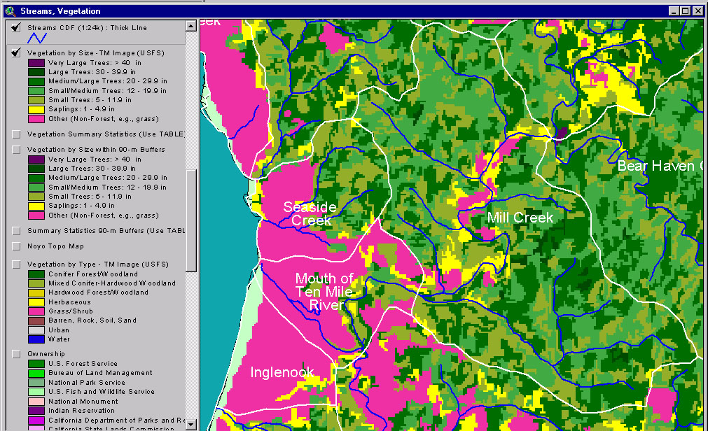
This image from the KRIS Ten Mile River Map project shows USFS vegetation and stand types for the Mouth of the Ten Mile River Calwater planning watershed derived from a 1994 Landsat (see Info Links for more background information). The large areas of Non-Forest in the west of the Calwater are dunes to the south), a grassy coastal plain, agricultural lands and the estuary and its associated vegetation. Scale of accuracy for stands is one hectare.
This is an aerial photo of the mouth of the Ten Mile River provided by Matthews and Associates (2001). Note the sand dunes to the south of the river and grasslands in upland areas to the north and along ridges extending into the interior. The low lying areas adjacent to the estuary are likely salt tolerant plant species such as salt grass.
This Landsat Vegetation view is taken from the KRIS Ten Mile Map project and shows the Mouth of the Ten Mile River and Mill Creek Calwater planning watersheds and those in the Middle Fork, lower North Fork and part of the South Fork basin.
The map above comes from the KRIS Ten Mile Map project and shows timber harvests as mapped by the California Department of Forestry by year from 1992-2000. Only two small timber harvests have been filed in the Mouth of the Ten Mile River Calwater Planning watershed which is mostly sand dunes, marsh and farm land.
This picture shows the Mouth of the Ten Mile River and Mill Creek Calwater Planning watershed planning watersheds as of 1999. Graham Matthews Associates, as part of their TMDL sediment study, joined this aerial photo set in ArcView. The layer has also been included in the KRIS Ten Mile Map project. The photos have not been ortho-corrected and show some variation in contrast due to the different times of day that photos were taken.
 Click on image to enlarge (352K).
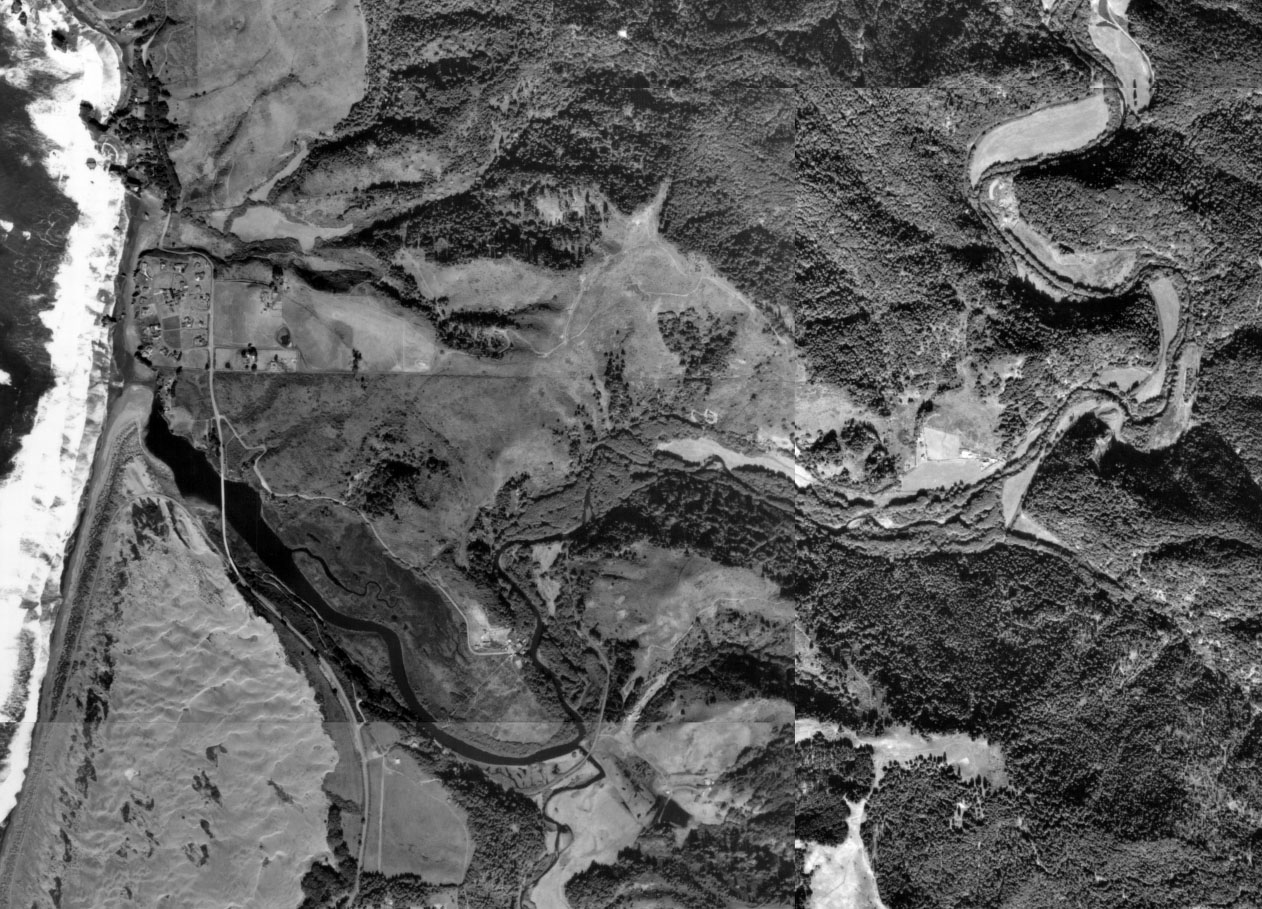 Click on image to enlarge (341K).
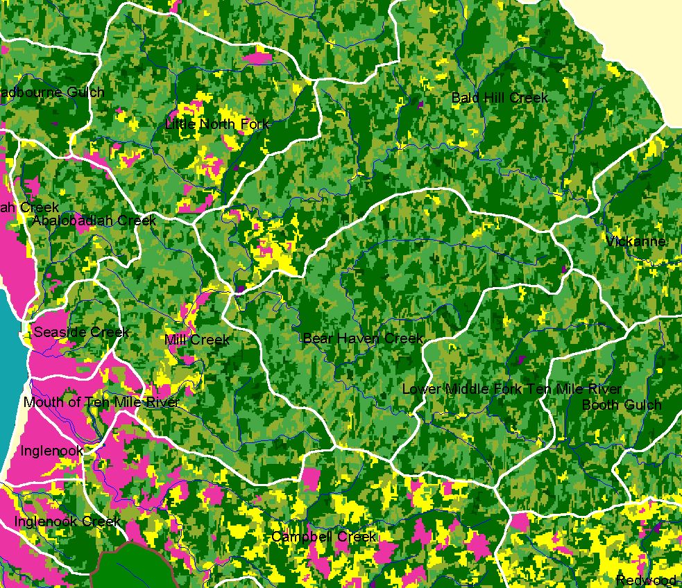 Click on image to enlarge (344K).
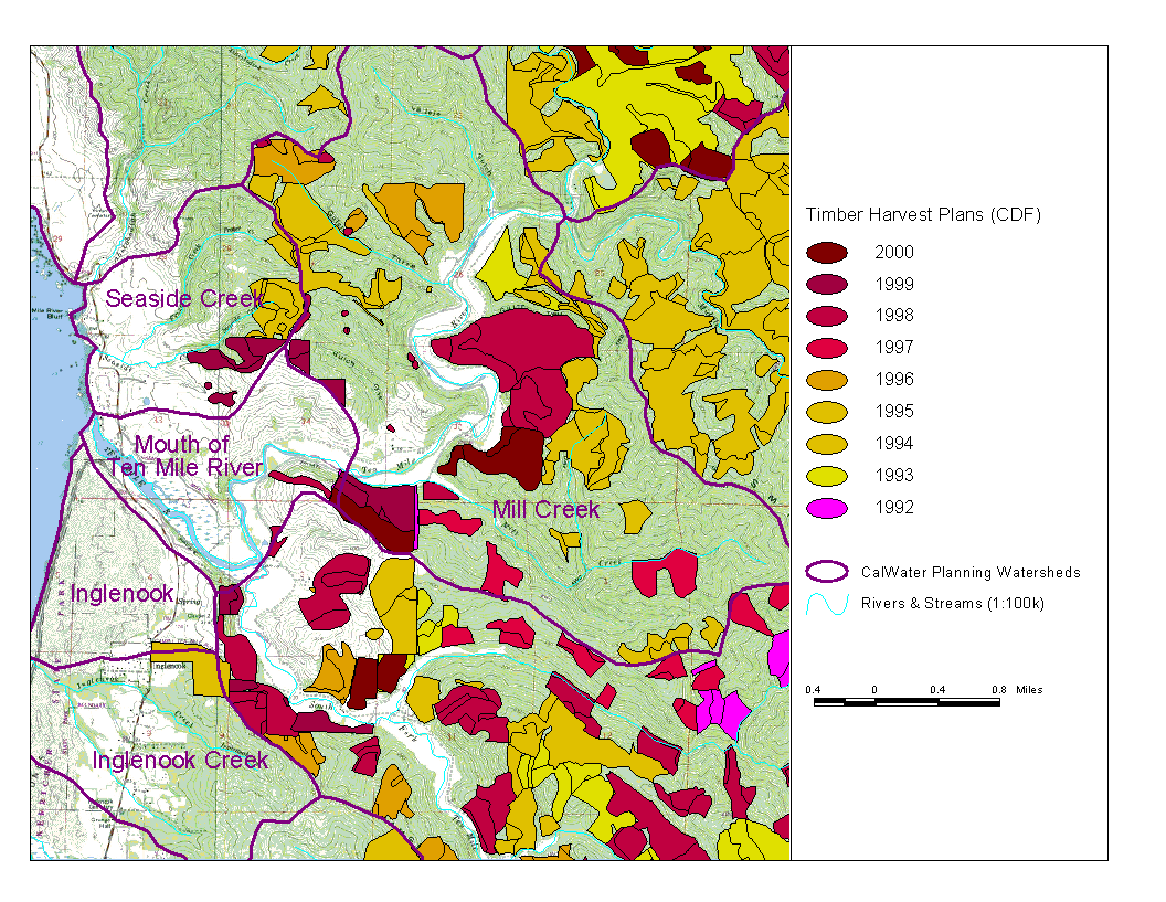 Click on image to enlarge (183K).
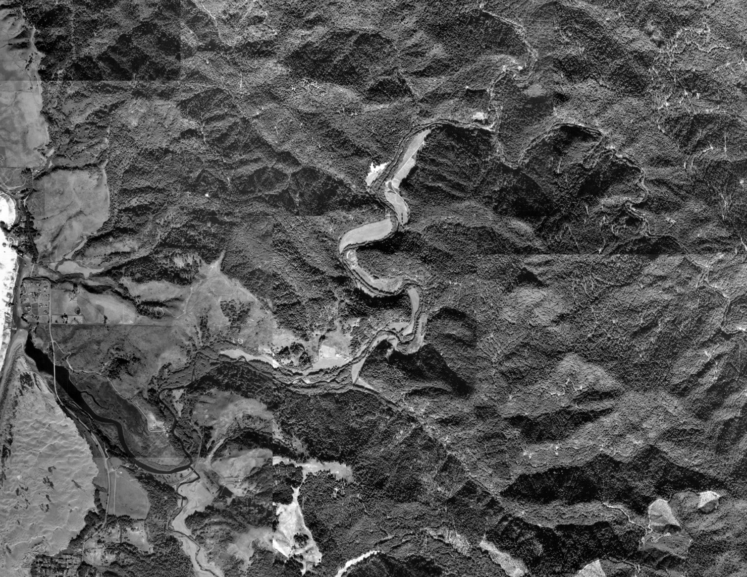 Click on image to enlarge (796K).
To learn more about this topic click here
| www.krisweb.com |