 |
 |
| Background | Hypotheses| Bibliography | Maps | Home |
|
|
| Background | Hypotheses| Bibliography | Maps | Home |
SHALSTAB Examples from the Gualala Basin
KRIS Web Background Pages: Modeling Shallow Landslides
![]()
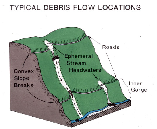 |
The image at left is by Dr. William Weaver from his work at Redwood National Park and shows typical debris flow locations derived from Park studies. The illustration shows that roads may trigger failures when crossing headwater swales. Note also that failures in upslope areas may be linked to culvert and fill failures further down the drainage. Failures of multiple crossings tend to have very significant impacts on stream reaches below. |
| www.krisweb.com |