Bibliography Background About KRIS
Pilot KRIS Kootenai Maps
 There are a wealth of electronic map data available for parts of the Kootenai River basin. The pilot KRIS Kootenai Map Arc View project received data from the Kootenai River Network, Kootenai National Forest and the Interior Columbia Basin Ecosystem Management Project. Full KRIS projects assemble comprehensive Arc View projects, including the Spatial Analyst extension for full quarry power of spatial data. Map data can now be viewed within the KRIS database due integration of a KRIS-Map Viewer. Data assimilated for the KRIS Kootenai pilot project appear on the internet as static maps, but some retain hotlinks which can be used to link with restoration photos (view maps in pilot KRIS Kootenai).
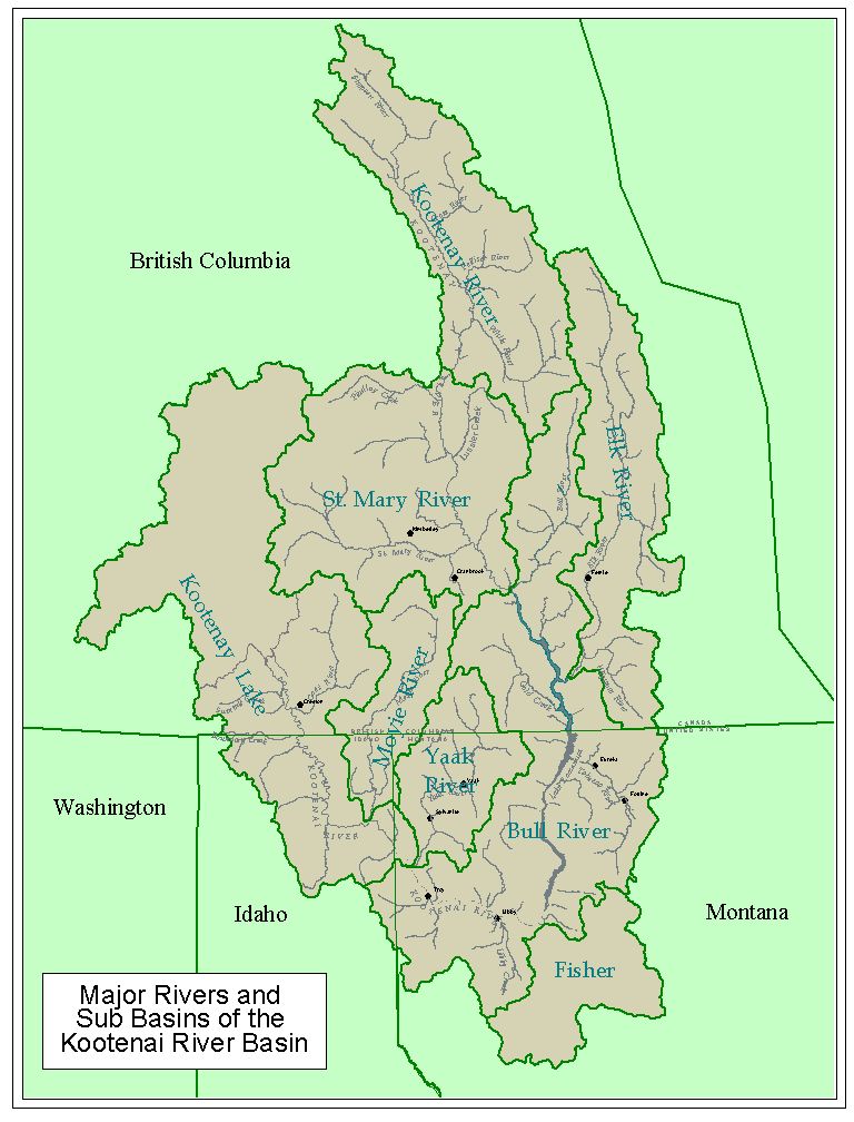
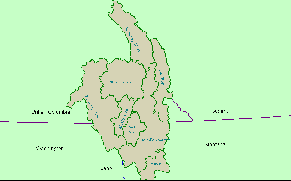
KRIS Kootenai Project Sub-basins: Basin boundaries conform to 4th field hydrologic unit code (HUC) watersheds from the U.S. Geologic Survey in the U.S. and similar watersheds in Canada created by the Rocky Mountain Data Consortium (see Sub-Basin Map). The eight basins are named under this convention, but at the request of reviewers and KRN, the Bull River sub-basin has been re-named the Middle Kootenai. Because this project is only a pilot, existing boundaries had to be used, but sub-basins could be redefined in a full project.
The following are spatial data providers for the KRIS Kootenai pilot project:
Interior Columbia Basin Ecosystem Management Project: The Interior Columbia Basin/East Side Forest Ecosystem Management Project (ICBEMP) has accumulated a wealth of spatial data. Only a fraction of the more than 300 different Geographic Information System (GIS) data layers or themes provided by ICBEMP are used in the pilot KRIS Kootenai project. ICBEMP data are available for download from the U.S. Forest Service Pacific Northwest Research Station, which serves as custodian of the project data. Spatial data layers in KRIS Kootenai include ownership, land use, mine locations, geology and others.
Kootenai National Forest: The Kootenai National Forest provided spatial data for the pilot KRIS Kootenai project.
Kootenai River Network: The Kootenai River Network (KRN) is the sponsor of the pilot KRIS Kootenai project and provided mapping data that it had acquired for base layers.
Other Sources of Available Map Data
Montana Natural Resources Information System (http://nris.state.mt.us/gis/gis.html): Although there was not sufficient time or budget to acquire map data from the Montana Natural Resources Information System for the KRIS Kootenai pilot project, NRIS provides a wealth of useful mapping data on-line.