
|
Area/Topic | Bibliography | Background | Hypotheses | Home |
|
Map Page.
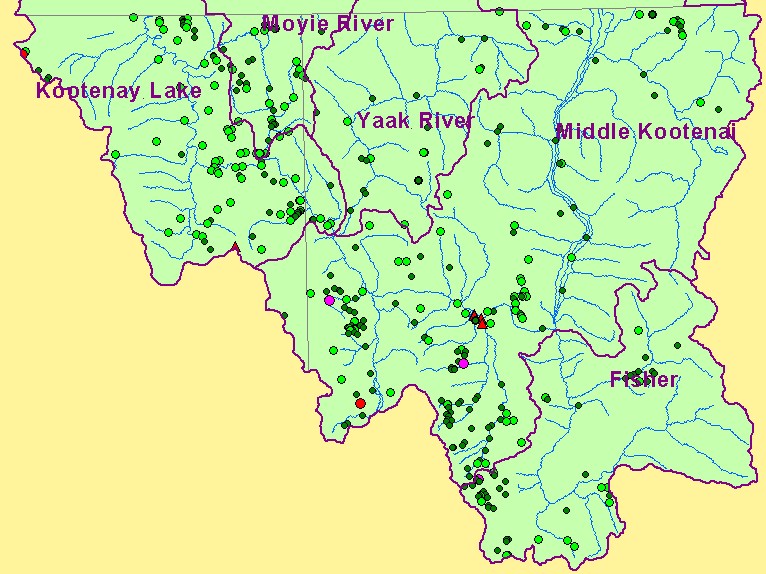
You selected the area Basin-wide and the topic Map: 7. Mining Related Hazard Potentia, U.S. Kootenai River Basin |
| This is a map of Mining Related Hazard Potential for the U.S. portion of the Kootenay River basin and a coarse (1:250000) stream map. Categories for hazard potential are high hazard (red), possible hazard (hot pink), undetermined (light green) and no likelihood (dark green). Data were provided by the Interior Columbia Basin Ecosystem Management Project. Scale = 1:830,520 . | |||
|
|
||
| www.krisweb.com |