

|
|
|
| Background | Hypotheses | Bibliography | Maps | Home |
![]()
These pages are designed to supply basic information about data included in the pilot KRIS Kootenai project and links to original sources, if they are on the web. The background pages also references relevant scientific literature, some of which are in the KRIS bibliography and can be accessed by clicking the author's name, if it appears in blue.
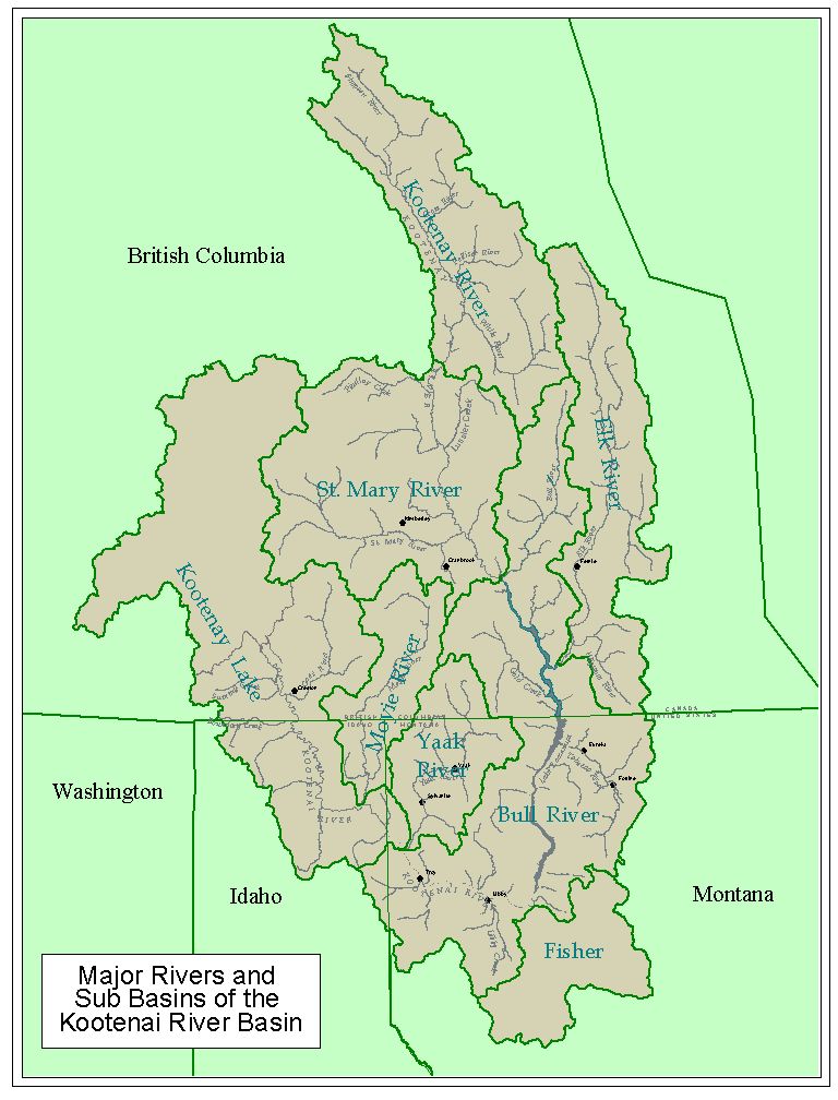
The Kootenai River mainstem flows over 407 miles (655 km), rising in the Rocky Mountains in southeast British Columbia. It then flows south into northwest Montana and then back northwest through the Idaho Panhandle and back into Canada, before joining the Columbia River at Castlegar, B.C. The river is used to generate hydroelectricity, which forms several large reservoirs, the largest of which is There it flows through Kootenay Lake (64 mi/103 km long; 191 sq mi/495 sq km). Important fish species which inhabit the river and its impoundments include the white sturgeon, burbot, bull trout, rainbow trout, west slope cutthroat, mountain white fish and kokanee. The Canadian name is spelled Kootenay. The KRIS Kootenai project is split into eight large sub-basins (see Sub-Basin Map).
![]()
| White Sturgeon | Flows and Climatologically Data |
| Bull Trout | Sediment |
| Westslope Cutthroat Trout | Water Quality |
| Burbot | Map Data |
| www.krisweb.com |