|
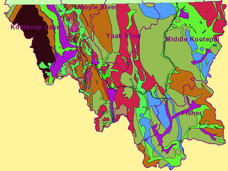
This is a map of lithology in the U.S. portion of the Kootenay River basin. The granitic batholith of the Rocky Mountains is visible in black in the west (at left) on the
map. Much of the landscape in the rest of the Kootenai Basin is shaped by past glacial activity, as indicated by glacial drift and lake sediments. Underlying bedrock
geology can determine inherent erodibility and may effect the way various types of land use impact sediment yield. Data were provided by the U.S.F.S. Interior Columbia
Basin Ecosystem Management Project. Scale = 1:830,520 .
|
|